
The Aegadian Islands are a group of five small mountainous islands in the Mediterranean Sea off the northwest coast of Sicily, Italy, near the cities of Trapani and Marsala, with a total area of 37.45 square kilometres (14.46 sq mi).

Myanmar is the northwestern-most country of mainland Southeast Asia. It lies along the Indian and Eurasian Plates, to the southeast of the Himalayas. To its west is the Bay of Bengal and to its south is the Andaman Sea. It is strategically located near major Indian Ocean shipping lanes.The neighboring countries are China, India, Bangladesh, Thailand and Laos.
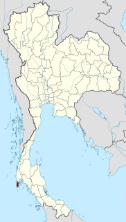
Phuket is one of the southern provinces (changwat) of Thailand. It consists of the island of Phuket, the country's largest island, and another 32 smaller islands off its coast. It lies off the west coast of Thailand in the Andaman Sea. Phuket Island is connected by the Sarasin Bridge to Phang Nga Province to the north. The next nearest province is Krabi, to the east across Phang Nga Bay.

Cheduba Island is an island in the Bay of Bengal close to Ramree Island and belongs to Myanmar, formerly Burma. It has a maximum length of 33 km (21 mi), with an area of approximately 523 km2 (202 sq mi)

Ramree Island is an island off the coast of Rakhine State, Burma. The area of the island is about 1,350 square kilometres (520 sq mi) and the main populated center is Ramree.
The Coco Islands are a small group of islands in the northeastern Bay of Bengal. They are part of the Yangon Region of Myanmar. The islands are located 414 km (257 mi) south of the city of Yangon. Cocos Island group consists of 5 islands, 4 islands on Great Coco Reef and another solaitary island on the Little Coco Reef. To the north of this island group lies Preparis Island also belonging to Myanmar, and to the south lies the Landfall Island belonging to India.
Daung Kyun, also known as Ross Island, is an island in the Mergui Archipelago, Burma.

Tarner Island is a triangular shaped island in Loch Bracadale just off the coast off the Harlosh peninsula of Skye in Scotland. It is about 28 hectares in extent.

Table Island is a conspicuous flat-topped, rocky island lying north of Greenwich Island and north-northwest of the Aitcho group on the west side of English Strait in the South Shetland Islands, Antarctica. The island is rising to over 150 metres and extending 1.4 by 1 kilometre, with a surface area of 112 hectares. It is separated from Aitcho Islands to the south-southeast by the 1.9-kilometre (1.2-mile) wide Klimash Passage.
Myingun Island, also known as Myengu Island, is an island in the Bay of Bengal. It is administrated by Myanmar and belongs to Rakhine State. The island is located 5 kilometres to the south of Sittwe, separated from the continental shore by a 2-kilometre-wide (1.2 mi) strait.

Than Kyun or Davis Island is an island at the southern end of the Mergui Archipelago, Burma. It is the largest and highest island of the Alladin Islands, a scattered cluster of islands extending to the W and SSW of Zadetkyi Island. This densely wooded island has two main peaks, each with a height of around 450 metres. The island has a roughly round shape with a diameter of about 6 kilometres. Off its eastern shore rises a 5.5-metre-high (18.0-foot) rock surrounded by a reef. Than Kyun lies 4.5 kilometres west of the southern end of Zadetkyi Island.
Kalegauk Island is an island in Ye Township, Mon State, Burma (Myanmar). It is located in the Andaman Sea, 8.25 kilometres (5.13 mi) from the coast of Mon State.
Wa Kyun is an island in the Andaman Sea, right off the coast of Mon State, in the southern area of Burma. This 2 kilometres (1.2 mi) long island is located in the midst of a shoal or shallow area. It is covered with dense forest and rises to a height of 135 metres (443 ft).
Kokunye Kyun is an island in the Andaman Sea, right off the coast of Mon State, in the southern area of Burma. It is located in an area of shoals. This island is 1.4 kilometres (0.87 mi) long and its maximum width is 0.4 kilometres (0.25 mi). It is covered with dense forest and rises to a height of 140 metres (460 ft).
Christie Island is an island in the Mergui Archipelago and the southernmost point of Burma (Myanmar). It lies at the southern end of the archipelago 18 km (11 mi) to the NNE of Ko Surin Nuea, and the Thai-Burmese oceanic border is located between these two islands.
Preparis Island is an island located between the Bay of Bengal and the Andaman Sea, 77 km (48 mi) to the NNE of the Coco Islands and 133 km (83 mi) to the SSW from Cape Negrais, the nearest point in the coast of Burma. It is 340 km (210 mi) south of the city of Yangon. To the south of Preparis lies the Coco Islands group of 5 small islands, and further south lies the Landfall Island belonging to India.

The Geography of Franz Josef Land refers to an island group belonging to Arkhangelsk Oblast of Russia. It is situated in the Barents Sea of the Arctic, north of Novaya Zemlya and east of Svalbard. At latitudes between 80.0° and 81.9° north, it is the most northerly group of islands associated with Eurasia. The extreme northernmost point is Cape Fligely on Rudolf Island. The archipelago consists of 191 ice-covered islands with a total area of 16,134 km2 (6,229 sq mi). It is currently uninhabited. The archipelago is only 900 to 1,110 km from the North Pole, and the northernmost islands are closer to the Pole than any other land except for Canada's Ellesmere Island and Greenland. The largest island is Zemlya Georga which measures 110 km (68 mi) from end to end. The highest point in the archipelago is on Ostrov Viner-Neyshtadt which reaches 620 m (2,034 ft) above sea level. The central cluster of large islands in the midst of the archipelago forms a compact whole, known as Zichy Land, where islands are separated from each other by very narrow sounds that are frozen most of the year.
Nantha Kyun is an island off the coast of Rakhine State, Burma.
Myingyi Kyun, also known as High Island, is a small island off the coast of Ayeyarwady Region, Burma.
Gwa Kyun, also known as Gwa Chaung, is a small island off the coast of Rakhine State, Burma.


