Amayé-sur-Seulles is a commune in the Calvados department in the Normandy region of northwestern France.

The Canada–United States border, officially known as the International Boundary, is the longest international border in the world between two countries. The terrestrial boundary is 8,891 kilometers (5,525 mi) long. The land border has two sections: Canada's border with the contiguous U.S. to its south, and Canada's border with the U.S. state of Alaska to its west. The bi-national International Boundary Commission deals with matters relating to marking and maintaining the boundary, and the International Joint Commission deals with issues concerning boundary waters. The agencies currently responsible for facilitating legal passage through the international boundary are the Canada Border Services Agency (CBSA) and U.S. Customs and Border Protection (CBP).

Harringay is a district of north London, England, within the London Borough of Haringey. It is centred on the section of Green Lanes running between the New River, where it crosses Green Lanes by Finsbury Park, and Duckett's Common, near Turnpike Lane.

Avenue C is a north-south avenue located in the Alphabet City area of the East Village neighborhood of Manhattan, New York City, east of Avenue B and west of Avenue D. It is also known as Loisaida Avenue. It starts at South Street, proceeding north as Montgomery Street and Pitt Street, before intersecting East Houston Street and assuming its proper name. Avenue C ends at 23rd Street, running nearly underneath the FDR Drive from 18th Street. North of 14th Street the road forms the eastern boundary of Stuyvesant Town and Peter Cooper Village.

Monkseaton is an area of Whitley Bay, North Tyneside, in the North East of England. Historically in Northumberland, it is in the north-east of the borough, 3⁄4 mile (1.2 km) from the North Sea coast and 1 1⁄2 miles (2.4 km) north of the River Tyne at North Shields. A mile to the north of Monkseaton, the extensive built-up areas of North Tyneside change abruptly into green belt stretching north into south-east Northumberland. It is at an elevation of 130 feet (40 m) above sea-level.
New York State Route 25 (NY 25) is an east–west state highway in downstate New York in the United States. The route extends for just over 105 miles (169 km) from east midtown Manhattan in New York City to the Cross Sound Ferry terminal at Orient Point on the end of Long Island's North Fork. NY 25 is carried from Manhattan to Queens by way of the double-decked Queensboro Bridge over the East River.

Manjeri is a major town and the largest municipality in Malappuram district, Kerala, India. It is the fourth-most populous municipality in the state and the largest in the district. It is situated 23 kilometres (14 mi) southeast to Karipur International Airport and 13 kilometres (8.1 mi) northeast to the district headquarters, and forms a part of Malappuram metropolitan area. It is one of the major commercial towns under the Malappuram urban agglomeration and serves as the headquarters of Eranad Taluk. Manjeri Municipality is a Local Self Government Institution with a jurisdiction of three villages namely Manjeri, Payyanad, and Narukara.

Belton and Manthorpe is a civil parish in the South Kesteven district of Lincolnshire, England, consisting of Belton and Manthorpe, just north of Grantham. According to the 2001 census it had a population of 517 in 192 households. By 2011 the authorities recorded 528 people in 216 homes.

Highway 17 is a highway in Canada that straddles and criss-crosses the Alberta–Saskatchewan provincial border. The portion from the provincial border at Dillberry Lake Provincial Park to the provincial border 800 metres (2,600 ft) north of the North Saskatchewan River is designated as Alberta Provincial Highway No. 17 by Alberta Transportation, commonly referred to as Highway 17.
New York State Route 52 (NY 52) is a 108.72-mile-long (174.97 km) state highway in the southeastern part of the state. It generally runs from west to east through five counties, beginning at the Pennsylvania state line in the Delaware River near Narrowsburg, crossing the Hudson River on the Newburgh–Beacon Bridge, and ending in Carmel. NY 52 and NY 55, both major east–west routes of the Mid-Hudson Region, run parallel to each other, intersecting in downtown Liberty.

Anais is a commune in the Charente-Maritime department in the Nouvelle-Aquitaine region of southwestern France.
King's Highway 23, commonly referred to as Highway 23, is a provincially maintained highway in the Canadian province of Ontario. The route travels from Highway 7 east of Elginfield north to Highway 9 and Highway 89 in Harriston. The total length of Highway 23 is 97.7 kilometres. The highway was first established in 1927 between Highway 8 in Mitchell and Highway 9 in Teviotdale, via Monkton, Listowel and Palmerston. As part of a depression relief program, it was extended south to Highway 7 in 1934. It remained relatively unchanged until 2003, when it was rerouted northward from Palmerston to Harriston.

Whitemud Drive is a major east–west freeway in southern Edmonton, Alberta, that stretches from 231 Street at the western city limit to Anthony Henday Drive just east of Edmonton in Strathcona County. The portion in southeast Edmonton from Anthony Henday Drive to Calgary Trail / Gateway Boulevard is designated as Highway 14, and from there until Anthony Henday Drive in west Edmonton is designated as Highway 2. The portion of Whitemud Drive from 170 Street and 75 Street forms part of the Edmonton inner ring road.
Kendall Drive, also known as Southwest 88th Street and historically North Kendall Drive, runs for 13.3 miles (21.4 km) in an east–west orientation across mid-southern Miami-Dade County, Florida. The majority of Kendall Drive, between State Road 997 at The Hammocks and US 1 on the Kendall–Pinecrest border, is signed as the 10.7-mile-long (17.2 km) State Road 94. The road serves as a major arterial road through the suburbs of the southern Miami metropolitan area, connecting its predominantly residential neighborhoods to shopping districts and to three freeways, allowing commuter travel.
King's Highway 121, commonly referred to as Highway 121, was a provincially maintained highway in the Canadian province of Ontario that connected several communities in the cottage country region of Central Ontario on the southern edge of the Canadian Shield. Between Fenelon Falls and Minden, Highway 121 served as an alternative route to Highway 35, which was severely congested during summer weekends. From Minden, the highway branched east to Haliburton Village and thereafter followed the present route of Highway 118 to Highway 28 in Paudash.

South Willingham is a village and civil parish in the East Lindsey district of Lincolnshire, England, and partly within the Lincolnshire Wolds Area of Outstanding Natural Beauty. At South Willingham is Belmont transmitting station, the second tallest structure in the UK.

Kireka

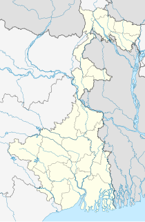
Bangaljhi is a village in the Chapra CD block in the Krishnanagar Sadar subdivision of the Nadia district in the state of West Bengal, India.


