Tuindorp Oostzaan

Last updated

Tuindorp Oostzaan
Neighbourhood of Amsterdam
Tuindorp Oostzaan Amsterdam-Noord 9.jpg
Location map Netherlands Greater Amsterdam.png
Red pog.svg
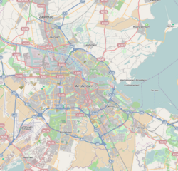
Tuindorp Oostzaan
Location in Amsterdam
Netherlands location map.svg
Red pog.svg
Tuindorp Oostzaan
Tuindorp Oostzaan (Netherlands)
Coordinates: 52°25′N4°54′E / 52.417°N 4.900°E / 52.417; 4.900 Coordinates: 52°25′N4°54′E / 52.417°N 4.900°E / 52.417; 4.900
Country Netherlands
Province North Holland
COROP Amsterdam
Population
 (2021) [1]
  Total17,330
Time zone UTC+1 (CET)

Tuindorp Oostzaan is a neighbourhood of Amsterdam, Netherlands. The neighbourhood is named after the adjacent village Oostzaan. Approximately 20 minutes from Amsterdam Airport Schiphol. As of 6 August 2021, the neighbourhood had a population of 17,330. [1]

Contents

History

Tuindorp Oostzaan was originally a working-class neighbourhood. It is one of the so-called 'garden villages' that was developed around 1919 between the First and Second World War as a counterbalance to the impoverished neighbourhoods in the city. Another reason for the neighbourhood of Tuindorp Oostzaan to arise was the need of housing of the growing group of workers from the new industry and shipyards on the north banks of the IJ.

Flooding

Rescue by boat in 1960 Ramp Tuindorp Oostzaan, mensen halen bezittingen op, Bestanddeelnr 910-9546.jpg
Rescue by boat in 1960

The levee breach on the night of 14 January 1960 made a deep impression. Within a few hours waters rose up to two metres high in Tuindorp Oostzaan and nearby neighbourhoods. Some people had to be evacuated by boats. "A coincidence," was the conclusion about the cause of the flooding. Probably caused by a burst water pipe. The total damage amounted to about eight million guilders (roughly three and a half million EUR) which at that time was a substantial amount. Reportedly, the compensation of the government was so generous that people joked: "Give us our daily bread, and if possible a flood."

Present-day

In 2021, the district had 17,330 inhabitants. Relatively speaking, there are many elderly people and families with children compared to all of Amsterdam-Noord. Single family homes are in the majority. The old, low-lying part of Tuindorp Oostzaan is mostly built in the twenties. The upper part is built in different periods of time and contains more modern houses, lofts, apartments and villas.

Present-day Tuindorp Oostzaan offers a mix of experimental festivals, picturesque country villages and restaurants. Close by you will find the NDSM terrain, a creative hotspot. On this former shipyard on the northern bank of the IJ grows a self-made city with hundreds of artists, creative businesses, sustainable business, unconventional homes, innovative culture and media, amazing cafes, hotels and restaurants and ground breaking events, on land and on water. NDSM is the new focal point for creative urban energy.

Related Research Articles

Amsterdam Weatherbox template

Amsterdam is the capital and most populous city of the Netherlands; with a population of 872,680 within the city proper, 1,558,755 in the urban area and 2,480,394 in the metropolitan area. Found within the province of North Holland, Amsterdam is colloquially referred to as the "Venice of the North", due to the large number of canals which form a UNESCO World Heritage Site.

Meadowhall (shopping centre) Indoor shopping centre in Sheffield, South Yorkshire, England

Meadowhall is an indoor shopping centre in Sheffield, South Yorkshire, England. It lies 3 miles (5 km) north-east of Sheffield city centre, and 2 miles (3 km) from Rotherham town centre. It is the largest shopping centre in Yorkshire, and currently the eleventh-largest in the United Kingdom. As of 2021, plans for an extension are currently under consideration, for completion in the 2020s, which would make Meadowhall the fourth-largest shopping centre in the United Kingdom.

Spaarndam Village in North Holland, Netherlands

Spaarndam is a small village in the province of North Holland, the Netherlands, on the Spaarne river and the IJ lake. The oldest part of the village, on the western side of the Spaarne, belongs to the municipality of Haarlem; the newer part on the eastern side is a part of the municipality of Haarlemmermeer. The village is built around a dam in the river, which is also the division line of the two municipalities.

Downtown Calgary Neighbourhood in Calgary, Alberta, Canada

Downtown Calgary is a dense urban district in central Calgary, Alberta. It contains the second largest concentration of head offices in Canada, despite only being the country’s fourth largest city in terms of population. The downtown is divided into several residential, commercial, corporate, and mixed-use neighbourhoods, including the Financial District (CBD), Eau Claire, Chinatown, East Village, Beltline, and the West End.

Floods in Bangladesh

Bangladesh is a land of many rivers. Yes, it is very prone to flooding due to being situated on the Brahmaputra River Delta and the many distributaries flowing into the Bay of Bengal. Due to being part of such a basin and being less than 5 metres above mean sea level, Bangladesh faces the cumulative effects of floods due to water flashing from nearby hills, the accumulation of the inflow of water from upstream catchments, and locally heavy rainfall enhanced by drainage congestion. Bangladesh faces this problem almost every year. Coastal flooding, combined with the bursting of river banks is common, and severely affects the landscape and society of Bangladesh. 80% of Bangladesh is [floodplain], and it has an extensive sea coastline, rendering the nation very much at risk of periodic widespread damage. Whilst more permanent defenses, strengthened with reinforced concrete, are being built, many embankments are composed purely of soil and turf and made by local farmers. Flooding normally occurs during the monsoon season from June to September. The convectional rainfall of the monsoon is added to by relief rainfall caused by the Himalayas. Meltwater from the Himalayas is also a significant input.

Flood control in the Netherlands Manmade control of flooding in the Netherlands

Flood control is an important issue for the Netherlands, as due to its low elevation, approximately two thirds of its area is vulnerable to flooding, while the country is densely populated. Natural sand dunes and constructed dikes, dams, and floodgates provide defense against storm surges from the sea. River dikes prevent flooding from water flowing into the country by the major rivers Rhine and Meuse, while a complicated system of drainage ditches, canals, and pumping stations keep the low-lying parts dry for habitation and agriculture. Water control boards are the independent local government bodies responsible for maintaining this system.

IJburg Neighbourhood of Amsterdam in North Holland, Netherlands

IJburg is a residential neighbourhood under construction in Amsterdam, Netherlands. It is situated in the IJmeer and is being built on artificial islands which have been raised from the lake. The Haveneiland, Rieteilanden, Steigereiland and Centrumeiland are already inhabited as of 2004. It is part of the municipality Amsterdam-Oost and also contains the Diemerpark, one of the city's largest parks.

2004 Boscastle flood

The 2004 Boscastle flood occurred on Monday, 16 August 2004 in the two villages of Boscastle and Crackington Haven in Cornwall, England, United Kingdom. The villages suffered extensive damage after flash floods caused by an exceptional amount of rain that fell over eight hours that afternoon. The flood in Boscastle was filmed and extensively reported but the floods in Crackington Haven and Rocky Valley were not mentioned beyond the local news. The floods were the worst in local memory. A study commissioned by the Environment Agency from hydraulics consulting firm HR Wallingford concluded that it was among the most extreme ever experienced in Britain. The peak flow was about 140 m3/s, between 5:00 pm and 6:00 pm BST. The annual chance of this flood in any one year is about 1 in 400. The probability each year of the heaviest three-hour rainfall is about 1 in 1300. At midday on 16 August 2004, heavy thundery showers had developed across the South West due to a weak disturbance to the northeast of the United Kingdom.

Amsterdam-Noord Borough of Amsterdam in North Holland, Netherlands

Amsterdam-Noord is a borough of Amsterdam, Netherlands with a population of about 90,000. The IJ, the body of water which separates it from Amsterdam-Centrum and the rest of the city, is situated southwest of Amsterdam-Noord. The borough, which has an area of 49.01 km2, borders the municipalities of Zaanstad, Oostzaan, Landsmeer and Waterland to the north, all part of the province of North Holland like Amsterdam. It borders the Markermeer to the east.

Sunnyside, Calgary Neighbourhood in Calgary, Alberta, Canada

Sunnyside is an innercity community in Calgary, Alberta located on the north side of the Bow River immediately adjacent to Calgary's downtown. The community partners with the neighbouring community of Hillhurst to form the Hillhurst-Sunnyside Community Association. The combined communities have an area redevelopment plan in place, revised in 2009.

Schellingwoude Neighbourhood of Amsterdam in North Holland, Netherlands

Schellingwoude is a neighbourhood of Amsterdam, Netherlands. A former village located on the northern shore of the IJ, in the province of North Holland, it was a separate municipality between 1817 and 1857, when it was merged with Ransdorp; the latter merged with Amsterdam in 1921. Nowadays it is part of the Amsterdam-Noord borough and the Landelijk Noord district.

Milford Lake

Milford Lake, also known as Milford Reservoir, is the largest man-made lake in Kansas with 15,700 acres (64 km2) of water. Over 33,000 acres (130 km2) of land resources are managed for quality recreational experiences as well as for protection of the project’s natural and cultural resources. Approximately 70% of the land resources are available for public hunting.

Port Vell Port of Barcelona (Spain)

Port Vell is a waterfront harbor in Barcelona, Catalonia, Spain, and part of the Port of Barcelona. It was built as part of an urban renewal program prior to the 1992 Barcelona Olympics. Before this, it was a run-down area of empty warehouses, railroad yards, and factories. 16 million people visit the complex each year.

Schinkelbuurt Neighborhood of Amsterdam in North Holland, Netherlands

Schinkelbuurt is a little neighborhood of Amsterdam, Netherlands. It is located directly south of Amsterdam's city centre and it is part of the borough Amsterdam-Zuid, in the part of the city known as the Old South.

Westelijke Eilanden (Amsterdam) Neighborhood of Amsterdam in North Holland, Netherlands

Westelijke Eilanden are three islands in the Centrum district of Amsterdam: Bickerseiland, Prinseneiland and Realeneiland. They are located to the south of the IJ and the Zeeheldenbuurt, to the north of the railway line between Central Station and Amsterdam-Sloterdijk, to the west of the Westerdok and to the east of the Planciusbuurt on the Westerkanaal. The Westelijke Eilanden form the core of the Golden Reael area, which also includes the adjacent Westerdok island, the Haarlemmerbuurt and the Planciusbuurt.

2013 Alberta floods Natural disaster in southern Alberta, Canada

In the days leading up to June 19, 2013, Alberta, Canada, experienced heavy rainfall that triggered catastrophic flooding described by the provincial government as the worst in Alberta's history. Areas along the Bow, Elbow, Highwood, Red Deer, Sheep, Little Bow, and South Saskatchewan rivers and their tributaries were particularly affected. A total of 32 states of local emergency were declared and 28 emergency operations centres were activated as water levels rose and numerous communities were placed under evacuation orders.

Rijn-Schelde-Verolme

The shipbuilding company Rijn-Schelde-Verolme Machinefabrieken en Scheepswerven NV (RSV) was a combination of shipyards and machine factories founded in 1971. In 1983 the company went broke with a staggering loss of public money. It led to the Parliamentary inquiry about RSV.

1964 Zagreb flood Flood in Zagreb, Yugoslavia

On 25 October 1964, a devastating flood of the River Sava struck Zagreb, SR Croatia, SFR Yugoslavia. High rainfall upriver caused rivers and streams in the Sava catchment basin to swell and spill over their banks in many places throughout Slovenia and northern Croatia. The worst flooding occurred in Zagreb. Sava floods were a known hazard in the city, having affected the development of the area since the Roman times, and the 1964 flood did not have the largest extent. However, it occurred following several decades of large-scale industrialisation and urban growth which had caused the city to expand into the most vulnerable areas. The quality of building construction and flood defences in the floodplain was mostly low. Regulation of Sava and its tributaries upriver from Zagreb cut off many natural detention basins, such as fields and pastures, which caused water to pile up ahead of the city. To make matters worse, the soil was already saturated from a mid-month episode of fairly high rainfall. The second episode of high rainfall, during 22–25 October, upriver in Slovenia, produced a record-high water wave in the Sava. At Zagreb's Sava River gauge, the water crested at 514 cm above zero level, exceeding the previous high water mark by more than half a metre (2 ft). This proved too much for the city's embankments. Around 60 km2 (23 sq mi) of the city was flooded, including most neighbourhoods on the western side of the floodplain.

Nederlandsche Scheepsbouw Maatschappij

The Nederlandsche Scheepsbouw Maatschappij (NSM), was a Dutch shipbuilding company based in Amsterdam. It existed from 1894 to 1946. From c. 1908 it was the biggest Dutch shipbuilding company.

Amsterdamsche Droogdok Maatschappij

Amsterdamsche Droogdok Maatschappij (ADM) was a major shipyard in Amsterdam, Netherlands.

References

  1. 1 2 "Kerncijfers wijken en buurten 2021". CBS.nl (in Dutch). 6 August 2021. Retrieved 22 December 2021.