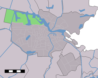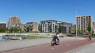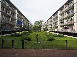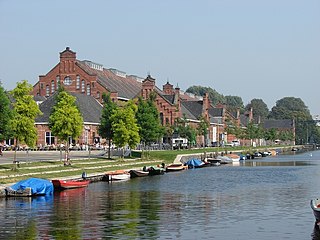
Amsterdam-Zuidoost ("Amsterdam-Southeast") is a borough (stadsdeel) of Amsterdam, Netherlands. It consists of four residential neighborhoods—Bijlmermeer, Venserpolder, Gaasperdam and Driemond—as well as the Amstel III/Bullewijk Business Park and the Amsterdam Arena entertainment and shopping district.

Oud-West is a neighborhood of Amsterdam, Netherlands, roughly covering the area between the Overtoom, a major thoroughfare west of the city centre, and the parallel De Clercqstraat, a shopping street. The exact boundaries are the Vondelpark and the Singelgracht, Hugo de Grootgracht and Kostverlorenvaart canals. The neighbourhood consists of two historically and demographically distinct communities: the Overtoombuurt in the south and the Kinkerbuurt in the north.

Osdorp is neighbourhood of Amsterdam, Netherlands. A larger area was, from 1981 until 2010, a stadsdeel (borough) of Amsterdam and in 2010 was merged into the new borough of Amsterdam Nieuw-West.

Westpoort is a borough (stadsdeel) of Amsterdam, Netherlands. The borough covers the Port of Amsterdam, the main harbour and industrial area of the city, and is located in the north-western part of Amsterdam. It is divided in the industrial areas of Teleport, Sloterdijk areas I, II and II, De Heining and the harbour area (Havengebied).

Indische Buurt is a neighborhood in the borough of Oost, the eastern part of the city of Amsterdam, Netherlands. The name of the neighborhood dates from the early 20th century, and is derived from the fact that the neighborhood's streets are named after islands and other geographical concepts in the former Dutch colony of the Dutch East Indies or now known as Indonesia. The first street was named in 1902.
The port of Amsterdam is a seaport in Amsterdam in North Holland, Netherlands. It is the 4th busiest port in Europe by metric tonnes of cargo. The port is located on the bank of a former bay named the IJ and the North Sea Canal, with which it is connected to the North Sea. The port was first used in the 13th century and was one of the main ports of the Dutch East India Company in the 17th century. Today, the port of Amsterdam is the second largest port in the Netherlands, the largest being the Port of Rotterdam. In 2014, the port of Amsterdam had a cargo throughput of 97.4 million tons, most of which was bulk cargo.

Kinkerbuurt is the neighborhood in Amsterdam, Netherlands. Along with the Overtoombuurt, it is part of the neighborhood of Oud-West in the borough of Amsterdam-West. It was built at the beginning of the twentieth century when Amsterdam was being expanded. Kinkerstraat, the area's main shopping street, was named after Dutch poet and lawyer Johannes Kinker.

The Zeeheldenbuurt is a neighbourhood of Amsterdam, Netherlands. Located in the borough Amsterdam-West, it borders directly on the Westelijke Eilanden to the west. It lies between the Westerkanaal and the Westerdok; to the north is Houthaven and the IJ. The neighbourhood is served by the S100 road, and is sometimes confused with the nearby Admiralenbuurt.

Amsterdam-Oost is a borough of Amsterdam, Netherlands, established in May 2010 after a merger of the former boroughs of Zeeburg and Oost-Watergraafsmeer. In 2013, the borough had almost 123,000 inhabitants.

Amsterdam-West is a borough of Amsterdam, Netherlands, to the west of the centre of the city. This borough was formed in 2010 through the merging of four former boroughs Oud West, Westerpark, De Baarsjes and Bos en Lommer.

Amsterdam-Zuid is a borough (stadsdeel) of Amsterdam, Netherlands. The borough was formed in 2010 as a merger of the former boroughs Oud-Zuid and Zuideramstel. The borough has almost 138,000 inhabitants (2013). With 8,500 homes per square kilometer, it is one of the most densely populated boroughs of Amsterdam. It has the highest income per household of all boroughs in Amsterdam.

Amsterdam Nieuw-West is a borough comprising the westernmost neighbourhoods of the city of Amsterdam, Netherlands. It was created in 2010 after a merger of the former boroughs Osdorp, Geuzenveld-Slotermeer and Slotervaart. In 2017, the borough had almost 150,000 inhabitants.

Bos en Lommer is a neighborhood of Amsterdam, Netherlands. From 1990 to 2010 it was considered a district of the municipality of Amsterdam in the province of North Holland. As of May 1, 2010, it was merged into the new Amsterdam-West borough.

Buitenveldert is a neighborhood of Amsterdam, Netherlands. It is considered the modern Jewish quarter of Amsterdam with its Synagogue, Jewish schools, nursing homes, shops and restaurants.

Overtoombuurt is a neighborhood of Amsterdam, Netherlands. Along with the Kinkerbuurt, it is part of the larger neighborhood of Oud-West in the borough of Amsterdam-West. The borough administration distinguishes several smaller areas within the Overtoombuurt: the eastern part north of the Overtoom thoroughfare is called Helmersbuurt, the western section is called Cremerbuurt, while the area south of the Overtoom and adjacent to the Vondelpark is called the Vondelparkbuurt.

Slotervaart is a neighborhood in the far western part of Amsterdam, Netherlands. The area is named after the canal Slotervaart; the first houses were built in 1955.

The Westergasfabriek is a former gasworks in Amsterdam, the Netherlands, now used as a cultural venue.

Geuzenveld-Slotermeer is a neighborhood and former borough (stadsdeel) comprising some of the most western parts of the city of Amsterdam, Netherlands. As a borough it existed from 1990 till 2010, when it merged with the boroughs Osdorp and Slotervaart to form the new borough Amsterdam Nieuw-West.

Westerpark is a neighbourhood of Amsterdam, Netherlands. It is bordered by the Staatsliedenbuurt on the south and the Spaarndammerbuurt on the northeast and Sloterdijk area of Westpoort on the west. It is a non-residential area, containing the park by the same name, the Westergasfabriek, the Sint-Barbara cemetery, and railyards.


