
Tula Municipality is one of the municipalities in the Mexican state of Tamaulipas. The seat is at Ciudad Tula.
Tula Municipality is one of the municipalities in the Mexican state of Tamaulipas. The seat is at Ciudad Tula.

The Arctic Archipelago, also known as the Canadian Arctic Archipelago, is an archipelago lying to the north of the Canadian continental mainland, excluding Greenland and Iceland.

Tula de Allende is a town and one of the 84 municipalities of Hidalgo in central-eastern Mexico. The municipality covers an area of 305.8 km2 (118.07 sq mi), and as of 2010, the municipality had a total population of 103,919. The municipality includes numerous smaller outlying towns, the largest of which are El Llano, San Marcos, and San Miguel Vindho. It is a regional economic center and one of Mexico's fastest growing cities. However, it is best known as the home of the Tula archeological site, noted for its Atlantean figures. Its built-up area made up of Atotonilco de Tula, Atitalaquia, Tlaxcoapan municipalities was home to 188,659 inhabitants at the 2010 census.
La Labor is a municipality in the Honduran department of Ocotepeque.
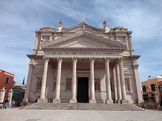
San José Iturbide is a Mexican city located in the Northeast region of the state of Guanajuato, within the Sierra Gorda range. It is named in honor of Saint Joseph and the first Emperor of Mexico, Agustín de Iturbide. The municipality has an area of 534.11 square kilometres and is bordered to the north by San Luis de la Paz and Doctor Mora, to the east by Tierra Blanca, to the south by the state of Querétaro, and to the west by San Miguel de Allende. The municipality had a population of 54,661 inhabitants according to the 2005 census.

Barrio de Muñó is a municipality and town located in the province of Burgos, Castile and León, Spain. According to the 2004 census (INE), the municipality has a population of 32 inhabitants.

Belbimbre is a municipality and town located in the province of Burgos, Castile and León, Spain. According to the 2004 census (INE), the municipality has a population of 80 inhabitants.

Neila is a municipality and town located in the province of Burgos, Castile and León, Spain. According to the 2004 census (INE), the municipality has a population of 235 inhabitants.
Royuela de Río Franco is a municipality and town located in the province of Burgos, Castile and León, Spain. According to the 2004 census (INE), the municipality has a population of 289 inhabitants.

Villaquirán de los Infantes is a municipality located in the province of Burgos, Castile and León, Spain. According to the 2004 census (INE), the municipality has a population of 187 inhabitants.

Salvatierra de Esca is a municipality located in the province of Zaragoza, Aragon, Spain. According to the 2004 census (INE), the municipality has a population of 269 inhabitants.
Sisamón is a municipality located in the province of Zaragoza, Aragon, Spain. According to the 2004 census (INE), the municipality has a population of 60 inhabitants.

Fuente Encalada is a municipality located in the province of Zamora, Castile and León, Spain. At the 2009 census (INE) the municipality had a population of 125 inhabitants.
Fuentes de Ropel is a municipality located in the province of Zamora, Castile and León, Spain. According to the 2009 census (INE), the municipality has a population of 513 inhabitants.

Melgar de Tera is a municipality located in the province of Zamora, Castile and León, Spain. According to the 2004 census (INE), the municipality has a population of 530 inhabitants.
Moraleja de Sayago is a municipality located in the province of Zamora, Castile and León, Spain. According to the 2004 census (INE), the municipality has a population of 296 inhabitants.
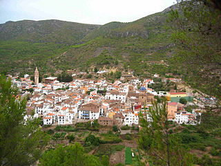
Ayódar is a municipality in the comarca of Alto Mijares, Castellón, Valencia, Spain.
Güémez Municipality is a municipality located in the Mexican state of Tamaulipas. It is known in Mexico for being the hometown of the "Güémez Philosopher", a somewhat fictional wise man who uses simple ideas to explain complex situations.

Tula is a town located in Tula Municipality in the Mexican state of Tamaulipas.
Juan Rodríguez Clara is a city and its surrounding municipality in the Mexican state of Veracruz. It is located in the south of the state, about 335 km from the state capital Xalapa. The municipality covers a surface are of 934.20 km2 and the municipal seat is located at 18°00′N95°24′W. Formerly known as El Burro and Nopalapan de Zaragoza, the current name commemorates a local martyr to the cause of agrarianism and was adopted in 1925. The municipality was established on 22 December 1960 from land belonging to San Juan Evangelista.
La Guadalupita is a neighborhood in the municipality of Xochimilco, in the southern part of Mexico City. The area was referred to as Las Ánimas or Place of the Souls until its official foundation during Mexico’s colonial period. Residents celebrated its patron saint, the Virgin Mary, on December 12, in the church of San Bernardino de Siena, located in the nearby neighborhood of Santa Crucita, only until the completion of their own chapel, in 1927.
| International | |
|---|---|
| National | |
22°00′N99°00′W / 22.000°N 99.000°W
| | This article about a location in the Mexican state of Tamaulipas is a stub. You can help Wikipedia by expanding it. |
