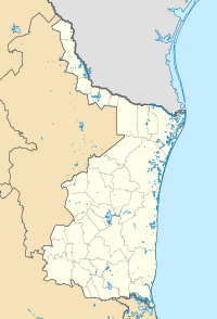
Rio Grande City is a city in and the county seat of Starr County, Texas. The population was 14,411 at the time of the 2020 census. The city is 41 miles (66 km) west of McAllen. The city also holds the March record high for the United States at 108 °F (42 °C). The city is connected to Camargo, Tamaulipas, via the Rio Grande City–Camargo International Bridge. The city is situated within the Rio Grande Valley.

Matamoros, officially known as Heroica Matamoros, is a city in the northeastern Mexican state of Tamaulipas, and the municipal seat of the homonymous municipality. It is on the southern bank of the Rio Grande, directly across the border from Brownsville, Texas, United States. Matamoros is the second largest city in the state of Tamaulipas. As of 2016, Matamoros had a population of 520,367. In addition, the Matamoros–Brownsville Metropolitan Area has a population of 1,387,985, making it the 4th largest metropolitan area on the Mexico–US border. Matamoros is the 39th largest city in Mexico and anchors the second largest metropolitan area in Tamaulipas.
Nuevo León is a state in the northeast region of Mexico. The state was named after the New Kingdom of León, an administrative territory from the Viceroyalty of New Spain, itself was named after the historic Spanish Kingdom of León. With a total land area of 64,555 square kilometers, Nuevo León is the 13th largest federal entity in Mexico. The state is bordered by Tamaulipas to the east, Coahuila to the west, and both Zacatecas and San Luis Potosi to the south. To the north, it shares an extremely narrow international border with the U.S. state of Texas. The Laredo-Colombia Solidarity International Bridge is the only vehicular bridge that connects the United States with the state of Nuevo León. It crosses over the Rio Grande between the city of Colombia, Nuevo León, and Laredo, Texas.

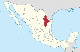
Tamaulipas, officially the Free and Sovereign State of Tamaulipas, is a state in the northeast region of Mexico; one of the 31 states which, along with Mexico City, comprise the 32 Federal Entities of Mexico. It is divided into 43 municipalities.

Reynosa is a border city in the northern part of the state of Tamaulipas, in Mexico. It is also the municipal seat of Reynosa Municipality.

The Lower Rio Grande Valley, commonly known as the Rio Grande Valley or locally as the Valley or RGV, is a region spanning the border of Texas and Mexico located in a floodplain of the Rio Grande near its mouth. The region includes the southernmost tip of South Texas and a portion of northern Tamaulipas, Mexico. It consists of the Brownsville, Harlingen, Weslaco, Pharr, McAllen, Edinburg, Mission, San Juan, and Rio Grande City metropolitan areas in the United States and the Matamoros, Río Bravo, and Reynosa metropolitan areas in Mexico. The area is generally bilingual in English and Spanish, with a fair amount of Spanglish due to the region's diverse history and transborder agglomerations It is home to some of the poorest cities in the nation, as well as many unincorporated, persistent poverty communities called colonias. A large seasonal influx occurs of "winter Texans" — people who come down from the north for the winter and then return north before summer arrives.

The Nueces River is a river in the U.S. state of Texas, about 315 miles (507 km) long. It drains a region in central and southern Texas southeastward into the Gulf of Mexico. It is the southernmost major river in Texas northeast of the Rio Grande. Nueces is Spanish for nuts; early settlers named the river after the numerous pecan trees along its banks.

José de Escandón y Helguera, conde de Sierra was a Spanish Indian-fighter in New Spain and the founder and first governor of the colony of Nuevo Santander, which extended from the Pánuco River in the modern-day Mexican state of Tamaulipas to the Guadalupe River in the modern-day U.S. state of Texas.

Nuevo Laredo is a city in the Municipality of Nuevo Laredo in the Mexican state of Tamaulipas. The city lies on the banks of the Rio Grande, across from Laredo, United States. The 2010 census population of the city was 373,725. Nuevo Laredo is part of the Laredo-Nuevo Laredo Metropolitan Area with a population of 636,516. The municipality has an area of 1,334.02 km2 (515.07 sq mi). Both the city and the municipality rank as the third largest in the state.

Nuevo Santander was a region of the Viceroyalty of New Spain, covering the modern Mexican state of Tamaulipas and extending into modern-day southern Texas in the United States. A history of Texas, commissioned by the U.S. government's Federal Writers' Project in 1934, noted that "The borders of New Santander did not stop at the Rio Bravo" ; and added that the borders "went north to the Nueces, near Corpus Christi, then west and north to the Medina, then south again on a line along Laredo to the eastern slopes of the Sierra Madres, deep in Mexico."

The Republic of the Rio Grande was one of a series of independence movements in Mexico against the unitary government dominated by Antonio López de Santa Anna, including the Republic of Texas, and the Second Republic of Yucatán. Insurgents fighting against the Centralist Republic of Mexico sought to establish the Republic of the Rio Grande as an independent nation in northern Mexico. The rebellion lasted from 17 January to 6 November 1840.
Jiménez is a town and seat of the municipality of Jiménez in the Mexican state of Coahuila, at an altitude of 250 meters above sea level. It is located on the confluence of the Río San Diego and the Rio Grande bordering with the U.S. state of Texas. It had a population of 1,160 inhabitants in the 2010 census, and is, unusually for a Mexican municipal seat, the second-largest locality in the municipality, after the town of San Carlos.
Blas María de la Garza Falcón was a Spanish settler of Tamaulipas and South Texas.
Mier, also known as El Paso del Cántaro, is a city in Mier Municipality in Tamaulipas, located in northern Mexico near the Rio Grande, just south of Falcon Dam. It is 90 miles (140 km) northeast of Monterrey on Mexican Federal Highway 2.
Antonio Canales Rosillo was a 19th-century Mexican politician, surveyor, and military officer also known for co-founding the short-lived Republic of the Rio Grande.
Tomás Sánchez de la Barrera was a veteran Spanish captain who founded Laredo, Texas, United States, and Nuevo Laredo, Tamaulipas, Mexico, the only town in the Nuevo Santander province.

Joint Operation Nuevo León-Tamaulipas is an anti-drug joint operation in two Mexican states of Tamaulipas and Nuevo León by Federal Police and the Mexican Armed Forces. The objective of the joint operation is to eliminate Los Zetas and Gulf Cartel operations in the area. So far, many cartel members have been either killed or arrested. Recently Los Zetas and the Gulf Cartel have broken relations and started fighting each other.

Gilberto García Mena, also known as El June, is a Mexican convicted drug lord and former high-ranking member of the Gulf Cartel, a criminal group based in Tamaulipas, Mexico. He began his criminal career as a small-time marijuana smuggler in his teens, and later joined the Gulf Cartel under kingpin Juan García Ábrego. García Mena was arrested by U.S. authorities in Texas while possessing marijuana in 1984, but was released without a conviction. He returned to Mexico, and established a center of operations in Nuevo León. García Mena was arrested on drug-trafficking charges in 1989, but authorities were again unable to convict him. Released in 1990, he rejoined the Gulf Cartel.

Edelio López Falcón, commonly referred to as El Yeyo, was a Mexican suspected drug lord and former high-ranking member of the Gulf Cartel, a criminal group based in Tamaulipas, Mexico. Prior to his involvement in drug trafficking, López Falcón owned a flower business in Miguel Alemán. He was part of the cartel during the 1990s and was a trusted enforcer of the former kingpin Gilberto García Mena. López Falcón's role in the cartel was managing drug shipments from Tamaulipas to the United States. Security forces believed López Falcón was not a violent crime boss; he preferred to indulge in his personal interests, which included promoting music and entertainment, managing his restaurant chains, and running his horse-breeding business. After joining the cartel, he continued to pose as a legitimate businessman to keep a low profile.
Clotilde Pérez García was a Mexican-American physician, activist, author, and educator.