San Carlos | |
|---|---|
 | |
 Coat of arms | |
| Country | |
| State | Tamaulipas |
| Municipal seat | San Carlos |
| Population (2010) | |
| • Total | 9,331 |
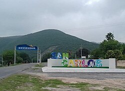
San Carlos Municipality is a municipality located in the Mexican state of Tamaulipas.

San Carlos | |
|---|---|
| | |
| Coat of arms | |
| Country | |
| State | Tamaulipas |
| Municipal seat | San Carlos |
| Population (2010) | |
| • Total | 9,331 |
San Carlos Municipality is a municipality located in the Mexican state of Tamaulipas.
24°24′10″N98°59′20″W / 24.4029°N 98.9890°W
| | This article about a location in the Mexican state of Tamaulipas is a stub. You can help Wikipedia by expanding it. |

San Carlos is a community and census-designated place (CDP) in Hidalgo County, Texas. The population was 3,130 at the 2010 United States Census. It is part of the McAllen–Edinburg–Mission Metropolitan Statistical Area.

San Carlos is the capital city of the municipality of San Carlos and of the Río San Juan Department of Nicaragua.

Rionegro is a city and municipality in Antioquia Department, Colombia, located in the subregion of Eastern Antioquia. The official name of the city is "Ciudad Santiago de Arma de Rionegro". Rio Negro means "Black River" in Spanish, as the city received its name after a river that looks black because of the shadows cast by trees. The river traverses the city and it is the most prominent geographical feature of the municipality. Rionegro is also sometimes called the Cuna de la democracia as it was one of the most important cities during the era of the Colombia's struggle for independence and the 1863 constitution was written in the city.

San Carlos is a town and municipality in the Colombian department of Antioquia, part of the subregion of Eastern Antioquia. It is called the hydro-electrical capital of Colombia, because it has many dams and it produces much energy.

Alfoz is a municipality in the Spanish Galician province of Lugo. It is in the region of A Mariña Central. It borders the municipalities of Foz, Mondoñedo, Abadín and O Valadouro.

Altamirano is a municipality in the Mexican state of Chiapas. The municipality covers an area of 1120 km2. As of 2010, the municipality had a total population of 29,865, up from 21,948 as of 2005.

Padilla Municipality is a municipality in the Mexican state of Tamaulipas. After the flood at the Vicente Guerrero Dam in 1970, the seat was moved from Padilla to the town of Nuevo Padilla.
San Fernando is a municipality and city located in the Mexican state of Tamaulipas. It is about 85 miles (137 km) away from Brownsville, Texas, United States. The municipality has a population of 57,220, while the city itself has a population of 29,665.

Carlos A. Carrillo is a municipality in the Mexican state of Veracruz.

Cuautlancingo Municipality is a town and municipality in the Mexican state of Puebla, south-eastern Mexico. It is part of the Metropolitan area of Puebla. The town is bordered on the north by the state of Tlaxcala, Tlaxcala, east to the municipality of Tlaxcala and the city of Puebla, to the south with the municipality of San Pedro Cholula and Puebla and west by the municipality of Coronango.
Izúcar de Matamoros is a municipality in the Mexican state of Puebla in south-eastern Mexico.
Nealtican (municipality) is a municipality in the Mexican state of Puebla in south-eastern Mexico. The municipal seat is the town of San Buenaventura Nealtican.
San Gregorio Atzompa Municipality is a municipality in the Mexican state of Puebla in south-eastern Mexico.
San Jerónimo Tecuanipan (municipality) is a town and municipality in the Mexican state of Puebla in south-eastern Mexico.
San Juan Atzompa (municipality) is a town and municipality in the Mexican state of Puebla in south-eastern Mexico.
San Matías Tlalancaleca is a town and municipality in the Mexican state of Puebla in south-eastern Mexico. The population of San Matias Tlalancaleca was 20,974 inhabitants in 2015.
San Pablo Anicano (municipality) is a town and municipality in the Mexican state of Puebla in south-eastern Mexico.

San Salvador el Verde (municipality) is a town and municipality in the Mexican state of Puebla in south-eastern Mexico. It is best known as the site of the Chautla Hacienda, which was the property of Eulogio Gillow, the first archbishop of Antequera (city of Oaxaca) and contains an English style residence called locally called "El Castillo" (The Castle). The facility today is run as a recreation center.
San Carlos, also known as Puerto San Carlos, is a fishing community facing the Pacific Ocean, in Magdalena Bay of Baja California Sur, Mexico. It is located in Comondú Municipality and had a 2020 census population of 5,742.
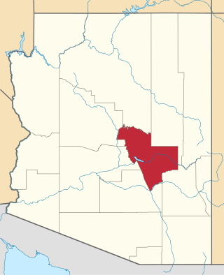
The Mescal Mountains are a series of connected mountain ridges in southern Gila County, Arizona. Their highest point is El Capitan Mountain, which has an elevation of 6,568 ft and a prominence of 1,828 ft. The highest point has a topographic isolation of 5.98 miles, with the nearest point of equal or greater elevation being to the north west in the Pinal Mountains. The mountain ridges are visible in the east from Arizona State Route 77 between Globe and Winkelman.The range is approximately 10 miles west of San Carlos Lake, which lies in the San Carlos Apache Indian Reservation; the ridges themselves also mostly fall within the boundary of the reservation, with the exception of the western section and the high point. As such, hiking the ridge may require special permission from San Carlos Apache Indian Reservation, although no trails exist on the mountains themselves or leading to them. The ridge's relative proximity to the more visually dominant Pinal Mountains, make it an often-overlooked feature. The range is one of many to occur in the Arizona transition zone.
