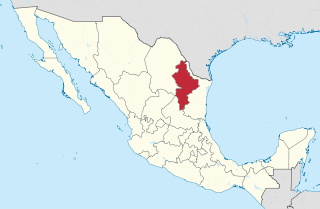
Nuevo León is a state in northeast Mexico. The state borders the Mexican states of Tamaulipas, Coahuila, Zacatecas, and San Luis Potosi, and has an extremely narrow international border with the U.S. state of Texas. With a population of 5.78 million people, it is the seventh-most populous federal entity in Mexico and the fourteenth most densely populated as of 2020. Nuevo León is the 13th-largest federal entity in Mexico by area, with a total land area of 64,156 square kilometers.

Tamaulipas, officially the Free and Sovereign State of Tamaulipas, is a state in Mexico; one of the 31 states which, along with Mexico City, comprise the 32 Federal Entities of Mexico. It is divided into 43 municipalities.

Ciudad Victoria is the seat of the Municipality of Victoria, and the capital of the Mexican state of Tamaulipas. It is located in the northeast of Mexico at the foot of the Sierra Madre Oriental. It borders the municipality of Güémez to the north, Llera to the south, Casas Municipality to the east, and the municipality of Jaumave to the west. The city is located 246 km (153 mi) from Monterrey and 319 km (198 mi) from the US - Mexico border. Ciudad Victoria is named after the first president of Mexico, Guadalupe Victoria.

Reynosa is a border city in the northern part of the state of Tamaulipas, in Mexico which also holds the municipal seat of Reynosa Municipality.

Tampico is a city and port in the southeastern part of the Mexican state of Tamaulipas. It is located on the north bank of the Pánuco River, about 10 kilometers (6 mi) inland from the Gulf of Mexico, and directly north of the state of Veracruz. Tampico is the fifth-largest city in Tamaulipas, with a population of 314,418 in the city proper and 929,174 in the metropolitan area.

Ciudad Madero is a coastal city located on the Gulf of Mexico in the southeast of the Mexican state of Tamaulipas. It is the seventh most populous city in the state, with a census-estimated 2015 population of 209,175 within an area of 18.0 square miles (46.6 km2) the city is the third-largest in the Tampico metropolitan area. It is also an important center for oil refining.

Tamaulipas is a state in Northeast Mexico that is divided into 43 municipalities. According to the 2020 Mexican census, it is the fourteenth most populated state with 3,527,735 inhabitants and the sixth largest by land area spanning 80,249.3 square kilometres (30,984.4 sq mi).

Altamira is a municipality in the Mexican state of Tamaulipas. It is located immediately to the north of the municipalities of Tampico and Ciudad Madero, at the southern tip of the state of Tamaulipas, on the Gulf of Mexico. Additionally, it borders the municipalities of González on the west and Aldama on the north, as well as Pánuco in the state of Veracruz on the southeast. Altamira can also refer to the city, founded in 1749, that is its municipal seat and second-largest community. The municipality is primarily made up of the cities of Miramar and Altamira, in addition to many smaller outlying towns such as Cuauhtémoc. The municipality has a total area of 1,666.53 km2.

Metropolitan areas of Mexico have been traditionally defined as the group of municipalities that heavily interact with each other, usually around a core city, in Mexico. The phenomenon of metropolization in Mexico is relatively recent, starting in the 1940s. Because of an accelerated level of urbanization in the country, the definition of a metropolitan area is reviewed periodically by the Mexican population and census authorities.
Cadereyta Jiménez is the name of a city as well as of a municipality in the Mexican state of Nuevo León.

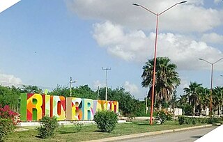
Río Bravo, formally Ciudad Río Bravo, is a city on the northern border of the state of Tamaulipas in northeastern Mexico.

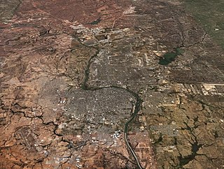
Laredo–Nuevo Laredo is one of six transborder agglomerations along the U.S.-Mexican border. The city of Laredo is situated in the U.S. state of Texas on the northern bank of the Rio Grande and Nuevo Laredo is located in the Mexican State of Tamaulipas in the southern bank of the river. This area is also known as the Two Laredos or the Laredo Borderplex. The area is made up of one county in the U.S and three municipalities in Mexico. Two urban areas, three cities, and 12 towns make the Laredo–Nuevo Laredo Metropolitan area. The two sides of the Borderplex are connected by four International Bridges and an International Railway Bridge. The Laredo–Nuevo Laredo Metropolitan area has a total of 636,516 inhabitants according to the INEGI Census of 2010 and the United States Census estimate of 2010. According to World Gazetteer this urban agglomeration ranked 157th largest in North and South America in 2010 with an estimated population of 675,481. This area ranks 66th in the United States and 23rd in Mexico.

The Municipality of Nuevo Laredo is located in the Mexican state of Tamaulipas. Its municipal seat is Nuevo Laredo. The municipality contains more than 60 localities which the most important ones are Nuevo Laredo, El Campanario y Oradel, and Álvarez, the last two being suburbs of the city of Nuevo Laredo. By population, the municipality is the third largest in the state of Tamaulipas. The Nuevo Laredo municipality is the northernmost in Tamaulipas, lying at the extreme northwestern tip of its narrow strip of land along the Río Grande. The city of Nuevo Laredo contains approximately 97.5% of the total population of the municipality.

Mainero is a municipality located in the Mexican state of Tamaulipas. Its capital is called Villa Mainero and had 338 inhabitants during a 2020 INEGI census. The municipality as a whole had 2 048 inhabitants. Other localities include José Guadalupe Mainero, Guadalupe Mainero and Guadalupe Mainero. All named after Guadalupe Mainero (1856–1901), a Mexican journalist, teacher and governor of Tamaulipas between May 4, 1896 and July 31, 1901.
Pueblo Viejo is a municipality in the Mexican state of Veracruz. It is located in the state's Huasteca Alta region. The municipal seat is the city of Ciudad Cuauhtémoc.

Tampico Alto is a municipality of the Mexican state of Veracruz. It is located in the state's Huasteca Alta region, at the northern end of Tamiahua Lagoon. The municipal seat is also called Tampico Alto.

Altamira is a port city on the Gulf of Mexico and is located near the southeastern tip of the state of Tamaulipas in Mexico. It is the second-largest city in the municipality of Altamira. To the south is Tampico, also in this state.

The Tampico metropolitan area is the third most populous metropolitan area in the state of Tamaulipas, in the country of Mexico. Its in-state metropolitan area of Tamaulipas counts with the municipalities of Tampico, Ciudad Madero, Altamira. On the other hand, the out-of-state municipalities include Pueblo Viejo and Pánuco, from the state of Veracruz.

Citlaltépetl is a municipality in the Mexican state of Veracruz, located 223 kilometres (139 mi) northwest of the state capital of Xalapa and 99 kilometres (62 mi) south of the city of Tampico, Tamaulipas.

The Alvarado mangroves ecoregion covers a series of mangrove forest areas along the Gulf of Mexico coast of the states of Tamaulipas and Veracruz in Mexico. they are the most northerly mangroves in the western Gulf. The largest tracts of mangrove swamps occur at the mouths of rivers, and nearby coastal lagoon.


