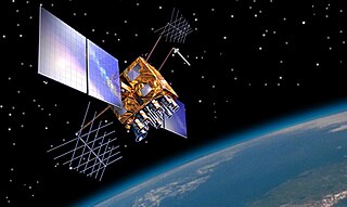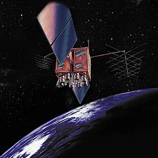
USA-201, also known as GPS IIR-19(M), GPS IIRM-6 and GPS SVN-48, is an American navigation satellite which forms part of the Global Positioning System. It was the sixth of eight Block IIRM satellites to be launched, and the nineteenth of twenty one Block IIR satellites overall. It was built by Lockheed Martin, using the AS-4000 satellite bus.
USA-35, also known as Navstar 2-01, GPS II-1 and GPS SVN-14, was an American navigation satellite which formed part of the Global Positioning System. It was the first of nine Block II GPS satellites to be launched, which were the first operational GPS satellites to be launched.

USA-242, also known as GPS IIF-4, GPS IIF SV-5, Navstar-68 and Vega, is an American navigation satellite which was launched on 15 May 2013 and became operational on 21 June 2013. The fourth Block IIF GPS satellite, it forms part of the Global Positioning System.
USA-94, also known as GPS IIA-13, GPS II-22 and GPS SVN-35, was an American navigation satellite which formed part of the Global Positioning System. It was the thirteenth of nineteen Block IIA GPS satellites to be launched.

USA-145, also known as GPS IIR-3 and GPS SVN-46, is an American navigation satellite which forms part of the Global Positioning System. It was the third Block IIR GPS satellite to be launched, out of thirteen in the original configuration, and twenty one overall. It was built by Lockheed Martin, using the AS-4000 satellite bus.

USA-183, also known as GPS IIR-14(M), GPS IIRM-1 and GPS SVN-53, is an American navigation satellite which forms part of the Global Positioning System. It was the first of eight Block IIRM satellites to be launched, and the fourteenth of twenty one Block IIR satellites overall. It was built by Lockheed Martin, using the AS-4000 satellite bus.

USA-190, also known as GPS IIR-15(M), GPS IIRM-2 and GPS SVN-52, is an American navigation satellite which forms part of the Global Positioning System. It was the second of eight Block IIRM satellites to be launched, and the fifteenth of twenty one Block IIR satellites overall. It was built by Lockheed Martin, using the AS-4000 satellite bus.

USA-192, also known as GPS IIR-16(M), GPS IIRM-3 and GPS SVN-58, is an American navigation satellite which forms part of the Global Positioning System. It was the third of eight Block IIRM satellites to be launched, and the sixteenth of twenty one Block IIR satellites overall. It was built by Lockheed Martin, using the AS-4000 satellite bus.

USA-196, also known as GPS IIR-17(M), GPS IIRM-4 and GPS SVN-55, is an American navigation satellite which forms part of the Global Positioning System. It was the fourth of eight Block IIRM satellites to be launched, and the seventeenth of twenty one Block IIR satellites overall. It was built by Lockheed Martin, using the AS-4000 satellite bus.

USA-199, also known as GPS IIR-18(M), GPS IIRM-5 and GPS SVN-57, is an American navigation satellite which forms part of the Global Positioning System. It was the fifth of eight Block IIRM satellites to be launched, and the eighteenth of twenty one Block IIR satellites overall. It was built by Lockheed Martin, using the AS-4000 satellite bus.

USA-203, also known as GPS IIR-20(M), GPS IIRM-7 and GPS SVN-49, is an American navigation satellite which was intended to become part of the Global Positioning System. It was the sixth of seven Block IIRM satellites to be launched, and the twentieth of twenty one Block IIR satellites overall. It was built by Lockheed Martin, using the AS-4000 satellite bus, and had a mass of 2,032 kilograms (4,480 lb).

USA-232, also known as GPS IIF-2, and GPS SVN-63, is an American navigation satellite which forms part of the Global Positioning System. It was the second of twelve Block IIF satellites to be launched.

USA-239, also known as GPS IIF-3, GPS SVN-65, and Navstar-67 is an American navigation satellite which forms part of the Global Positioning System. It was the third of twelve Block IIF satellites to be launched.

USA-248, also known as GPS IIF-5, GPS SVN-64 and NAVSTAR 69, is an American navigation satellite which forms part of the Global Positioning System. It was the fifth of twelve Block IIF satellites to be launched.

USA-251, also known as GPS IIF-6, GPS SVN-67 and NAVSTAR 70, is an American navigation satellite which forms part of the Global Positioning System. It was the sixth of twelve Block IIF satellites to be launched.

USA-256, also known as GPS IIF-7, GPS SVN-68 and NAVSTAR 71, is an American navigation satellite which forms part of the Global Positioning System. It was the seventh of twelve Block IIF satellites to be launched.

USA-258, also known as GPS IIF-8, GPS SVN-69 and NAVSTAR 72, is an American navigation satellite which forms part of the Global Positioning System. It was the eighth of twelve Block IIF satellites to be launched.

USA-262, also known as GPS IIF-10, GPS SVN-72 and NAVSTAR 74, is an American navigation satellite which forms part of the Global Positioning System. It was the tenth of twelve Block IIF satellites to be launched.

USA-265, also known as GPS IIF-11, GPS SVN-73 and NAVSTAR 75, is an American navigation satellite which forms part of the Global Positioning System. It was the eleventh of twelve Block IIF satellites to be launched.

USA-266, also known as GPS IIF-12, GPS SVN-70 and NAVSTAR 76, is an American navigation satellite which forms part of the Global Positioning System. It was the twelfth of twelve Block IIF satellites to be launched.


