Vallenar

Last updated
Vallenar
Plaza de Armas de Vallenar.jpg


Escudo Vallenar.png
Txu-oclc-224571178-sh19-01.jpg
Chile location map.svg
Red pog.svg
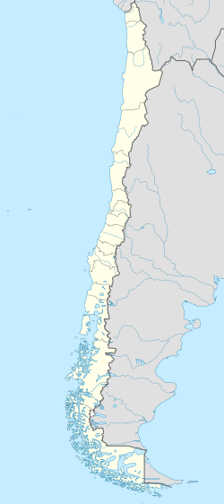
Vallenar
Location in Chile
Coordinates: 28°34′15″S70°45′29″W / 28.57083°S 70.75806°W / -28.57083; -70.75806 Coordinates: 28°34′15″S70°45′29″W / 28.57083°S 70.75806°W / -28.57083; -70.75806
Country Flag of Chile.svg  Chile
Region Flag of Atacama, Chile.svg  Atacama
Province Huasco
Founded1789
Founded asSan Ambrosio de Ballenary
Founded by Ambrose O'Higgins
Government
[1]
  Type Municipality
   Alcalde Cristian Tapia Ramos
Area
[2]
  Total7,083.7 km2 (2,735.0 sq mi)
Elevation
441 m (1,447 ft)
Population
 (2012 Census) [2]
  Total52,096
  Density7.4/km2 (19/sq mi)
   Urban
48,040
   Rural
4,290
Demonym(s) Vallenarino
Sex
[2]
  Men23,284
  Women24,765
Time zone UTC−4 (CLT)
  Summer (DST) UTC−3 (CLST)
Area code(s) 56 + 51
Website Official website (in Spanish)

Vallenar is a city and commune in Atacama Region, Chile. It is the capital of the Huasco Province and is located in the valley of the Huasco River. Vallenar has 52,000 inhabitants. Its main activities are farming and mining. It was founded as San Ambrosio de Ballenary by Ambrose O'Higgins in 1789, after his birthplace in Ballynary in County Sligo, Ireland.

Contents

Llanos de Challe National Park is located 60 km (37 mi) northwest of the city of Vallenar.

Demographics

According to the 2002 census by the National Statistics Institute, Vallenar had 48,040 inhabitants (23,284 men and 24,756 women). Of these, 43,750 (91.1%) lived in urban areas and 4,290 (8.9%) in rural areas. The population grew by 1.7% (792 persons) between the 1992 and 2002 censuses. [2]

Administration

As a commune, Vallenar is a third-level administrative division of Chile administered by a municipal council, headed by an alcalde who is directly elected every four years. The 2008-2012 alcalde is Cristian Tapia Ramos. [1]

Within the electoral divisions of Chile, Vallenar is represented in the Chamber of Deputies by Mr. Alberto Robles (PRSD) and Mr. Giovanni Calderón (UDI) as part of the 6th electoral district, (together with Caldera, Tierra Amarilla, Freirina, Huasco and Alto del Carmen). The commune is represented in the Senate by Isabel Allende Bussi (PS) and Baldo Prokurica Prokurica (RN) as part of the 3rd senatorial constituency (Atacama Region).

Climate

Climate data for Vallenar
MonthJanFebMarAprMayJunJulAugSepOctNovDecYear
Average high °C (°F)26.6
(79.9)
26.7
(80.1)
25.3
(77.5)
22.7
(72.9)
20.6
(69.1)
18.9
(66.0)
18.88
(65.98)
19.8
(67.6)
21.0
(69.8)
22.7
(72.9)
24.1
(75.4)
25.5
(77.9)
22.7
(72.9)
Daily mean °C (°F)18.6
(65.5)
18.6
(65.5)
17.1
(62.8)
14.9
(58.8)
13.1
(55.6)
11.7
(53.1)
11.4
(52.5)
12.2
(54.0)
13.0
(55.4)
14.5
(58.1)
15.6
(60.1)
17.5
(63.5)
14.9
(58.8)
Average low °C (°F)13.1
(55.6)
13.1
(55.6)
12.0
(53.6)
10.1
(50.2)
8.6
(47.5)
7.1
(44.8)
6.8
(44.2)
7.3
(45.1)
7.9
(46.2)
9.0
(48.2)
10.1
(50.2)
11.8
(53.2)
9.7
(49.5)
Average precipitation mm (inches)0.0
(0.0)
0.0
(0.0)
0.7
(0.03)
1.3
(0.05)
4.1
(0.16)
3.2
(0.13)
11.9
(0.47)
7.1
(0.28)
2.1
(0.08)
1.2
(0.05)
0.0
(0.0)
0.0
(0.0)
31.6
(1.24)
Mean monthly sunshine hours 337.9299.5285.2240.0213.9195.0210.8235.6249.0288.3303.0325.53,183.7
Mean daily sunshine hours 10.910.69.28.06.96.56.87.68.39.310.110.58.7
Source: Universidad de Chile [3] [4]

Notable people

Related Research Articles

Calama, Chile City and Commune in Antofagasta, Chile

Calama is a city and commune in the Atacama Desert in northern Chile. It is the capital of El Loa Province, part of the Antofagasta Region. Calama is one of the driest cities in the world with average annual precipitation of just 5 mm (0.20 in). The River Loa, Chile's longest, flows through the city. Calama has a population of 147,886.

Tocopilla City and Commune in Antofagasta, Chile

Tocopilla is a city and commune in the Antofagasta Region, in the north of Chile. It is the capital of the province that bears the same name.

Copiapó City and Commune in Atacama, Chile

Copiapó is a city in northern Chile, located about 65 kilometers east of the coastal town of Caldera. Founded on December 8, 1744, it is the capital of Copiapó Province and Atacama Region.

Río Negro, Chile City and Commune in Los Lagos, Chile

Río Negro is a Chilean city and commune in Osorno Province, Los Lagos Region. The city is located 38 km south of Osorno and 6 km west of Route 5. It has an area of 1,266 km² and a population of 14,732 inhabitants.

Caldera, Chile City and Commune in Atacama, Chile

Caldera is a port city and commune in the Copiapó Province of the Atacama Region in northern Chile. It has a harbor protected by breakwaters, being the port city for the productive mining district centering on Copiapó to which it is connected by the first railroad constructed in Chile.

Chañaral City and commune in Atacama, Chile

Chañaral is a small coastal city and commune in the Atacama Region, Chile and capital of the Chañaral Province. It is a colourful town largely unknown by tourists, who generally head straight for towns such as San Pedro de Atacama. The town is considered unspoiled, with the benefit of having absolutely no high rise buildings. On the arid hills nearby is a lighthouse which casts a beam over the town during the night. Throughout the day and night, there is a lively, bustling atmosphere on the narrow streets. Despite it being coastal, it is not a typical seaside resort, partly because the ocean is contaminated by the copper mining industry. Situated a short distance to the north is the Pan de Azúcar National Park.

Huara Commune in Tarapacá, Chile

Huara is a Chilean town and commune in Tamarugal Province, Tarapacá Region. It is located 45 km (28 mi) or northeast of Iquique. The village is crossed by the Pan-American Highway and is the crossing point for the road that goes to Oruro in Bolivia. This road also serves as access to the Atacama Giant site and the Volcán Isluga National Park.

Pozo Almonte City and Commune in Tarapacá, Chile

Pozo Almonte is a city and commune of Chile located in the interior of Atacama Desert. It has been the capital of Tamarugal Province since this province was established in 2007. The city is located at 52 km (32 mi) from Tacapacá Region's capital, Iquique. It has over 15,000 inhabitants. The commune has an area of 13,766 km (8,554 mi) and borders the following communes: Iquique, Alto Hospicio, Huara, Pica, María Elena and Tocopilla.

La Unión, Chile city and commune in Los Ríos, Chile

La Unión is a city and commune of the Ranco Province in the Los Ríos Region in Chile. It is situated approximately 40 km north of Osorno and 80 km southeast of Valdivia. Covering an area of 2,136.7 km², it has a population of 36,447, of which 25,615 are considered part of the urban population, according to the 2012 census. The commune derived its name from the confluence of the Llollelhue and Radimadi rivers.

Huasco Province Province in Atacama, Chile

Huasco Province is one of three provinces of the northern Chilean region of Atacama (III). Vallenar is the capital city.

Huasco City and Commune in Atacama, Chile

Huasco is a Chilean city and commune, in the Huasco Province, Atacama Region.

Camarones, Chile City and Commune in Arica y Parinacota, Chile

Camarones is a city and commune in the Arica y Parinacota Region in Chile. It forms part of the administrative Arica Province and has a population of 1,220. Its municipality seat is in the town of Cuyo, located next to the Chile Highway 5. Cuyo is the administrative center of the commune and a place of rest for travellers. The main towns are Codpa and Caleta Camarones. The latter is a fishing inlet of only 44 inhabitants. Codpa is the largest town in the commune, located 114 kilometres (71 mi) from the city of Arica. It is an entirely rural commune with almost no tourist activity, and is well known for its uncharted areas. The only Afro-Chilean community in Chile is located in Camarones.

Timaukel Commune in Magallanes y Antártica Chilena, Chile

Timaukel is a commune located in the Chilean part of Tierra del Fuego Island. It is part of Tierra del Fuego Province in Magallanes Region. The commune is administered by the municipality in Villa Cameron, which is the main port and settlement within the commune.

Aysén, Chile Commune in Aysén, Chile

Aysén or Aisén is a Chilean commune located in Aysén Province, Aysén del General Carlos Ibáñez del Campo Region. It is home to the city of Puerto Aysén and to the towns of Villa Mañiguales and Puerto Chacabuco.

Taltal City and Commune in Antofagasta, Chile

Taltal is a Chilean commune and city in Antofagasta Province, Antofagasta Region. According to the 2012 census, the commune has a population of 11,132 and has an area of 20,405.1 km2 (7,878 sq mi). The commune is home to Paranal Observatory and includes the northern portion of Pan de Azúcar National Park.

Diego de Almagro, Chile City and Commune in Atacama, Chile

Diego de Almagro is a Chilean city and commune in Chañaral Province, Atacama Region. The commune has an area of 18,663.8 km2 (7,206 sq mi). The area is named after Diego de Almagro.

Tierra Amarilla, Chile City and Commune in Atacama, Chile

Tierra Amarilla is a Chilean commune and city in Copiapó Province, Atacama Region. According to the 2012 census, the commune population was 12,898 and has an area of 11,191 km².

Freirina Town and Commune in Atacama, Chile

Freirina is a Chilean commune and town in Huasco Province, Atacama Region. The commune spans an area of 3,577.7 km2 (1,381 sq mi).

Alto del Carmen Commune in Atacama, Chile

Alto del Carmen is a Chilean commune and village in Huasco Province, Atacama Region. The commune spans an area of 5,938.7 km2 (2,293 sq mi).

Petorca Town and Commune in Valparaíso, Chile

Petorca is a Chilean town and commune located in the Petorca Province, Valparaíso Region. The commune spans an area of 1,516.6 km2 (586 sq mi). Since 2010 Petorca has been affected by a long-term drought aggravated by poor water administration that have allowed limited water resources go to avocado plantations rather than human settlements.

References

  1. 1 2 "Municipality of Vallenar" (in Spanish). Retrieved 4 November 2010.
  2. 1 2 3 4 "National Statistics Institute" (in Spanish). Retrieved 8 September 2010.
  3. "Información climatológica de estaciones chilenas-Chile Norte" (in Spanish). Archived from the original on January 16, 2013. Retrieved March 17, 2014.
  4. "Tabla 4.6: Medias mensuales de horas de sol diarias extraídas del WRDC ruso (en (hrs./dia))" (PDF). Elementos Para La Creación de Un Manual de Buenas Prácticas Para Instalaciones Solares Térmicas Domiciliarias (in Spanish). Universidad de Chile. September 2007. p. 81. Retrieved 21 January 2015.