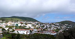
Valverde, Santa Cruz de Tenerife

Last updated
Valverde
Valverde2009.jpg
Coat of Arms of Valverde (Santa Cruz de Tenerife Province).svg
Karte Gemeinde Valverde 2022.png
Location of the municipality within El Hierro
Valverde, Santa Cruz de Tenerife
Location of Valverde
Canarias-loc.svg
Red pog.svg
Valverde
Espana-Canarias-loc.svg
Red pog.svg
Valverde
Coordinates: 27°48′0″N17°55′0″W / 27.80000°N 17.91667°W / 27.80000; -17.91667
CountryFlag of Spain.svg  Spain
Autonomous community Flag of the Canary Islands.svg  Canary Islands
Province Provincia de Santa Cruz de Tenerife - Escudo.svg  Santa Cruz de Tenerife
IslandFlag of El Hierro.svg  El Hierro
Area
[1]
  Total103.65 km2 (40.02 sq mi)
Elevation
[1]
571 m (1,873 ft)
Population
 (2018) [2]
  Total4,955
  Density48/km2 (120/sq mi)
Postal code
E-38900

Valverde (Spanish meaning "green valley") is a municipality in the Canary Islands in the province of Santa Cruz de Tenerife. It is located on the north-east part of El Hierro (the rest of the island being the municipalities of Frontera and El Pinar). The town of the same name serves as the island's official capital. It is both the smallest Canarian capital and the only one not located by the sea. The town's airport and seaport are both several kilometres away on the island's east coast.

Contents

Pastureland and smallholdings dominate the central plateau area with pine and cloud forest at progressively higher elevations. The coastal areas and lower slopes are arid and mainly left to unimproved scrub and sparse grassland. Volcanism is prominent, with several cinder cones and areas of lava flow to be seen.

Historical population

YearPopulation
20014,227
20024,643
20034,727
20135,048
Church of Nuestra Senora de la Concepcion, Valverde Concepcionvalverde2009.JPG
Church of Nuestra Señora de la Concepción, Valverde
Charco Azul, Valverde Charco Azul.JPG
Charco Azul, Valverde
The Giant Lizard of El Hierro, endemic to this island Gallotia simonyi.jpg
The Giant Lizard of El Hierro, endemic to this island

Climate

The city has a tropical desert climate (Köppen climate classification BWh) with mild temperatures year round. [3] Winters are mild and warm with a January mean of 18.8 °C (65.8 °F). Temperatures rarely go below 10 °C (50.0 °F) with the record low being 8.0 °C (46.4 °F) on January 16, 1981. [4] Frosts are non-existent. [5] Most of the precipitation falls during the winter months. Summers are warm with the warmest month, September averaging 24.1 °C (75.4 °F), indicating a seasonal lag. Precipitation is scarce during this time, averaging 0 millimetres (0 in) to 2 millimetres (0 in). Owing to its proximity to the sea, extreme temperatures are rare with the highest temperature recorded being 34.2 °C (93.6 °F) on October 16, 1983. [4]

Valverde is at an altitude of 571 metres above sea level, while El Hierro airport is just 32 metres above sea level. The difference in altitude can have a significant effect on the weather.

Climate data for Hierro Airport
MonthJanFebMarAprMayJunJulAugSepOctNovDecYear
Record high °C (°F)28.5
(83.3)
29.4
(84.9)
32.6
(90.7)
33.2
(91.8)
31.4
(88.5)
32.0
(89.6)
32.4
(90.3)
33.8
(92.8)
33.3
(91.9)
34.2
(93.6)
32.4
(90.3)
28.3
(82.9)
34.2
(93.6)
Mean daily maximum °C (°F)20.9
(69.6)
20.8
(69.4)
21.4
(70.5)
21.6
(70.9)
22.6
(72.7)
24.0
(75.2)
25.0
(77.0)
26.1
(79.0)
26.5
(79.7)
25.6
(78.1)
23.7
(74.7)
22.2
(72.0)
23.4
(74.1)
Daily mean °C (°F)18.8
(65.8)
18.6
(65.5)
19.0
(66.2)
19.3
(66.7)
20.3
(68.5)
21.7
(71.1)
22.8
(73.0)
23.7
(74.7)
24.1
(75.4)
23.3
(73.9)
21.6
(70.9)
20.0
(68.0)
21.1
(70.0)
Mean daily minimum °C (°F)16.6
(61.9)
16.4
(61.5)
16.7
(62.1)
17.0
(62.6)
17.9
(64.2)
19.3
(66.7)
20.5
(68.9)
21.3
(70.3)
21.7
(71.1)
20.9
(69.6)
19.5
(67.1)
17.8
(64.0)
18.8
(65.8)
Record low °C (°F)8.0
(46.4)
9.0
(48.2)
9.2
(48.6)
10.0
(50.0)
10.0
(50.0)
10.0
(50.0)
14.0
(57.2)
14.2
(57.6)
15.2
(59.4)
11.0
(51.8)
12.0
(53.6)
9.6
(49.3)
8.0
(46.4)
Average precipitation mm (inches)28
(1.1)
29
(1.1)
20
(0.8)
14
(0.6)
2
(0.1)
1
(0.0)
0
(0)
0
(0)
2
(0.1)
12
(0.5)
26
(1.0)
33
(1.3)
170
(6.7)
Average precipitation days (≥ 1.0 mm)32310000022419
Average relative humidity (%)74767474747577787776747475
Mean monthly sunshine hours 1401581841972332292102342101891571432,339
Source 1: Agencia Estatal de Meteorología (normals 1971-2010) [5]
Source 2: Agencia Estatal de Meteorología (extremes only 1973-present) [4]

See also

Related Research Articles

<span class="mw-page-title-main">Desert climate</span> Arid climate subtype in the Köppen climate classification system with very little precipitation

The desert climate or arid climate is a dry climate sub-type in which there is a severe excess of evaporation over precipitation. The typically bald, rocky, or sandy surfaces in desert climates are dry and hold little moisture, quickly evaporating the already little rainfall they receive. Covering 14.2% of Earth's land area, hot deserts are the second most common type of climate on Earth after the polar climate.

<span class="mw-page-title-main">El Hierro</span> Island of the Canary Islands, Spain

El Hierro, nicknamed Isla del Meridiano, is the second-smallest and farthest south and west of the Canary Islands, in the Atlantic Ocean off the coast of Africa, with a population of 11,659 (2023). Its capital is Valverde. At 268.51 square kilometres (103.67 sq mi), it is the second-smallest of the eight main islands of the Canaries.

<span class="mw-page-title-main">Ibiza (city)</span> Municipality in Balearic Islands, Spain

Ibiza, officially in Catalan: Eivissa, is a city and municipality located on the southeast coast of the island of Ibiza in the Balearic Islands autonomous community.

<span class="mw-page-title-main">Almería</span> Municipality in Andalusia, Spain

Almería is a city and municipality of Spain, located in Andalusia. It is the capital of the province of the same name. It lies in southeastern Iberia on the Mediterranean Sea. Caliph Abd al-Rahman III founded the city in 955. The city grew wealthy during the Islamic era, becoming a world city throughout the 11th and 12th centuries. It enjoyed an active port that traded silk, oil, and raisins. Being adjacent to a small desert, Almería has an exceptionally dry climate by European standards.

<span class="mw-page-title-main">Köppen climate classification</span> Climate classification system

The Köppen climate classification is one of the most widely used climate classification systems. It was first published by German-Russian climatologist Wladimir Köppen (1846–1940) in 1884, with several later modifications by Köppen, notably in 1918 and 1936. Later, German climatologist Rudolf Geiger (1894–1981) introduced some changes to the classification system in 1954 and 1961, which is thus sometimes called the Köppen–Geiger climate classification.

<span class="mw-page-title-main">Rota, Andalusia</span> Town in Cádiz, Spain

The town of Rota is a Spanish municipality located in the Province of Cádiz, Andalusia. Its surface area is 84 km2 and is bordered by the towns of Chipiona, Sanlúcar de Barrameda and El Puerto de Santa María. It is located near the city of Jerez de la Frontera and is 36 kilometers away from the provincial capital, Cadiz. It had in the year 2009 28,516 inhabitants, with a density of 339 inhabitants / km2. It belongs to two associations, the Association of Municipalities of Cadiz Bay along with the municipalities of Cadiz, Jerez de la Frontera, El Puerto de Santa María, San Fernando, Chiclana and Puerto Real; and the Association of Municipalities of the Lower Guadalquivir that comprises municipalities of Northwest Coast of Andalusia.

<span class="mw-page-title-main">Ramos Arizpe</span> City in the Mexican state of Coahuila

Ramos Arizpe is a city and seat of the surrounding municipality of the same name in the Mexican state of Coahuila. Ramos Arizpe is located 11 km from the state capital of Saltillo. It is part of the Saltillo metropolitan area. The city reported a population of 48,228 in the 2005 census; the municipality had a population of 56,708. Its area is 5,306.6 km2.

<span class="mw-page-title-main">El Hierro Airport</span> Airport in El Hierro

El Hierro Airport is an airport located 9 km (5.6 mi) northeast of Valverde. It is the only existing airport on the Island of El Hierro, Canary Islands, Spain. It was inaugurated in December 1972.

<span class="mw-page-title-main">Climate of Argentina</span> Climate of the country

The climate of Argentina varies from region to region, as the vast size of the country and wide variation in altitude make for a wide range of climate types. Summers are the warmest and wettest season in most of Argentina except in most of Patagonia where it is the driest season. Warm in the north, cool in the center and cold in the southern parts experiencing frequent frost and snow. Because southern parts of the country are moderated by the surrounding oceans, the cold is less intense and prolonged than areas at similar latitudes in the northern hemisphere. Spring and autumn are transition seasons that generally feature mild weather.

<span class="mw-page-title-main">Mao, Dominican Republic</span> Place in Valverde, Dominican Republic

The Dominican city of Santa Cruz de Mao, or simply Mao, is the head municipality of the Valverde province, in the northwest of the country.

<span class="mw-page-title-main">Climate of Europe</span> Overview of the climate of Europe

Europe is generally characterized by a temperate climate. Most of Western Europe has an Oceanic climate, in the Köppen climate classification, featuring cool to warm summers and cool winters with frequent overcast skies. Southern Europe has a distinctively Mediterranean climate, which features warm to hot, dry summers and cool to mild winters and frequent sunny skies. Central-eastern Europe is classified as having a humid continental climate, which features warm to hot summers and cold winters.

Río Colorado is a town and municipality in the Río Negro Province of Argentina. It is the administrative centre of the Pichi Mahuida Department.

<span class="mw-page-title-main">Climate of Spain</span> Overview of the climate of Spain

The climate of Spain is highly diverse and varies considerably across the country's various regions. Spain is the most climatically diverse country in Europe with 13 different Köppen climates.

<span class="mw-page-title-main">Climate of Barcelona</span> Climate of Barcelona, Spain

Barcelona has a Mediterranean climate (Csa) according to Köppen-Geiger classification, a warm-temperate subtropical climate according to Troll-Paffen climate classification, and a subtropical climate according to Siegmund/Frankenberg climate classification.

Valencia and its metropolitan area have a hot semi-arid climate with mild winters and warm to hot summers. According to Troll-Paffen climate classification, Valencia has a warm-temperate subtropical climate and according to Siegmund/Frankenberg climate classification, Valencia has a subtropical climate.

Madrid and its metropolitan area has a cold semi-arid climate which transitions to a mediterranean climate (Csa) on the western half of the city. According to the Troll-Paffen climate classification, Madrid has warm-temperate subtropical climate and according to the Siegmund/Frankenberg climate classification, Madrid has a subtropical climate. Madrid has hot summers and relatively cool winters with somewhat frequent frosts and occasional snowfalls, with 3-4 snowy days on average.

Bilbao and its metropolitan area has an oceanic climate according to the Köppen climate classification with mild winters and warm summers. According to the Troll-Paffen climate classification, Bilbao has a temperate climate and according to the Siegmund/Frankenberg climate classification, Bilbao has a subtropical climate. According to the European Environment Agency, Bilbao lies within the Atlantic biogeographical region. The climate of Bilbao and the rest of the north-western part of Spain is different from the rest of the country, characterized by a higher amount of rainfall and precipitation days, fewer sunshine hours and mild temperatures, in summer comparable to northern half of Europe with temperate climate.

<span class="mw-page-title-main">Climatic regions of Argentina</span> Overview of climatic regions of Argentina

Due to its vast size and range of altitudes, Argentina possesses a wide variety of climatic regions, ranging from the hot subtropical region in the north to the cold subantarctic in the far south. The Pampas region lies between those and featured a mild and humid climate. Many regions have different, often contrasting, microclimates. In general, Argentina has four main climate types: warm, moderate, arid, and cold in which the relief features, and the latitudinal extent of the country, determine the different varieties within the main climate types.

El Hierro Launch Centre is a proposed project by Instituto Nacional de Técnica Aeroespacial (INTA) to create a spaceport on the island of El Hierro, part of the Canary Islands. It would be located in the south of the island, in the area of Tacorón, 5 km from La Restinga. in the municipality of El Pinar, Canary Islands. It is being proposed as a center of civil use exclusively, for the launch of micro- and nanosatellites with scientific or commercial objectives, such as telecommunications or Earth observation.

References

  1. 1 2 "SUPERFICIE, PERÍMETRO Y ALTITUD DE LOS MUNICIPIOS DE CANARIAS" (in Spanish). Instituto Canario de Estadística (ISTAC). Archived from the original on 2012-12-04.
  2. Municipal Register of Spain 2018. National Statistics Institute.
  3. Kottek, M.; J. Grieser; C. Beck; B. Rudolf; F. Rubel (2006). "World Map of the Köppen-Geiger climate classification updated" (PDF). Meteorol. Z. 15 (3): 259–263. doi:10.1127/0941-2948/2006/0130 . Retrieved January 14, 2013.
  4. 1 2 3 "Valores extremos. Hierro Aeropuerto" (in Spanish). Agencia Estatal de Meteorología. Retrieved January 14, 2013.
  5. 1 2 "Valores climatológicos normales. Hierro Aeropuerto" (in Spanish). Agencia Estatal de Meteorología. Retrieved January 14, 2013.