
Nevertire is a rural village in New South Wales, Australia. It is located at the junction of the Mitchell Highway and the Oxley Highway, in Warren Shire. Nevertire is about 496 kilometres northwest of Sydney, 78 km north-west of Narromine and about 107 km from Dubbo. It is about 20 km south-west of Warren on the western end of the Oxley Highway. At the 2011 census, Nevertire had a population of 225 people.

The City of Cockburn is a local government area in the southern suburbs of the Western Australian capital city of Perth about 8 kilometres (5 mi) south of Fremantle and about 24 kilometres (15 mi) south of Perth's central business district. The City covers an area of 167.5 square kilometres (64.7 sq mi) and had a population of over 104,000 as at the 2016 Census.

The City of Melville is a local government area in the southern suburbs of the Western Australian capital city of Perth, east of the port city of Fremantle and about 12 kilometres (7.5 mi) south of Perth's central business district. The City covers an area of 52.73 square kilometres (20.36 sq mi) and had a population of about 98,000 as at the 2016 Census.

The City of Kwinana is a local government area of Western Australia. It covers an area of approximately 118 square kilometres in metropolitan Perth, and lies about 38 km south of the Perth central business district, via the Kwinana Freeway. Kwinana maintains 287 km of roads and had a population of almost 39,000 as at the 2016 Census.

The City of Vincent is a local government area of Western Australia. It covers an area of approximately 10.4 square kilometres (4.0 sq mi) in metropolitan Perth, the capital of Western Australia, and lies about 3 km from the Perth CBD. The City of Vincent maintains 139 km of roads and 104 ha of parks and gardens. It had a population of over 33,000 at the 2016 Census.
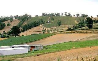
The Adelaide Hills region is located in the southern Mount Lofty Ranges east of the city of Adelaide in the state of South Australia. The largest town in the area, Mount Barker is one of Australia's fastest-growing towns. Before British colonisation of South Australia, the area was inhabited by the Peramangk people.

Hahndorf is a small town in the Adelaide Hills region of South Australia. Currently an important tourism spot, it has previously been a centre for farming and services.

Huntingdale is a suburb in Melbourne, Victoria, Australia, 16 km south-east of Melbourne's Central Business District, located within the City of Monash local government area. Huntingdale recorded a population of 1,949 at the 2021 census.
Oakleigh East is a suburb in Melbourne, Victoria, Australia 16 km south-east of Melbourne's Central Business District, located within the City of Monash local government area. Oakleigh East recorded a population of 6,804 at the 2021 census.

Cudlee Creek is a small town near Adelaide, South Australia. It is located in the Adelaide Hills Council local government area.
Medowie is a suburb of the Port Stephens local government area in the Hunter Region of New South Wales, Australia. It is located approximately 34 km (21 mi) by road north of Newcastle, not far from RAAF Base Williamtown and is home to many of the personnel stationed there. The Worimi people are the traditional owners of the Port Stephens area.

Kellyville Ridge is a suburb of Sydney, in the state of New South Wales, Australia. Kellyville Ridge is located 41 kilometres north-west of the Sydney central business district in the local government area of City of Blacktown. It is part of Greater Western Sydney.

Bexley North is a suburb in southern Sydney, in the state of New South Wales, Australia, 13 kilometres south-west of the Sydney CBD. It is part of the St George area. Bexley North is in the local government area of the Bayside Council.

Ballidu is a town in the Central Midlands division of the Wheatbelt region of Western Australia, about 217 kilometres (135 mi) north of Perth. Ballidu is also 34 kilometres (21 mi) north of the town of Wongan Hills which, along with a few other small towns such as Cadoux and Bindi Bindi make up the Shire of Wongan-Ballidu.

Summertown is a town in the Adelaide Hills region of South Australia. It adjoins Uraidla. At the 2016 census, Summertown had a population of 676.

Lobethal is a town in the Adelaide Hills area of South Australia. It is located in the Adelaide Hills Council local government area, and is nestled on the banks of a creek between the hills and up the sides of the valley. It was once the centre of the Adelaide Hills wool processing industry, which continued until around 1950. The mill buildings are now used by a number of cottage industry and handcraft businesses. At the 2016 census, Lobethal had a population of 2,135.

The Shire of Wongan–Ballidu is a local government area in the Wheatbelt region of Western Australia, about 180 kilometres (112 mi) NNE of Perth, the state capital. The Shire covers an area of 3,369 square kilometres (1,301 sq mi) and its seat of government is the town of Wongan Hills. The shire includes the Wongan Hills, after which the town is named.

The City of Armadale is a local government area in the southeastern suburbs of the Western Australian capital city of Perth, about 28 kilometres (17.4 mi) southeast of Perth's central business district. The City covers an area of 560 square kilometres (216 sq mi), much of which is state forest rising into the Darling Scarp to the east, and had a population of almost 80,000 as at the 2016 Census. At the 2021 census, the population had risen to 94,184.

The Ponds is a suburb of Sydney, in the state of New South Wales, Australia. The Ponds is about 40 kilometres (25 mi) west-northwest (WNW) of the Sydney central business district in the Blacktown local government area. The 2016 census recorded the resident population of The Ponds as 11,731.

Mount Surprise is a rural town and locality in the Shire of Etheridge, Queensland, Australia. In the 2021 census, the locality of Mount Surprise had a population of 138 people.

