Cuanza Sul Province or Kwanza-Sul is a province of Angola. It has an area of 55,660 square kilometres (21,490 sq mi) and a population of 1,881,873. Sumbe is the capital of the province.

Malanje is the capital city of Malanje Province in Angola with a population of 455,000 (2014). It is located 380 kilometres (240 mi) east of Angola's capital Luanda. Near it are the spectacular Calandula waterfalls, the rock formations of Pungo Andongo, and the Capanda Dam. The climate is mainly humid, with average temperatures between 20 and 24 °C and rainfall 900 to 130 millimetres in the rainy season.
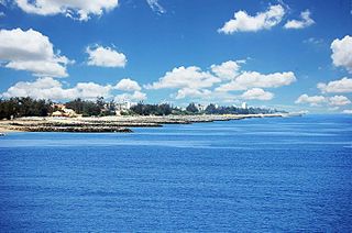
Lobito is a town, with a population of 357,950 (2014), and a municipality in Benguela Province in Angola, with a population of 393,079 (2014), located on the Atlantic Coast north of Catumbela Estuary.

Luena is a town located in east central Angola. It is the administrative capital of Moxico Province, with a population of 273,675 (2014), including refugees from the Angolan Civil War that officially ended in 2002.
Caála is a town and a municipality located 23 km west of the city of Huambo, in the namesake province in Angola. It was known as Vila Robert Williams while Angola was a Portuguese colony, after the famous railroad developer and mining magnate, Sir Robert Williams. The town has a population of 130,000 and the municipality a population of 279,792.
Caxito is a town, with a population of 55,000 (2014), and a commune in the municipality of Dande, province of Bengo, Angola.
Kuito is a city, with a population of 355,423 (2014), located in central Angola. It is the administrative capital of Bié Province. Under Portuguese rule until 1975, it was called Silva Porto. Kuito was under siege in 1993/94 and again in 1998/99 by the rebel forces from UNITA. Many buildings in Kuito are still heavily damaged as a result of these sieges.
N'dalatando is a town, with a population of 161,584 (2014), and a commune in the municipality of Cazengo, province of Cuanza Norte, Angola.
Lucapa is a town, with a population of 110,000 and a municipality with a population of 154,305, located in eastern Angola. Lucapa is the former capital of Lunda Norte Province.
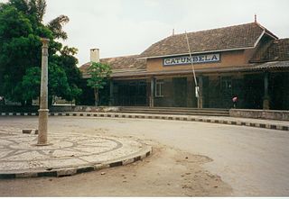
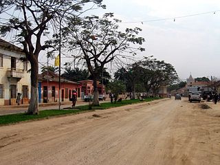
Catumbela is a city, with a population of 95,034 (2014), and a municipality of the Benguela province in Angola. The municipality has a population of 175,805 (2014).
Bailundo is a municipality, with a population of 294,494 (2014), and a town, with a population of 70,481 (2014), in the province of Huambo, Angola.
Gabela is a town, with a population of 116,903 (2014), and a commune, named Gabela Sede, in the municipality of Amboim, province of Cuanza Sul, Angola and the seat of that municipality. The area of the commune comprises 459 km2 with a population of 184,723. It was founded as N'Guebela on September 28, 1907.
Quibala is a municipality in Cuanza Sul, Angola. It comprises an area of 5,875 km. It is bordered by the city of Calulo in the north, by the town of Waku-Kungo in the east, by the municipality of Ebo in the south, and in the west by the municipality of Gabela and by Porto Amboim.
Andulo is a town, with a population of 50,000 (2014) and a municipality in Bié Province in Angola. The municipality covers an area of 10,100 square kilometres (3,900 sq mi), with a Population of 258,161 (2014). It is bordered to the north by the municipality of Mussende, to the east by the municipalities of Luquembo and Nharea, to the south by the municipalities of Cunhinga, Mungo and Bailundo and west by the municipalities of Cela and Quibala.
Calai is a town, with a population of 8,741 (2014), and a municipality in Cuando Cubango Province in Angola.

Barra do Dande is a town, with a population of 75,000 (2014), and a commune in the municipality of Dande, province of Bengo, Angola.
Cela is a município (municipality) in the province of Cuanza Sul in Angola. It covers an area of 4,610 square kilometres (1,780 sq mi) and its population is 225,520.
Waku Kungo Airport is an airport serving Waku-Kungo in Cuanza Sul Province, Angola. The runway is 6.5 kilometres (4.0 mi) south of Waku-Kungo, near the village of Cela.
Kissanga Kungo is a town and commune of Angola, located in the province of Cuanza Sul.