Walstonburg, North Carolina

Last updated

Walstonburg, North Carolina
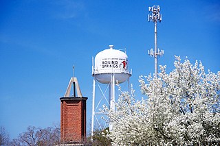
Walstonburg, North Carolina.jpg
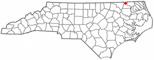
NCMap-doton-Walstonburg.PNG
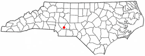
Location of Walstonburg, North Carolina
Coordinates: 35°35′46″N77°41′53″W / 35.59611°N 77.69806°W / 35.59611; -77.69806
Country United States
State North Carolina
County Greene
Area
[1]
  Total0.41 sq mi (1.05 km2)
  Land0.41 sq mi (1.05 km2)
  Water0.00 sq mi (0.00 km2)
Elevation
[2]
115 ft (35 m)
Population
 (2020)
  Total193
  Density474.20/sq mi (183.13/km2)
Time zone UTC-5 (Eastern (EST))
  Summer (DST) UTC-4 (EDT)
ZIP code
27888
Area code 252
FIPS code 37-70860 [3]
GNIS feature ID2406829 [2]

Walstonburg is a town in Greene County, North Carolina, United States. The population was 219 at the 2010 census. [4] It is located north of Snow Hill on North Carolina Highway 91. The town is part of the Greenville Metropolitan Area.

Contents

History

The Titus W. Carr House and Speight-Bynum House are listed on the National Register of Historic Places. [5]

Geography

Walstonburg is located in northern Greene County. North Carolina Highway 91 leads south 10 miles (16 km) to Snow Hill, the Greene County seat, and north 1 mile (1.6 km) to U.S. Route 264 Alternate, which in turn leads east 22 miles (35 km) to Greenville and northwest 15 miles (24 km) to Wilson.

According to the United States Census Bureau, Walstonburg has a total area of 0.41 square miles (1.05 km2), all land. [4]

Demographics

Historical population
CensusPop.Note
1910 127
1920 15824.4%
1930 17812.7%
1940 19811.2%
1950 177−10.6%
1960 1917.9%
1970 176−7.9%
1980 1812.8%
1990 1883.9%
2000 22419.1%
2010 219−2.2%
2020 193−11.9%
U.S. Decennial Census [6]

As of the census [3] of 2000, there were 224 people, 91 households, and 66 families residing in the town. The population density was 546.5 inhabitants per square mile (211.0/km2). There were 101 housing units at an average density of 246.4 per square mile (95.1/km2). The racial makeup of the town was 81.25% White, 15.62% African American, 2.23% from other races, and 0.89% from two or more races. Hispanic or Latino of any race were 2.23% of the population.

There were 91 households, out of which 27.5% had children under the age of 18 living with them, 60.4% were married couples living together, 7.7% had a female householder with no husband present, and 26.4% were non-families. 25.3% of all households were made up of individuals, and 7.7% had someone living alone who was 65 years of age or older. The average household size was 2.46 and the average family size was 2.90.

In the town, the population was spread out, with 23.2% under the age of 18, 6.3% from 18 to 24, 34.8% from 25 to 44, 23.2% from 45 to 64, and 12.5% who were 65 years of age or older. The median age was 37 years. For every 100 females, there were 109.3 males. For every 100 females age 18 and over, there were 102.4 males.

The median income for a household in the town was $36,875, and the median income for a family was $41,750. Males had a median income of $24,063 versus $22,250 for females. The per capita income for the town was $19,571. About 11.1% of families and 13.3% of the population were below the poverty line, including 4.0% of those under the age of eighteen and 6.9% of those 65 or over.

Education

The town is served by the Greene County Public School system, with five schools located in nearby Snow Hill.

Transportation

The closest airport to Walstonburg is Pitt-Greenville Airport ( IATA : PGV, ICAO : KPGV, FAA LID : PGV) with service to Charlotte Douglas International Airport, although most residents use Raleigh-Durham International Airport for domestic and international travel.

Highways that run through the area include NC 121 and NC 91. The closest interstate is I-95, located 17 miles (27 km) to the west in Wilson.

Notable people

Related Research Articles

<span class="mw-page-title-main">Wilson County, North Carolina</span> County in North Carolina, United States

Wilson County is a county located in the U.S. state of North Carolina. As of the 2020 census, the population was 78,784. The county seat is Wilson. The county comprises the Wilson, NC Micropolitan Statistical Area, which is also included within the Rocky Mount-Wilson-Roanoke Rapids, NC Combined Statistical Area.
<span class="mw-page-title-main">Pitt County, North Carolina</span> County in North Carolina, United States

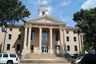
Pitt County is a county located in the Inner Banks region of the U.S. state of North Carolina. As of the 2020 census, the population was 170,243, making it the 14th-most populous county in North Carolina. Its county seat is Greenville.

<span class="mw-page-title-main">Greene County, North Carolina</span> County in North Carolina, United States

Greene County is a county located in the U.S. state of North Carolina. As of the 2020 census, the population was 20,451. Its county seat is Snow Hill.

<span class="mw-page-title-main">Beaufort County, North Carolina</span> County in North Carolina, United States

Beaufort County is a county located in the U.S. state of North Carolina. As of the 2020 census, the population was 44,652. Its county seat is Washington. The county was founded in 1705 as Pamptecough Precinct. Originally included in Bath County, it was renamed Beaufort Precinct in 1712 and became Beaufort County in 1739.

Sandy Creek is a town in Brunswick County, North Carolina, United States. The population was 260 at the 2010 census. It is part of the Wilmington, NC Metropolitan Statistical Area.

<span class="mw-page-title-main">Boiling Springs, North Carolina</span> Town in North Carolina, United States

Boiling Springs is a town in Cleveland County, North Carolina, United States and is located in the westernmost part of the Charlotte metropolitan area, located approximately 50 miles away from the city. As of the 2010 census, the town's population was 4,647. It is home to Gardner–Webb University. The town is named after the natural spring found on the university's property, which feeds a small lake.

Greenevers is a town in Duplin County, North Carolina, United States. As of the 2020 census, the population was 567. At the previous census in 2010, the population was 634.

<span class="mw-page-title-main">Kenansville, North Carolina</span> Town in North Carolina, United States

Kenansville is a town in Duplin County, North Carolina, United States. Its population was 770 at the 2020 census. It is the county seat of Duplin County. The town was named for James Kenan, a member of the North Carolina Senate. Liberty Hall, his early 1800s era historic home, is located within Kenansville.

<span class="mw-page-title-main">Hookerton, North Carolina</span> Town in North Carolina, United States

Hookerton is a town in Greene County, North Carolina, United States. The population was 409 at the 2010 census. It is geographically located southeast of Snow Hill on North Carolina Highway 123. The town is part of the Greenville Metropolitan Area.

<span class="mw-page-title-main">Snow Hill, North Carolina</span> Town in North Carolina, United States

Snow Hill is a town in Greene County, North Carolina, United States. The population was 1,595 at the 2010 census. It is the county seat of Greene County and is part of the Greenville Metropolitan Area. Snow Hill hosts numerous tennis tournaments during the year. Snow Hill is home to the Green Ridge Racquet Club. Many junior players and adults travel to Snow Hill in order to play in the USTA Sanctioned tournaments.

<span class="mw-page-title-main">Coats, North Carolina</span> Town in North Carolina, United States

Coats is a town in Harnett County, North Carolina, United States. The population was 2,112 at the 2010 census, and in 2018 the estimated population was 2,464. Coats is a part of the Dunn Micropolitan Area, which is a part of the greater Raleigh–Durham–Cary Combined Statistical Area (CSA) as defined by the United States Census Bureau.

<span class="mw-page-title-main">Como, North Carolina</span> Town in North Carolina, United States

Como is a town in Hertford County, North Carolina, United States. The population was 91 at the 2010 census.
<span class="mw-page-title-main">Lowesville, North Carolina</span> Census-designated place in North Carolina, United States

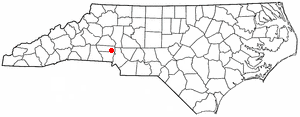
Lowesville is a census-designated place (CDP) in Lincoln County, North Carolina, United States. The population was 2,945 at the 2010 census, up from 1,440 in 2000.

<span class="mw-page-title-main">Creswell, North Carolina</span> Town in North Carolina, United States

Creswell is a town in Washington County, North Carolina, United States. The population was 207 at the 2020 census.

Eureka is a town in Wayne County, North Carolina, United States. The population was 197 at the 2010 census. It is included in the Goldsboro, North Carolina Metropolitan Statistical Area.

Dunean is a census-designated place (CDP) in Greenville County, South Carolina, United States. The population was 3,671 at the 2010 census, down from 4,158 in 2000. It is part of the Greenville–Mauldin–Easley Metropolitan Statistical Area.

Parker is a census-designated place (CDP) in Greenville County, South Carolina, United States. The population was 11,431 at the 2010 census, up from 10,760 in 2000. It is part of the Greenville–Mauldin–Easley Metropolitan Statistical Area.

<span class="mw-page-title-main">Loris, South Carolina</span> City in South Carolina, United States

Loris is a city in Horry County, South Carolina, United States. The population was 2,396 at the 2010 census, up from 2,079 in 2000.

<span class="mw-page-title-main">Virgilina, Virginia</span> Town in Virginia, United States

Virgilina is a town in Halifax County, Virginia, United States. The population was 154 at the 2010 census. Virgilina was once a copper mining town. It was a stop on the Atlantic and Danville Railway as recently as the 1950s. It is named "Virgilina" because it is located on the Virginia and North Carolina border.
<span class="mw-page-title-main">Locust, North Carolina</span> City in North Carolina, United States

Locust is a small rural city in Stanly and Cabarrus counties in the U.S. state of North Carolina. The population was 2,930 at the 2010 census.

References

  1. "ArcGIS REST Services Directory". United States Census Bureau. Retrieved September 20, 2022.
  2. 1 2 U.S. Geological Survey Geographic Names Information System: Walstonburg, North Carolina
  3. 1 2 "U.S. Census website". United States Census Bureau . Retrieved January 31, 2008.
  4. 1 2 "Geographic Identifiers: 2010 Demographic Profile Data (G001): Walstonburg town, North Carolina". American Factfinder. U.S. Census Bureau. Retrieved January 6, 2017.[ dead link ]
  5. "National Register Information System". National Register of Historic Places . National Park Service. July 9, 2010.
  6. "Census of Population and Housing". Census.gov. Retrieved June 4, 2015.
  7. "Theodore 'Blue' Edwards leaves a constant reminder" The East Carolinian. Retrieved May 20, 2014.
  8. "Eddie Mays". Daily News. March 27, 1983. p. 174. Retrieved February 22, 2022.