
Golcar is a village on a hillside crest above the Colne Valley in the Kirklees district, in West Yorkshire, England, 3 miles (5 km) west of Huddersfield, and just north of the River Colne and the Huddersfield Narrow Canal.

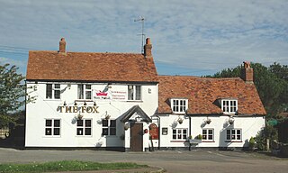
Walton is a village in the civil parish of Kimcote and Walton, in the Harborough district, in the county of Leicestershire, England, south of Leicester and west of Market Harborough. The village has a pub named The Dog and Gun.

Werrington is a residential area of the city of Peterborough, in the ceremonial county of Cambridgeshire, England. For electoral purposes it comprises North Werrington and South Werrington wards. Werrington spans an area of two and a half square miles (6 km2) and has a population of 14,800.

Shipton Lee is a hamlet and former civil parish, now in the parish of Quainton, in the county of Buckinghamshire, England. In 1881 the parish had a population of 61. From 1866 to 1886 Shipton Lee was a civil parish in its own right. On 25 March 1886 the parish was abolished and merged with Quainton.

Childwall is a suburb and ward of Liverpool, in Merseyside, England, located to the southeast of the city. It is bordered by Belle Vale, Bowring Park, Broadgreen, Gateacre, Mossley Hill, and Wavertree. In 2019, the population was 13,640.

Stanground is a residential area of Peterborough, in the ceremonial county of Cambridgeshire, England. For electoral purposes, it comprises the Stanground South and Fletton & Stanground wards in the North West Cambridgeshire constituency.

Pitsea is a town and former civil parish in the Borough of Basildon in south Essex, England. It comprises five sub-districts: Eversley, Northlands Park Neighbourhood, Chalvedon, Pitsea Mount and Burnt Mills. It is part of the new town of Basildon.

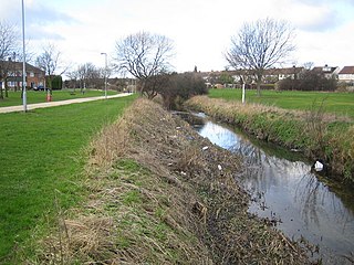
Paston is a residential area and electoral ward in the city of Peterborough, in the ceremonial county of Cambridgeshire, England.

Coton is a hamlet and former civil parish, now in the parish of Ravensthorpe, in the West Northamptonshire district, in the ceremonial county of Northamptonshire, England. It is located between Guilsborough and Ravensthorpe. Coton Manor is a popular visitor attraction for its gardens and bluebell woods. In 1931 the parish had a population of 83.
Limbury is a suburb of Luton, in the Luton district, in the ceremonial county of Bedfordshire, England, and was formerly a village before Luton expanded around it. The area is roughly bounded by Bramingham Road to the north, Marsh Road to the south, Bramingham Road to the west, and Catsbrook Road, Runfold Avenue, Grosvenor Road, Bancroft Road and Blundell Road to the east.
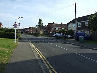
Gunthorpe is a residential area of the city of Peterborough, in the ceremonial county of Cambridgeshire, England. Since 2015 Gunthorpe has its own ward within Peterborough City Council that also encompasses parts of South Werrington.

Woodston is a largely residential and industrial area of the city of Peterborough, in the ceremonial county of Cambridgeshire, England. For electoral purposes, it forms part of Fletton ward in North West Cambridgeshire constituency. Oundle Road runs through most of Woodston into the Ortons.

North Lynn is an urban residential area of King's Lynn, in the King's Lynn and West Norfolk district, in the county of Norfolk, England.

Parkstone is an area of Poole, in the Bournemouth, Christchurch and Poole district, in the ceremonial county of Dorset, England. It is divided into 'Lower' and 'Upper' Parkstone. Upper Parkstone - "Up-on-'ill" as it used to be known in local parlance - is so-called because it is largely on higher ground slightly to the north of the lower-lying area of Lower Parkstone - "The Village" - which includes areas adjacent to Poole Harbour.
Bowthorpe is a suburban village to the west of Norwich, in the county of Norfolk, England.

Ashton is a hamlet and former civil parish, now in the parish of Bainton, in the Peterborough district, in the ceremonial county of Cambridgeshire, England. In 1881 the parish had a population of 106.

Burcot is a hamlet in the civil parish of Clifton Hampden, in the South Oxfordshire district, in the county of Oxfordshire, England. It is on the left bank of the River Thames. In 1931 the parish had a population of 187.

Denton is a hamlet and former civil parish, now in the parish of Cuddesdon and Denton, in the South Oxfordshire district, in Oxfordshire, England. Denton's toponym is derived from the Old English den-tun meaning "valley farmstead". Denton is in a fold of the landscape, between the two hills on which Cuddesdon and Garsington stand. Denton is an ancient manor and had its own civil parish, but it was merged with neighbouring Cuddesdon in the 20th century.
Pilsgate is a hamlet and former civil parish, now in the parish of Barnack, in the Peterborough district, in the ceremonial county of Cambridgeshire, England. Pilsgate is close to the county boundary and 3 miles (5 km) south-east of Stamford, Lincolnshire. In 1881 the parish had a population of 125.
Tiddington is a village in the civil parish of Tiddington-with-Albury, in the South Oxfordshire district, in Oxfordshire, England. It is about 3+1⁄2 miles (5.6 km) west of Thame, on the A418 road between Thame and Oxford. The 2011 Census recorded Tiddington-with-Albury's population as 683. Tiddington is on the county boundary with Buckinghamshire. It was a manor and hamlet of the parish of Albury, although for most of its history it has been a larger place than Albury. In 1866 Tiddington became a separate civil parish, on 1 April 1932 the parish was merged with Albury to form "Tiddington with Albury". In 1931 the parish had a population of 163.

