
Cambridgeshire is a ceremonial county in the East of England and East Anglia. It is bordered by Lincolnshire to the north, Norfolk to the north-east, Suffolk to the east, Essex and Hertfordshire to the south, and Bedfordshire and Northamptonshire to the west. The largest settlement is the city of Peterborough, and the city of Cambridge is the county town.

Peterborough is a cathedral city in the City of Peterborough district in the ceremonial county of Cambridgeshire, England. For centuries, the city and many of its surrounding villages formed the Soke of Peterborough, in the historic county of Northamptonshire. The Soke of Peterborough had an independent county council, based in the city, between 1889 and 1965. After the Soke of Peterborough was abolished in 1965, the city formed part of the short-lived Huntingdon and Peterborough until 1974. Though the city has a long history as part of Northamptonshire, the city has been part of Cambridgeshire since 1974, and is the largest settlement in that county.

East Anglia is an area in the East of England, often defined as including the counties of Norfolk, Suffolk and Cambridgeshire. The name derives from the Anglo-Saxon kingdom of the East Angles, a people whose name originated in Anglia, in what is now Northern Germany.

Crowland or Croyland is a town in the South Holland district of Lincolnshire, England. It is situated between Peterborough and Spalding. Crowland contains two sites of historical interest, Crowland Abbey and Trinity Bridge.

The Fens or Fenlands in eastern England are a naturally marshy region supporting a rich ecology and numerous species. Most of the fens were drained centuries ago, resulting in a flat, dry, low-lying agricultural region supported by a system of drainage channels and man-made rivers and automated pumping stations. There have been unintended consequences to this reclamation, as the land level has continued to sink and the dykes have been built higher to protect it from flooding.
Seahenge, also known as Holme I, was a prehistoric monument located in the village of Holme-next-the-Sea, near Old Hunstanton in the English county of Norfolk. A timber circle with an upturned tree root in the centre, Seahenge, along with the nearby timber circle Holme II, was built in the spring-summer of 2049 BC, during the early Bronze Age in Britain. Contemporary theory is that they were used for ritual purposes; in particular Holme II has been interpreted as a mortuary monument that may originally have formed the boundary of a burial mound.
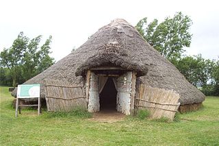
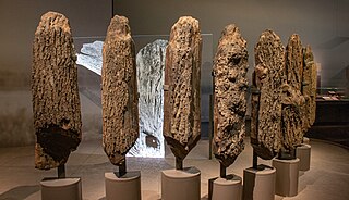
Flag Fen, east of Peterborough, England, is a Bronze Age site which was constructed about 3500 years ago and consists of more than 60,000 timbers arranged in five very long rows, creating a wooden causeway across the wet fenland. Part-way across the structure a small island was formed. Items associated with it have led scholars to conclude that the island was of religious significance. Archaeological work began in 1982 at the site, which is located 800 m east of Fengate. Flag Fen is now part of the Greater Fens Museum Partnership. A visitor centre has been constructed on site and some areas have been reconstructed, including a typical Iron Age roundhouse dwelling.

Fenland is a local government district in Cambridgeshire, England. It was historically part of the Isle of Ely. The district covers around 500 square kilometres (190 sq mi) of mostly agricultural land in the extremely flat Fens. The council is based in March. Other towns include Chatteris, Whittlesey and Wisbech.

Whittlesey is a market town and civil parish in the Fenland district of Cambridgeshire, England. Whittlesey is 6 miles (10 km) east of Peterborough. The population of the parish was 17,667 at the 2021 Census.
Fen Causeway or the Fen Road is the modern name for a Roman road of England that runs between Denver, Norfolk in the east and Peterborough in the west. Its path covers 24 miles (39 km), passing March and Eldernell before joining the major Roman north–south route Ermine Street west of modern-day Peterborough. It provided a link from the north and west of England to East Anglia.

Maxey is a village in the Peterborough unitary authority, in the ceremonial county of Cambridgeshire, England, located between Peterborough and Stamford and southwest of The Deepings. It is home to nearly 700 residents.
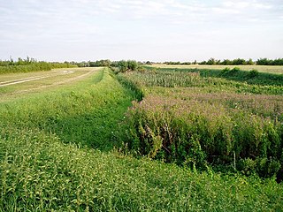
The Car Dyke was, and to a large extent still is, a long ditch which runs along the western edge of the Fens in eastern England for a distance of over 57 miles (92 km). It is generally accepted as being of Roman age and, for many centuries, to have been taken as marking the western edge of the Fens. The name derives from carr, a fourteenth-century word for marsh or drained land.
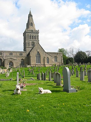
Castor is a village and civil parish in the City of Peterborough unitary authority, about 4 miles (6.4 km) west of the city centre. The parish is part of the former Soke of Peterborough, which was considered part of Northamptonshire until 1888 and then Huntingdon and Peterborough from 1965 to 1974, when it became part of Cambridgeshire.

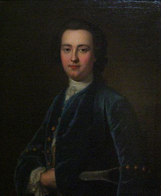
Francis Manning Marlborough Pryor is an English archaeologist specialising in the study of the Bronze and Iron Ages in Britain. He is best known for his discovery and excavation of Flag Fen, a Bronze Age archaeological site near Peterborough, as well as for his frequent appearances on the Channel 4 television series Time Team.

Thorney is a village in the Peterborough unitary authority in the ceremonial county of Cambridgeshire, England. Located around eight miles (13 km) east of Peterborough city centre, on the A47.
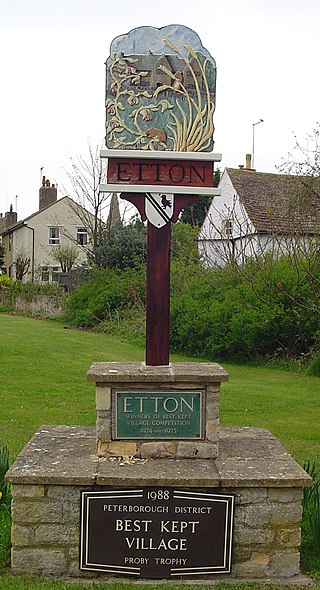
Etton is a village and civil parish in the unitary authority area of the city of Peterborough, Cambridgeshire, in England. For electoral purposes it forms part of Northborough ward in North West Cambridgeshire constituency. The parish had a population of 158 persons and 58 households in 2001.

The A1175 road is a road in south-west Lincolnshire, England. It runs between Stamford and Spalding, along the old A16 route.
Peterborough Museum and Art Gallery houses the historical and art collections of the city of Peterborough in Cambridgeshire, England. Managed by Vivacity on behalf of the city council, it is part of the Greater Fens Museum Partnership.

DigVentures is a social enterprise organising crowdfunded archaeological excavation experiences. It is registered with the Chartered Institute for Archaeologists (CIfA), and is a CIfA Accredited Field School.

John Clare Cottage is a cottage and literary museum in Helpston, Peterborough, United Kingdom. The cottage was the birthplace of English poet John Clare (1793-1864).

