Related Research Articles
Nondalton is a city on the west shore of Six Mile Lake in the Lake and Peninsula Borough, Alaska, United States. At the 2020 census, the population was 133, down from 164 in 2010.

Lexa is a town in northern Phillips County, Arkansas, United States. The population was 286 at the 2010 census.

Buffalo is a village in Mechanicsburg Township in Sangamon County, Illinois, United States. The population was 503 at the 2010 census. It is part of the Springfield, Illinois Metropolitan Statistical Area.
Unity is a town in Clark County in the U.S. state of Wisconsin. The population was 745 at the 2000 census. The Village of Unity is located partially within the town. The unincorporated community of Riplinger is also located in the town.

Bolam is a small village located in County Durham, England. The village population at the 2011 census was 209. It is situated a few miles to the north-west of Darlington.
Careysburg District is one of four districts located in Montserrado County, Liberia. Bensonville is the capital, and the total district population is 28,463.
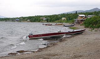
Lake Dreamland is a neighborhood of Louisville, Kentucky located along Campground Road and the Ohio River.

Pirates Cove is an embayment in Marin County, California, United States, between Muir Beach and Tennessee Cove. A trail leads from the terminus of the California Coastal Trail to a small beach area, surrounded by steep hills and coastal scrub.
The Emmbrook School is a co-educational secondary school located in Emmbrook, Wokingham, Berkshire, England, for students between 11 and 18 years of age. There are around 1,378 students at the school, with nearly 200 in the Sixth Form. The School is expanding in September 2021 by increasing their numbers joining Year 7

West St. Modeste is a town in the Canadian province of Newfoundland and Labrador. The town had a population of 102 in the Canada 2021 Census.

Dixie is a neighbourhood in the city of Mississauga, Ontario, Canada. The community lies in the southeastern part of the city and is one of the older neighbourhoods in the city.
Samwodzie is a village in the administrative district of Gmina Kozienice, within Kozienice County, Masovian Voivodeship, in east-central Poland. It lies approximately 7 kilometres (4 mi) east of Kozienice and 82 km (51 mi) south-east of Warsaw.
Łoskajmy is a village in the administrative district of Gmina Bartoszyce, within Bartoszyce County, Warmian-Masurian Voivodeship, in northern Poland, close to the border with the Kaliningrad Oblast of Russia.
Glaro District is one of 10 districts of River Gee County, Liberia. As of 2008, the population was 4,992.
Nyenawliken District (Nyanawriliken) is one of 10 districts of River Gee County, Liberia. As of 2008, the population was 5,159.
Nyenebo District is one of 10 districts of River Gee County, Liberia. As of 2008, the population was 5,703.
Tuobo District is one of 10 districts of River Gee County, Liberia. As of 2008, the population was 4,868.
Norwein District is one of 8 districts of Rivercess County, Liberia. As of 2008, the population was 13,900.
Wee-Gbehy-Mahn District is one of 17 districts of Nimba County, Liberia. As of 2008, the population was 32,934.
Munger is an unincorporated community in northeast Reynolds County, in the U.S. state of Missouri.
References
- ↑ "2008 Population and Housing Census" (PDF). Government of the Republic of Liberia. May 11, 2009. Retrieved 2010-03-08.
- ↑ "River Gee County Development Agenda" (PDF). Republic of Liberia. 2008. Retrieved 2008-10-20.
Coordinates: 4°51′06″N7°35′51″W / 4.85167°N 7.59750°W
| | This Liberia location article is a stub. You can help Wikipedia by expanding it. |