Webster | |
---|---|
Village | |
Coordinates: 45°52′45″N92°21′55″W / 45.87917°N 92.36528°W | |
Country | United States |
State | Wisconsin |
County | Burnett |
Area | |
• Total | 1.75 sq mi (4.54 km2) |
• Land | 1.75 sq mi (4.54 km2) |
• Water | 0.00 sq mi (0.00 km2) |
Population | |
• Total | 653 |
• Estimate (2019) [3] | 619 |
• Density | 353.11/sq mi (136.33/km2) |
Time zone | UTC-6 (Central (CST)) |
• Summer (DST) | UTC-5 (CDT) |
ZIP codes | 54893 |
Area code(s) | 715 & 534 |
FIPS code | 55-85025 |
GNIS feature ID | 1584391 |
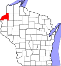
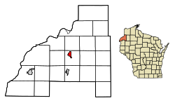
Webster is a village in Burnett County in the U.S. state of Wisconsin. The population was 653 at the 2010 census. It is along Wisconsin Highway 35.
The village was called Clam River until 1896, when a new post office was established and resident J.D. Rice petitioned U.S. Rep. John J. Jenkins to change the name to Webster, after lexicographer Noah Webster. [4]
Webster's location is at 45°52′45″N92°21′55″W / 45.87917°N 92.36528°W (45.879066, -92.365163). [5]
According to the United States Census Bureau, the village has a total area of 1.76 square miles (4.56 km2), all of it land. [6]
The village of Webster is geographically within the town of Meenon, but is a separate entity.
Webster is located 65 miles south of Superior, 94 miles northeast of Minneapolis, and 110 miles northwest of Eau Claire.
Census | Pop. | Note | %± |
---|---|---|---|
1920 | 399 | — | |
1930 | 501 | 25.6% | |
1940 | 524 | 4.6% | |
1950 | 552 | 5.3% | |
1960 | 514 | −6.9% | |
1970 | 502 | −2.3% | |
1980 | 610 | 21.5% | |
1990 | 623 | 2.1% | |
2000 | 653 | 4.8% | |
2010 | 653 | 0.0% | |
2019 (est.) | 619 | [3] | −5.2% |
U.S. Decennial Census [7] |
As of the census [2] of 2010, there were 653 people, 308 households, and 172 families living in the village. The population density was 371.0 inhabitants per square mile (143.2/km2). There were 355 housing units at an average density of 201.7 per square mile (77.9/km2). The racial makeup of the village was 90.4% White, 1.8% African American, 3.8% Native American, 0.2% Asian, 0.9% from other races, and 2.9% from two or more races. Hispanic or Latino of any race were 2.0% of the population.
There were 308 households, of which 27.9% had children under the age of 18 living with them, 31.8% were married couples living together, 17.5% had a female householder with no husband present, 6.5% had a male householder with no wife present, and 44.2% were non-families. 39.9% of all households were made up of individuals, and 22.4% had someone living alone who was 65 years of age or older. The average household size was 2.12 and the average family size was 2.76.
The median age in the village was 40.3 years. 24.2% of residents were under the age of 18; 6% were between the ages of 18 and 24; 24.3% were from 25 to 44; 23.9% were from 45 to 64; and 21.6% were 65 years of age or older. The gender makeup of the village was 43.6% male and 56.4% female.
As of the census [8] of 2000, there were 653 people, 302 households, and 176 families living in the village. The population density was 367.8 people per square mile (141.6/km2). There were 327 housing units at an average density of 184.2/sq mi (70.9/km2). The racial makeup of the village was 90.51% White, 0.46% African American, 5.05% Native American, 0.46% Asian, and 3.52% from two or more races. Hispanic or Latino of any race were 0.31% of the population.
There were 302 households, out of which 28.1% had children under the age of 18 living with them, 40.4% were married couples living together, 15.6% had a female householder with no husband present, and 41.4% were non-families. 38.1% of all households were made up of individuals, and 27.8% had someone living alone who was 65 years of age or older. The average household size was 2.16 and the average family size was 2.88.
In the village, the population was spread out, with 25.0% under the age of 18, 8.0% from 18 to 24, 22.5% from 25 to 44, 17.2% from 45 to 64, and 27.4% who were 65 years of age or older. The median age was 40 years. For every 100 females, there were 76.0 males. For every 100 females age 18 and over, there were 75.0 males.
The median income for a household in the village was $29,432, and the median income for a family was $35,288. Males had a median income of $28,214 versus $21,500 for females. The per capita income for the village was $15,411. About 5.8% of families and 9.9% of the population were below the poverty line, including 15.4% of those under age 18 and 9.4% of those age 65 or over.
The Village of Webster is part of the School District of Webster. The school district includes Webster Middle–High School, serving grades 5–12, and Webster Elementary School, serving grades K–4. The district enrolled 655 students in 2017–2018. Webster School District covers about 550 square miles of land, mostly in Burnett County, with a small portion in southwest Douglas County. It is the second largest district in the State of Wisconsin, in terms of geographical area. Students come from the Village of Webster, Town of Meenon, Town of Swiss, Community of Danbury, Town of Dairyland, and several other townships, [10] as well as land belonging to the St. Croix Chippewa Indians of Wisconsin. [11]
South Webster is a village in northeast Scioto County, Ohio, United States. It lies along State Route 140. The population was 670 at the 2020 census.
Meenon is a town in Burnett County in the U.S. state of Wisconsin. The population was 1,163 at the 2010 census. It is the home of the Burnett County Government Center.
Bell Center is a village in Crawford County, Wisconsin, United States. The population was 117 at the 2010 census.
Argonne is a town in Forest County, Wisconsin, United States. The population was 512 at the 2010 census. The census-designated place of Argonne is located in the town. The unincorporated community of Wisconsin Junction is also located in the town.
Taylor is a village in Jackson County, Wisconsin, United States, along the Trempealeau River. The population was 484 at the 2020 census.
Brokaw is a former village in Marathon County, Wisconsin, United States. It is part of the Wausau, Wisconsin Metropolitan Statistical Area. The population was 251 at the 2010 census. Brokaw merged with the village of Maine, Wisconsin on October 1, 2018.
Coleman is a village in Marinette County, Wisconsin, United States. The population was 726 at the 2020 census. It is part of the Marinette, WI–MI Micropolitan Statistical Area.
Clifton is a town in Monroe County, Wisconsin, United States. The population was 693 at the 2000 census.
Frederic is a village in Polk County, Wisconsin, United States. The population was 1,137 at the 2010 census. It was established as a village in 1901.
Weyerhaeuser is a village in Rusk County, Wisconsin, United States. The population was 238 at the 2010 census.
Exeland is a village in Sawyer County, Wisconsin, United States. The population was 229 at the 2020 census.
Dorchester is a village in Clark and Marathon counties in the U.S. state of Wisconsin, along the 45th parallel. It is part of the Wausau, Wisconsin Metropolitan Statistical Area. The population was 876 at the 2010 census. Of this, 871 were in Clark County, and only 5 were in Marathon County.
Belleville is a village in Dane and Green counties in the U.S. state of Wisconsin. The population was 2,491 at the 2020 census. Of this, 1,909 were in Dane County, and 582 were in Green County.
Viola is a village in Richland (mostly) and Vernon counties in the U.S. state of Wisconsin. The population was 699 at the 2010 census. Of this, 477 were in Richland County, and 222 were in Vernon County.
Dallas is a village in Barron County in the U.S. state of Wisconsin. The population was 409 at the 2010 census. The village is located within the Town of Dallas.
Unity is a village in Clark and Marathon counties in the U.S. state of Wisconsin. It is part of the Wausau, Wisconsin Metropolitan Statistical Area. The population was 343 at the 2010 census. Of this, 204 were in Marathon County, and 139 were in Clark County. The village is located in northeastern town of Unity in Clark County and northwestern town of Brighton in Marathon County.
Lowell is a village in Dodge County, Wisconsin, United States, along the Beaver Dam River. The population was 340 at the 2010 census. The village is located within the Town of Lowell.
Solon Springs is a town in Douglas County, Wisconsin, United States. As of the 2010 census, the town had a total population of 910. The Village of Solon Springs is located within the town. The unincorporated community of Sauntry is also located in the town.
Milltown is a village in Polk County, Wisconsin, United States. The population was 917 at the 2010 census. The village is located within the Town of Milltown.
Aniwa is a village in Shawano County, Wisconsin, United States. The population was 260 at the 2010 census. The village is located within the Town of Aniwa. U.S. Route 45 runs north–south through the village.