Welburn | |
---|---|
![]() St John the Evangelist | |
Location within North Yorkshire | |
Population | 516 (2011 census) [1] |
OS grid reference | SE720680 |
Civil parish |
|
Unitary authority | |
Ceremonial county | |
Region | |
Country | England |
Sovereign state | United Kingdom |
Post town | YORK |
Postcode district | YO60 |
Dialling code | 01653 |
Police | North Yorkshire |
Fire | North Yorkshire |
Ambulance | Yorkshire |
UK Parliament | |
Welburn is a village and civil parish in North Yorkshire, England, on the north bank of the River Derwent. It lies on the edge of the Howardian Hills, near to the stately home Castle Howard. It is about 14 miles from York and 5 miles south-west of Malton/Norton. It is a popular area for walkers and bird-watchers. The parish's population was estimated at 523 people in 2013. [2] This figure includes the developments at Crambeck, Holmes Crescent and Chestnut Avenue that are some distance outside the heart of the village.
It is a traditional village in regards to its linear structure. The Main Street has two main offshoots; one lane, to the south, is called Church Lane (formerly Bank Lane) and leads to St John the Evangelist Church, built in 1858, [3] to the newly built Village Hall, and to a small area of housing, mostly constructed in the 1960s. The lane leading northwards is called Water Lane, a short section of road serving two properties and over a small stream to farmland. Main Street continues south-eastwards of the village centre as Chestnut Avenue to join the main A64 road to Malton and York.
Welburn was part of the Ryedale district from 1974 to 2023. It is now administered by the unitary North Yorkshire Council.
It has one school, Welburn Community School, in the centre of the village. It also has a pub, the Crown and Cushion, which provides a centre for the village and Four and Twenty Blackbirds, village bakery and café. Welburn is one of the few villages in the area that still has a red telephone box (located near the centre of the village); they are becoming an increasing rarity in North Yorkshire.
The parish council of the area is based at Welburn Village Hall. It has elected members from Welburn and Crambeck, an adjoining settlement. Crambeck, formerly a reformatory school, was used in the Roman period times as the site of a pottery. [4] The Roman ceramic produced here is known as Crambeck Ware. The recently redeveloped Village Hall, operational since May 2007, is used for a range of activities and groups in the village and the surrounding area. These groups include the Women's Institute, horticultural society, indoor bowling club, country dancing, Local History Group, Wine Club and an Art & Craft club. The eco-friendly Village Hall is a gathering place for villagers and local walkers. [2]
Near Crambeck there is a disused railway station called Castle Howard railway station. It is on the York to Scarborough Line and was opened 1845 with closure to passengers in 1930, although the line is still open. [5] A road was built from the station to the stately home. It was decommissioned and became a public road in the early 1900s.
Visitors arriving by road approached from a different direction along a road that offered a spectacular view over to the great house. The view was framed by the 'Exclamation Gates', so called due to the responses that they would elicit from astonished visitors. [6] The columns, which are grade II listed, can still be seen to the west of the village, heading towards Whitwell-on-the-Hill. [7]
Located 3.8 miles from the centre of Welburn lies one of Englands finest historic houses, Castle Howard. The house with its 1,000 acre grounds was designed by Sir John Vanbrugh for the 3rd Earl of Carlisle 300 years ago. Today it is a visitor site attracting families and dog-walkers. It is also used to hold wedding receptions and formal events. The profits made that are generated from tourists and visitors help towards the restoration and conservation of 200 listed monuments and buildings that surround the estate. Within these large grounds other amusements have been built to generate money, such as a local farm shop with butchers selling a selection of meat sourced locally from the Castle Howard estate. There is also a coffee shop, courtyard café, bookshop, carriage house shop and a garden centre all selling local produce and items.
Welburn's parish church is St John the Evangelist, it is an ecclesiastical parish formed from the Bulmer, Yorkshire ancient parish. The church was built from 1859 to 1865 and has been designated as a grade II listed building. It is an Anglican Christian church within the church of England that is used by the residents of Welburn and Crambeck. Services are held each Sunday, but the church is open daily for prayer and private meditation.
Welburn's village hall is run by local volunteers from the community of Welburn and Crambeck. The volunteers manage the facility for the use of local communities, residents and friends of Welburn. Regular events are held in Welburn's village hall such as art groups, parish council meetings, zumba classes, horticultural society, wine club, country dancing and many other various events.
The Crown and Cushion pub changed its after Queen Victoria travelled through the station on her way to castle Howard. [8]
The main road connecting the area of Welburn is the A64. This main road starts at Leeds and runs through York, up to Welburn and continues through ending at Scarborough. The closest railway station to Welburn is located within Malton approximately 7 miles (11 km) north-east of Welburn. However, there is a frequent bus service local from Welburn. This calls at Bulmer, Castle Howard, Claxton, Flaxton, Foston, High Hutton, Hopgrove, Low Hutton, Malton, Sandhutton, near Thirsk, Sheriff Hutton, Thornton-le-Clay, West Lilling and York.
Welburn is situated within the North East England climate range. Its climate is influenced by the locations Eastern and Western boundaries. The high altitude of the nearby Pennines results in a wet, dull, frequently cool environment. The Pennines also casts a 'rain shadow' throughout the area that mixes with the prevailing westerly winds. The North sea also contributes to the climate as it exerts a moderate control on coastal areas in which it keeps summer conditions relatively cool. The average temperature of Welburn depend upon the altitude and its proximity to the coast. Temperature shows a diurnal and seasonal variation. January is usually the coldest month with daily temperatures varying from −0.5 °C on the highest ground to 1.5 °C along the coast in the area of South Yorkshire. The lowest known temperature recorded in the region was in Houghall near Durham, which is located approximately 70.4 miles from Welburn. The temperature recorded was −21.1 °C on 5 January 1941. The summer months are considerably warmer, especially the months of July and August with a mean daily temperature ranging from 21 °C in the South of Yorkshire, to a temperature of 16 °C or less in areas situated in the higher Pennines. The highest known temperature for this region was in August 1990, with temperatures of 33 °C caused by several heatwaves. Average annual sunshine durations over the region of North East England range from 1500 hours along the coast to less than 1250 hours in the higher Pennines, this also explains the temperature range due to the difference in altitudes.
Welburn's parish plan was created for the rural community to contribute their ideas within their local society. The parish plan included funding access to help a range of organisations including local planning authorities, government agencies and the police services during a period of five years.
The graph to the right shows Welburn's occupational census data for 1881. Welburn's job sector was mainly in agriculture as can be seen from the graph. Although a lot of employment shows as 'Persons without specific data' and 'Unknown occupation' within the graph the known data portrays that the majority of occupations within the Welburn area were involved in the agriculture sector. If compared to the recent 2011 Census data for Welburn, it can be seen that an extremely small proportion of people currently work in the agriculture sector. As society has changed it seems most economically active residents are working within the retail and wholesale job sector. [9]
Welburn Community Primary School is located within a large rural area containing communities such as Welburn, Barton Hill, Crambeck, Crambe, Whitwell, Bulmer, The Castle Howard Estate and Barton Le Willows. The main part of the school was built in 1841. The newest part of the school building was an extension erected in 2004. Welburn Community Primary School has approximately sixty pupils within the school.
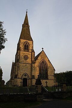
Rastrick is a village in the county of West Yorkshire, England, between Halifax, 5 miles (8 km) north-west and Huddersfield, 4 miles (7 km) south.
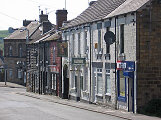
Worsbrough is a district to the south of Barnsley in the metropolitan borough of Barnsley, South Yorkshire, England. Before 1974, Worsbrough had its own urban district council in the West Riding of Yorkshire. Much of Worsbrough is now part of Barnsley Metropolitan Borough Council's, Worsbrough ward, although certain parts of the historic Worsbrough district, such as Birdwell, Rockley and Blacker Hill, currently lie within neighbouring council wards.
Pickering is a market town and civil parish in North Yorkshire, England, on the border of the North York Moors National Park. Historically part of the North Riding of Yorkshire, it is at the foot of the moors, overlooking the Vale of Pickering to the south. Pickering Parish Church, with its medieval wall paintings, Pickering Castle, the North Yorkshire Moors Railway and Beck Isle Museum have made Pickering popular with visitors. Nearby places include Malton, Norton-on-Derwent and Scarborough.
Malton is a market town, civil parish and electoral ward in North Yorkshire, England. Historically part of the North Riding of Yorkshire, the town has a population measured for both the civil parish and the electoral ward at the 2011 Census as 4,888.
Thornton Watlass is a small village and civil parish in North Yorkshire, England. It is located north of Masham and south of Bedale on the eastern slopes of the Ure Valley at the entrance to Wensleydale and the Yorkshire Dales National Park. It is 11 miles (18 km) north of Ripon, 4 miles (6.4 km) from the A1(M) motorway, 11 miles (18 km) from the main railway line at Northallerton and 18 miles (29 km) from Teesside Airport. Its population was 180 in 2000, 190 in 2005, 224 in 2011 and 240 in 2016.
Barton-le-Street is a village and civil parish in North Yorkshire, England. According to the 2001 census the parish had a population of 186 reducing to 170 at the 2011 Census. It is located about five miles west of Malton, between Appleton-le-Street and Slingsby on the old Roman road which is now the B1257.
Norton-on-Derwent, commonly referred to as simply Norton, is a town and civil parish in North Yorkshire, England. Norton borders the market town of Malton, and is separated from it by the River Derwent. The 2001 Census gave the population of the parish as 6,943, increasing at the 2011 Census to 7,387.
Dalton is a village and civil parish in North Yorkshire in England. Dalton is situated about six miles north-west of Richmond and about five miles south-east of Barnard Castle within the council district of Richmondshire and close to the A66 trans-Pennine trunk road. It was listed in the Domesday book. The Dalton parish boundary includes the village itself as well the houses at Dalton Heights plus numerous surrounding farms. The population of the parish was 147 according to the 2001 census, increasing to 181 at the 2011 Census.
Bulmer is a village and civil parish in North Yorkshire, England. According to the 2001 census it had a population of 174, increasing to 202 at the census 2011. The village is about 7 miles (11 km) south-west of Malton.
Stockton-on-the-Forest is a village and civil parish in the unitary authority of the City of York in North Yorkshire, England.
Sheriff Hutton is a village and civil parish in North Yorkshire, England. It lies about 10 miles (16 km) north by north-east of York.
Topcliffe is a village and civil parish in North Yorkshire, England. The village is situated on the River Swale, on the A167 road and close to the A168. It is about 5 miles (8 km) south-west of Thirsk and 11 miles (18 km) south of the county town of Northallerton. It has a population of 1,489. An army barracks, with a Royal Air Force airfield enclosed within, is located to the north of the village.
Slingsby is a village and civil parish in North Yorkshire, England, 6 miles (10 km) west of Malton on the B1257 road. At the 2001 Census, it had a population of 634, increasing to 665 at the 2011 Census.
Crambe is a village and civil parish in the Ryedale district of North Yorkshire, England. It is near the River Derwent and 6 miles (10 km) south-west of Malton. The population as of the 2011 census was less than 100. Details are included in the civil parish of Whitwell-on-the-Hill. The village is located in the Howardian Hills Area of Outstanding Natural Beauty. The father of the renowned mathematician Karl Pearson was born in the village.
Terrington is a village and civil parish in the Ryedale district of North Yorkshire, England. It is situated in the Howardian Hills, 4 miles (6.4 km) west of Malton.
Hovingham is a large village and civil parish in the Ryedale district of North Yorkshire, England. It is on the edge of the Howardian Hills and about 7 miles (11 km) south of Kirkbymoorside.
Westow is a village and civil parish in North Yorkshire, England. Westow is situated in the lee of Spy Hill, bordering the Howardian Hills Area of Outstanding Natural Beauty, 3 miles (4.8 km) from the A64 road linking Leeds to the East Coast, 5 miles (8 km) west of the town of Malton, and 15 miles (24 km) east of the city of York.
Huttons Ambo is a civil parish in the former Ryedale district of North Yorkshire, England. It is about 14 miles (22.5 km) north-east of York and 3 miles (4.8 km) south-west of Malton. The civil parish of Huttons Ambo consists of the villages of High Hutton and Low Hutton.
Crambeck near Crambe and Malton in Yorkshire is near the River Derwent.
Henderskelfe is a civil parish in North Yorkshire, England. The parish does not contain any villages, though it is named after a previous settlement and castle which occupied the land on which Castle Howard is now built. Historically the area was a township in the ecclesiastical parish of Bulmer, however it has been its own civil parish since 1866.