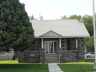
Minidoka County is a county located in the U.S. state of Idaho. As of the 2020 census, the population was 21,613. The county seat and largest city is Rupert.

Lincoln County is a county located in the U.S. state of Idaho. As of the 2020 census, the population was 5,127. The county seat and largest city is Shoshone. The county is named after President Abraham Lincoln. The Idaho Territory was created in 1863, during the Lincoln Administration of 1861–65.

Jerome County is a county in the U.S. state of Idaho. As of the 2020 Census the county had a population of 24,237. The county seat and largest city is Jerome. The county was created by the Idaho Legislature on February 8, 1919, by a partition of Lincoln County. It was named after either Jerome Hill, a developer of the North Side Irrigation Project, his son-in-law Jerome Kuhn, or his grandson Jerome Kuhn, Jr.

Gooding County is a county located in the U.S. state of Idaho. As of the 2020 census, the population was 15,598. Its county seat is Gooding. The county was created by the Idaho Legislature on January 28, 1913, by a partition of Lincoln County. It is named for Frank R. Gooding, the 7th governor and a United States Senator from Idaho.

Canyon County is located in the U.S. state of Idaho. As of the 2020 Census, the population was 231,105, which by 2022 was estimated to have risen to 251,065. making it the second-most populous county in Idaho. The county seat is Caldwell, and its largest city is Nampa. Canyon County is part of the Boise metropolitan area.

Garden City is a city in Ada County, Idaho. The population was 12,316 at the time of the 2020 census. Garden City is nearly surrounded by Boise but retains a separate municipal government.

Aberdeen is a city in Bingham County, Idaho, United States. The community was named after Aberdeen, in Scotland. The population was 1,756 at the 2020 census.

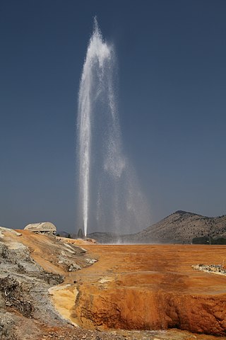
Soda Springs is a city in Caribou County, Idaho, United States. Its population was 3,133 at the time of the 2020 census. The city has been the county seat of Caribou County since the county was organized in 1919. In the 1860s, Soda Springs served as the seat of Oneida County.

Malta is a city in Cassia County, Idaho, United States. The population was 193 at the 2010 census. It is part of the Burley, Idaho Micropolitan Statistical Area.

Cottonwood is a city in Idaho County, Idaho. On the Camas Prairie in north central Idaho, the population was 900 at the 2010 census, down from 944 in 2000. It is just west of U.S. Route 95, between Grangeville and Lewiston.

Roberts is a city in Jefferson County, Idaho, United States. It is part of the Idaho Falls, Idaho Metropolitan Statistical Area. The population was 580 at the 2010 census.

Lapwai is a city in Nez Perce County, Idaho, United States. Its population was 1,137 at the 2010 census, and it is the seat of government of the Nez Perce Indian Reservation.

Peck is a city in Nez Perce County, Idaho, United States. The population was 197 at the 2010 census. It is part of the Lewiston, ID-WA Metropolitan Statistical Area. Many residents of Peck work in nearby Orofino, Idaho. Additionally, Peck residents attend high school in Orofino since Peck does not have a high school.

Grand View is a city along the Snake River in Owyhee County, Idaho, United States. The population was 440 at the 2020 census. It is part of the Boise City–Nampa, Idaho Metropolitan Statistical Area.

Marsing is a city in Owyhee County, Idaho, United States. The population was 1,031 at the time of the 2010 census. It is part of the Boise metropolitan area.

Fruitland is a city along the Snake and Payette rivers in Payette County, Idaho, United States. It lies along U.S. Route 95 in the Treasure Valley of southwest Idaho, about 50 miles (80 km) west of Boise on the border with Oregon. It is part of the Ontario Micropolitan Area. Fruitland is named after apple orchards that surround the community, and its slogan is "The Big Apple of Idaho."

Filer (FĪ-ler) is a city in Twin Falls County, Idaho, United States. The population was 2,508 at the 2010 census. Filer is located just west of the intersection of U.S. Routes 93 and 30.

Hansen is a city in Twin Falls County, Idaho, United States. The population was 1,144 at the 2010 census. It is part of the Twin Falls, Idaho Micropolitan Statistical Area.

Mangham is a village in Richland Parish in northeastern Louisiana, United States. The population was 672 at the 2010 census. Mangham was established in 1890. It is named for Wiley P. Mangham, the publisher of the Richland Beacon-News, a weekly newspaper in Rayville, the seat of Richland Parish.

Bassett is a city in Rock County, Nebraska, United States. The population was 538 at the 2020 census. It is the county seat of Rock County.


