
Deerfield is a town in Franklin County, Massachusetts, United States. Settled near the Connecticut River in the 17th century during the colonial era, the population was 5,090 as of the 2020 census. Deerfield is part of the Springfield, Massachusetts Metropolitan Statistical Area in western Massachusetts, lying 30 miles (48 km) north of the city of Springfield.

Historic Deerfield is a museum dedicated to the heritage and preservation of Deerfield, Massachusetts, and history of the Connecticut River Valley. Its historic houses, museums, and programs provide visitors with an understanding of New England's historic villages and countryside. It is located in the village of Old Deerfield which has been designated a National Historic Landmark District, and is listed on the National Register of Historic Places. The museum also hosts the Dublin Seminar for New England Folklife.

Chestnut Hill is a wealthy New England village located six miles (10 km) west of downtown Boston, Massachusetts, United States. It is best known for being home to Boston College and a section of the Boston Marathon route. Like all Massachusetts villages, Chestnut Hill is not an incorporated municipal entity. It is located partially in Brookline in Norfolk County; partially in the city of Boston in Suffolk County, and partially in the city of Newton in Middlesex County. Chestnut Hill's borders are defined by the 02467 ZIP Code. The name refers to several small hills that overlook the 135-acre Chestnut Hill Reservoir rather than one particular hill.

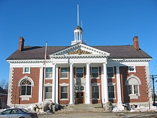
The Old Jeffersonville Historic District is located in Jeffersonville, Indiana, United States. It marks the original boundaries of Jeffersonville, and is the heart of modern-day downtown Jeffersonville. It was placed on the National Register of Historic Places in 1983. The area is roughly bounded by Court Avenue at the North, Graham Street on the east, the Ohio River at the south, and Interstate 65 at the west. In total, the district has 203 acres (0.8 km2), 500 buildings, 6 structures, and 11 objects. Several banks are located in the historic buildings in the district. The now defunct Steamboat Days Festival, held on the second weekend in September, used to be held on Spring Street and the waterfront. Jeffersonville's largest fire wiped out a block in the historic district on January 11, 2004, which destroyed the original Horner's Novelty store.

The West Newton Village Center Historic District encompasses the heart of the village of West Newton, in the city of Newton, Massachusetts in the United States. It extends along Washington Street between Lucas Court in the west and Davis Court in the east, and includes a few properties on immediately adjacent side streets, including Watertown Street and Waltham Street. The village is the second-largest of Newton's commercial centers and is the best-preserved of its late 19th and early 20th century village centers. The district was listed on the National Register of Historic Places in 1990.

The Old Town Historic District is a historic district in North Attleborough, Massachusetts, which encompasses the historic early town center of Attleboro, which it was originally a part of. It was here that Attleboro's first church was built, and its militia training ground was laid out. The district retains 18th-century vestiges of this early history, and was largely bypassed by 19th-century industrialization. The district was added to the National Register of Historic Places in 1991.

The Old King's Highway Historic District encompasses what was historically the principal east–west thoroughfare through Barnstable, Massachusetts. It encompasses Barnstable's entire length of what is now designated Massachusetts Route 6A, called Main Street, between the town lines of Sandwich and Yarmouth. It includes more than 1,000 acres (400 ha) and all buildings whose properties are front on the road, nearly 500 in all. The area consists of the main population centers of Barnstable from its founding in the late 1630s until the mid-19th century when the southern parts of the community became more significant in economic prominence. The district was listed on the National Register of Historic Places in 1987.

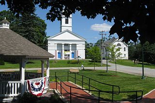
The Heath Center Historic District encompasses a rural village with predominantly 18th- and 19th-century structures in Heath, a small agricultural town in hills of northwestern Franklin County, Massachusetts, United States. The district is centered on the junction of several roads, around which the center of the town grew. South Road arrives from the south, East Main Street and Bray Road from the east, Ledge Road from the north, and West Main Street from the west.

The Bradstreet Historic District encompasses the rural 19th-century village of Bradstreet in Hatfield, Massachusetts. It is centered at the junction of Depot Road and Main Street, and includes properties lining those two streets and Old Farm Road. Most of the buildings in the area date to the second half of the 19th century, featuring architectural styles typical of the period, including Queen Anne, Second Empire, Italianate, and Colonial Revival. The village grew on land that was originally granted to colonial governor Simon Bradstreet and divided in 1682, and has remained largely agricultural since then. The district was listed on the National Register of Historic Places in 1997.

The Williamsburg Center Historic District is a historic district on Massachusetts Route 9 in Williamsburg, Massachusetts. It encompasses the traditional center of the town, which was settled in the 18th century and grew to prosperity in the mid-19th century. It was listed on the National Register of Historic Places in 1980.

The Hatfield Center Historic District encompasses the traditional center of Hatfield, Massachusetts. The area, first laid out in 1661, is bounded by Maple Street to the south, the Connecticut River to the east, Day Avenue and School Street to the north, and the Mill River to the west. The area's layout and land use patterns are relatively little altered since they were laid out, leaving a well-preserved early colonial village landscape. The district was added to the National Register of Historic Places in 1994.

The North Hadley Historic District encompasses the historic rural village of North Hadley, located between Mount Warner and the Connecticut River in Hadley, Massachusetts. It includes properties on River Drive between Stockwell Road and Stockbridge Street, and includes properties on French, Meadow and Mt. Warner Streets. It is a well-preserved example of a rural farming and mill community, with architecture dating from the late 18th to early 20th centuries. The district was listed on the National Register of Historic Places in 1993.

The Granville Center Historic District is a historic district encompassing the historic center of Granville, Massachusetts. The cluster of buildings in the village center includes the Congregational church, and a number of Federal and Greek Revival residences. The district was listed on the National Register of Historic Places in 1991.

The Nobility Hill Historic District is a residential historic district roughly bounded by Chestnut and Maple Streets and Cedar Avenue in Stoneham, Massachusetts. The district includes a number of high quality houses representing a cross section of fashionable housing built between 1860 and 1920. It was added to the National Register of Historic Places in 1990.

The Brookline Town Green Historic District encompasses the historic colonial heart of the town of Brookline, Massachusetts. Centered on a stretch of Walnut Street between Warren and Chestnut Streets, this area is where the town's first colonial meeting house and cemetery were laid out, and was its center of civic life until the early 19th century. The district was listed on the National Register of Historic Places in 1980.

The Cypress–Emerson Historic District encompasses a residential area on the west side of Brookline Village in Brookline, Massachusetts, United States. Centered on Waverly and Cypress Streets, and including Emerson Park, this area was developed in the post-Civil War era, its growth matching that of the commercial areas of the village. The district was listed on the National Register of Historic Places in 1985.

Norwichtown is a historic neighborhood in the city of Norwich, Connecticut, United States. It is generally the area immediately north of the Yantic River between I-395 and Route 169.

The South Berwick Village Historic District encompasses the historic village center of South Berwick, Maine. First settled in the 1640s, the village developed along a major route between Boston, Massachusetts and Portland, Maine in the early 19th century. The village has about 150 years of architecture reflective of this history, and was listed on the National Register of Historic Places in 2010.
The Stowe Village Historic District encompasses most of the village center of Stowe, Vermont. Since the 19th century, the village has been one of Vermont's major resort centers, and its center is architecturally reflective of this history. It was listed on the National Register of Historic Places in 1978.
The Oakham Center Historic District encompasses a portion of the historic town center of Oakham, Massachusetts. Roughly bounded by Coldbrook Rd., Maple St., Barre Rd., and Deacon Allen Drive, the area was formed as a civic center about 1770, with town incorporation following in 1775. It includes a well-preserved variety of early 19th-century residential architecture, as well as the town's Greek Revival Congregational church, and its 1908 library. The district was listed on the National Register of Historic Places in 2020.


