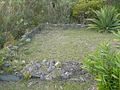
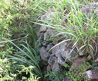
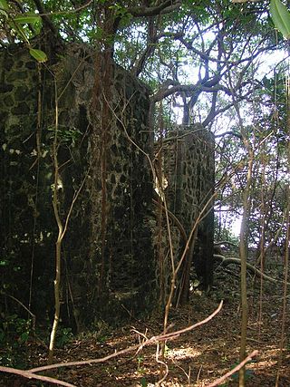
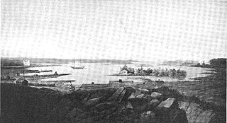
Part of the remains of the barracks of the Whelk Point Fort
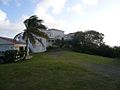
The Whelk Point Fort was a colonial fort erected on the southeast part of Tortola in the British Virgin Islands. The fort fell into disrepair and ruin, and relatively little of the original structure remains. In 1992 a house was built over the original foundations of the fort, but the remains of the barracks can still be seen on the land behind the house. The ruins are on private property and are not generally accessible to the public.
The main fortification was built by the British at the outbreak of the American War of Independence. The fort guarded two strategic locations. Primarily, the fort overlooks the narrow passage entering Paraquita Bay to the west - one of the largest natural harbours in the British Virgin Islands and the natural gateway to one of the relatively few large agricultural areas on Tortola. The passage into Paraquita Bay is extremely narrow to navigate in any event with the wind and waves surging directly into the gap, and it would be almost impossible to make the entrance in an eighteenth-century sailboat under immediate fire from the fort only 100 meters away. Secondly, the fort formed part of a twin fortification (with Fort Shirley) around the settlement which was based in what is now known as Hodge's Creek. Although that settlement declined in importance, for a considerable part of the Territory's history (when the main administration of the islands was conducted from Spanish Town on Virgin Gorda), that was the most significant settlement on Tortola.
The fort later fell again into disrepair, and it was acquired in 1966 by Neville Westwood and his wife, who built their home on the adjacent land. That house was subsequently torn down and a new house erected over the foundations of the fort in 1992.
The history of the British Virgin Islands is usually, for convenience, broken up into five separate periods:
Fort York is an early 19th-century military fortification in the Fort York neighbourhood of Toronto, Ontario, Canada. The fort was used to house members of the British and Canadian militaries, and to defend the entrance of the Toronto Harbour. The fort features stone-lined earthwork walls and eight historical buildings within them, including two blockhouses. The fort forms a part of Fort York National Historic Site, a 16.6 ha (41-acre) site that includes the fort, Garrison Common, military cemeteries, and a visitor centre.
Fort Victoria is a former military fort on the Isle of Wight, England, built to guard the Solent. The earliest fort on the site was a coastal fort known as Sharpenode Bulwark built in 1545–1547 by Henry VIII, but these defences had fallen into disrepair by the 17th century. Fort Victoria was built in the 1850s. It was a brick-built triangular fort with two seaward batteries meeting at a right angle. It remained in use until 1962. Parts of the fort were subsequently demolished; areas of the fort that were preserved have become part of Fort Victoria Country Park.
Bare Island is a heritage-listed islet located at La Perouse, New South Wales in the Eastern Suburbs of Sydney in eastern Australia. The islet is located about 16 kilometres (9.9 mi) south east of the Sydney central business district, within Botany Bay, close to the bay's northern headland. Containing former fortification facilities, Bare Island was a former war veterans' home and museum and is now a historic site that was added to the New South Wales State Heritage Register on 2 April 1999 and is significant as an almost completely intact example of late nineteenth century coastal defence technology. It was designed by Sir Peter Scratchley, Gustave Morell and James Barnet and built from 1881 to 1889 by John McLeod on behalf of the NSW Department of Public Works.
St. Phillip's Anglican Church, also known as the African Church, in the Kingstown area of Tortola in British Virgin Islands, was built in 1840 by a community of Africans who had been liberated from illegal slave ships.
Fort Purcell is a ruined fort near Pockwood Pond on the island of Tortola in the British Virgin Islands.
Joost van Dyk was a Dutch privateer who was one of the earliest European settlers in the British Virgin Islands in the seventeenth century, and established the first permanent settlements within the Territory. The islands of Jost Van Dyke and its smaller neighbor Little Jost Van Dyke, as well as Little Dix Bay on Virgin Gorda island, are named after him.
Fort Charlotte is a fort built on Harrigan's Hill, Tortola, British Virgin Islands. The fort was named after Queen Charlotte.
Fort Burt is a colonial fort that was erected on the southwest edge of Road Town, Tortola in the British Virgin Islands above Road Reef Marina. The site is now a hotel and restaurant of the same name, and relatively little of the original structure remains. However, one of the original cannons has survived and stands on the veranda of the hotel, vigilantly looking over the harbour.
Fort George is a colonial fort which was erected on the northeast edge of Road Town, Tortola in the British Virgin Islands above Baugher's Bay. The site is now a ruin.
Fort Recovery is a fort on the West End of Tortola in the British Virgin Islands. In historical records, the fort is often referred to as Tower Fort, and the area around the fort is still referred to as "Towers" today. A hotel is now built around the Tower.
Road Town Fort is a colonial fort which was erected on Russell Hill in Road Town, Tortola in the British Virgin Islands above the town's main wharf. In historical records it is sometimes referred to as Fort Road Town. The fort subsequently fell into ruin, and in the 1960s the Bougainvillea clinic was built on top of the old structure. The strong room of the original fort, which was once the Territory's treasury, still survives today, and is now used as a storeroom by the clinic.
Mount Healthy windmill is a ruined windmill on the north side of Tortola in the British Virgin Islands. It was formerly used during the plantation era of the Territory to crush sugar cane. After the collapse of the sugar economy in the early nineteenth century the windmill fell into disuse and became a ruin. It crushed cane for the sugar mill and rum distillery in nearby Brewer's Bay. There are other ruins like the Boiling House, remnants of the Animal Mill Round, distillery, hospital, storage, shed, and housing. The 18th century windmill belonged to the area's wealthiest planter. Slaves harvested and processed sugar cane into sugar at this extensive sugarcane plantation.
Cooper Bay ruin is a ruin in Cooper Bay, on the north side of Tortola in the British Virgin Islands. The ruin dates from the sugar plantation era, and was presumed abandoned during the economic collapse of the British Virgin Islands during the mid-19th century.
The Cooten Bay ruin is a ruin in Cooten Bay, on the north side of Tortola in the British Virgin Islands. The ruin probably dates from the sugar plantation era, although the fortification of the property with cannon may suggest an earlier date. It is presumed that it was abandoned during the economic collapse of the British Virgin Islands during the mid-19th century, when many plantations were abandoned.
The Dutch Virgin Islands is the collective name for the enclaves that the Dutch West India Company had in the Virgin Islands. The area was ruled by a director, whose seat was not permanent. The main reason for starting a colony here was that it lay strategically between the Dutch colonies in the south and New Netherland. The Dutch West India Company was mainly affected by the competition from Denmark, England and Spain. In 1680 the remaining islands became a British colony.
Larmer Bay ruin is a ruin in Larmer Bay, on the north side of Tortola in the British Virgin Islands. The ruin dates from the sugar plantation era, and was presumed abandoned during the economic collapse of the British Virgin Islands during the mid-19th century.
Fort William was a fort in St. John's built in 1698 to protect English interests on Newfoundland, primarily against French opposition. It was the original headquarters of the British garrison in Newfoundland. A second fort, known as Fort George was situated at the east end of the harbour connected by a subterranean passage with Fort William. On the south side of the Narrows, there was a third fortification called the Castle. Garrison headquarters were later moved to Fort Townshend, which was built between 1775-1779.
Fort Drummond, also known as Fort Colyer or Fort Collier, is a military fort located on the west end of Drummond Island on Whitney Bay, in the vicinity of De Tour Village, Michigan. It is the only known military and civilian site established by British forces on American soil following the War of 1812. It was listed on the National Register of Historic Places in 1969 and designated a Michigan State Historic Site in 1956.
Fort Campbell, also known locally as Il-Fortizza ta' Selmun, is a former fort in Mellieħa, Malta. It was built by the British during 1937 and 1938. It is notable as the most important fortification north of the Victoria Lines, and the last major fortification to be built in Malta. Today, it lies in ruins.
This page is based on this Wikipedia article Text is available under the CC BY-SA 4.0 license; additional terms may apply. Images, videos and audio are available under their respective licenses.