White Top Mountain (California)

Last updated
White Top Mountain
White Top Mountain, California.jpg
East aspect
Highest point
Elevation 7,607 ft (2,319 m) [1] [2]
Prominence 687 ft (209 m) [1]
Parent peak Peak 8261 [2]
Isolation 2.5 mi (4.0 km) [2]
Coordinates 36°46′48″N117°24′46″W / 36.7800807°N 117.4128956°W / 36.7800807; -117.4128956 [3]
Geography
Relief map of California.png
Red triangle with thick white border.svg
White Top Mountain
Location in California
Usa edcp relief location map.png
Red triangle with thick white border.svg
White Top Mountain
White Top Mountain (the United States)
CountryUnited States
State California
County Inyo
Protected area Death Valley National Park
Parent range Panamint Range [1]
Cottonwood Mountains
Topo map USGS White Top Mountain
Geology
Age of rock Ordovician
Mountain type Fault block
Type of rock Sedimentary rock

White Top Mountain is a 7,607-foot-elevation (2,319-meter) summit in Inyo County, California, United States.

Contents

Description

White Top Mountain is part of the Cottonwood Mountains which are the northern extension of the Panamint Range. [4] It is set within Death Valley National Park and the Mojave Desert. Precipitation runoff from this landform drains to Death Valley via Dry Bone Canyon. Topographic relief is significant as the summit rises 7,100 feet (2,164 meters) above the valley floor in 7.5 miles (12.1 km). The mountain is composed of Ordovician limestone, a marine sedimentary rock. [5] This mountain's toponym has been officially adopted by the United States Board on Geographic Names. [3]

Climate

According to the Köppen climate classification system, White Top Mountain has a cold desert climate, with the lower valleys in a hot desert climate zone. Temperatures average between 0 °F to 30 °F in January, and 50 °F to 100 °F in July. [6] Typical of high deserts, summer temperatures can be exceedingly hot, while winter temperatures can be very cold. Snowfall is common, but the snow melts rapidly in the arid and sunny climate. Rainfall is very low, and the evaporation rate classifies the area as desert.

See also

Related Research Articles

<span class="mw-page-title-main">The Titan (Fisher Towers)</span> Mountain in United States of America

The Titan is a 6,112-foot-elevation (1,863-meter) pillar in Grand County, Utah, United States.

<span class="mw-page-title-main">Bannock Peak</span> Mountain in Wyoming, United States

Bannock Peak is a 10,329-foot (3,148-metre) mountain summit in the southern section of the Gallatin Range in Yellowstone National Park, in the U.S. state of Wyoming. The peak ranks as the sixth-highest peak in the Gallatin Range. Precipitation runoff from the mountain drains west into headwaters of the Gallatin River and east into Panther Creek which is a tributary of the Gardner River. Topographic relief is significant as the summit rises nearly 2,000 feet above Panther Creek in one mile (1.6 km). This mountain's toponym was officially adopted in 1897 by the United States Board on Geographic Names.

<span class="mw-page-title-main">Three Rivers Peak</span> Mountain in Wyoming, United States

Three Rivers Peak is a 9,958-foot (3,035 m) mountain summit in the southern section of the Gallatin Range in Yellowstone National Park, in the U.S. state of Wyoming.

<span class="mw-page-title-main">Hoyt Peak</span> Summit in Yellowstone National Park, Wyoming

Hoyt Peak is a 10,506 feet (3,202 m) summit located on the shared border of Yellowstone National Park and North Absaroka Wilderness, in Park County, Wyoming.

<span class="mw-page-title-main">Round Mountain (Grand County, Utah)</span> Mountain in Grand County, Utah, United States

Round Mountain is a small 6,185-foot (1,885 m) summit made of gray hornblende plagioclase trachyte in the Castle Valley in southeastern Grand County, Utah, United States. It is located two miles (3.2 km) southeast of Castle Valley, Utah, and about 10 miles (16 km) east-northeast of Moab. Round Mountain is an extinct bysmalith, or igneous volcanic plug, that rises 1,000 feet (305 m) above the valley floor in 0.4 miles (0.64 km). Precipitation runoff from the mountain drains into Castle Creek, which is a tributary of the Colorado River. The nearest higher peak is Castleton Tower, 1.42 miles (2.29 km) to the north.
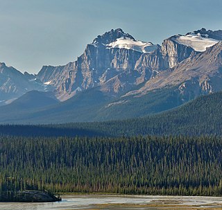
<span class="mw-page-title-main">Epaulette Mountain</span> Mountain in Banff NP, Alberta, Canada

Epaulette Mountain is a 3,094-metre (10,151-foot) mountain summit in Alberta, Canada.

<span class="mw-page-title-main">White Pyramid (Banff)</span> Mountain in Banff NP, Alberta, Canada

White Pyramid is a 3,219-metre (10,561 ft) mountain summit located between the Howse River valley and Mistaya River valley of Banff National Park, in the Canadian Rockies of Alberta, Canada. Its nearest higher peak is Howse Peak, 3.00 km (1.86 mi) to the south. Topographic relief is significant as the summit rises 1,460 meters (4,790 ft) above Chephren Lake in 2.5 km. White Pyramid is visible from the Icefields Parkway in the vicinity of Waterfowl Lakes.

<span class="mw-page-title-main">Mollys Castle</span>

Mollys Castle is a remote 5,265-foot (1,605-meter) elevation summit located near Goblin Valley State Park, in Emery County, Utah. Mollys Castle is situated 2.3 mi (3.7 km) east of Wild Horse Butte, and one-half mile outside the park's east boundary. The top of this magnificent butte rises 265 feet above its surrounding terrain. Precipitation runoff from Mollys Castle enters the Colorado River drainage basin.

<span class="mw-page-title-main">Top Notch Peak</span> Mountain in Wyoming, United States

Top Notch Peak is a 10,245-foot-elevation (3,123 meter) mountain summit located in Yellowstone National Park, in Park County, Wyoming, United States.

<span class="mw-page-title-main">Easley Peak</span> Mountain in the state of Idaho

Easley Peak is an 11,108-foot elevation (3,386 m) mountain summit located on the common border that Blaine County shares with Custer County, in Idaho, United States.

<span class="mw-page-title-main">Battleship Rock</span>

Battleship Rock is a 5,422-foot-elevation (1,653-meter) summit in San Juan County, Utah, United States.

<span class="mw-page-title-main">Bell Butte</span>

Bell Butte is a 5,351-foot-elevation (1,631-meter) pillar in San Juan County, Utah, United States.

<span class="mw-page-title-main">Adobe Mesa</span>

Adobe Mesa is a 7,475-foot-elevation (2,278-meter) summit in Grand County, Utah, United States.

<span class="mw-page-title-main">Argon Tower</span>

Argon Tower is a 4,750-foot-elevation (1,448-meter) pillar in Grand County, Utah. It is located within Arches National Park and like many of the rock formations in the park, Argon Tower is composed of Entrada Sandstone. The tower is 260 feet tall, and topographic relief is significant as the summit rises 450 feet vertically above the Park Avenue Trail in 400 feet laterally. Precipitation runoff from Argon Tower drains to the nearby Colorado River via Courthouse Wash. This landform was shown briefly in the opening scene credits of the 1989 American action-adventure film Indiana Jones and the Last Crusade.

<span class="mw-page-title-main">Three Penguins</span>

Three Penguins is a 4,488-foot-elevation (1,368-meter) summit in Grand County, Utah, United States.

<span class="mw-page-title-main">Tower of Babel (Utah)</span>

Tower of Babel is a 4,655-foot-elevation (1,419-meter) summit in Grand County, Utah. It is located within Arches National Park and like many of the rock formations in the park, it is composed of Entrada Sandstone. The tower is 500 feet tall, and topographic relief is significant as the summit rises 500 feet vertically above the main park road in approximately 200 feet laterally. Precipitation runoff from Tower of Babel drains to the nearby Colorado River via Courthouse Wash. This landform's descriptive toponym has been officially adopted by the United States Board on Geographic Names. This landform was shown briefly in the opening scene of the 1989 American action-adventure film Indiana Jones and the Last Crusade.

<span class="mw-page-title-main">Mars Hotel (Arches National Park)</span>

Mars Hotel is a 4,635-foot-elevation (1,413-meter) summit in Grand County, Utah, United States.

<span class="mw-page-title-main">Square Top</span>

Square Top is a 7,412-foot-elevation (2,259-meter) summit in Emery County, Utah, United States.

<span class="mw-page-title-main">Wildrose Peak</span> Mountain in California, United States

Wildrose Peak is a 9,064-foot-elevation (2,763-meter) summit in Inyo County, California, United States.

<span class="mw-page-title-main">Rogers Peak (California)</span> Mountain in California, United States

Rogers Peak is a 9,991-foot-elevation (3,045-meter) summit in Inyo County, California, United States.

References

  1. 1 2 3 "White Top Mountain, California". Peakbagger.com. Retrieved 2024-09-25.
  2. 1 2 3 "White Top Mountain - 7,607' CA". listsofjohn.com. Retrieved 2024-09-25.
  3. 1 2 U.S. Geological Survey Geographic Names Information System: White Top Mountain
  4. Historic Resource Study, a History of Mining in Death Valley National Monument,, Volume 1, Linda W. Greene, 1981, p. 12.
  5. Geologic Map of California Death Valley Sheet, Robert Streitz, 1974, State of California Department of Conservation, conservation.ca.gov
  6. Peel, M. C.; Finlayson, B. L. & McMahon, T. A. (2007). "Updated world map of the Köppen−Geiger climate classification". Hydrology and Earth System Sciences. 11 (5): 1633–1644. Bibcode:2007HESS...11.1633P. doi: 10.5194/hess-11-1633-2007 . ISSN   1027-5606. S2CID   9654551.