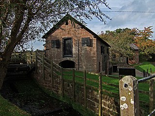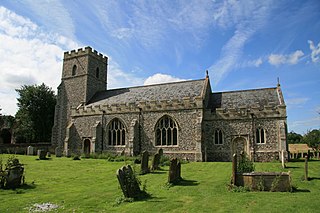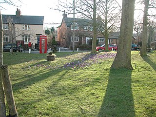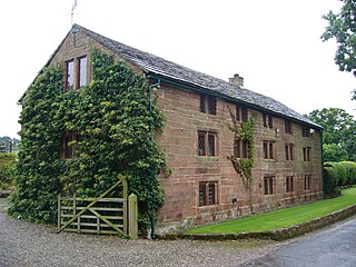
Aldford is a village and former civil parish, now in the parish of Aldford and Saighton, in the Cheshire West and Chester district, in the ceremonial county of Cheshire, England.. The village is approximately 6.5 miles (10.5 km) to the south of Chester, on the east bank of the River Dee. The Aldford Brook joins the Dee just north of the village.

Alvanley is a small rural village and civil parish near Helsby, in the unitary authority of Cheshire West and Chester and the ceremonial county of Cheshire, England. The village is on the B5393 road and near junction 14 of the M56 motorway. According to the 2011 census the civil parish had a population of 472.

Barton is a village and civil parish in the unitary authority of Cheshire West and Chester and the ceremonial county of Cheshire, England. The village is located near the Welsh border, about twelve miles south of Chester and only about eight miles east of Wrexham in Wales.

Stretton is a hamlet and civil parish in the unitary authority of Cheshire West and Chester and the ceremonial county of Cheshire, England. The small, rural parish also includes the hamlet of Wetreins Green. It is near the Welsh border, approximately thirteen miles south of Chester and about eight miles east of Wrexham in Wales.

Mollington is a village and civil parish in the unitary authority of Cheshire West and Chester and the ceremonial county of Cheshire, England. It is two miles north of the city of Chester, with the A41 Liverpool–Chester trunk road and Shropshire Union Canal to the east and southeast, the A540 Wirral peninsula trunk road to the south and west and the A5117 link road to the north. Nearby settlements include Backford, Blacon, Capenhurst and Saughall.

Moggerhanger is a village in the English county of Bedfordshire. It is west of Sandy on the road to Bedford. Its population in 2001 was 636, but had reduced to 620 at the 2011 Census. In the twentieth century the village name was spelled variously as: Moggerhanger, Mogerhanger, Muggerhanger and Morehanger. Local pronunciation of the name is as Morhanger.

Graffham is a village, Anglican parish and civil parish in West Sussex, England, situated on the northern escarpment of the South Downs within the South Downs National Park. The civil parish is made up of the village of Graffham, part of the hamlet of Selham, and South Ambersham. It forms part of the Bury Ward for the purposes of electing a Councillor to Chichester District Council.

West Acre is a village and civil parish in the King's Lynn and West Norfolk district of the county of Norfolk, England. It covers an area of 14.49 km2 (5.59 sq mi) and had a population of 187 in 83 households at the 2001 census, the population increasing to 260 at the 2011 Census.

Puddington is a village and civil parish on the Wirral Peninsula, in the unitary authority of Cheshire West and Chester and the ceremonial county of Cheshire, England. It is located to the south east of the town of Neston and close to the border with Wales.

Willington is a village and civil parish 9 miles (14 km) from Chester in Cheshire, England. At the 2011 census, the population was 277.

Utkinton is a village and former civil parish, now in the parishes of Utkinton and Cotebrook, in the unitary authority area of Cheshire West and Chester and the ceremonial county of Cheshire, England. It is approximately 2 miles (3.2 km) north of Tarporley, 8 miles (13 km) west of Winsford and 9 miles (14 km) east of Chester. The upper part of Utkinton is known as 'Quarry Bank'. Utkinton is at the heart of the local farming community. The area is also on the Sandstone Trail.

Handley is a village and civil parish in the unitary authority of Cheshire West and Chester and the ceremonial county of Cheshire, England. It is part of the local government ward of Tattenhall, a larger settlement approximately 2 miles (3.2 km) to the east. The hamlet of Milton Green is to the north west of the village. The A41 road, which previously passed through the village now bypasses it, having been re-routed further to the east.

Wervin is a small village and civil parish in the unitary authority of Cheshire West and Chester and the ceremonial county of Cheshire, England. It is situated between Chester and Ellesmere Port, near the Shropshire Union Canal and the M53 motorway.

Lower Kinnerton is a village and former civil parish, now in the parish of Dodleston, in the unitary authority of Cheshire West and Chester and the ceremonial county of Cheshire, England, close to the England–Wales border. The neighbouring village of Higher Kinnerton is across the border in Flintshire. Lower Kinnerton is south of Broughton and to the north west of the village of Dodleston. It is a small agricultural community, which is also home to a local kennel and cattery business.

Honingham is a village and civil parish in the English county of Norfolk, located 8 miles (13 km) to the west of Norwich along the A47 trunk road. It covers an area of 10.55 km2 (4.07 sq mi) and had a population of 342 in 145 households at the 2001 census, increasing to a population of 358 in 160 households at the 2011 Census. For the purposes of local government, it falls within the district of Broadland. Honingham Hall was demolished in 1966.

Thrumpton is a village and civil parish in Nottinghamshire, England. At the time of the 2001 census it had a population of 152, increasing to 165 at the 2011 census, and 178 at the 2021 census. It is located on the A453 road 6 miles (9.7 km) south-west of West Bridgford. The 13th century Church of All Saints is Grade II* listed and was restored in 1871. Many of the gabled brick houses in the village were built between 1700 and 1745 by John Emerton of Thrumpton Hall.

Great Whelnetham is a village and civil parish in the West Suffolk district of Suffolk in eastern England. Located around two miles south of Bury St Edmunds, in 2005 its population was 820.

West Burton is a hamlet and civil parish in Nottinghamshire, England, located in the north-east of the county within the district of Bassetlaw. It lies between the villages of Bole and Sturton le Steeple. The Saxon name "burh-ton" states a fortified farmstead with the village lying to the west of Gate Burton in Lincolnshire. The recorded population at the 2021 census was 14 residents.

Thorney is a village and civil parish about 10 miles (16 km) north of Newark-on-Trent, in the Newark and Sherwood district, in the county of Nottinghamshire, England. The settlement is close to the eastern edge of the county. In the census of 2011, the parish had a population of 248, falling to 228 at the 2021 census. A small portion of Drinsey Nook mainly in Lincolnshire falls into the parish to the north, Thorney Moor is a hamlet to the south of the parish area. The parish borders other nearby parishes including Wigsley, Kettlethorpe, Newton on Trent, Saxilby with Ingleby, Harby, North Clifton, South Clifton and Hardwick.

South Clifton is a village and civil parish in the Newark and Sherwood district of Nottinghamshire, England. It is 11 miles north of Newark-on-Trent. With the 2011 census, the parish had a population of 326, this fell to 308 at the 2021 census. The parish touches Thorney, Girton, Fledborough, Wigsley, Marnham, Normanton on Trent, Spalford and North Clifton.


