Wolford, North Dakota

Last updated

Wolford, North Dakota
Post office in Wolford, North Dakota 7-18-2009.jpg
Post office in Wolford
ND Pierce County Wolford.svg
Location of Wolford, North Dakota
Coordinates: 48°29′51″N99°42′14″W / 48.49750°N 99.70389°W / 48.49750; -99.70389
CountryUnited States
State North Dakota
County Pierce
Founded1905
Area
[1]
  Total0.18 sq mi (0.47 km2)
  Land0.18 sq mi (0.47 km2)
  Water0.00 sq mi (0.00 km2)
Elevation
[2]
1,618 ft (493 m)
Population
 (2020)
  Total43
  Density238.89/sq mi (92.29/km2)
Time zone UTC-6 (CST)
  Summer (DST) UTC-5 (CDT)
ZIP code
58385
Area code 701
FIPS code 38-87180
GNIS feature ID1036341 [2]

Wolford is a city in Pierce County, North Dakota, United States. The population was 43 at the 2020 census. [3] Wolford was founded in 1905.

Contents

Geography

According to the United States Census Bureau, the city has a total area of 0.16 square miles (0.41 km2), all land. [4]

Demographics

Historical population
CensusPop.Note
1940 206
1950 140−32.0%
1960 136−2.9%
1970 81−40.4%
1980 76−6.2%
1990 56−26.3%
2000 50−10.7%
2010 36−28.0%
2020 4319.4%
2021 (est.)40 [5] −7.0%
U.S. Decennial Census [6]
2020 Census [3]

2010 census

As of the census of 2010, there were 36 people, 17 households, and 10 families residing in the city. The population density was 225.0 inhabitants per square mile (86.9/km2). There were 27 housing units at an average density of 168.8 per square mile (65.2/km2). The racial makeup of the city was 100.0% White.

There were 17 households, of which 23.5% had children under the age of 18 living with them, 58.8% were married couples living together, and 41.2% were non-families. 41.2% of all households were made up of individuals, and 17.7% had someone living alone who was 65 years of age or older. The average household size was 2.12 and the average family size was 2.90.

The median age in the city was 51.5 years. 25% of residents were under the age of 18; 0.0% were between the ages of 18 and 24; 19.4% were from 25 to 44; 36.2% were from 45 to 64; and 19.4% were 65 years of age or older. The gender makeup of the city was 47.2% male and 52.8% female.

2000 census

As of the census of 2000, there were 50 people, 21 households, and 14 families residing in the city. The population density was 312.8 inhabitants per square mile (120.8/km2). There were 30 housing units at an average density of 187.7 per square mile (72.5/km2). The racial makeup of the city was 100.00% White.

There were 21 households, out of which 28.6% had children under the age of 18 living with them, 61.9% were married couples living together, 4.8% had a female householder with no husband present, and 33.3% were non-families. 33.3% of all households were made up of individuals, and 4.8% had someone living alone who was 65 years of age or older. The average household size was 2.38 and the average family size was 3.07.

In the city, the population was spread out, with 26.0% under the age of 18, 2.0% from 18 to 24, 32.0% from 25 to 44, 30.0% from 45 to 64, and 10.0% who were 65 years of age or older. The median age was 38 years. For every 10 females there were 10.8 males. For every 10 females age 18 and over, there were 11.7 males.

The median income for a household in the city was $37,500, and the median income for a family was $38,750. Males had a median income of $21,250 versus $13,750 for females. The per capita income for the city was $18,662. None of the population and none of the families were below the poverty line.

Education

The school district is Wolford School District. [7] Its only school, Wolford Public School, closed in 2019. Students in the district, if wishing to attend a traditional school, may go to schools in Cando, Rolette, or Rugby. [8]

Related Research Articles

Wolford Township is a township in Crow Wing County, Minnesota, United States. The population was 326 at the 2000 census. Wolford Township was named for Richard Wolford, an early settler.

<span class="mw-page-title-main">Hettinger, North Dakota</span> City in North Dakota, United States

Hettinger is a city in, and the county seat of, Adams County, North Dakota, United States. The population was 1,074 at the 2020 census.

<span class="mw-page-title-main">Warwick, North Dakota</span> City in North Dakota, United States

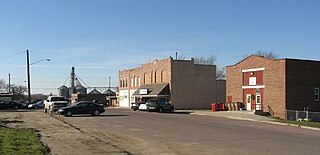
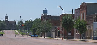
Warwick is a city in Benson County, North Dakota, United States. The population was 55 at the 2020 census. Warwick was founded in 1907.

<span class="mw-page-title-main">Watford City, North Dakota</span> City in North Dakota, United States

Watford City, founded in 1914, is a city in and the county seat of McKenzie County, North Dakota, United States. The population was 6,207 at the 2020 census, making it the thirteenth largest city in North Dakota. Because Watford City is part of the Bakken field, the North Dakota oil boom has significantly increased population and construction since the 2010 census.

<span class="mw-page-title-main">Fairmount, North Dakota</span> City in Richland County, North Dakota, United States

Fairmount is a city in Richland County, North Dakota, United States. The population was 343 at the 2020 census. Fairmount was founded in 1884. It is part of the Wahpeton, ND–MN Micropolitan Statistical Area.

<span class="mw-page-title-main">Webster, South Dakota</span> City in South Dakota, United States

Webster is a city in and the county seat of Day County, South Dakota, United States. The population was 1,728 at the 2020 census.

<span class="mw-page-title-main">Clear Lake, South Dakota</span> City in South Dakota, United States

Clear Lake is a city in and the county seat of Deuel County, South Dakota, United States. The population was 1,218 at the 2020 census.

<span class="mw-page-title-main">Milbank, South Dakota</span> City in South Dakota, United States

Milbank is a city in Grant County, South Dakota, United States, located along the South Fork of the Whetstone River. The population was 3,544 at the 2020 census. It is the county seat of Grant County. Milbank is the birthplace of American Legion Baseball. The program was created in Milbank in 1925 and is now enjoyed by high school aged youth on more than five thousand teams in all fifty states.

<span class="mw-page-title-main">Parkston, South Dakota</span> City in South Dakota, United States

Parkston is a city in Hutchinson County, South Dakota, United States. The population was 1,567 at the 2020 census.

<span class="mw-page-title-main">Kadoka, South Dakota</span> City in South Dakota, United States

Kadoka is a city in, and the county seat of, Jackson County, South Dakota, United States. The population was 543 at the 2020 census. The town occupies about 2.3 square miles.

<span class="mw-page-title-main">Lennox, South Dakota</span> City in South Dakota, United States

Lennox is a city in Lincoln County, South Dakota, United States, located 20 miles (32 km) southwest of Sioux Falls. The population was 2,423 at the 2020 census.

<span class="mw-page-title-main">Tea, South Dakota</span> City in South Dakota, United States

Tea is a city in Lincoln County, South Dakota, United States and is a suburb of Sioux Falls. The population was 5,598 at the 2020 census.

<span class="mw-page-title-main">Leola, South Dakota</span> City in South Dakota, United States

Leola is a small city in, and the county seat of, McPherson County, South Dakota, United States. It was founded on May 1, 1884, and named for Leola Haynes, daughter of one of the town's founders. The population was 434 as of the 2020 census.

<span class="mw-page-title-main">Baltic, South Dakota</span> City in South Dakota, United States

Baltic is a city on the Big Sioux River in northern Minnehaha County, South Dakota, United States. The population was 1,246 at the 2020 census.

<span class="mw-page-title-main">Crooks, South Dakota</span> City in South Dakota, United States

Crooks is a city in Minnehaha County, South Dakota, United States and is a suburb of Sioux Falls. The population was 1,362 at the 2020 census. Crooks was named New Hope until 1904. The town's present name honors W. A. Crooks, a local politician.

<span class="mw-page-title-main">Garretson, South Dakota</span> City in South Dakota, United States

Garretson is a city in Minnehaha County, South Dakota, United States. The city had a population of 1,228 at the 2020 census.

<span class="mw-page-title-main">Mission, South Dakota</span> City in South Dakota, United States

Mission is a city on the Rosebud Indian Reservation in northern Todd County, South Dakota, United States. The population was 1,156 at the 2020 census.

<span class="mw-page-title-main">Parker, South Dakota</span> City in South Dakota, U.S.

Parker is a city in Turner County, South Dakota, United States. The population was 1,194 at the 2020 census. It is the county seat of Turner County. Parker is bordered on its eastern side by South Dakota State Highway 19. Its northern side is bordered by South Dakota State Highway 44. Parker is located approximately 8 miles (13 km) northwest of Chancellor, 42 miles (68 km) east of Parkston and 41 miles (66 km) south of Madison.

<span class="mw-page-title-main">Elk Point, South Dakota</span> City in South Dakota, United States

Elk Point is a city in and county seat of Union County, South Dakota, United States. The population was 2,149 as of the 2020 census.

<span class="mw-page-title-main">Eagle Butte, South Dakota</span> City in South Dakota, United States

Eagle Butte is a city in Dewey and Ziebach counties in South Dakota, United States. The population was 1,258 at the 2020 census.

References

  1. "ArcGIS REST Services Directory". United States Census Bureau. Retrieved September 20, 2022.
  2. 1 2 U.S. Geological Survey Geographic Names Information System: Wolford, North Dakota
  3. 1 2 "Explore Census Data". United States Census Bureau . Retrieved July 23, 2022.
  4. "US Gazetteer files 2010". United States Census Bureau . Retrieved June 14, 2012.
  5. "City and Town Population Totals: 2020-2021". United States Census Bureau. July 23, 2022. Retrieved July 23, 2022.
  6. United States Census Bureau. "Census of Population and Housing" . Retrieved September 7, 2013.
  7. "2020 CENSUS - SCHOOL DISTRICT REFERENCE MAP: Pierce County, ND" (PDF). United States Census Bureau . Retrieved August 13, 2021.
  8. Skurzewski, Joe (May 10, 2019). "Wolford Public School to close at end of school year". West Dakota Fox KFYR-TV . Retrieved August 13, 2021.