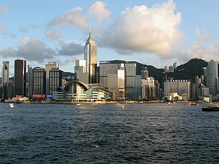
Wan Chai District is one of the 18 districts of Hong Kong. The district is located at the north shore of Hong Kong Island with a population of 167,146 in 2001. The district has the second most educated residents with the highest income, the second lowest population and the third oldest residents, and is also the only district without the presence of public housing estates. It is a relatively affluent district, with one in five persons having liquid assets of more than HKD 1 million.

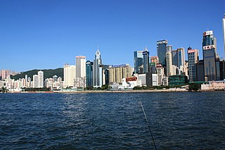
Causeway Bay is a heavily built-up area of Hong Kong, located on Hong Kong Island, and covering parts of Wan Chai District. The Cantonese name is also romanised as Tung Lo Wan as in Tung Lo Wan Road (銅鑼灣道). The rent in the shopping areas of Causeway Bay was ranked as the world's most expensive for the second year in a row, after overtaking New York City's Fifth Avenue in 2012.

Central is the central business district of Hong Kong. It is located in Central and Western District, on the north shore of Hong Kong Island, across Victoria Harbour from Tsim Sha Tsui, the southernmost point of Kowloon Peninsula. The area was the heart of Victoria City, although that name is rarely used today.

Chai Wan, formerly known as Sai Wan (西灣), lies at the east end of the urban area of Hong Kong Island next to Shau Kei Wan. The area is administratively part of the Eastern District, and is a mosaic of industrial and residential areas. The population was 186,505 in 2001.

The City of Victoria, often called Victoria City or simply Victoria, was the de facto capital of Hong Kong during the British colonial period. It was initially named Queenstown but was soon known as Victoria. It was one of the first urban settlements in Hong Kong and almost all government departments still have their head offices located within its limit.
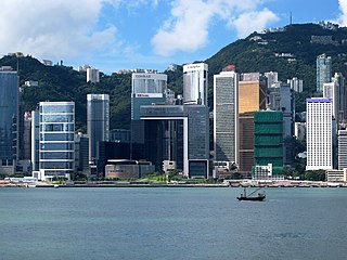
Admiralty is the eastern extension of the central business district on the Hong Kong Island of Hong Kong. It is located on the eastern end of the Central and Western District, bordered by Wan Chai to the east and Victoria Harbour to the north.

Shau Kei Wan or Shau Ki Wan is a neighborhood in the Eastern District of Hong Kong Island.
Harcourt Road is a major road in Admiralty in Hong Kong, connecting Central and Wan Chai, starting at Murray Road and ending at Arsenal Street. The road is 780 metres in length and has 4 lanes of traffic on either side. The section of Harcourt Road westbound between Rodney Street and Cotton Tree Drive features a frontage road.

Wan Chai is a station on the Island Line of the Hong Kong MTR. The livery colour is lime green. It serves the Wan Chai locality within the district of the same name. The station platforms are located underneath Hennessy Road, a major trunk road connecting the Central and Eastern districts.

Chai Wan Road located in Hong Kong, is one of the major roads in Chai Wan on Hong Kong Island. It runs from Shau Kei Wan to Chai Wan through Chai Wan Gap; with one of the steepest inclines in Hong Kong on either side, with signs posted 1 in 10 gradient. It is therefore popularly referred to as Cheung Meng Che (長命斜), or long-lived incline.

The Island Eastern Corridor (IEC) is an expressway built along the northeastern shore of Hong Kong Island in Hong Kong. It starts from Causeway Bay in the west and ends in Chai Wan in the east. It is part of Route 4. The section between Causeway Bay and Quarry Bay consists mainly of viaducts built along Victoria Harbour.

Queen's Road East is a street in Wan Chai, in the north of Hong Kong Island, Hong Kong, connecting Admiralty in the west to Happy Valley in the east. Queen's Road East is one of the four sections of Queen's Road, and historically included Queensway.
Wellington Barracks was a military barracks located to the east of Garden Road in Admiralty, Hong Kong. One of many military complexes constructed by the British Army in the area, the land was returned to the Hong Kong government in the 1970s and gradually reverted to civilian use. As a result, the barracks was closed at the end of that decade, demolished in the mid-1980s and replaced with Harcourt Garden.

Tonnochy Road is a street in Wan Chai on the Hong Kong Island of Hong Kong. It runs from Hennessy Road, across Lockhart Road, Jaffe Road, Gloucester Road, to Hung Hing Road near Victoria Harbour. The wide Gloucester Road divides Tonnochy Road into a north and a south sections. Gloucester Road has a flyover to turn into the road at the north.
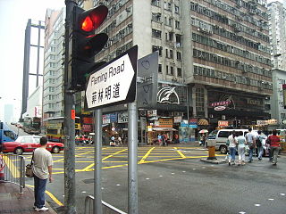
Fleming Road is a road in Wan Chai and Wan Chai North on the Hong Kong Island of Hong Kong. The road begins south with Johnston Road, runs across Hennessy Road, Lockhart Road and Jaffe Road, flies over Gloucester Road and runs across Harbour Road and ends at the junction with Convention Avenue and Expo Drive East.

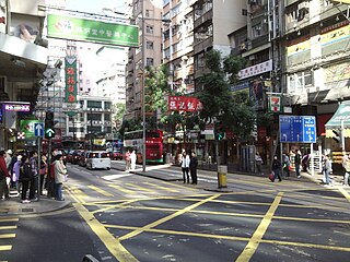
Johnston Road is a major road in Wan Chai on the Hong Kong Island of Hong Kong.

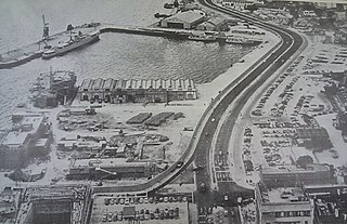
Causeway Bay Typhoon Shelter is a typhoon shelter located in Causeway Bay, Hong Kong, between the Hong Kong Island entrance of Cross Harbour Tunnel on Kellett Island and Island Eastern Corridor. It was the first typhoon shelter in Hong Kong. At the present location it is about 14 hectares in area, although it is currently largely filled in, as part of road development works.

Stone Nullah Lane is a one-way street in Wan Chai, Hong Kong Island, Hong Kong. Named after the water channel that until 1959 ran down its middle, it stretches from Lung On Street to Queen's Road East. The street is noted for its historical landmarks, most notably the Blue House and Wan Chai Pak Tai Temple.
Tin Lok Lane, is a street in Wan Chai between Hennessy Road and Wan Chai Road.