Yarbro, Arkansas

Last updated

Yarbro, Arkansas
Unincorporated community
U.S. Route 61 Arch.jpg
USA Arkansas location map.svg
Red pog.svg
Yarbro, Arkansas
Coordinates: 35°58′45″N89°54′37″W / 35.97917°N 89.91028°W / 35.97917; -89.91028
Country United States
State Arkansas
County Mississippi
Elevation
253 ft (77 m)
Time zone UTC-6 (Central (CST))
  Summer (DST) UTC-5 (CDT)
Area code 870
GNIS feature ID56583 [1]

Yarbro is an unincorporated community in Mississippi County, Arkansas, United States.

Description

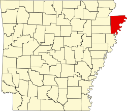
Yarbro is around 1 mile (1.6 km) south of the Missouri border and about 3 miles (4.8 km) north of Blytheville. [1]

U.S. Route 61 and Arkansas Highway 150 intersect in Yarbro. [2] A Route 61 overpass across St. Louis–San Francisco Railway track was built by the Bureau of Public Roads in 1939, and was listed on the National Register of Historic Places in 2022. [3] The nearby United States Highway 61 Arch is also listed on the Register. [4]

The town was first settled in 1885 and was known as "Steal Easy" due to the large cattle population of the town and its proximity to the state border. When a post office opened in the community on March 22, 1900, the town was officially named Yarbro, after a local settler family. By 1912, the town was home to three general merchandise and grocery stores, a post office, a barbershop, a restaurant, a pool hall, a train station, a blacksmith shop, a boarding house, a stave mill, a Methodist church, a school, two gins, and a bank. [5] The post office closed in 1926. [6] Home to a two-room schoolhouse, Yarbro became part of the Blytheville School District in 1942. [5]

Related Research Articles

<span class="mw-page-title-main">Interstate 55</span> North–south Interstate Highway in the central US

Interstate 55 (I-55) is a major Interstate Highway in the central United States. As with most primary Interstates that end in a five, it is a major cross-country, north–south route, connecting the Gulf of Mexico to the Great Lakes. The highway travels from LaPlace, Louisiana, at I-10 to Chicago, Illinois, at U.S. Route 41, at McCormick Place. The major cities that I-55 connects to are New Orleans, Louisiana; Jackson, Mississippi; Memphis, Tennessee; St. Louis, Missouri; and Chicago, Illinois.

<span class="mw-page-title-main">Mississippi County, Arkansas</span> County in Arkansas, United States

Mississippi County is the easternmost county in the U.S. state of Arkansas. As of the 2020 census, the population was 40,685. There are two county seats, Blytheville and Osceola. The county is named for the Mississippi River which borders the county to the east. Mississippi County is part of the First Congressional District in Arkansas.

<span class="mw-page-title-main">Lake Village, Arkansas</span> City in Arkansas, United States

Lake Village is a city in and the county seat of Chicot County, Arkansas, United States. The population was 2,575 at the 2010 census. It is located in the Arkansas Delta. Lake Village is named for its location on Lake Chicot, an oxbow lake formed by the Mississippi River.

<span class="mw-page-title-main">Blytheville, Arkansas</span> City in Arkansas, United States

Blytheville is one of two county seat and the largest city in Mississippi County, Arkansas, United States. It is approximately 60 miles (100 km) north of West Memphis. The population was 13,406 at the 2020 census, down from 15,620 in 2010.

<span class="mw-page-title-main">Burdette, Arkansas</span> Town in Arkansas, United States

Burdette is a town in Mississippi County, Arkansas, United States. The population was 140 at the 2020 census, down from 191 in 2010.

<span class="mw-page-title-main">Dell, Arkansas</span> Town in Arkansas, United States

Dell is a town in Mississippi County, Arkansas, United States. The population was 194 at the 2020 census.

<span class="mw-page-title-main">Wilson, Arkansas</span> City in Arkansas known for its cotton production

Wilson is a city in Mississippi County, Arkansas, United States. The community is located in the Arkansas Delta and is surrounded by fertile cropland historically used to produce cotton. Wilson started as a company town in 1886 by Robert E. Lee Wilson, who would build a cotton empire and run it from the city. The Wilson Company would become so successful that all of the town's buildings were rebuilt in the Tudor Revival architectural style following Wilson's son's honeymoon to England in 1925. Wilson incorporated in 1959, becoming a town with public roads and municipal government. The extensive property holdings of the Lee Wilson and Company remained in the Wilson family until 2010. The community has seen a rapid decline in economic activity and population since the advent of mechanization on the farm, reducing the need for manual labor to produce cotton. The population was 766 at the 2020 census, down from 903 at the 2010 census.

<span class="mw-page-title-main">U.S. Route 61</span> Highway in the United States

U.S. Route 61 or U.S. Highway 61 (U.S. 61) is a major United States highway that extends 1,400 miles (2,300 km) between New Orleans, Louisiana and the city of Wyoming, Minnesota. The highway generally follows the course of the Mississippi River and is designated the Great River Road for much of its route. As of 2004, the highway's northern terminus in Wyoming, Minnesota, is at an intersection with Interstate 35 (I-35). Until 1991, the highway extended north on what is now Minnesota State Highway 61 through Duluth to the Canada–U.S. border near Grand Portage, then continued to Thunder Bay, Canada, as Ontario Highway 61. Its southern terminus in New Orleans is at an intersection with U.S. Route 90. The route was an important south–north connection in the days before the interstate highway system.

<span class="mw-page-title-main">U.S. Route 165</span> Highway in the United States

U.S. Route 165 is a north–south United States highway spur of U.S. Highway 65. It currently runs for 412 miles (663 km) from U.S. Route 90 in Iowa, Louisiana north to U.S. Highway 70 in North Little Rock, Arkansas. The route passes through the states of Arkansas and Louisiana. It passes through the cities of Monroe and Alexandria in Louisiana. A segment of US 165 serves as a routing of the Great River Road within Arkansas.

<span class="mw-page-title-main">U.S. Route 78</span> Highway in the United States

U.S. Route 78 (US 78) is an east–west United States Numbered Highway that runs for 843.3 miles (1,357.2 km) from Cash, Arkansas, to Charleston, South Carolina. From Byhalia, Mississippi to Birmingham, Alabama, US 78 runs concurrently with Interstate 22 (I-22). The highway’s western terminus is at I-57/US 67 near Cash, and its eastern terminus is on Line Street, in Charleston. Prior to November 2023, before the western extension, the highway's former western terminus was at US 64/US 70/US 79 in Memphis, Tennessee.

<span class="mw-page-title-main">Reverie, Tennessee</span> Place in Tennessee, United States

Reverie is an unincorporated community in Tipton County, Tennessee, United States. In 2001, the population was 11.

<span class="mw-page-title-main">Arkansas Highway 77</span> State highway in Arkansas, United States

Highway 77 is a north–south state highway in Northeast Arkansas. The route of 66.70 miles (107.34 km) runs from US Highway 70 (US 70) in West Memphis north through small towns and agricultural areas of the Arkansas Delta to Missouri Route 108 at the Missouri state line. It is generally a low-traffic road except in West Memphis. Created during the 1926 Arkansas state highway numbering, the route was extended in the 1950s and 1960s, including along a former alignment of US 61. AR 77 does not have any spur or business routes.

<span class="mw-page-title-main">Interstate 55 in Arkansas</span> Section of highway in Arkansas, US

Interstate 55 (I-55) is a north–south Interstate Highway that has a 72.22-mile (116.23 km) section in the US state of Arkansas connecting sections in Tennessee and Missouri. The route enters Arkansas on the Memphis & Arkansas Bridge over the Mississippi River from Memphis, Tennessee. It travels northward through northeast Arkansas, connecting the cities of West Memphis and Blytheville. I-55 continues into Missouri heading to St. Louis, Missouri. The highway overlaps I-40 in West Memphis and has a junction with I-555, a spur route to Jonesboro, in Turrell. For the majority of its routing through Arkansas, I-55 generally follows U.S. Highway 61 (US 61) and has a 67.08-mile (107.95 km) long concurrency with US 78 from the Tennessee state line in Memphis to Blytheville for most of its length.

<span class="mw-page-title-main">Arkansas Highway 18</span> State highway in Arkansas, United States

Arkansas Highway 18 is a designation for two state highways in northeast Arkansas. One segment of 0.93 miles (1.50 km) runs from Highway 69 east of Jacksonport east to Highway 17 in Diaz. A second segment of 92.83 miles (149.40 km) runs from Highway 17 in Diaz east to the Mississippi River.

<span class="mw-page-title-main">Arkansas Highway 150</span> State highway in Arkansas, United States

Highway 150 is a 14.19-mile-long (22.84 km) east–west state highway in Mississippi County, Arkansas. The route runs from Highway 181 north of Gosnell east across US Route 61 (US 61) and Interstate 55 (I-55) to Highway 137 at Huffman.

<span class="mw-page-title-main">Arkansas Highway 151</span> State highway in Arkansas, United States

Arkansas Highway 151 is a designation for two north–south state highways in Mississippi County, Arkansas. An eastern route of 5.75 miles (9.25 km) runs from Highway 148 north to Highway 18. A second route of 6.65 miles (10.70 km) begins at U.S. Route 78 (US 78)/Highway 18 in Blytheville and runs north to Missouri supplemental route TT (SSR-TT) at the Missouri state line. A third route was dedicated in May 2013 and begins at State Line Avenue in Texarkana and continues east to Interstate 49 (I-49)/US 71.

<span class="mw-page-title-main">Arkansas Highway 312</span> Highway in Arkansas

Highway 312 is a designation for three east–west state highways in northern Mississippi County, Arkansas. Two highways are rural, two-lane highways connecting agricultural areas around Blytheville. A third route runs in Blytheville as a city street. The highways were established during a ten-year period, beginning in 1963, and have remained unchanged since establishment. All routes are maintained by the Arkansas Department of Transportation (ArDOT).

<span class="mw-page-title-main">Arkansas Highway 325</span> State highway in Arkansas, United States

Arkansas Highway 325 is a north–south state highway in Mississippi County, Arkansas. The route of 5.00 miles (8.05 km) runs from US 61 in Osceola north through the city to terminate at Highway 158.

<span class="mw-page-title-main">Special routes of U.S. Route 65</span>

A total of eight special routes of U.S. Route 65 exist, divided between the U.S. states of Arkansas and Missouri. Currently, they are all business loops, although a spur route in Pine Bluff, Arkansas and bypass routes in Baton Rouge, Louisiana and Springfield, Missouri both existed in the past.

<span class="mw-page-title-main">United States Highway 61 Arch</span> United States historic place

The United States Highway 61 Arch is an arch which crosses U.S. Route 61 (US 61) at the Arkansas–Missouri state line, between Blytheville, Arkansas and Steele. The concrete horseshoe arch reads "Entering Arkansas" on one side and "Entering Missouri" on the other. The Mississippi County, Arkansas Road Improvement District built the arch in 1924 after paving the highway; it erected a similar arch over the highway at the Crittenden County line, but the other arch was removed in the 1950s. At the time, the highway was called the North–South Road, and it was already a major route between St. Louis, Missouri and Memphis, Tennessee; the next year, it was designated as part of US 61. The arch is the only archway over a U.S. Highway in Arkansas.

References

  1. 1 2 "Yarbro". Geographic Names Information System . United States Geological Survey, United States Department of the Interior.
  2. "Mississippi County 47A (Blytheville Inset)" (PDF). Arkansas Department of Transportation. Retrieved December 9, 2024.
  3. Wilcox, Ralph S. (Autumn 2021). "Arkansas Listings in the National Register of Historic Places: Bureau of Public Roads Railroad Overpasses". The Arkansas History Quarterly. 80 (3): 375–381. Retrieved December 9, 2024.
  4. Cothren, Zac (August 29, 2001). "National Register of Historic Places Registration Form: United States Highway 61 Arch". Arkansas Preservation. Retrieved December 10, 2024.
  5. 1 2 Ross, Alice Marie (January 17, 1986). "A Bustling Village on the Pemiscot Bayou". Courier News. No. 211.
  6. "Post Offices". Jim Forte Postal History. Retrieved December 9, 2024.