Yorkville, Wisconsin

Last updated

Yorkville, Wisconsin
WIMap-doton-Yorkville.png
Location of Yorkville, Wisconsin
Coordinates: 42°42′26″N87°59′52″W / 42.70722°N 87.99778°W / 42.70722; -87.99778
Country Flag of the United States.svg  United States
State Flag of Wisconsin.svg  Wisconsin
County Racine
Area
[1]
  Total33.61 sq mi (87.05 km2)
  Land33.49 sq mi (86.74 km2)
  Water0.12 sq mi (0.31 km2)
Elevation
[2]
709 ft (216 m)
Population
 (2020)
  Total3,246
  Density93.46/sq mi (36.09/km2)
Time zone UTC-6 (Central (CST))
  Summer (DST) UTC-5 (CDT)
Area code 262
FIPS code 55-89575 [3]
GNIS feature ID1584495 [2]

Yorkville is a town in Racine County, Wisconsin, United States. The population was 3,246 at the 2020 census. The unincorporated communities of Ives Grove, Sylvania, and Yorkville are located in the town.

Contents

History

The town was founded primarily by farmers immigrating from Cornwall, England.

Geography

According to the United States Census Bureau, the town has a total area of 34.4 square miles (89.0 km2), of which, 34.3 square miles (88.9 km2) of it is land and 0.04 square miles (0.1 km2) of it (0.09%) is water.

Demographics

Historical population
CensusPop.Note
2000 3,291
2010 3,071−6.7%
2020 3,2465.7%
U.S. Decennial Census [4]

As of the census [3] of 2000, there were 3,291 people, 1,123 households, and 917 families residing in the town. The population density was 95.9 people per square mile (37.0/km2). There were 1,153 housing units at an average density of 33.6 per square mile (13.0/km2). The racial makeup of the town was 98.12% White, 0.24% African American, 0.15% Native American, 0.33% Asian, 0.24% from other races, and 0.91% from two or more races. Hispanic or Latino of any race were 1.43% of the population.

There were 1,123 households, out of which 35.2% had children under the age of 18 living with them, 70.9% were married couples living together, 6.9% had a female householder with no husband present, and 18.3% were non-families. 14.8% of all households were made up of individuals, and 4.5% had someone living alone who was 65 years of age or older. The average household size was 2.75 and the average family size was 3.05.

In the town, the population was spread out, with 24.4% under the age of 18, 5.9% from 18 to 24, 31.0% from 25 to 44, 28.9% from 45 to 64, and 9.8% who were 65 years of age or older. The median age was 40 years. For every 100 females, there were 103.3 males. For every 100 females age 18 and over, there were 103.0 males.

The median income for a household in the town was $62,076, and the median income for a family was $63,867. Males had a median income of $46,232 versus $29,500 for females. The per capita income for the town was $23,895. About 2.3% of families and 6.9% of the population were below the poverty line, including 2.2% of those under age 18 and 5.2% of those age 65 or over.

Education

Yorkville Elementary School is a K–8 school with a staff of 47. [5]

Notable people

Related Research Articles

<span class="mw-page-title-main">St. Elmo, Illinois</span> City in Illinois, United States

St. Elmo is a city in Fayette County, Illinois, United States. The population was 1,254 at the 2020 census. St. Elmo was established in 1871.

<span class="mw-page-title-main">Roseland, Louisiana</span> Town in Louisiana, United States

Roseland is a town in Tangipahoa Parish, Louisiana, United States. The population was 1,123 at the 2010 census. It is the birthplace of Cajun chef and storyteller Justin Wilson.

<span class="mw-page-title-main">Clover, South Carolina</span> Town in South Carolina, United States

Clover is a town in York County, South Carolina, United States. It is located in the greater Charlotte metropolitan area. As of 2020, the population was at 6,671 within the town limits. Clover is twinned with the Northern Irish town of Larne on County Antrim's East Coast.

<span class="mw-page-title-main">Yorkville, Tennessee</span> City in Tennessee, United States

Yorkville is a city in Gibson County, Tennessee. The population was 286 at the 2010 census.

<span class="mw-page-title-main">Iron River, Wisconsin</span> Town in Wisconsin, United States

Iron River is a town in Bayfield County, Wisconsin, United States. The population was 1,123 at the 2010 census. The census-designated place of Iron River is located in the town. The unincorporated community of Topside is also located in the town.

<span class="mw-page-title-main">Wabeno, Wisconsin</span> Town in Wisconsin, United States

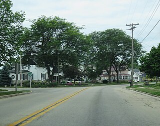
Wabeno is a town in Forest County, Wisconsin, United States. The population was 1,166 at the 2010 census. The census-designated place of Wabeno and the unincorporated communities of Carter, Padus, and Soperton are located in the town. Wabeno is situated within Wisconsin's 7th congressional district.

<span class="mw-page-title-main">Farmington, Jefferson County, Wisconsin</span> Town in Wisconsin, United States

Farmington is a town in Jefferson County, Wisconsin, United States. The population as of the 2010 census was 1,380.

<span class="mw-page-title-main">Beaver, Marinette County, Wisconsin</span> Town in Wisconsin, United States

Beaver is a town in Marinette County, Wisconsin, United States. The population was 1,123 at the 2000 census. The unincorporated community of Beaver is located in the town.

<span class="mw-page-title-main">Sugar Camp, Wisconsin</span> Town in Wisconsin, United States

Sugar Camp is a town in Oneida County, Wisconsin, United States. The population was 1,694 at the 2010 census. The unincorporated community of Sugar Camp is located in the town

<span class="mw-page-title-main">Union Grove, Wisconsin</span> Village in Wisconsin, United States

Union Grove is a village in Racine County, Wisconsin, United States. The population was 4,806 at the 2020 census.

<span class="mw-page-title-main">Yorkville, Ohio</span> Village in Ohio, United States

Yorkville is a village in Belmont and Jefferson counties in the U.S. state of Ohio. The population was 968 at the 2020 census. Yorkville lies within two Metropolitan Statistical Areas; the Belmont County portion is part of the Wheeling metropolitan area, while the Jefferson County portion is part of the Weirton–Steubenville metropolitan area.

Watertown is a town in Jefferson County, Wisconsin, United States. The population was 1,975 at the 2010 census. The unincorporated community of Ebenezer is located in the town.

<span class="mw-page-title-main">Hustisford, Wisconsin</span> Village in Wisconsin, United States

Hustisford is a village in Dodge County, Wisconsin, United States. The population was 1,101 at the 2020 census. The village is located within the town of Hustisford.

Jefferson is a town in Jefferson County, Wisconsin, United States. The population was 2,178 at the 2010 census. The city of Jefferson is located partially within the town. The census-designated place of Helenville is also located in the town.

<span class="mw-page-title-main">Sullivan, Wisconsin</span> Village in Wisconsin, United States

Sullivan is a village in Jefferson County, Wisconsin, United States. The population was 651 at the 2020 census. The village is located within the Town of Sullivan, and is known to residents of southern Wisconsin including the Madison and Milwaukee metro areas as the location of the National Weather Service forecast office MKX, although its mailing address is in nearby Dousman.

<span class="mw-page-title-main">Peshtigo (town), Wisconsin</span> Town in Wisconsin, United States

Peshtigo is a town located in Marinette County, Wisconsin, United States. The population was 4,006 at the 2020 census. The City of Peshtigo is located within the town. The historic Peshtigo Fire took place here.

<span class="mw-page-title-main">Pound, Wisconsin</span> Village in Wisconsin, United States

Pound is a village in Marinette County, Wisconsin, United States. The population was 377 at the 2010 census. The village is located within the Town of Pound. Pound is part of the Marinette, WI– MI Micropolitan Statistical Area.

<span class="mw-page-title-main">Gillett, Wisconsin</span> City in Wisconsin, United States

Gillett is a city in Oconto County, Wisconsin, United States. The population was 1,386 at the 2010 census. It is part of the Green Bay Metropolitan Statistical Area. The city is adjacent to the Town of Gillett.

Hawkins is a town in Rusk County, Wisconsin, United States. The population was 170 at the 2000 census. The Village of Hawkins is located within the town.

<span class="mw-page-title-main">Walworth, Wisconsin</span> Village in Wisconsin, United States

Walworth is a village in Walworth County, Wisconsin, United States. The population was 2,759 at the 2020 census. The village is located within the Town of Walworth.

References

  1. "2019 U.S. Gazetteer Files". United States Census Bureau. Retrieved August 7, 2020.
  2. 1 2 "US Board on Geographic Names". United States Geological Survey. October 25, 2007. Retrieved January 31, 2008.
  3. 1 2 "U.S. Census website". United States Census Bureau . Retrieved January 31, 2008.
  4. "Census of Population and Housing". Census.gov. Retrieved January 1, 2023.
  5. "Yorkville Elementary School". Yorkville.elementary.k12.wi.us. December 12, 2007. Archived from the original on December 12, 2007. Retrieved August 12, 2017.
  6. 'Collections of the State Historical Society of Wisconsin,' volume 9, Lyman Copeland Draper, Wisconsin Historical Society: 1909, Wisconsin Necrology-1880, pg. 449-450

42°44′31″N88°01′36″W / 42.74194°N 88.02667°W / 42.74194; -88.02667