
The Swan River is a major river in the southwest of Western Australia. The river runs through the metropolitan area of Perth, Western Australia's capital and largest city.

Morrisville is a borough in Bucks County, Pennsylvania, United States. It is located just below the falls of the Delaware River opposite Trenton, New Jersey. The population was 9,809 in the 2020 Census.

Yardley is a borough in Bucks County, Pennsylvania, United States. Yardley borders the Delaware River and Ewing, New Jersey to its east and Lower Makefield Township to its north, west, and south. The United States Post Office assigns many addresses in Lower Makefield Township the preferred city of "Yardley", although they are outside the borough. The population was 2,434 at the 2010 census. Yardley is part of the Delaware Valley metropolitan area.

West Springfield is a city in Hampden County, Massachusetts, United States. It is part of the Springfield, Massachusetts Metropolitan Statistical Area. The population was 28,835 at the 2020 United States Census. The city is also known as "West Side", in reference to the fact that it is on the western side of the Connecticut River from Springfield, a fact which played a major part in the town's early history.

Matlock is the county town of Derbyshire, England. It is in the south-eastern part of the Peak District, with the National Park directly to the west. The spa resort of Matlock Bath is immediately south of the town as well as Cromford lying further south still. The civil parish of Matlock Town had a population in the 2021 UK census of 10,000.

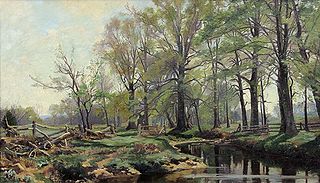
The River Rea is a small river which passes through Birmingham, England. It is the river on which Birmingham was founded by the Beorma tribe in the 7th century.

The Passaic River is a river, approximately 80 miles (130 km) long, in Northern New Jersey. The river in its upper course flows in a highly circuitous route, meandering through the swamp lowlands between the ridge hills of rural and suburban northern New Jersey, called the Great Swamp, draining much of the northern portion of the state through its tributaries.
The Rahway River is a river in Essex, Middlesex, and Union Counties, New Jersey, United States, The Rahway, along with the Elizabeth River, Piles Creek, Passaic River, Morses Creek, the Fresh Kills River, has its river mouth at the Arthur Kill.

Northfield is a residential area in outer south Birmingham, England, near the boundary with Worcestershire, which it was historically within. It is also a council constituency, managed by its own district committee. The constituency includes the wards of Kings Norton, Longbridge, Weoley Castle and the smaller ward of Northfield that includes West Heath and Turves Green.

The River Brent is a river in west and northwest London, England, and a tributary of the River Thames. 17.9 miles (28.8 km) in length, it rises in the Borough of Barnet and flows in a generally south-west direction before joining the Tideway stretch of the Thames at Brentford.

The Millstone River is a 38.6-mile-long (62.1 km) tributary of the Raritan River in central New Jersey in the United States.

The Green Brook Flood Control Project is a flood control project in Somerset County in central New Jersey first proposed in the early 1970s in the wake of two major flooding events: a 1971 flood event and a major 1973 flood which ravaged the Green Brook and Raritan River basins, causing millions in property damage and several deaths in central New Jersey.

County Route 508 is a county highway in the U.S. state of New Jersey. The highway extends 16.14 miles (25.97 km) from Mount Pleasant Avenue in Livingston to Belleville Turnpike in Kearny.

Royce Brook is a tributary of the Millstone River in Hillsborough and Manville, New Jersey in the United States.

Hadspen is a town on the South Esk River in the north of Tasmania, Australia, 8 kilometres (5.0 mi) south west of Launceston. Hadspen has few commercial establishments and is primarily a residential suburb of nearby Launceston. Most of the town's buildings are residential, and relatively recent. The town's population of just over 2000 has grown rapidly from only a few hundred in the 1960s, and there are development plans that call for its doubling.
The Lenape Trail is a trail through Essex County, connecting many county parks and reservations, wooded spaces, and historical sites. It begins in Newark, New Jersey and ends in Millburn, New Jersey. It was established in 1982. It is the fifth longest trail in the state behind the Delaware and Raritan Canal Trail, the Appalachian Trail, the completed section of the Highlands Trail in the state and the Batona Trail. The Lenape trail traverses Newark and its suburbs, as well as the Watchung Mountains and Passaic Meadows. Because of the steepness of the Watchung Mountains and the flood-prone nature of the Passaic Meadows, the former basin of Glacial Lake Passaic, these areas have remained much less developed than the rest of the northeastern part of the state. This trail therefore offers hikers an opportunity to see cultural and historical sites of an urban trail, as well as large natural and undeveloped areas. The trail's proximity to New York City and the various ridges it traverses, including Forest Hill, Orange Mountain, and Second Watchung Mountain, offer many views of the skyline. The Lenape Trail forms a segment of the Liberty-Water Gap Trail and incorporates the West Essex Trail, the Lenape Trail's only rail-to-trail section. The Lenape Trail also connects with Morris County's Patriots Path trail system on its western terminus.
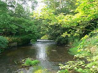
Cound Brook is a tributary of the River Severn in Shropshire, England, running to south of the county town Shrewsbury. The Cound Brook rises in the Stretton Hills, and enters the River Severn at Eyton on Severn after winding its way for 22 miles (35 km) across the southern Shropshire-Severn plain. This length is measured from high on the Long Mynd.
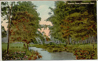
The Noroton River is a 9.4-mile-long (15.1 km) stream which forms most of the border between Stamford and Darien, Connecticut, United States. The river's headwaters are in New Canaan, Connecticut and flow into Holly Pond. It is the largest flowing body of water between the Mill River/Rippowam River to the west and the Fivemile River to the east, although Stony Brook and the Goodwives River in Darien are not much smaller.

Wallpack Valley is a valley located in Sussex County in northwestern New Jersey formed by Wallpack Ridge on the west, and Kittatinny Mountain on the east. Wallpack Ridge separates the Wallpack Valley from the valley of the Delaware River, and contains the watershed of the Flat Brook and its main tributaries Big Flat Brook and Little Flat Brook. It is a narrow valley, roughly 25 miles (40 km) in length running from Montague Township south of Port Jervis, New York to the Walpack Bend in the Delaware River near Flatbrookville in Walpack Township where the Flat Brook enters the Delaware at 300 feet above sea level.

Hurricane Floyd in 1999 was the costliest natural disaster in New Jersey's history, until it was surpassed by Hurricane Irene in 2011. Damage in the state totaled $250 million (1999 USD), much of it in Somerset and Bergen counties. Seven people died in New Jersey during Floyd's passage – six due to drowning, and one in a traffic accident. A police lieutenant took his life after coordinating floodwater rescues for nearly 48 hours.