
New Providence is a borough on the northwestern edge of Union County, in the U.S. state of New Jersey. It is located on the Passaic River, which forms the county boundary with Morris County bordering Chatham Township. As of the 2020 United States census, the borough's population was 13,650, an increase of 1,479 (+12.2%) from the 2010 census count of 12,171, which in turn reflected increase of 264 (+2.2%) from the 11,907 counted in the 2000 census.

The Raritan River is a river of the U.S. state of New Jersey. Its watershed drains much of the central region of the state, emptying into the Raritan Bay near Staten Island on the Atlantic Ocean.

The Passaic River is a river, approximately 80 miles (130 km) long, in Northern New Jersey. The river in its upper course flows in a highly circuitous route, meandering through the swamp lowlands between the ridge hills of rural and suburban northern New Jersey, called the Great Swamp, draining much of the northern portion of the state through its tributaries.

Toney's Brook is a tributary of the Second River in Essex County, New Jersey in the United States.

The Pompton River is a tributary of the Passaic River, approximately 8 miles (13 km) long, in Passaic County in northern New Jersey in the United States.

The Rockaway River is a tributary of the Passaic River, approximately 35 mi (56 km) long, in Morris County, New Jersey in the United States. The upper course of the river flows through a wooded mountainous valley, whereas the lower course flows through the populated New Jersey suburbs and former industrial area west of New York City. It drains an area of approximately 130 sq mi (340 km²).
The Saddle River flows south through much of Bergen County, New Jersey. The river runs through densely populated suburban areas for much of its course. The river takes its name from the river near Saddell in Argyll and Bute in Scotland.
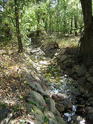
Spring Garden Brook is a tributary of the Passaic River in Morris County, New Jersey in the United States.
Pascack Brook is a tributary of the Hackensack River in Bergen County, New Jersey, United States.

The Millstone River is a 38.6-mile-long (62.1 km) tributary of the Raritan River in central New Jersey in the United States.
Stevenson Brook is a tributary of the Passaic River in Hawthorne, Passaic County, New Jersey in the United States.
Goffle Brook is a tributary of the Passaic River which flows south through a section of Passaic County and Bergen County in New Jersey and drains the eastern side of the First Watchung Mountain. Heading up the brook from the confluence with the Passaic River, one encounters the borough of Hawthorne, the village of Ridgewood, the borough of Midland Park, and the township of Wyckoff.

The Peckman River is a tributary of the Passaic River in Essex and Passaic Counties, New Jersey in the United States.

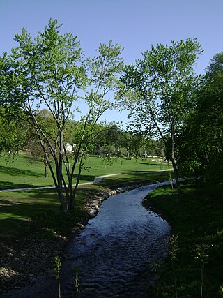
Loantaka Brook is a tributary of the Passaic River in New Jersey in the United States.

Goffle Hill, also referred to as Goffle Mountain and historically known as Totoway Mountain and Wagaraw Mountain, is a range of the trap rock Watchung Mountains on the western edge of the Newark Basin in northern New Jersey. The hill straddles part of the border of Bergen County and Passaic County, underlying a mostly suburban setting. While hosting patches of woodlands, perched wetlands, and traprock glades, the hill is largely unprotected from development. Extensive quarrying for trap rock has obliterated large tracts of the hill in North Haledon, and Prospect Park. Conservation efforts seeking to preserve undeveloped land, such as the local Save the Woods initiative (2007–present), are ongoing.

Cranbury Brook, also known as Cranberry Brook, is a tributary of the Millstone River in Middlesex and Monmouth Counties, New Jersey in the United States.
Yantacaw Brook is a tributary of the Third River in Essex County, New Jersey, United States. The brook rises in Montclair and then continues into the Third River in Bloomfield, New Jersey and then into Belleville and Nutley, where it enters the Passaic River. Both Yantacaw Brook and the Third River were referred to by the Lenape people as Yantokah or Yantacaw.

Wadham Creek, usually styled Wadhams Creek, and in the 18th century first known by European settlers as Whittlesey Creek, is a tributary of the Susquehanna River in Luzerne County, Pennsylvania, in the United States. It is approximately 1.1 miles (1.8 km) long and flows through Plymouth Township and Plymouth Borough. The creek's watershed has an area of 1.28 square miles (3.3 km2). It has one dam. The drainage basin of Wadham Creek is designated as a Coldwater Fishery and a Migratory Fishery.
Brown Creek is a tributary of the Susquehanna River in Luzerne County, Pennsylvania, in the United States. It is approximately 3.1 miles (5.0 km) long and flows through Larksville and Plymouth. The watershed of the creek has an area of 2.79 square miles (7.2 km2). It is designated as a Coldwater Fishery and a Migratory Fishery. The creek has two dams on it: the Brown Creek Dam and the Brown Creek Debris Dam. It is crossed by a number of bridges, and covered by several buildings.

Passaic River Parkway, often called Passaic River Park, is a linear park along the banks of the Passaic River in Union County, New Jersey. It is one of the three "emerald necklaces" in the Union County Park System, the others being Rahway River Parkway and Elizabeth River Parkway.
