List of crossings of the Upper Passaic River

Last updated

Passaic River Bridge North elevation. Oblique view to southeast. - Passaic River Bridge, Spanning Passaic River on U.S. Route 46, Paterson, Passaic County, NJ HAER NJ,16-PAT,37-5.tif
Passaic River Bridge

The Upper Passaic River in New Jersey is the section of the Passaic River above the Dundee Dam, including the Great Falls. The entire river flows for 81 miles from its river's source in Mendham to the river mouth at Newark Bay in the northeastern part of the state. [1] The Passaic traverses 45 municipalities, and its watershed provides drinking water for more than 3.5 million people in the region. [2] [3] The midpoint of the upper river generally delineates the Passaic-Bergen, Passaic-Essex, Essex-Morris, Morris-Union and sections of the Morris-Somerset county lines.

Contents

There are over 110 crossings along the lower and upper river [4] [5] [6] [7] including vehicular [8] [9] and rail bridges. [8] [10] The upper reaches are also crossed by footbridges, dams, culverts, and a pre-colonial weir. In the colonial era the first bridge along the lower reaches was at Bridge Street in Newark [11] and the first over the upper river was Totowa Bridge, constructed before 1737. [12] The creation of Society for Establishing Useful Manufactures in 1791 [13] [14] began a period of development of cities and industries along the river. The emergence of the early railroads in the state led to further industrialization and urbanization and many rail bridges. [15] The flood of 1903 caused damage or destruction of most bridges in the vicinity of Paterson. [16] [17] The advent of the automobile age and suburbanization in the early and mid-20th century saw the construction of highway bridges in northern New Jersey. [15] [18]

At the Great Falls Bigfalls14w info.jpg
At the Great Falls

Existing crossings of the Lower Passaic are PD Draw, Lincoln Highway Passaic River Bridge, Pulaski Skyway, Point-No-Point Bridge, Chaplain Washington Bridge, Harry Laderman Bridge, Jackson Street Bridge, Dock Bridge, Bridge Street Bridge, Newark Drawbridge, William A. Stickel Memorial Bridge, Clay Street Bridge, NX Bridge, WR Draw, Belleville Turnpike Bridge, Avondale Bridge, Lyndhurst Draw, Route 3 Passaic River Crossing, Union Avenue Bridge, Gregory Avenue Bridge, Market Street Bridge, Eighth Street Bridge, Passaic Street Bridge, Monroe Street Bridge and Veterans Bridge. [19] [9] [10]

Power transmission lines pass over the river several times. The Public Service Electric and Gas Company (PSE&G) Northern Inner Ring Transmission Line runs from Metuchen Substation to Athenia Substation in Clifton via Roseland Substation and also includes right of way from Roseland Substation to West Orange Substation. The Pennsylvania-New Jersey Interconnection (PJM Interconnection) Bushkill to Roseland Transmission Line extends from Roseland to Hardwick Township in Warren County. [20] Jersey Central Power and Light also has lines across the river.

Crossings

CrossingImageDatesTypeCarries/CarriedLocale/MunicipalityCoordinates NBI/FRA codeNotesReferences
Dundee Dam DundeeDamPassaicRiver1.tif

Dundee Dam 20070803-jag9889.jpg

1861dam Clifton -
Garfield
40°53′01″N74°07′36″W / 40.8835°N 74.1266°W / 40.8835; -74.1266 (Dundee Dam) NJRHP #22327 (SHPO) [21]
Garden State Parkway Garden State Parkway Bridge 20070801.jpg Garden State Parkway GSPkwy Shield.svg
milepoint 158.28
Clifton -
Elmwood Park
40°53′23″N74°07′47″W / 40.8898°N 74.1296°W / 40.8898; -74.1296 (Garden State Parkway bridge) 361582T NJTA [8] [22] [23]
Passaic River Bridge
aka Crooks Avenue Bridge
site of Weasel Bridge
US Route 46 Bridge 20070801.jpg c.1937
1995 rebuild
open spandrel
(false concrete arch;true steel girder)
U.S. Route 46 US 46.svg
milepoint 63.95
Clifton-
Paterson -
Elmwood Park
40°53′38″N74°07′44″W / 40.8938°N 74.1290°W / 40.8938; -74.1290 (Passaic River Bridge) 1607168 Morris Goodkind
NJDOT
Cedar Lawn Cemetery
NJRHP #2330 (SHPO) (breakout)
[24] [8] [25] [26] [27]
[28] [29] [30]
Route 46 1955 culvert U.S. Route 46 US 46.svg
milepoint 64.52
Elmwood Park 40°53′36″N74°07′07″W / 40.893297°N 74.118486°W / 40.893297; -74.118486 (Route 46 Fleischer Brook) 0220152over branch of the Passaic [8] [27] [25] [31]
Christopher Columbus Highway
Interstate 80 Bridge 20070801.jpg 1964
1969
Interstate 80 I-80 (NJ).svg
milepoint 60.47
Paterson -
Elmwood Park
40°54′07″N74°08′00″W / 40.9020°N 74.1334°W / 40.9020; -74.1334 (I-80 bridge) 1610152 NJDOT [8] [32]
Market Street Bridge Market Street Bridge P8010133.jpg 1903 lost flood
1923
2005 replace
Market Street
CR 448 CR 448 jct.svg
CR 56 Bergen County 56.svg
40°54′09″N74°08′00″W / 40.90247°N 74.13342°W / 40.90247; -74.13342 (Market Street Bridge) 020011C [8] [31] [33]
NYS&W
milepost 18.00
NYS&W Railroad Bridge 20070801.jpg c.1937rail New York, Susquehanna and Western Railway 40°54′15″N74°07′57″W / 40.90405°N 74.13245°W / 40.90405; -74.13245 (NYS&W rail bridge) 6150??? NJ Midland
Passaic–Bergen Rail Line
[34]
Broadway Bridge
1903 Bridge PassaicRiverBroadwayBridge.tif
1903 Bridge
1988 Bridge Broadway Bridge 20070801-jag9889.jpg
1988 Bridge
1903 lost flood
1931
1988 rebuilt
arch NJ Route 4 Ellipse sign 4.svg
milepoint 0.17
Broadway
Public Service
40°55′06″N74°07′49″W / 40.9182°N 74.1303°W / 40.9182; -74.1303 (Route 4 Bridge) 0205150 NJDOT
North Jersey Rapid Transit
[8] [31] [35] [36]
[37] [38]
Morlot Avenue Bridge Morlot Avenue Bridge 20070801-jag9889.jpg 1890 lost flood
1904 new
1976 rehab
2009 replace
open truss Morlot Avenue
33rd Street
CR 651 CR 651 jct.svg
Paterson - Fair Lawn 40°55′27″N74°08′25″W / 40.92408°N 74.14018°W / 40.92408; -74.14018 (Morlot Avenue Bridge) 020017E [8] [31] [39] [40]
Fair Lawn Avenue Bridge
aka Fifth Avenue Bridge
Fairlawn Avenue Bridge 20070801-jag9889.jpg 1905
1967 rehab
2018 replace (planned)
through truss bridge Fair Lawn Avenue
Fifth Avenue
40°56′02″N74°08′23″W / 40.9339°N 74.1396°W / 40.9339; -74.1396 (Fairlawn/Fifth Avenue Bridge) 1600009Scheduled for replacement 2020 [41] [8] [42] [43] [44]
[45] [46] [47]
Fair Lawn-Paterson Fish Weir Fish Weir Passaic River 20070801-jag9889.jpg weir 40°56′11″N74°08′26″W / 40.93631°N 74.14060°W / 40.93631; -74.14060 (Fairlawn-Paterson Fish Weir) Acquackanonk tribe
Slooterdam
[48] [49]
Maple Avenue Bridge
replaced Wagaraw Bridge
Maple Avenue Bridge 20070805-jag9889.jpg 1907
1992 rehab
County Route 507 County 507.svg 40°56′26″N74°08′38″W / 40.94056°N 74.14377°W / 40.94056; -74.14377 (Maple Avenue Bridge) 1600010 [8] [45] [50]
Lincoln Avenue Bridge
replaced Moffat Bridge
Lincoln Ave Bridge 20070805-jag9889.jpg 1903 lost flood
1926
1993 rebuilt
stringerLincoln Avenue
County Route 504 County 504.svg
Paterson - Hawthorne 40°56′30″N74°08′53″W / 40.94164°N 74.14807°W / 40.94164; -74.14807 (Lincoln Avenue Bridge (Moffat Bridge)) 1600011 [8] [45] [17] [51]
NYS&W Bridge NYS&W Railroad Bridge 20070805-jag9889.jpg 1869 originalrail New York, Susquehanna and Western Railway 40°56′17″N74°09′14″W / 40.93808°N 74.15393°W / 40.93808; -74.15393 (NYS&W rail bridge) 6150??? NJ Midland
Passaic–Bergen Rail Line
[52] [34]
Main Line
milepost 17.34
MainLineNJTPassaicRiver.tif 1848 originalrail
Pratt through truss
NJT Main Line
EL
Erie Main Line
Newark Branch.
40°56′14″N74°09′26″W / 40.93731°N 74.15715°W / 40.93731; -74.15715 (Main Line rail bridge) 4003???
NJRHP #252 (SHPO)
[8] [53] [52] [34]
Sixth Avenue Bridge Sixth Ave Bridge 20070805-jag9889.jpg c.1900
1987 rehab
pony truss North Sixth Street
CR 652 CR 652 jct.svg
Paterson -
Prospect Park
40°56′03″N74°10′00″W / 40.9342°N 74.1667°W / 40.9342; -74.1667 (Sixth Avenue Bridge) 1600012 [8] [45] [54] [55]
Hillman Street Bridge1902 lost to flood
1907 lost to flood
arch replaced
footbridge
Paterson 40°55′47″N74°09′55″W / 40.9297°N 74.1653°W / 40.9297; -74.1653 (Hillman Street Bridge) [56] [57]
Straight Street Bridge Straight Street Bridge 20070829-jag9889.jpg 1907
2003 restored
Pennsylvania (petit) truss Straight Street
North Bridge Street
CR 650 CR 650 jct.svg
40°55′35″N74°09′58″W / 40.9263°N 74.1661°W / 40.9263; -74.1661 (Straight Street Bridge) 1600014 [8] [45] [58] [59] [60]
Arch Street Bridge Arch Street Bridge 20070829-jag9889.jpg 1905
2008 rehab
Parker truss Arch Street 40°55′24″N74°10′12″W / 40.9233°N 74.1701°W / 40.9233; -74.1701 (Arch Street Bridge) 1600015 Public Service [8] [45] [60] [61]
Main Street
aka Temple Street Bridge
1905 Bridge MainStBridgePassaicRiverPaterson1.tif
1905 Bridge
1998 Bridge Main Street Bridge 20070829-jag9889.jpg
1998 Bridge
1905
1998 rebuilt
Main Street 40°55′20″N74°10′22″W / 40.92210°N 74.17274°W / 40.92210; -74.17274 (Main Street Bridge) 1600016 [8]
Totowa Bridgepre 1737
?? removed
wooden 40°55′18″N74°10′28″W / 40.92154°N 74.17431°W / 40.92154; -74.17431 (Totowa Bridge) Acquackanonk Bridge [62] [12]
West Broadway Bridge Concrete-Metal Bridge PassaicRiverPaterson.tif 1897
2004 restore
Melan type concrete arch Paterson-Hamburg Turnpike
West Broadway
County Route 509
CR 673 CR 673 jct.svg
40°55′16″N74°10′30″W / 40.9211°N 74.1751°W / 40.9211; -74.1751 (West Broadway Bridge) 1600017NJRHP #3959 (SHPO) [8] [45] [63] [64]
Mulberry Street
aka Alfano Island Bridge
Mulberry Street Bridge 20070829-jag9889.jpg to Alfano Island 40°55′13″N74°10′32″W / 40.92017°N 74.17554°W / 40.92017; -74.17554 (Mulberry Street Bridge)
Footbridge
(proposed)
pedestrian path
bike path
over Alfano Island 40°55′09″N74°10′38″W / 40.9193°N 74.1771°W / 40.9193; -74.1771 (Proposed footbridge) [65]
Chasm Bridge
Paterson Great Falls National Historical Park
The Great Falls of the Passaic, NJ.JPG 1827
1844
1868
1888
1944
utility
footbridge
(former)
water pipes and pedestrian path 40°54′58″N74°10′52″W / 40.91600°N 74.18112°W / 40.91600; -74.18112 (Chasm Bridge) NJRHP #2362
NRHP #7000391
original known as Clinton Btidge [66] [67]
Footbridge
Paterson Great Falls National Historical Park
GreatFallsPatersonFootbridges.tif

Great Falls Footbridge 20100317-jag9889.jpg

1971 footbridge pedestrian path 40°54′58″N74°10′52″W / 40.91607°N 74.181200°W / 40.91607; -74.181200 (Footbridge at Paterson Great Falls National Historical Park) NJRHP #2362
NRHP #7000391
[68] [69]
Island Dam
aka SUM Dam
IslandDamSUMDamGreatFallsPassaicRiver1.tif c.1794
1840
dam 40°54′56″N74°10′55″W / 40.91547°N 74.18191°W / 40.91547; -74.18191 (Society for Establishing Useful Manufactures Dam) Society for Establishing Useful Manufactures
NJRHP #2362
NRHP #7000391
[70]
Footbridge
at Paterson Great Falls National Historical Park
PassaicFallsPowerHouseDamBridge.tif footbridge pedestrian path 40°54′55″N74°10′53″W / 40.91529°N 74.18143°W / 40.91529; -74.18143 (Footbridge at Paterson Great Falls National Historical Park) over cove of Passaic
NJRHP #2362
NRHP #7000391
Wayne Avenue WayneAveSpruceStBridgePassaicSUMDam.tif 1985 opened
2018 rebuilt (planned)
Wayne Avenue
CR 673 CR 673 jct.svg
40°54′55″N74°10′55″W / 40.9152°N 74.1820°W / 40.9152; -74.1820 (Wayne Avenue Bridge) 1600018 [8] [71]
Spruce Street Bridge
SpruceStreetBridgePassaicRiverPaterson.tif c.1931
1985 replaced
40°54′53″N74°10′56″W / 40.91473°N 74.18221°W / 40.91473; -74.18221 (Spruce Street Bridge) 1600018 [72]
Westside Park Footbridge
Postcard View WestSideParkBridgePassaicRiverPaterson.tif
Postcard View
West Side Park Bridge 20070829-jag9889.jpg
footbridgepedestrian path 40°54′44″N74°11′08″W / 40.91209°N 74.18552°W / 40.91209; -74.18552 (Westside Park Footbridge)
Lincoln Bridge LincolnBridgePassaicRiverPaterson.tif removedover island
Paterson, Passaic and Rutherford Electric Railway
40°54′29″N74°11′44″W / 40.90792°N 74.19567°W / 40.90792; -74.19567 (Lincoln Bridge) Lido Venice Club (closed) [73] [74] [75] [76]
Glover Avenue Bridge Glover Ave Bridge 20070829-jag9889.jpg Glover Avenue
CR 636 CR 636 jct.svg
Paterson &
Woodland Park -
Totowa
40°54′27″N74°11′45″W / 40.90752°N 74.19575°W / 40.90752; -74.19575 (Glover Avenue Bridge) 16002020 Holy Sepulchre Cemetery [8]
Hillery Street Bridge
1898 Bridge Postcard View HilleryStreetBridgePassaicRiver(1913view).tif
1898 Bridge Postcard View
1973 Bridge Hillery Street Bridge 20070829-jag9889.jpg
1973 Bridge
2009 Bridge Hillery Street Bridge 20090427-jag9889.jpg
2009 Bridge
1898
1973 rehab
2009 rehab
Pratt pony truss Hillery Street
Totowa Road
CR 644 CR 644 jct.svg
Totowa - Woodland Park 40°54′15″N74°12′02″W / 40.90406°N 74.20043°W / 40.90406; -74.20043 (Hillery Street Bridge) 1600039 [8] [77] [78]
Paterson High Bridge
milepost 18.00
PatersonHighBridgeBoontonBranchDL&W.tif 1964 removedrail
Plate girder
Boonton Branch
Erie-Lackawanna Railroad
DL&W
40°53′47″N74°12′04″W / 40.89632°N 74.20118°W / 40.89632; -74.20118 (Paterson High Bridge) [79]
Christopher Columbus Highway Interstate 80 Bridge 20070829-jag9889.jpg 1964
2009 repaired
Interstate 80 I-80 (NJ).svg
milepoint 56.34
40°53′46″N74°12′05″W / 40.8962°N 74.2014°W / 40.8962; -74.2014 (I-80 bridge) 1610153 NJDOT [8] [32] [80]
Lackawanna Avenue Southwest elevation. Aerial view to northeast. - Passaic River Bridge, Spanning Passaic River on U.S. Route 46, Totowa, Passaic County, NJ HAER NJ,16-TOTO,2-2.tif

Lackawanna Ave Bridge 20090427-jag9889.jpg

1894
1965 rehab
1976 rehab
Lackawanna Avenue
part of original westbound Route 46
40°53′30″N74°13′05″W / 40.89165°N 74.21796°W / 40.89165; -74.21796 (Lackawanna Avenue Bridge) 1600021 [8] [28]
Passaic Valley Water Commission Northeast elevation. View to southwest. - Passaic River Bridge, Spanning Passaic River on U.S. Route 46, Totowa, Passaic County, NJ HAER NJ,16-TOTO,2-6.tif

PVWC Utility Bridge 20070829-jag9889.jpg

utilityPassaic Valley Water Commission water main 40°53′27″N74°13′09″W / 40.89086°N 74.21930°W / 40.89086; -74.21930 (PVWC water main) [81]
Passaic River Bridge
Northeast elevation. Oblique view to west. - Passaic River Bridge, Spanning Passaic River on U.S. Route 46, Totowa, Passaic County, NJ HAER NJ,16-TOTO,2-7.tif

Route 46 Bridge 20090427-jag9889.jpg

1939
1998 rehab
open spandrel U.S. Route 46 US 46.svg
milepoint 57.94
Totowa -
Little Falls
40°53′25″N74°13′12″W / 40.8903°N 74.2199°W / 40.8903; -74.2199 (Passaic River Bridge) 1606158 Morris Goodkind
NJDOT
[8] [26] [28] [27] [82]
Passaic Valley Water Commission PVWC Utility Bridge 20100316-jag9889.jpg utilityPVWC water main 40°52′59″N74°13′52″W / 40.88312°N 74.23122°W / 40.88312; -74.23122 (PVWC water main) [10]
Little Falls Water Treatment Plant PVWC Water Treatment Plant 20100316-jag9889.jpg c1925access road Totowa 40°52′59″N74°13′52″W / 40.88312°N 74.23122°W / 40.88312; -74.23122 (Former Morris Canal Little Falls Aqueduct)
Little Falls Aqueduct LittleFallsAqueductMorrisCanalPassaicRiver.tif 1828
c1925 remove
stone arch
navigable aqueduct
Morris Canal Totowa -
Little Falls
40°52′59″N74°13′52″W / 40.88312°N 74.23122°W / 40.88312; -74.23122 (Former Morris Canal Little Falls Aqueduct) [83] [84]
Union Avenue Bridge
replaced Beatties Bridge
LittleFallsCoveredBridgePassaicRiver1850.tif 1850
1890
1966
1995
covered (original)Union Avenue
CR 646 CR 646 jct.svg
over uninhabited island
Little Falls
Wayne
40°53′01″N74°13′59″W / 40.8836°N 74.2330°W / 40.8836; -74.2330 (Union Avenue Bridge) 1600022 Little Falls Station
NJ Route 62
[8] [67]
Union Avenue Union Ave Bridge 20070904-jag9889.jpg Union Avenue
CR 646 CR 646 jct.svg
over uninhabited island
Totowa
Wayne
40°53′04″N74°13′57″W / 40.88456°N 74.23249°W / 40.88456; -74.23249 (Union Avenue Bridge) 1600022 NJ Route 62 [85]
Beatties Dam
Little Falls
BeattiesDamLittleFallsPassaicRiver.tif 1899dam Totowa -
Little Falls
40°53′03″N74°14′04″W / 40.88420°N 74.23455°W / 40.88420; -74.23455 (Little Falls/Beatties Dam) [1]
Montclair-Boonton Line
milepost 19.43
NJ Railroad Bridge 20070904-jag9889.jpg 4004???rail Montclair-Boonton Line (NJT)
New York and Greenwood Lake Railway (Erie)
Singac,
Little Falls -
Wayne
40°53′18″N74°14′45″W / 40.88843°N 74.24597°W / 40.88843; -74.24597 (Montclair-Boonton Line rail bridge) [8] [86] [87]
Newark-Pompton Turnpike NJ Route 23 Bridge 20070904-jag9889.jpg 1916
1988 rehab
concrete arch Newark-Pompton Turnpike
NJ Route 23 Ellipse sign 23.svg
milepoint 4.52
40°53′16″N74°14′48″W / 40.88778°N 74.24665°W / 40.88778; -74.24665 (Newark-Pompton Turnpike bridge) 1604150 [8] [88]
Route 46 Passaic River Bridge
dual bridges
Route 46 Bridges 20070904-jag9889.jpg 1927 EB

1951 WB
2008 rehab

U.S. Route 46 US 46.svg
milepoint 55.45
Wayne - Fairfield Township 40°53′33″N74°15′57″W / 40.8925°N 74.2658°W / 40.8925; -74.2658 (Route 46 bridge) 0722157
0722158
Morris Goodkind
NJDOT
[8] [28] [27] [89]
Christopher Columbus Highway
dual bridges
Interstate 80 Bridges 20070904-jag9889.jpg 1967
1988 rehab
Interstate 80 I-80 (NJ).svg
milepoint 52.87
40°53′39″N74°16′00″W / 40.8943°N 74.2666°W / 40.8943; -74.2666 (I-80 bridge) 0726155 EB
0726156 WB
NJDOT [8] [32] [89]
Two Bridges Road Two Bridges@confluencePompton&Passaic.tif

Two Bridges Road Bridge 20070904-jag9889.jpg

1928Two Bridges Road CR 613 jct.svg Fairfield Township -
Lincoln Park
40°53′50″N74°16′22″W / 40.8973°N 74.2728°W / 40.8973; -74.2728 (Two Bridges Road Bridge) 070M060 William A. Stickel
At the confluence with the Pompton River
[8] [89]
Horseneck Road Bridge Horseneck Road Bridge 20111010-jag9889.jpg 1906
2000 replace
Horseneck Road Fairfield Township - Montville 40°52′56″N74°20′24″W / 40.8822°N 74.3400°W / 40.8822; -74.3400 (Horseneck Road Bridge) 1400282 [8] [90] [91] [92]
Christopher Columbus Highway
dual bridges
EB Interstate 80 Eastbound Bridge 20111010-jag9889.jpg
EB
WB Interstate 80 WB Bridge 20111010-jag9889.jpg
WB
1968stringer/multi-beam or girder Interstate 80 I-80 (NJ).svg
milepoint 48.46
Fairfield Township - Montville 40°52′04″N74°19′52″W / 40.8677°N 74.3310°W / 40.8677; -74.3310 (I-80 bridge) 1415157 EB
1415158 WB
Great Piece Meadows
NJDOT
[8] [32] [93]
Route 46 Passaic River Bridge US 46 Bridge 20111010-jag9889.jpg 1940
2008 rebuilt
U.S. Route 46 US 46.svg
milepoint 51.85
Fairfield Township - Pine Brook, Montville 40°51′45″N74°19′16″W / 40.86250°N 74.32114°W / 40.86250; -74.32114 (Route 46 bridge) 1410159 Great Piece Meadows
NJDOT
[8] [28] [27] [94]
Pine Brook Bridge
dual bridges
EB Pine Brook Bridge Eastbound 20111010-jag9889.jpg
EB
WB Pine Brook Bridge Westbound 20111010-ja9889.jpg
WB
c.1940
1981 reenforce
Bloomfield Avenue
NJ Route 159 Ellipse sign 159.svg milepoint 0.32
40°51′31″N74°19′09″W / 40.8585°N 74.3193°W / 40.8585; -74.3193 (Pine Brook Bridge) 1430152 EB
1430153 WB
Great Piece Meadows [8] [91] [95] [90]
Old Bloomfield Road1921stringerBloomfield Avenue Pine Brook, Montville 40°51′35″N74°19′39″W / 40.85986°N 74.32758°W / 40.85986; -74.32758 (Old Bloomfield Road bridge) 1410433over a branch of the Passaic [8] [90]
Route 46
NJ Route 159
dual bridges
1940
1921
stringerBloomfield Avenue
U.S. Route 46 US 46.svg
milepoint 51.54
NJ Route 159 Ellipse sign 159.svg milepoint 0.25
40°51′33″N74°19′39″W / 40.85924°N 74.32758°W / 40.85924; -74.32758 (Bloomfield Avenue bridges) 1431051 EB
1410158 WB
over a branch of the Passaic [8] [28] [27] [95] [90]
Essex Freeway
dual bridges
Essex Freeway Bridges 20110927-jag9889.jpg Interstate 280 I-280 (NJ).svg
milepoint 3.32
West Essex Park, Roseland -
East Hanover
40°49′50″N74°19′47″W / 40.8305°N 74.3296°W / 40.8305; -74.3296 (I-280 bridge) 1410155 EB
1410154 WB
[8] [96]
Eagle Rock Avenue Bi-County Bridge
replaced Swinefield Bridge
Eagle Rock Ave Bridge 20110826-jag9889.jpg 1968
2015 rebuilt
Eagle Rock Avenue
Lenape Trail
CR 611 CR 611 jct.svg
40°49′39″N74°20′06″W / 40.8276°N 74.3349°W / 40.8276; -74.3349 (Eagle Rock Avenue Bi-County Bridge) 1400443 [8] [91] [97] [98]
Morristown and Erie Railway ME Railroad Bridge 20110826-jag9889.jpg railME rail spur Roseland -
East Hanover
40°49′06″N74°20′04″W / 40.81841°N 74.33431°W / 40.81841; -74.33431 (Morristown and Erie Railway bridge) 6155??? Beaufort Station
Route 10
1931 Bridge NJ Route 10 Bridge 20110826-jag9889.jpg
1931 Bridge
1931
2014-17 rebuilt
NJ Route 10 Ellipse sign 10.svg
milepoint 17.6-17.9
Livingston -
East Hanover
40°48′02″N74°21′32″W / 40.80065°N 74.35897°W / 40.80065; -74.35897 (Route 10 bridge) 1402153 [8] [94] [99] [100]
Hanover Cook Bridge
1800s Bridge CooksHanoverBridgePassaicRiver.tif
1800s Bridge
1920 Bridge Hanover Cook Bridge 20110826-jag9889.jpg
1920 Bridge
1920Newark and Mount Pleasant Turnpike
Old Mt. Pleasant Avenue
40°48′00″N74°21′35″W / 40.79995°N 74.35968°W / 40.79995; -74.35968 (Hanover Cook Bridge) 070M063 William A. Stickel [8] [101]
Columbia Turnpike
South Orange Avenue
Columbia Turnpike Bridge 20110826-jag9889.jpg Columbia Turnpike
South Orange Avenue
County Route 510 County 510.svg
Livingston -
Florham Park & Hanover
40°46′45″N74°22′08″W / 40.77915°N 74.36887°W / 40.77915; -74.36887 (Columbia Turnpike bridge) 1400447 [8]
Eisenhower Parkway unbuiltTriborough Road Chatham - Livingston 40°45′30″N74°22′31″W / 40.7582°N 74.3753°W / 40.7582; -74.3753 (unbuilt Eisenhower Parkway bridge)
Passaic Avenue Passaic Avenue Bridge 20110902-jag9889.jpg 1925

1969 redecked

Passaic Avenue
CR 607 CR 607 jct.svg
Florham Park - Millburn 40°45′21″N74°21′41″W / 40.75575°N 74.36134°W / 40.75575; -74.36134 (Passaic Avenue Bridge) 070M065 [8]
Route 241975 culvert NJ Route 24 Ellipse sign 24.svg
milepoint 5.98
Chatham 40°44′34″N74°22′14″W / 40.74274°N 74.37066°W / 40.74274; -74.37066 (Route 24 bridge) 1422161over branch of the Passaic [8] [94] [102]
Route 24
dual bridges
1971 NJ Route 24 Ellipse sign 24.svg
milepoint 6.52
Chatham - Millburn 40°44′34″N74°22′14″W / 40.74274°N 74.37066°W / 40.74274; -74.37066 (Route 24 bridge) 1733154 EB
1733153 WB
[8] [89] [102]
Main Street

westbound
NJ Route 124 Ellipse sign 124.svg 40°44′22″N74°22′18″W / 40.73938°N 74.37165°W / 40.73938; -74.37165 (Route 124 eastbound bridge) 1406157 [8]
Main Street
Morris Turnpike

eastbound
Morris Turnpike EB Bridge 20110902-jag9889.jpg 1874
1909
Main Street
Morris Turnpike
NJ Route 124 Ellipse sign 124.svg
40°44′21″N74°22′18″W / 40.73923°N 74.37159°W / 40.73923; -74.37159 (Main Street Bridge) 1406158 Hobart Gap [8] [94] [103]
Edwards Mill Bridge Summit Ave Bridge 20110927-jag9889.jpg 1916 concrete arch Summit Avenue Chatham -
Summit
(Passaic River Parkway)
40°44′04″N74°22′39″W / 40.73433°N 74.37756°W / 40.73433; -74.37756 (Summit Avenue/Edwards Mill Bridge) 1400514 [8] [94] [104] [105]
Bonnel's Bridge1925stringerWatchung Avenue
CR 646
40°43′44″N74°22′45″W / 40.72892°N 74.37913°W / 40.72892; -74.37913 (Watchung Avenue Bridge) 1400515 Shunpike Road [8] [94]
Morristown Line
milepost 22.31
MorristownLine(MP22.31)Passaic River.tif rail Morristown Line (NJT)
EL
DL&W
Morris and Essex
40°43′33″N74°23′13″W / 40.72575°N 74.38688°W / 40.72575; -74.38688 (Morristown Line rail bridge) 4006???NJRHP #234 (SHPO)
NJT # 319
[8]
Spillway Dam Passaic River NJ dam near Summit and Chatham.jpg spillway dam 40°43′34″N74°23′21″W / 40.72620°N 74.38905°W / 40.72620; -74.38905 (Spillway Dam) [94]
Page Mill Bridge Stanley Ave Bridge 20110927-jag9889.jpg 1929stringerStanley Avenue 40°43′34″N74°23′23″W / 40.72608°N 74.38974°W / 40.72608; -74.38974 (Stanley Avenue Bridge) 1400516 [8] [94]
Mt. Vernon Avenue Mount Vernon Ave Bridge 20111002-jag9889.jpg 1906
1974 rehab
1989 rehab
steel through girderMt. Vernon Avenue 40°43′13″N74°23′27″W / 40.72034°N 74.39097°W / 40.72034; -74.39097 (Mt. Vernon Avenue Bridge) 1400520 [8]
Passaic Street Passaic Street Bridge 20111002-jag9889.jpg Passaic Street Chatham -
New Providence
(Passaic River Parkway)
40°42′48″N74°24′26″W / 40.71344°N 74.40734°W / 40.71344; -74.40734 (Passaic Street Bridge) 2011060 [8] [106]
Central Avenue
Fairmont Avenue
Central Ave Bridge 20111002-jag9889.jpg 1928stringerCentral Avenue
Fairmont Avenue
40°42′06″N74°25′37″W / 40.70173°N 74.42693°W / 40.70173; -74.42693 (Central Avenue Bridge) 2011062 [8] [85]
Bridge Avenue
Snyder Avenue
Snyder Ave Bridge 20110930-jag9889.jpg 1927stringerBridge Avenue
Snyder Avenue
Chatham -
Berkeley Heights
40°41′23″N74°26′23″W / 40.68970°N 74.43965°W / 40.68970; -74.43965 (Bridge Avenue Bridge) 2001001 [8] [85]
Valley Road
Springfield Avenue
Springfield Ave Bridge 20110930-jag9889.jpg 1936girderValley Road
Springfield Avenue
CR 512 County 512.svg
Berkeley Heights
(Passaic River Parkway) -
Gillette,
Long Hill Township
40°40′47″N74°27′06″W / 40.67981°N 74.45162°W / 40.67981; -74.45162 (Valley Road Bridge) 2001017 [8] [85]
Gladstone Branch
milepost 26.27
NJ Transit Gladstone Branch Bridge 20110930-jag9889.jpg rail Gladstone Branch (NJT)
EL
DL&W
40°40′47″N74°27′06″W / 40.67967°N 74.45158°W / 40.67967; -74.45158 (NJT Gladstone Branch rail bridge) 4009???aka Townley Bridge
Morris and Essex Railroad
New Jersey West Line Railroad
[8] [107]
Hillcrest Road
Mountain Avenue
Hillcrest Rd Bridge 20110930-jag9889.jpg 1998stringerMountain Avenue
Hillcrest Road
County Route 531 County 531.svg
Gillette,
Long Hill Township -
Warren Township
40°40′14″N74°27′52″W / 40.67053°N 74.46443°W / 40.67053; -74.46443 (Hillcrest Road Bridge) 18L1109 [8] [108]
Stirling Road
Plainfield Road
Stirling Rd Bridge 20110930-jag9889.jpg 1993slabStirling Road
Plainfield Road
CR 653 CR 653 jct.svg
Long Hill Township -
Warren Township
40°39′58″N74°28′56″W / 40.66605°N 74.48232°W / 40.66605; -74.48232 (Plainfield Road Bridge) 18L1108 [8] [108]
Valley Road Valley Rd Bridge 20111008-jag9889.jpg 1930-31stringerValley Road
County Route 512 County 512.svg
Millington,
Long Hill Township -
Bernards Township
40°39′53″N74°31′47″W / 40.66482°N 74.52971°W / 40.66482; -74.52971 (Valley Road Bridge) 18H1110 [8] [108] [109]
Stonehouse Road Bridge
1923 Bridge PassaicRiverBridgeMillington.tif
1923 Bridge
2009 Bridge Stone House Road Bridge 20111008-jag9889.jpg
2009 Bridge
1923
2009 replace
arch
Stonehouse Rd.
Haas Road
40°40′16″N74°31′33″W / 40.67111°N 74.52575°W / 40.67111; -74.52575 (Stonehouse Road Bridge) 1400540 Millington Station [8] [94] [110]
Millington High Bridge
milepost 30.47
MillingtonHighBridgeDL&WPassaicRiver.tif

Millington Trestle 20111006-jag9889.jpg

1928rail Gladstone Branch (NJT)
EL
DL&W
40°40′39″N74°31′40″W / 40.67745°N 74.52779°W / 40.67745; -74.52779 (Millington High Bridge) 4009??? Morris and Essex Railroad
New Jersey West Line Railroad
NJT #104
[8] [111]
Davis Bridge Davis Bridge 20111008-jag9889.jpg South Maple Avenue
Basking Ridge Road
CR 657 CR 657 jct.svg
40°40′53″N74°31′43″W / 40.68125°N 74.52851°W / 40.68125; -74.52851 (South Maple Avenue Bridge) 1400541 [8] [94] [112]
White Bridge White Bridge Road Bridge 20111008-jag9889.jpg 1890
1952 reinforce
Lord Stirling Road
White Bridge Road
Lord Stirling Park
Millington,
Long Hill Township -
Basking Ridge
40°41′40″N74°30′52″W / 40.69453°N 74.51431°W / 40.69453; -74.51431 (White Bridge) 1400563 Great Swamp National Wildlife Refuge [8] [113]
Osborn Pond Dam Osbonr Pond Dam 20111008-jag9889.jpg Dam Bernards Township -

Harding Township

40°43′16″N74°31′56″W / 40.72110°N 74.53209°W / 40.72110; -74.53209 (Osborn Pond Dam)
Madisonville Road
Lee's Hill Road
Madisonville Road Bridge 20111008-jag9889.jpg 1975box beamLee's Hill Road
Madisonville Road
40°43′16″N74°31′55″W / 40.72117°N 74.53207°W / 40.72117; -74.53207 (Madisonville Road Bridge) 18H1305 [8] [108]
Interstate 287
dual bridges
NB Interstate 287 NB Bridge 20111008-jag9889.jpg
NB
SB Interstate 287 SB Bridge 20111008-jag9889.jpg
SB
NB 1968
SB 1966
culvert Interstate 287 I-287.svg
milepoint 30.17
Marine Hector Cafferata Jr. Congressional Medal of Honor Highway
40°43′55″N74°32′16″W / 40.73205°N 74.53767°W / 40.73205; -74.53767 (I-287 bridge) 1815182 NB
1815183 SB
[8] [108] [114]
Mt. Kemble Avenue
Morristown Road
1924 Bridge US Route 202 Bridge 20111006-jag9889.jpg
1924 Bridge
1924

2012 rebuilt

Mt. Kemble Avenue
Morristown Road
US Route 202 US 202.svg
milepoint 39.06
40°44′01″N74°32′24″W / 40.73369°N 74.53994°W / 40.73369; -74.53994 (Mt. Kemble Avenue Bridge) 1809158 [8] [108] [115] [116] [117]
Van Dorans Mill Dam milldam 40°44′00″N74°32′34″W / 40.73324°N 74.54267°W / 40.73324; -74.54267 (Van Dorans Mill Dam)
Hardscrabble Road Extensionprivate way Harding Township 40°44′26″N74°32′56″W / 40.74069°N 74.54893°W / 40.74069; -74.54893 (Hardscrabble Road Extension?) At confluence with Indian Grove Brook
Patriots' Path Passaic River, New Jersey Brigade Area, Bernardsville, NJ.jpg footbridge Patriots' Path Bernardsville 40°45′07″N74°33′05″W / 40.75191°N 74.55136°W / 40.75191; -74.55136 (Patriots' Path bridge) Morristown National Historical Park
New Jersey Brigade Encampment Site
NJRHP #3381
NRHP #66000053
[118]
Leddell Road
Jockey Hollow Road
culvert Leddell Road
Jockey Hollow Road
40°45′25″N74°33′18″W / 40.75689°N 74.55511°W / 40.75689; -74.55511 (Leddell Road / Jockey Hollow Road bridge) 1400658 [8]
Leddell RoadLeddell Road Mendham Township 40°45′40″N74°33′15″W / 40.76120°N 74.55415°W / 40.76120; -74.55415 (Leddell Road Bridge)
Tempe Wick RoadTempe Wick Road
CR 646 CR 646 jct.svg
40°45′58″N74°33′16″W / 40.76615°N 74.55443°W / 40.76615; -74.55443 (Tempe Wick Road Bridge) [119]
Ledells Dam
aka Washington Corners Dam
LeddellsDamWashingtonCornersMendham.tif milldam 40°45′59″N74°33′16″W / 40.76641°N 74.55458°W / 40.76641; -74.55458 (Ledells Dam) NJRHP #5410
NJRHP #316
NRHP #00000959
Tempe Wick Road-Washington Corners Historic District
Tributary sources in vicinity of
West Morris Mendham High School
[120] [121]
Corey LaneCorey Lane 40°46′09″N74°33′41″W / 40.76911°N 74.56142°W / 40.76911; -74.56142 (Corey Lane Bridge)
Tempe Wick RoadTempe Wick Road
CR 646 CR 646 jct.svg
40°46′18″N74°34′11″W / 40.77174°N 74.56978°W / 40.77174; -74.56978 (Tempe Wick Road Bridge) [2] [3] [1]
Corey Lane culvert Corey Lane 40°45′51″N74°34′32″W / 40.76427°N 74.57551°W / 40.76427; -74.57551 (Corey Lane culvert)
Hardscrabble Road Hardscrabble Rd Bridge 20111008-jag9889.jpg culvert Hardscrabble Road Mendham Borough 40°45′46″N74°34′37″W / 40.76276°N 74.57696°W / 40.76276; -74.57696 (Hardscrabble Road culvert)

Abbreviations and definitions

See also

The course and watershed of the Passaic and area of the prehistoric Lake Passaic Passaicwatershedmap.png
The course and watershed of the Passaic and area of the prehistoric Lake Passaic

Related Research Articles

<span class="mw-page-title-main">New Jersey Route 3</span> State highway in New Jersey, US

Route 3 is a state highway in the northeastern part of New Jersey. The route runs 10.84 miles (17.45 km) from U.S. Route 46 (US 46) in Clifton, Passaic County, to US 1/9 in North Bergen, Hudson County. The route intersects many major roads, including US 46, which takes travelers to Interstate 80 (I-80) west for commuting out of the city-area, the Garden State Parkway and Route 21 in Clifton, Route 17 and the Western Spur of the New Jersey Turnpike (I-95) in East Rutherford, the Eastern Spur of the New Jersey Turnpike in Secaucus, and Route 495 in North Bergen, for traffic going to the Lincoln Tunnel into New York City. Route 3 serves as the main artery to the Lincoln Tunnel from I-80, in conjunction with a portion of US 46 and Route 495. Portions of the route are not up to freeway standards; with driveways serving businesses and bus stops. Despite this, many construction projects have been underway over the years to alleviate this issue. Route 3 also provided access to Hoffmann La Roche's former American headquarters in Nutley, the Meadowlands Sports Complex and American Dream Meadowlands in East Rutherford. The road inspired a story in The New Yorker in 2004 by Ian Frazier due to its views of the Manhattan skyline. Route 3 was originally the Lincoln Tunnel Approach and ended at the state line in the Hudson River, though it was scaled back following the construction of I-495; which is now Route 495 due to also not meeting interstate highway standards.

<span class="mw-page-title-main">New Jersey Route 7</span> State highway in northern New Jersey, US

Route 7 is a state highway in the northern part of New Jersey in the United States. It has two sections, an east–west alignment running from U.S. Route 1/9 Truck in Jersey City to Route 21 in Belleville, and a north–south alignment running from the Newark/Belleville to the Nutley/Clifton border. The New Jersey Department of Transportation (NJDOT) lists Route 7 as a single north–south highway with a small gap between the alignments. The entire highway has a combined length of 9.46 mi (15.22 km).

<span class="mw-page-title-main">New Jersey Route 139</span> State highway in Hudson County, New Jersey, US

Route 139 is a state highway in Jersey City, New Jersey in the United States that heads east from the Pulaski Skyway over Tonnele Circle to the state line with New Jersey and New York in the Holland Tunnel, which is under the Hudson River, to New York City. The western portion of the route is a two level highway that is charted by the New Jersey Department of Transportation (NJDOT) as two separate roadways: The 1.45-mile (2.33 km) lower roadway (Route 139) between U.S. Route 1/9 (US 1/9) over Tonnele Circle and Interstate 78 (I-78) at Jersey Avenue, and the 0.83-mile (1.34 km) upper roadway running from County Route 501 and ending where it joins the lower highway as part of the 12th Street Viaduct, which ends at Jersey Avenue. The lower roadway is listed on the federal and NJ state registers of historic places since 2005. The eastern 1.32 miles (2.12 km) of the route includes the Holland Tunnel approach that runs concurrent with Interstate 78 on the one-way pair of 12th Street eastbound and 14th Street westbound. Including the concurrency, the total length of Route 139 is 2.77 miles (4.46 km).

<span class="mw-page-title-main">Pulaski Skyway</span> Bridge in Jersey City, New Jersey, United States

The Pulaski Skyway is a four-lane bridge-causeway in the northeastern part of the U.S. state of New Jersey, carrying an expressway designated U.S. Route 1/9 (US 1/9) for most of its length. The structure has a total length of 3.502 miles (5.636 km). Its longest bridge spans 550 feet (168 m). Traveling between Newark and Jersey City, the roadway crosses the Passaic and Hackensack rivers, Kearny Point, the peninsula between them, and the New Jersey Meadowlands.

<span class="mw-page-title-main">Interstate 80 in New Jersey</span> Highway in New Jersey

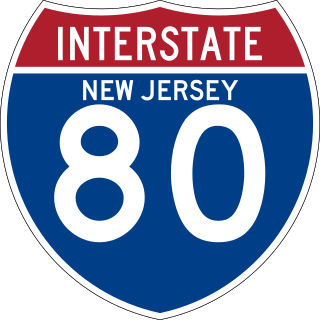
Interstate 80 (I-80) is a major Interstate Highway in the United States, running from San Francisco, California, eastward to the New York metropolitan area. In New Jersey, I-80 runs for 68.35 miles (110.00 km) from the Delaware Water Gap Toll Bridge at the Pennsylvania state line to its eastern terminus at I-95 in Teaneck, Bergen County. I-95 continues from the end of I-80 to the George Washington Bridge for access to New York City. The highway runs parallel to U.S. Route 46 (US 46) through rural areas of Warren and Sussex counties before heading into more suburban surroundings in Morris County. As the road continues into Passaic and Bergen counties, it heads into more urban areas. The New Jersey Department of Transportation (NJDOT) identifies I-80 within the state as the Christopher Columbus Highway.

<span class="mw-page-title-main">Passaic–Bergen–Hudson Transit Project</span>

The Passaic–Bergen–Hudson Transit Project is a project under study by NJ Transit to reintroduce passenger service on a portion of the New York, Susquehanna and Western Railway (NYSW) right-of-way (ROW) in Passaic, Bergen and Hudson counties using newly built, FRA-compliant diesel multiple unit rail cars. Plans call for service to run from Hawthorne south through Paterson, east to Hackensack and then southeast to North Bergen, where it would join the Hudson-Bergen Light Rail (HBLR).

<span class="mw-page-title-main">Elizabeth River (New Jersey)</span> River in Union County, New Jersey, U.S.

The Elizabeth River runs through Essex and Union counties, New Jersey in the United States for 11.9 miles (19.2 km) before draining into the Arthur Kill.

<span class="mw-page-title-main">Bridge Street Bridge (Newark)</span> Bridge in Newark and Harrison, New Jersey

Bridge Street Bridge is a swing bridge over the Passaic River connecting Newark and Harrison, New Jersey. It is the 10th bridge from the river's mouth at Newark Bay and is 5.7 miles (9.2 km) upstream from it. Carrying vehicular traffic, the roadway is designated County Route 508.

<span class="mw-page-title-main">Belleville Turnpike Bridge</span> Bridge in North Arlington, in New Jersey

The Belleville Turnpike Bridge is a vehicular moveable bridge spanning the Passaic River in northeastern New Jersey 8.9 miles (14.3 km) from its river mouth at Newark Bay. Also known as Rutgers Street Bridge and Route 7 Bridge, it is the fourth fixed crossing to be built at the location, today the tripoint of the municipal and county lines of Belleville in Essex, Kearny in Hudson, and North Arlington in Bergen. Commissioned by the New Jersey Department of Transportation, which owns and operates it, the vertical lift bridge opened in 2002.

<span class="mw-page-title-main">Winant Avenue Bridge</span> Bridge in Little Ferry and Ridgefield Park

The Winant Avenue Bridge is a vehicular movable bridge spanning the Hackensack River in Bergen County, New Jersey 14 miles (23 km) from its mouth at Newark Bay. Built in 1934, it is also known as the Route 46 Hackensack River Bridge and S46 Bridge, it carries U.S. Route 46 (US 46) in Little Ferry and Ridgefield Park. Owned and operated by the New Jersey Department of Transportation (NJDOT), the double leaf bascule bridge is located on a navigable reach. While there have been no requests since 1978, the Code of Federal Regulations last amended in 1999 requires 24-hour notice to be opened. The bridge has been minimally altered since its construction and is eligible for individual listing on the National Register of Historic Places (NRHP).

<span class="mw-page-title-main">Lincoln Highway Passaic River Bridge</span> Bridge in Newark and Kearny

The Lincoln Highway Passaic River Bridge is a vehicular moveable bridge crossing the Passaic River at a point 1.8 mi (2.9 km) from the river mouth at Newark Bay in northeastern New Jersey, United States. The vertical lift bridge, along the route of the Lincoln Highway, carries U.S. Route 1/9 Truck and the East Coast Greenway between the Ironbound section of Newark and Kearny Point in Kearny. Opened in 1941, it is owned by and operated by the New Jersey Department of Transportation (NJDOT) and required by the Code of Federal Regulations to open on 4-hour notice for maritime traffic.

<span class="mw-page-title-main">Union Avenue Bridge (Passaic River)</span> Bridge in Rutherford & Passaic, New Jersey

Union Avenue Bridge is a vehicular bridge over the Passaic River in northeastern New Jersey, crossing the county line at the town of Rutherford in Bergen County and the city of Passaic in Passaic County. It takes its name from Union Avenue in Rutherford which connects to River Drive in Passaic. The two-lane, four-span fixed bridge which opened in 2002 is 13.2 miles (21.2 km) from the river's mouth at Newark Bay. There is another Union Avenue Bridge traversing the Passaic at Little Falls

<span class="mw-page-title-main">Straight Street Bridge</span> Bridge in Paterson, New Jersey

The Straight Street Bridge is a vehicular bridge over the Passaic River in Paterson, New Jersey, that is listed on the National Register of Historic Places.

<span class="mw-page-title-main">Route 46 Passaic River Bridge</span>

The Route 46 Passaic River Bridge can refer to a number of bridges that carry U.S. Route 46 (US 46) over the Passaic River in Northern New Jersey. US 46 was originally developed as Route 6 under the direction of Morris Goodkind who was chief engineer of the New Jersey Highway Department from 1922 until 1955.

<span class="mw-page-title-main">West Broadway Bridge</span> Bridge in Paterson, New Jersey

The West Broadway Bridge, aka West Street Bridge and the Concrete-Metal Bridge, is a vehicular bridge over the Passaic River in Paterson, New Jersey. It carries West Broadway, traditionally the Paterson-Hamburg Turnpike, and connects to County Route 509 at its west end.

<span class="mw-page-title-main">Arch Street Bridge</span> Bridge in Paterson, New Jersey

Arch Street Bridge is Parker truss bridge over the Passaic River in Paterson, New Jersey. It was built in 1907 and rehabilitated in 1997. It was the third structure built at the location within a few years; the prior bridges were destroyed by floods in 1902 and 1903.

Sixth Avenue Bridge, aka the North Sixth Street Bridge, is a pony truss vehicular bridge over the Passaic River in northeastern New Jersey. It connects the Bunker Hill neighbourhood of Paterson and Prospect Park at the border with Hawthorne via North Sixth Street. It was originally constructed 1907 as a steel structure supported on stone masonry piers and abutments and is one of several bridges built after the Passaic Flood of 1903. The older span opened was abruptly closed in 1986 after the Passaic County engineer at the time, Gaetano Fabrina, found that some steel beams had rusted and were "banging and clanging."

<span class="mw-page-title-main">Market Street Bridge (Passaic River)</span> Bridge in Passaic & Wallington, New Jersey

Market Street Bridge, also known as the Second Street Bridge, is a vehicular bridge over the Passaic River crossing the Passaic-Bergen county line in Passaic and Wallington in northeastern New Jersey. The double-leaf bascule bridge was built in 1930 and fixed in the closed position in 1977. It was reconstructed in 2002. It carries a two-lane street and sidewalks in a late-19th and early-20th century industrial area along the river. An earlier structure built at the crossing in 1894 was damaged during the Passaic floods of 1902 and 1903 but survived.

References

  1. 1 2 3 Cowen, Richard (May 6, 2007). "Not-so-old-man river" (PDF). The Record. Retrieved November 7, 2016.
  2. 1 2 "Streams of the Great Swamp Watershed: Upper Passaic River". Great Swamp Watershed Association. Retrieved November 2, 2016.
  3. 1 2 "2011 – 2015 Business Plan" (PDF). Passaic River Coalition. 2010. Retrieved October 31, 2016. The source of the Passaic River begins near Mendham Township where small streams come together to form a brook running along the edge of Mendham High School's athletic field. It continues through open farm land and eventually collects water from eight counties in New Jersey and two in New York. Forty-five municipalities line its banks as it flows into Newark Bay and the whole watershed contains 118 municipalities. The river is about 81 miles long; the 935-square mile watershed is the primary water supply for over three and a half million people and major industries.
  4. "Crossings". tools.wmflabs.org. Retrieved December 8, 2016.
  5. "Crossings". tools.wmflabs.org. Retrieved December 8, 2016.
  6. "Lower Passiac River". Google Maps. Retrieved December 8, 2016.
  7. "Upper Passiac River". Google Maps. Retrieved December 8, 2016.
  8. 1 2 3 4 5 6 7 8 9 10 11 12 13 14 15 16 17 18 19 20 21 22 23 24 25 26 27 28 29 30 31 32 33 34 35 36 37 38 39 40 41 42 43 44 45 46 47 48 49 50 51 52 53 54 55 56 57 58 59 60 61 62 63 64 65 66 67 "Interim Bridge Report" (PDF). NJDOT. August 9, 2007. Retrieved December 1, 2016.
  9. 1 2 Federal Highway Administration (n.d.). "New Jersey". National Bridge Inventory. Federal Highway Administration. Retrieved December 10, 2016 via Uglybridges.
  10. 1 2 3 "New Jersey Coverage Map". Bridgehunter. Retrieved December 10, 2016.
  11. Olsen, Kevin K. (2008), A Great Conveniency A Maritime History of the Passaic River, Hackensack River, and Newark Bay, American History Imprints, ISBN   9780975366776
  12. 1 2 Nelson, William; Shriner, Charles Antony (1920), History of Paterson and Its Environs (the Silk City), vol. 2, Lewis Historical Publishing Company, p. 169, ISBN   9785877307438
  13. "History of Development". PVWC. Retrieved November 7, 2016.
  14. Friends of the Great Falls Archived February 14, 2004, at the Wayback Machine S.U.M.
  15. 1 2 "New Jersey Historic Bridge Survey" (PDF). NJDOT. September 1994. Retrieved November 7, 2016. Within the epoch of New Jersey's transportation history from the 17th century to 1945, two periods stand out as extraordinary for their rapid pace of change and growth. The first, running from about 1800 to 1860, saw internal improvements and technological advances such as turnpikes, canals, and railroads. They were all aimed at greater capacity, speed, directness, flexibility, and regularity of service than could be achieved by earlier modes of river navigation and overland travel. Historian George Rogers Taylor has quite correctly called 1800-1860 the "transportation revolution." The second extraordinary period of transportation growth occurred from 1919 to 1936, and was, in terms of historian Bruce Seely, "the golden age of highway building." During this period, New Jersey's road and highway bridges were substantially modernized to handle modern load requirements and increased volume of vehicular traffic. The result was to shift emphasis from railroads to highways.
  16. Ensslin, John C. (September 2, 2011). "1903 flood still ranks as North Jersey's worst". The Record. Archived from the original on November 16, 2016. Retrieved November 14, 2016.
  17. 1 2 Leighton, Marshall Ora (1904). "The Passaic Flood Of 1903" (PDF). Government Printing Office. p. 23. Retrieved November 9, 2016. The bridges crossing Passaic River in Passaic, Essex, and Bergen counties were almost completely destroyed, and the damage amounted to $654,811. Within the limits of Paterson, below Great Falls, all of the highway bridges except two were either severely damaged or completely carried away. West street bridge, the first below the falls, was a Melan concrete, steel-arch structure, built in 1897, and costing $65,000. It was composed of three spans, each about 90 feet long. The flood practically split two spans longitudinally, the upstream side of each, equal to about one-third of the width of the bridge, being carried away. This structure was built to conform to the established grades of streets on both sides of the river and was completely inundated, forming a barrier for floating débris and practically making a dam in the river. Main street bridge is a 3-span, steel-arch structure, which was completely covered during the flood, but was only slightly injured. Arch street bridge, built in 1902 to take the place of a structure carried away by the March flood, was a concrete-arch bridge of three spans. It was undermined at the north pier and collapsed, being practically destroyed. The original cost of this bridge was $34,000. Its piers presented a serious obstruction to the flow of the stream, especially as the channel is very narrow at this point. In addition to this, the bridge was of low grade and admirably adapted for deterring flood flow. Below Arch street bridge all the other structures crossing the Passaic were of iron and were carried away, with the exception of Sixth avenue and Wesel bridges. Those destroyed were designated as follows: Straight street, Hillman street, Moffat, Wagaraw, Fifth avenue, East Thirty-third street, and Broadway bridges. All these structures were built too low, and were inundated during the early stages of the flood.
  18. KSK Architects (January 2011). "New Jersey Historic Roadway Study" (PDF). NJDOT, NJSHPO, FHWA. Retrieved November 30, 2016.
  19. "Bridges over the Passaic River". Passaic River Basin. Retrieved January 10, 2017.
  20. "New Jersey and National Registers of Historic Places". New Jersey Department of Environmental Protection - Historic Preservation Office. Retrieved January 19, 2016.
  21. Historic American Engineering Record (1968). "Dundee Canal Industrial Historic District, Beginning at George Street in Passaic & extending north along Dundee Canal approximately 1.2 miles to Canal headgates opposite East Clifton Avenue in Clifton, Passaic, Passaic County, NJ". Library of Congress. Retrieved November 30, 2016.
  22. New Jersey Turnpike Authority (2013), Garden State Parkway, Arcadia Publishing Company, ISBN   9781439643600
  23. "Garden State Parkway straight line diagram" (PDF). NJDOT. Retrieved November 13, 2016.
  24. NJ-96
  25. 1 2 "National Bridge Inventory NJ 2015 NJ". Federal Highway Administration. 2015. Retrieved January 10, 2017.
  26. 1 2 "Passaic River Bridge" . Retrieved October 26, 2016.
  27. 1 2 3 4 5 6 New Jersey Department of Transportation (July 2014). "US 46 Straight Line Diagram" (PDF). New Jersey Department of Transportation. Retrieved November 25, 2016.
  28. 1 2 3 4 5 6 "Route 46 Corridor Project" (Press release). NJDOT. September 5, 2008. Retrieved October 30, 2016.
  29. "Evaluation of Bridge Scour Monitoring Methods" (PDF). NJODT. March 2002. Retrieved November 15, 2016.
  30. "The Capture of John Cadmus". Passaic County Historical Society. November 1956. Retrieved November 10, 2016.
  31. 1 2 3 4 "National Bridge Inventory Data Bergen County New Jersey". Uglybridges. Retrieved November 25, 2016.
  32. 1 2 3 4 "I-80 Straight Line Diagram" (PDF). New Jersey Department of Transportation . Retrieved November 26, 2016.
  33. "Passaic River Bridge" . Retrieved October 26, 2016.
  34. 1 2 3 "Recording and Coding Guide for Structure Inventory and Appraisal" (PDF). New Jersey Department of Transportation. 2003.
  35. "Passaic River Bridge" . Retrieved October 26, 2016.
  36. "Route 4 straight line diagram" (PDF). New Jersey Department of Transportation . Retrieved November 30, 2016.
  37. Sennstrom, Bernard H; Francis, Edward T. (1994). "Public Service Railway, Bergen Division". H.E. Cox. p. 175. Retrieved November 30, 2016.
  38. Eid, Jr., Joseph; Gummere, Barker (2007), Streetcars of New Jersey: Metropolitan Northeast, ISBN   9780980102628
  39. "Morlot Ave - 33rd St. Bridge Over the Passaic River". Historical Marker Project. Retrieved November 12, 2016. Reflecting the need for additional river crossings as the area grew in the late 19th century, the contract for the original bridge was awarded in July 1890 to Riverside Bridge and Iron Works of Paterson, N.J. for $8,895. This original bridge was washed away on October 10 during the disastrous Passaic river flood of 1903. The flood destroyed practically all the bridges over the Passaic River in Bergen, Passaic, and Essex counties. In 1904, a contract for the second bridge was awarded to Cyclopean Iron Works of Jersey City, N.J. for $27,890. The second bridge, which remained in use from 1904 to 2008, was a through grider [sic] bridge with three 82' spans supported on stone abutments and concrete piers. In 2008, construction began on the third bridge which was placed in service February 2009.
  40. "Rehabilitation of the Morlot Avenue Bridge - Maser Consulting PA" . Retrieved October 26, 2016.
  41. Noda, Stephanie. "Fair Lawn bridge replacement could begin in 2020". North Jersey Media Group.
  42. "Fifth Avenue Bridge" . Retrieved October 26, 2016.
  43. Nobile, Tom. "Historic bridge in Fair Lawn will be replaced" . Retrieved October 26, 2016.
  44. DIDUCH, MARY. "Fair Lawn Avenue bridge to be replaced in 2018" . Retrieved October 26, 2016.
  45. 1 2 3 4 5 6 7 Federal Highway Administration (n.d.). "Passaic County New Jersey". National Bridge Inventory. Federal Highway Administration. Retrieved November 25, 2016 via Uglybridges.
  46. "Transportation Improvement Program Fiscal Years 2014 - 2017: Fifth Avenue Bridge (AKA Fair Lawn Avenue Bridge) over Passaic River" (PDF). North Jersey Transportation Planning Association. July 2, 2015. Retrieved December 23, 2016.
  47. "Deterioration prompts traffic limits on aging bridge" . Retrieved December 20, 2016.
  48. Lutins, Allen; De Condo, Anthony P. (1999). "The Fair Lawn/Paterson Fish Weir". Vol. 54. Archaeological Society of New Jersey. Retrieved October 30, 2016.
  49. Villenueve, Marina (August 9, 2016). "History surfaces when Passaic River runs low". The Record. Retrieved November 30, 2016.
  50. "Passaic River Bridge" . Retrieved October 26, 2016.
  51. "Passaic County Road System". Passaic County. 2001. Archived from the original on July 28, 2016. Retrieved November 14, 2016.
  52. 1 2 "Environmental Resource Inventory Borough of Hawthorne:Transportation" (PDF). Borough of Hawthorne. Archived from the original (PDF) on December 13, 2016. Retrieved November 30, 2016.
  53. "NJT - Passaic River Bridge (Paterson-Hawthorne)" . Retrieved October 31, 2016.
  54. "Sixth Avenue Bridge". NJTPA. 2015. Retrieved November 13, 2016.
  55. "Passaic River Bridge" . Retrieved October 26, 2016.
  56. "HUNDREDS HOMELESS IN PATERSON FLOOD; Armory Opened and 110 Fam- ilies Sheltered There. Mrs. Garret A. Hobart at Head of Relief Committee -- One Life Lost -- Water Starts to Recede" (PDF). Retrieved November 11, 2016.
  57. "FLOOD THREATENS PATERSON.; Many People Stay Up All Night -- Police on Guard and Mills Flooded". The New York Times. March 20, 1907. Retrieved November 11, 2016.
  58. "Straight Street Bridge" . Retrieved October 26, 2016.
  59. "AWARDS" . Retrieved October 26, 2016.
  60. 1 2 Malone, Jim; Brady, Barry; Staudinger, Ruth (January 1, 1983). "An Archaeological Survey of the Arch Street Bridge Project M-8203 and the Straight Street Bridge Project M-8172 in Paterson, NJ" . Retrieved October 26, 2016.{{cite journal}}: Cite journal requires |journal= (help)
  61. "Arch Street Bridge" . Retrieved October 26, 2016.
  62. Graf, E. M. (April 1944). "Totowa Bridge". The Passaic County Historical Society. Retrieved November 30, 2016.
  63. "West Broadway Bridge" . Retrieved October 26, 2016.
  64. Mahmoud, Khaled (2015), Sustainable Bridge Structures: Proceedings of the 8th New York City Bridge Conference, 24-25 August, 2015, New York City, USA, CRC Press, ISBN   9781315657837
  65. TEAM. "Paterson Great Falls State Park" (PDF). NJ Department of Parks and Forestry. Retrieved December 25, 2016.
  66. Graff, E.M. (October 1944). "Passaic Falls Bridges". Passaic County Historical Society. Retrieved November 5, 2016.
  67. 1 2 Brydon, Norman F. (December 2006). "Passaic County's Covered Bridges (Extracted frcm Of Time, Ftre and the River:The Story of New Jersey's Covered Bridges)" (PDF). Vol. 6. The Fassaie County Historical Society by Norman F. Brydon). Archived from the original (PDF) on June 24, 2016. Retrieved February 9, 2017.{{cite magazine}}: Cite magazine requires |magazine= (help)
  68. "Paterson Dedicates Park in Celebrating Great Falls Festival". The New York Times. September 2, 1971. Retrieved November 8, 2016.
  69. Dente, Marcia A. (2010), Great Falls of Paterson, Arcadia Publishing, ISBN   9780738573229
  70. Historic American Buildings Survey (HAER NJ-2). "Great Falls/S. U. M. Power Canal System, Paterson, Passaic County, NJ". Library of Congress. Retrieved December 25, 2016.{{cite web}}: CS1 maint: numeric names: authors list (link)
  71. MALINCONICO, JOE. "Wayne Avenue bridge in Paterson being rebuilt" . Retrieved October 26, 2016.
  72. "Spruce Street Bridge (OLD)" . Retrieved October 26, 2016.
  73. No Name Supplied (January 1, 1935). "Lincoln Street Bridge crossing over the Passaic River into Totowa in Paterson, New Jersey". No Publisher Supplied. doi:10.7282/T39887GV . Retrieved October 26, 2016.{{cite journal}}: Cite journal requires |journal= (help)
  74. "Lincoln Bridge" . Retrieved October 26, 2016.
  75. redOrbit (August 12, 2008). "Deserted Island's Past Nearly Forgotten - Redorbit" . Retrieved October 26, 2016.
  76. "The Island where The Lido Venice once stood. Paterson, NJ". Facebook . Retrieved October 26, 2016.
  77. "Hillery Street Bridge" . Retrieved October 26, 2016.
  78. "Hillery Street Bridge". RCC Fabricators. Retrieved November 1, 2016.
  79. "EL - Paterson High Bridge" . Retrieved October 26, 2016.
  80. Unit, NJDOT Web Development. "NJDOT announces Route 80 westbound resurfacing and bridge repair project in Passaic County" . Retrieved October 31, 2016.
  81. "Passaic River Water Pipe Bridge" . Retrieved October 26, 2016.
  82. NJ-100
  83. "Morris Canal in Passaic County". Passaic County. Retrieved December 25, 2016.
  84. "Spotlight on the Morris Canal in the Township of Little Falls". Passaic County. Retrieved December 25, 2016.
  85. 1 2 3 4 "Historic Bridge Survey Union County (1991-1994)" (PDF). NJDOT. 2001. Retrieved November 3, 2016.
  86. "NJT - Passaic River Bridge (Singac)" . Retrieved December 20, 2016.
  87. "Railway Bridge Rehabilitation". Atlantic Engineering. 2008. Retrieved December 5, 2016.
  88. "NJ 23 Passaic River Bridge" . Retrieved October 31, 2016.
  89. 1 2 3 4 Federal Highway Administration (n.d.). "Essex County New Jersey". National Bridge Inventory. Federal Highway Administration. Retrieved November 25, 2016 via Uglybridges.
  90. 1 2 3 4 Federal Highway Administration (n.d.). "Morris County New Jersey". National Bridge Inventory. Federal Highway Administration. Retrieved November 25, 2016 via Uglybridges.
  91. 1 2 3 "Passaic River Bridge at Hanover, NJ" . Retrieved October 31, 2016.
  92. "Horseneck Road Bridge Replacement Project Fairfield and Montville". Berger Group. Retrieved November 17, 2016.
  93. "Uglybridges.com - I-80 EB over PASSAIC RIVER, Morris County, New Jersey" . Retrieved December 20, 2016.
  94. 1 2 3 4 5 6 7 8 9 10 "Historic Bridge Survey: Morris County (1991-1994)" (PDF). NJDOT. 2001. Retrieved November 3, 2016.
  95. 1 2 NJDOT. "NJ 159" (PDF). NJDOT. Retrieved December 5, 2016.
  96. NJDOT. "Interstate 280 Straight Line Diagram" (PDF). NJDOT. Retrieved December 5, 2016.
  97. "Eagle Rock Avenue Bridge Re-opens - WBGO Jazz 88.3FM" . Retrieved October 31, 2016.
  98. "Eagle Rock Avenue Bi-County Bridge to close May 18-Sept. 18". May 9, 2015. Retrieved October 31, 2016.
  99. Unit, NJDOT Web Development. "NJDOT to replace Route 10 bridge over Passaic River connecting East Hanover and Livingston" . Retrieved October 31, 2016.
  100. "NJTPA Transportation Improvement Program Fiscal Years 2014 - 2017 (Morris)" (PDF). NJTPA. p. 8. Retrieved November 29, 2016.
  101. Swanbeck, Steve (2001), East Hanover, Arcadia Publishing, p. 12, ISBN   9780738509655 , retrieved November 9, 2016
  102. 1 2 "Route 24 straight line diagram" (PDF). New Jersey Department of Transportation . Retrieved December 21, 2016.
  103. Cunningham, John T (1997), Chatham, Arcadia Publishing, ISBN   9780738545615
  104. "Summit Avenue Bridge" . Retrieved October 31, 2016.
  105. "Passaic River front in Summit garners Council's attention". September 24, 2010. Retrieved October 31, 2016.
  106. "Passaic St Bridge, New Providence to Chatham: Environmental Impact Statement". Northwestern University via Federal Highway Administration. 1972. Retrieved January 13, 2017.
  107. Troeger, Virginia B. (1996). Berkeley Heights. Arcadia Publishing. ISBN   9780738589947 . Retrieved January 13, 2017.
  108. 1 2 3 4 5 6 Federal Highway Administration (n.d.). "Somerset County New Jersey". National Bridge Inventory. Federal Highway Administration. Retrieved December 23, 2016 via Uglybridges.
  109. "Local capitaL project DeLivery program: Local concept Development phase Somerset and Morris Valley Road (H111)". NJTPA. Retrieved December 25, 2016.
  110. "Stone House Road Bridge" . Retrieved October 31, 2016.
  111. "DL&W - Millington High Bridge" . Retrieved October 31, 2016.
  112. "Passaic River Bridge" . Retrieved October 31, 2016.
  113. "Whitebridge Road Bridge" . Retrieved November 3, 2016.
  114. "I-287 Straight Line Diagram" (PDF). NJDOT . Retrieved October 31, 2016.
  115. "Route 202 straight line diagram" (PDF). NJDOT. Retrieved December 21, 2016.
  116. "NJDOT to reconstruct the Route 202 bridge over the Passaic River" (Press release). NJDOT. March 7, 2012.
  117. NJDOT. "Route 202 bridge reopened to traffic over the Passaic River on August 26, 2012". www.nj.gov. Retrieved March 30, 2018.
  118. "Morristown National Park". National Park Service National Register of Historic Places. May 7, 1979. Retrieved December 25, 2016.
  119. "Tempe Wick Road over the Passaic River". Amer Com Corp. 2012. Retrieved December 29, 2016.
  120. "Leddell's pond and dam, Tempe Wick Rd., not dated, Mendham, NJ :: The North Jersey History and Genealogy Center Photograph and Image Collection" . Retrieved November 3, 2016.
  121. "Ruins: Liddell's Saw Mill / John Logan's Mill / Leddell's Mills - Morris Co. - New Jersey" . Retrieved November 3, 2016.
  122. Recording and Coding Guide for Structural Inventory and Appraisal of the Nation's Bridges (FHWA PD-96-001) (PDF) (Report). Federal Highway Administration. December 1995. Retrieved November 29, 2016. When recording and coding for this item and following items, any structure or structures with a closed median should be considered as one structure, not two. Closed medians may have either mountable or non-mountable curbs or barriers.
    • "Historic Bridge Survey (1991-1994)". NJDOT. 2001. Retrieved December 10, 2016. State highways are measured west to east or south to north from the (1) state line or (2) origination of the route. Milepoints (referred to as mileposts on railroads) are measured to the nearest hundredth of a mile.

Sources