Avadi is a Municipal Corporation within the Chennai Metropolitan Area, located in the Thiruvallur district of Tamil Nadu, India, about 22 kilometres (14 mi) from Chennai Central Railway Station. It is surrounded by major defence establishments and is home to various universities and engineering colleges. The city is served by Avadi Railway Station of the Chennai Suburban Railway. As of 2011, Avadi had a population of 345,996, which is 10th most populous place in Tamil Nadu. It is home to the Heavy Vehicles Factory (HVF), Ordnance Factory Board (ODF) which houses Engine Factory and Combat Vehicles Research and Development Establishment (CVRDE). The lake in Avadi was known as Paaleripattu, which is now found only in very old land documents.

Tiruvallur district, also spelled as Thiruvallur district, is one of the 38 districts in the Indian state of Tamil Nadu. The fast developing city of Tiruvallur is the district headquarters. The district has a mixture of urban and rural characteristics. The eastern part of Tiruvallur district is dominated by urban characteristics while the Northern part of the district has influence of Andhra culture due to its position. In 2011, the district had a population of 3,728,104 with a sex-ratio of 987 females for every 1,000 males.

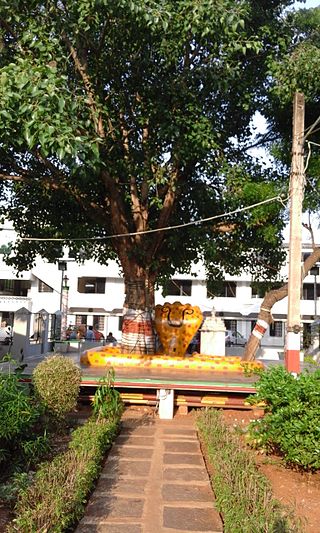
Tiruvallur is a Grade I municipality in the Indian state of Tamil Nadu. It is located on the banks of Coovum river about 46 km (29 mi) from downtown Chennai (Madras) and just 5 km from megacity border, in the western part of the Chennai Metropolitan Area (CMA). It is a satellite town of Chennai and is the administrative headquarters of Tiruvallur district. The city is known for the Veera Raghavar temple, one of the 108 sacred shrines of Vaishnavites. The tank festival is held at a pond near this temple. A Shiva temple near this shrine which is popular among the locals. There is also a 40-foot (12 m) tall Viswaroopa Panchamukha Hanuman temple, where the murti is made of a single green granite stone.

Poonamallee is suburb of Chennai, India under the Chennai Metropolitan Area. It was historically called Pushpagirimangalam, later renamed in Tamil as Poovirundhavalli, and now colloquially called as Poondhamalli. It is a town in the Poonamallee taluk of the Tiruvallur district in the Indian state of Tamil Nadu. The nearest Railway station is at Avadi. It acts as the gateway to the city from its western side. It is a town with rich cultural heritage and also a fast-growing areas in the city. As of 2011, the town had a population of 57,224. There are plans to merge the areas under Poonamallee Municipality with Avadi Municipal Corporation.
Mangadu is a western neighborhood of Chennai, India. Literally meaning a mango forest, Mangadu Municipality is about 18 km from Chennai Central railway station, 14 km from Chennai International Airport and 13 km from CMBT.
Pammal is a neighbourhood of Tambaram, Tamil Nadu, India. It is located 22 kilometers from Chennai Central Railway Station. It is located next to Pallavaram on the western side. It lies on the western side of the Grand Southern Trunk Road and close to Chennai International Airport. It is 7 kilometers away from Tambaram. The neighborhood is served by Pallavaram Railway Station of the Chennai Suburban Railway Network. Pammal falls under Chengalpattu District.
Arumbakkam is a residential locality in Chennai.
Nemili is a Taluk in Ranipet district of Tamil Nadu state, announced on 31 August 2015 by Tamil Nadu Chief minister Selvi J.Jayalalitha. This city, before becoming a separate taluk, it was a town panchyat under Arakkonam Taluk .This town is located in the Ranipet district about 72 kilometres from the state capital of Chennai. Nemili is supposedly one of the hottest towns in Tamil Nadu, where the temperature can exceed 43 °C (110 °F) for several days in peak of the summer. People of all religions are living in the city. The major businesses are farming, hand loom and power looms. Nemili itself is a panchayat town in Ranipet District in the Indian state of Tamil Nadu.
Podaturpet is a Town under Pallipattu(Pallipet) Taluk in Thiruvallur district in the Indian state of Tamil Nadu.
Valasaravakkam is a neighbourhood in the Chennai district of the Indian state of Tamil Nadu and a residential suburb of the city of Chennai. It is located in the Poonamallee Taluk at a distance of approximately 15 kilometres from the Kilometer Zero stone. Valasaravakkam lies on the Arcot Road, one of Chennai's arterial roads. It is under the Maduravoyal election constituency. In October, 2011 Valasaravakkam Municipality ceased to exist and the area became part of Chennai Corporation as Ward Nos 149 and 152, Southern Region, Corporation of Chennai. As of 2011, the town had a population of 47,378. Famous Sivan temple is in Kesavardhini.
Iyyappanthangal is a western neighborhood of Chennai, Tamilnadu, India. It comes under Mangadu Municipality of Chennai Metropolitan Area (CMA), governed by CMDA. It is located 20 kilometres (12 mi) away from Fort St George on the Mount-Poonamallee Road. The nearest railway stations are at Guindy about 11 kilometres (6.8 mi) away and Avadi about 12 kilometres (7.5 mi) away. The Porur Junction where a much needed road overbridge on the busy Guindy–Poonamallee stretch was built after a very long delay of nearly five years is just about 2 km from Iyyapanthangal and the Poonamallee Junction is just about 6 km from the town.
Mugalivakkam is a neighbourhood of Chennai. It is located in Sriperumbudur taluk of Kanchipuram district, in Tamil Nadu. It is situated 16 km south-west of Chennai on the Mount-Poonamallee Road. It is bounded by Porur on the North Meenambakkam and Manapakkam on the South and South East, Madhanandhapuram and Gerugambakkam on the South West and Ramapuram on the North East directions. The nearest railway station is at Guindy which is about 6 kilometres away. Porur junction is around 2 km away and Kathipara Junction is around 5 km away.
Periapalayam is a village about 40 km north of Chennai, in Tiruvallur district, Tamil Nadu State, India. The nearest Railway station is Thiruninravur.It is in Ellapuram block which stretches from east Thanakulam village, west Uthukottai, north Kosavanpettai and in the south up to Komakambedu village. It has one of the main routes to Andhra Pradesh.
Annanur is a western neighbourhood of Chennai, India. It is located near Ambattur and lies in Chennai District. It comes under the Avadi Municipal Corporation. It is located about 20 km from the city centre.
Nandiambakkam is a suburb in northern part of Chennai, Tiruvallur district, Tamil Nadu, India. It is a northern part of Chennai city. It has a population of around 17,000 people. The neighbourhood is served by Nandiambakkam railway station, of the Chennai Suburban Railway Network, MTC bus services which run from Minjur to Madras High court, Minjur to Ennore, and Minjur to CMBT and vice-versa.
Alwarthirunagar is an urban locality in Chennai, the capital city of Tamil Nadu, India. Alwarthirunagar Pin code is 600087 and postal head office is Valasaravakkam. It falls under Valasaravakkam municipality, in Maduravoyal constituency in Tiruvallur district in the Indian state of Tamil Nadu. The word nagar refers to a settlement in sanskrit. The neighbourhood was developed by the City Lando Corporation in the late 1960s. With the opening of schools and shopping centres, Alwarthirunagar emerged as a service centre in Chennai's west. Twenty acres of forestation in the area acts against pollution. The area is traversed by state road number 113.

St. Thomas Mount-Poonamallee Road, popularly known as the Mount-Poonamallee Road (SH-55), is an arterial road in the city of Chennai, India. It runs for 11 kilometres from Kathipara Junction to the NH 4 highway connecting St. Thomas Mount with the suburb of Poonamallee. About 5 kilometres of the Mount-Poonamallee Road is located in the Alandur taluk of Chennai district, part of Maduravoyal Taluk in Chennai district and the remainder in the Poonamallee taluk of Thiruvallur district.
Kadambathur, also spelt Kadambattur, is a town located in Tiruvallur district in the Indian state of Tamil Nadu. It is a census town in Tiruvallur taluk. According to the 2011 census, the town has a population of 11,235.
Sivapuram, also called Sivapuram Colony) is a small village/hamlet in Minjur block in Tiruvallur district of Tamil Nadu, India. It comes under Aladu Panchayath. It is located 45 kilometers west of the district headquarters Tiruvallur, 1 km from Minjur and 34 kilometers from the state capital Chennai. PIN for Sivapuram is 601204 and postal head office is Ponneri.