
Adambakkam is a neighbourhood of Chennai, India. It is primarily a residential locality situated in South Chennai. Adambakkam area comes under Velachery taluk and Alandur taluk, Chennai District of Chennai Corporation. Adambakkam is surrounded by areas namely, Alandur in the North-West, Nanganallur in the West, Madipakkam in the South, Velachery in the East and Guindy in the North. Earlier, one part of Adambakkam was under the direct governance of Chennai Corporation. From October 2011 onwards, the entire area was merged with the Chennai Corporation. Upon completion of the MRTS extension line, the neighbourhood will be served by Adambakkam railway station. Its Proximity to commercial localities like Velachery, accessible railway stations, Metro Stations and road transport routes makes Adambakkam an ideal choice of location to live.
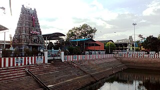
Thiruvanmiyur is a largely residential neighborhood in the south of Chennai, Tamil Nadu, India. Thiruvanmiyur witnessed a spike in its economy with the construction of Chennai's first dedicated technology office space, the Tidel Information Technology Park in neighboring Taramani. The subsequent rise of several information technology businesses, research centres and offices around Tidel park proved fortuitous for Thiruvanmiyur, as many of the workers at these offices often made Thiruvanmiyur their home. The Marundeeswarar Temple, dedicated to Shiva previously defined the area, leading it to be mentioned in Sangam Tamil epics. It is also commonly referred to as the MICO layout of Chennai city. Other Famous Temples are Ashtalakshmi Temple and Aarupadai Murugan Temple.
Ambattur is a northwestern neighbourhood of Chennai, India. It is located in Ambattur taluk of the Chennai District, surrounded by Avadi, Anna Nagar, Padi, Mogappair, Kallikuppam, Surapet, Korattur, Ayappakkam, Athipet and Thiruverkadu. It covers an area of 45 km2 (17 sq mi). The neighbourhood is served by Ambattur railway station of the Chennai Suburban Railway. Ambattur has its origins in a village of the same name which can be located at present as areas opposite to Ambattur telephone exchange. Ambattur was a village with large extents of agricultural farm lands irrigated by the once-sprawling Ambattur Lake. In 2011, the neighborhood had a population 466,205.

Anna Nagar, is a neighbourhood in the metropolitan city of Chennai, India. Named after former Chief Minister of Tamil Nadu C. N. Annadurai, it is located in the north-western part of Chennai and forms a part of the Aminjikarai taluk and the Anna Nagar Zone. It is one of the prime residential areas in Chennai and is home to several prominent doctors, lawyers and politicians. Real estate prices are among the highest in the city. A recent addition to the area is VR Chennai Mall, located near Shanthi Colony and Thirumangalam junction.
Virugambakkam is a residential neighbourhood of Chennai, Tamil Nadu, India. It is an important residential area of and is famous for its schools, market, residential colonies and residences of film artists. Virugambakkam had some of Chennai's oldest film studios.
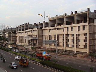
Nanganallur or Nangainallur is one of the southern neighbourhoods of Chennai, India. Since September 2011, it has become a part of Chennai Corporation. It is a residential area close to the Chennai International Airport.
Vadapalani is a neighbourhood in the city of Chennai in Tamil Nadu, India. It is known for its film studios and the Vadapalani Andavar Temple, which is an important pilgrimage centre. Situated in the western part of Chennai, Vadapalani is an important bus terminus on Arcot Road. Vadapalani is one of the busiest and densely populated areas in Chennai.
Pammal is a southern suburb in Chennai, Tamil Nadu, India.
Arumbakkam is a residential locality in Chennai.
Valasaravakkam is a neighbourhood in the Chennai district of the Indian state of Tamil Nadu and a residential suburb of the city of Chennai. It is located in the Maduravoyal Taluk at a distance of approximately 15 kilometres from the Kilometer Zero stone. Valasaravakkam lies on the Arcot Road, one of Chennai's arterial roads. It is under the Maduravoyal election constituency. In October, 2011 Valasaravakkam Municipality ceased to exist and the area became part of Chennai Corporation as Ward Nos 149 and 152, Southern Region, Corporation of Chennai. As of 2011, the town had a population of 47,378. Famous Sivan temple is in Kesavardhini.
Villivakkam is a neighbourhood of Chennai, Tamil Nadu, India. It is served by the Villivakkam railway station on the Chennai Central–Arakkonam suburban section. Villivakkam is the largest state assembly constituency in Tamil Nadu in terms of number of voters.
West Mambalam is a residential and commercial area in Chennai, India. It is known for its shops, bazaars and Hindu temples. It is bounded by Kodambakkam to the north and Saidapet to the south. T. Nagar and Nandanam stretch all along its eastern frontiers while Ashok Nagar lies to its west. The Ayodhya Mandapam is an important landmark.
Choolaimedu is a large residential and commercial locality in Chennai, Tamil Nadu, India. It borders Kodambakkam, Vadapalani, M.M.D.A. Colony, Aminjikarai, Mahalingapuram and Nungambakkam. Previously a part of Puliyur village, Kodambakkam, Choolaimedu has now become a hub for commercial interests and connects two of the busiest routes in Chennai, namely Arcot Road and Nelson Manickam Road.
Ashok Nagar is a residential locality situated at the southern part of Chennai, Tamil Nadu, India. It was established in 1964. At the heart of this colony, stands the Ashok Pillar. This four lion head stump, resembles the one erected by king Ashoka during the 3rd century BCE at Sanchi.
Korattur is a neighbourhood situated in the western part of Chennai. It is a part of the Ambattur Zone of Chennai Corporation and located along the Chennai-Bangalore/Mumbai railroad about 12 km from the Chennai Central. It is developed with TNHB Layouts similar to Anna Nagar and the southern section of Korattur located near Padi is often considered to be an integral part of Anna Nagar.
Madhavaram Milk Colony is a neighbourhood in northern Chennai, a metropolitan city in Chennai district in the Indian state of Tamil Nadu.
Alapakkam is a neighbourhood in western part of Central Chennai. It belongs to Central Chennai Revenue Division of Chennai district. It is surrounded by Porur, Valasaravakkam and Maduravoyal. It is part of Chennai corporation under zone 11. Entry into Alapakkam is through two main roads, that is, Arcot Road and Poonamallee High Road. Alapakkam belongs to Sriperumbudur Lok Sabha constituency and Maduravoyal assembly constituency.
Mogappair is a residential neighborhood in north-western Chennai, India. It is located west of the Jawaharlal Nehru Road and is part of the Ambattur zone (7) of the Greater Chennai Corporation. There are industrial estates to the north and west, namely, Padi and Ambattur.
Nerkundram or Nerkunram is a census town located in Chennai City, Chennai district in the Indian state of Tamil Nadu. It falls under Maduravoyal constituency in Tiruvallur district in the Indian state of Tamil Nadu. It consists of a portion of Ambattur taluk and part of Chennai Corporation. It falls under Sriperumbudur.
Sakkaramallur is an Indian village panchayat located in Arcot Taluk of Vellore District in the state of Tamil Nadu. Sakkaramallur is located on Right Bank of Palar River.


