
Attur or Aathur is a municipality and headquarters of Attur taluk in the Salem district in the state of Tamil Nadu, India. As of the 2011 census, the town had a population of 61,793. Attur is growing economically.

Vandavasi is a major town and a municipality in the Tiruvannamalai district of the Indian state of Tamil Nadu. The town is well known in the Carnatic history for the Battle of Wandiwash. Vandavasi town is also the largest manufacturer of kora artefacts including mats, shawls and vessels. As of 2011, the town had a population 74,320.
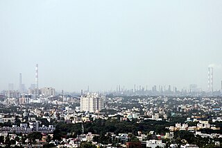
Alandur is a zone of Chennai corporation, and an urban node in Chennai district in Guindy division in the state of Tamil Nadu, India. It is Surrounded by Guindy in the North and East, Adambakkam in the South, Pazhavanthangal in the South-West and St Thomas Mount in the North-West. As of 2011, Alandur had a population of 164,430. The town agglomeration of Alandur will have an estimated population of 300,000 by 2030. Alandur neighbours the St. Thomas Mount Cantontment, the Officers Training Academy of the Indian army and the nearby towns of Guindy and Adambakkam. M. G. Ramachandran, a former chief minister of Tamil Nadu started his political career by winning his first legislative election from Alandur in 1967. Alandur also holds famous landmarks of Chennai namely Nehru Statue and Kathipara Junction.

Cheyyar, officially Tiruvetipuram is a Town in the Tiruvannamalai District in the Tamil Nadu state of South India. The most common name of this town is Cheyyar but it is also referred to as Tiruvetipuram in many government records. The town has an ancient temple called Vedapureeswarar Temple situated on the banks of the river.
Puzhuthivakkam, commonly known as Ullagaram or Ullagaram–Puzhuthivakkam, is a southern neighbourhood of Chennai in Tamil Nadu, India. Puzhuthivakkam loosely translates to dust neighborhood. The neighbourhood is part of the Greater Chennai Corporation, following Chennai's expansion into Kanchipuram district. Puzhuthivakkam is located between the neighborhoods of Madipakkam, Adambakkam, Velachery, Pallikaranai, and Nanganallur. Puzhuthivakkam was initially developed in the late 1960s and early 1970s. Upon completion of the MRTS extension line, the neighborhood will be served by Puzhuthivakkam railway station. As of 2011, the town had a population of 53,322.

Ambur is a town and municipality in newly announced Tirupathur district, Vellore region of Tamil Nadu, India. It is located on the banks of the Palar River between Chennai and Bangalore. Ambur has a sizeable leather industry, and is known for its spicy biryani and for the sweet, makkhenpeda. Ambur was the site of two major military actions in the 18th century. The first was the 1749 Battle of Ambur that opened the Second Carnatic War between the Arcot State and the Mughal Empire. In 1767, the siege of Ambur took place during the First Anglo-Mysore War, with local troops and a British force successfully resisting an attack by the Kingdom of Mysore and by the Hyderabad State.
Thiruverkadu is a Western suburb of Chennai, Tamil Nadu. It comes under Thiruvallur district administration. It is famous for its Devi Karumariamman Temple. There is also Vedapureeswarar Temple in Thiruverkadu, where Lord Shiva and Goddess Parvathi are seen in their wedding pose inside the sanctum sanctorum. As of 2011, the town had a population of 62,289. It is a town with rich cultural heritage and also a fast-growing areas in the city.
Rasipuram is a Municipality in the Indian state of Tamil Nadu. It is the headquarters for the Rasipuram taluk. As of 2015, the town had a population of 88,584 and an area of 24 km2 (9.3 sq mi). It has 27 wards and steps have been taken to increase the wards to 33. Rasipuram is known for ghee and tapioca sago.
Anakaputhur is a neighborhood in the city of Tambaram, situated within the Chennai Metropolitan Area, Tamil Nadu, India.

Kavundampalayam is an area located in Coimbatore, Tamil Nadu, India. It is within the Coimbatore Corporation, about 6 km north of the city centre. Goundampalayam is along Mettupalayam road in Coimbatore, one of the arterial roads of the city. As of 2011, the town had a population of 83,908.
Katthivakkam is an residential and industrial area located in the northern part of Chennai. It is a part of zone 1 in Greater Chennai Corporation. It is under Thiruvottiyur taluk in Chennai district. It is a part of Thiruvottiyur(state assembly constituency) and Chennai North. Formerly a town and a municipality of Thiruvallur district in the Indian state of Tamil Nadu, it has now been absorbed by Chennai city in September 2011 and within Chennai District limit since January 2018. The neighbourhood is served by Katthivakkam railway station. As of 2011, the town had a population of 36,617.
Kurichi is a neighborhood of Coimbatore city in the Indian state of Tamil Nadu. It was upgraded to a municipality in 2004, it was recently merged with the Coimbatore Corporation. As of 2011, the town had a population of 123,770

Thiruthangal is a neighbourhood of Sivakasi City, India.Thiruthangal is one of the Zones of Sivakasi City Municipal Corporation. Ninra Narayana Perumal temple, one among the 108 Divya Desams, Vishnu temples revered by saint poets, Alwars of 6th–9th century is located in Thiruthangal. The place is also famous for Karunellinathar temple, located adjacent to Nindra Narayana Temple.
Tindivanam is a town and a municipality in Viluppuram district in the Indian state of Tamil Nadu. It is the second largest town in Villupuram District after the headquarters town Villupuram. Important roads from north to south Tamil Nadu pass through Tindivanam and similarly from west to east.
Valasaravakkam is a neighbourhood in the Chennai district of the Indian state of Tamil Nadu and a residential suburb of the city of Chennai. It is located in the Maduravoyal Taluk at a distance of approximately 15 kilometres from the Kilometer Zero stone. Valasaravakkam lies on the Arcot Road, one of Chennai's arterial roads. It is under the Maduravoyal election constituency. In October, 2011 Valasaravakkam Municipality ceased to exist and the area became part of Chennai Corporation as Ward Nos 149 and 152, Southern Region, Corporation of Chennai. As of 2011, the town had a population of 47,378. Famous Sivan temple is in Kesavardhini.
Velampalayam is a third grade municipality in Tiruppur district in the Indian state of Tamil Nadu. As of 2011, the town had a population of 87,427.
Narasingapuram is a Municipality in Attur taluk, Salem district in the Indian state of Tamil Nadu. As of 2011, the town had a population of 23,084.
Maraimalai Nagar is a municipality town in South Chennai at Chengalpattu district, Tamil Nadu, India. Lying in the southern part of the Chennai metropolitan area, it is a satellite town of Chennai, the state capital, around 50 km from Downtown Chennai (Egmore) and about 15 km from Vandalur. It was developed by the CMDA in 1980. Many heavy industries are located in Maraimalai Nagar. The Ford India and BMW car factories are located within a mile from Maraimalai Nagar and the Indian software giant Infosys also has an office within eight kilometers of Maraimalai Nagar. SRM University has its main campus in the neighboring Potheri. As of 2011, Maraimalai Nagar had a population of 81,872.
Manali is an industrial and residential part of Chennai, India. It is a zone in Greater Chennai Corporation located in the northern part of Chennai district in the Indian state of Tamil Nadu. As of 2011, the neighborhood had a population of 35,248.
Mathur is a residential area located north of Chennai, a metropolitan city in Tamil Nadu, India. Mathur is administered by the Greater Chennai Corporation and belongs to Madhavaram taluk of Chennai district.


