Kosciuszko Road | |
|---|---|
 | |
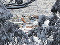
| Kosciuszko Road, towards Charlotte Pass | |
 East end West end | |
| Coordinates | |
| General information | |
| Type | Rural road |
| Length | 95.4 km (59 mi) [1] |
| Gazetted | August 1928 [2] |
| Major junctions | |
| East end | Pine Valley, New South Wales |
| West end | No through road Kosciuszko National Park, New South Wales |
| Location(s) | |
| Major settlements | Berridale, Jindabyne |
| Restrictions | |
| General | Within Kosciuszko National Park, it is compulsory for two-wheel drive vehicles to carry snow chains between the June and October long weekends. [3] |
Kosciuszko Road is a road in the Snowy Mountains of New South Wales, Australia, which runs from Pine Valley, to the ski resort of Charlotte Pass in Kosciuszko National Park.