Ngalba Bulal National Park

Last updated

Ngalba Bulal National Park
Queensland
Cedar-bay-national-park-north-queensland-australia.JPG
Ngalba Bulal National Park
Australia Queensland relief location map.jpg
Red pog.svg
Ngalba Bulal National Park
Nearest town or city Cooktown
Coordinates 15°46′37″S145°20′47″E / 15.77694°S 145.34639°E / -15.77694; 145.34639
Established2011
Managing authorities Queensland Parks and Wildlife Service
Website Ngalba Bulal National Park
See also Protected areas of Queensland

Ngalba Bulal is a national park in the Shire of Cook, Queensland, Australia. [1] In 2015, Cedar Bay National Park became the Mangkalba (Cedar Bay) section of the Ngalba Bulal National Park. [2] [3]

Contents

Geography

The park is 1,522 km (946 mi) northwest of Brisbane, 40 km (25 mi) south of Cooktown and accessible only by boat or foot. The park is one of the Wet Tropics World Heritage Area series of national parks, and is a gazetted World Heritage Site. [4] It is also known as Mangkal-Mangkalba [5] in the dialect of the local Aboriginal population, the Eastern Kuku Yalanji. [6]

History

The Cedar Bay area was developed in the 1870s for tin mining, and the remains of the tin work can still be seen in the area of Black Snake Rocks.

Cedar Bay gained a degree of notoriety in the 1970s when the Bjelke-Petersen government destroyed a hippie commune that had been present there since July 1972, when it was started by people who had unsuccessfully tried to set one up in Kuranda. [7] [8] The raid was controversial because of the immense cost ($50,000) and use of a helicopter, light aircraft and a Navy vessel to arrest 12 people on drug and vagrancy charges. [9] At the Cedar Bay inquiry, police were accused of burning huts, smashing personal belongings, destroying clothing, chopping down fruit plantations and, ironically, consuming alcohol at the site following the drug raid. Police, in their defence, tendered evidence of squalid living conditions and described the commune’s inhabitants as "filthy, criminal hippies". [10] Andrew Olle's report on this incident for the ABC current affairs show This Day Tonight won the award for "Outstanding Contribution to TV Journalism" at the Logie Awards of 1977. [11] [12]

In 2007, the Cedar Bay National Park was part of the 2,000 square kilometres (770 sq mi) of land handed over to Cape York's Aboriginal population by the Queensland government. [13] The handover came as a result of a 1994 Native Title claim. [14]

Cedar Bay National Park was known as Mount Finnigan National Park before being enlarged.

Activities

The park contains some of the northernmost tropical rainforests in Australia. Birdwatching is a popular activity with the most common birds including cassowaries, yellow-breasted sunbirds, double-eyed fig-parrots, mangrove kingfishers, beach stone-curlews and pied imperial-pigeons. Bush camping is permitted in the park, however fishing and collecting are prohibited. The sole walking track in the park was a former donkey track used by tin miners. It is inaccessible to all but fit walkers. [15]

See also

Related Research Articles

<span class="mw-page-title-main">Cape Melville National Park (Cape York Peninsula Aboriginal Land)</span> Protected area in Queensland, Australia

Cape Melville National Park (Cape York Peninsula Aboriginal Land) is a national park in the Shire of Cook, Queensland, Australia. The national park was previously named Cape Melville National Park until it was renamed on 28 November 2013.

<span class="mw-page-title-main">Cape Upstart National Park</span> Protected area in Queensland, Australia

Cape Upstart is a national park in the locality of Guthalungra in the Whitsunday Region local government area of North Queensland, Australia, 1,016 km northwest of Brisbane.

<span class="mw-page-title-main">Daintree National Park</span> Protected area in Queensland, Australia

The Daintree National Park is located in Far North Queensland, Australia, 1,757 km (1,092 mi) northwest of Brisbane and 100 km (62 mi) northwest of Cairns. It was founded in 1981 and is part of the Wet Tropics of Queensland. In 1988, it became a World Heritage Site. The park consists of two sections—Mossman Gorge and Cape Tribulation, with a settled agricultural area between them which includes the towns of Mossman and Daintree Village.

<span class="mw-page-title-main">Cape York Peninsula</span> Peninsula in Far North Queensland, Australia

Cape York Peninsula is a peninsula located in Far North Queensland, Australia. It is the largest wilderness in northern Australia. The land is mostly flat and about half of the area is used for grazing cattle. The relatively undisturbed eucalyptus-wooded savannahs, tropical rainforests and other types of habitat are now recognised and preserved for their global environmental significance. Although much of the peninsula remains pristine, with a diverse repertoire of endemic flora and fauna, some of its wildlife may be threatened by industry and overgrazing as well as introduced species and weeds.

<span class="mw-page-title-main">Laura, Queensland</span> Town in Queensland, Australia

Laura is a rural town and locality in the Shire of Cook, Queensland, Australia. In the 2016 census the locality of Laura had a population of 228 people.

<span class="mw-page-title-main">Daintree, Queensland</span> Town in Queensland, Australia

Daintree is a rural town and locality in the Shire of Douglas, Queensland, Australia. In the 2016 census, Daintree had a population of 129 people.

<span class="mw-page-title-main">Wujal Wujal</span> Town in Queensland, Australia

Wujal Wujal, sometimes spelt Wudjil Wudjil, is a rural town and locality in the Wujal Wujal Aboriginal Shire, Queensland, Australia. It is an Aboriginal community. In the 2021 census, the locality of Wujal Wujal had a population of 276 people.

<span class="mw-page-title-main">Cape Tribulation, Queensland</span> Suburb of Shire of Douglas, Queensland, Australia

Cape Tribulation is a headland and coastal locality in the Shire of Douglas in northern Queensland, Australia. In the 2021 census, Cape Tribulation had a population of 123 people.

<span class="mw-page-title-main">Far North Queensland</span> Region in Queensland, Australia

Far North Queensland (FNQ) is the northernmost part of the Australian state of Queensland. Its largest city is Cairns and it is dominated geographically by Cape York Peninsula, which stretches north to the Torres Strait, and west to the Gulf Country. The waters of Torres Strait include the only international border in the area contiguous with the Australian mainland, between Australia and Papua New Guinea.

<span class="mw-page-title-main">Lockhart River, Queensland</span> Town in Queensland, Australia

Lockhart River is a town in the Aboriginal Shire of Lockhart River and a coastal locality split between the Aboriginal Shire of Lockhart River and the Shire of Cook, on the Cape York Peninsula in Queensland, Australia. The town is an Aboriginal community. In the 2016 census, Lockhart River had a population of 724 people.
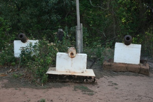
<span class="mw-page-title-main">Somerset, Queensland</span> Suburb of Shire of Torres, Queensland, Australia

Somerset is a coastal locality split between the Shire of Torres and the Northern Peninsula Area Region, Queensland, Australia. In the 2021 census, Somerset had a population of 0 people.

<span class="mw-page-title-main">Napranum, Queensland</span> Town in Queensland, Australia

Napranum is a remote town in the locality of Mission River in the Aboriginal Shire of Napranum, Queensland, Australia. At the 2016 census, the town of Napranum had a population of 950.

<span class="mw-page-title-main">Murray Falls</span> Waterfall in Far North Queensland, Australia

The Murray Falls, a cascade waterfall on the Murray River, is located in the UNESCO World Heritage–listed Wet Tropics in Murray Upper, Cassowary Coast Region in the Far North region of Queensland, Australia.
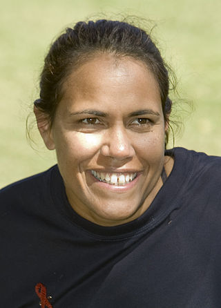
<span class="mw-page-title-main">Kuku Yalanji</span> Aboriginal Australian people of Far North Queensland rainforest region

The Kuku Yalanji, also known as Gugu-Yalanji, Kuku Yalandji or Kokojelandji, are an Aboriginal Australian people originating from the rainforest regions of Far North Queensland.

<span class="mw-page-title-main">Normanby River</span> River in northern Queensland, Australia

The Normanby River, comprising the East Normanby River, the West Normanby River, the East Normanby River North Branch, the East Normanby River South Branch and the Granite Normanby River, is a river system in Far North Queensland, Australia.

<span class="mw-page-title-main">Bloomfield Track</span>

The Bloomfield Track, which is also known as the Coast Road or officially, the Cape Tribulation-Bloomfield Road, is a controversial four-wheel-drive road in Far North Queensland, Australia. The road's construction through untouched wilderness was the cause of protests and blockades in the early 1980s.

<span class="mw-page-title-main">Mount Pieter Botte</span>

Mount Pieter Botte, also known as Ngalba-bulal, Alpaboolal, or Barbar, or Ginpure, is a mountain in the tableland region behind Cape Tribulation in Far North Queensland, Australia. It was named in 1848 by Captain Owen Stanley of the survey ship HMS Rattlesnake. The name was chosen by those on board the Rattlesnake. because of its resemblance to Peter Botte Mountain, a famous peak on the island of Mauritius. The mountain is part of the Wet Tropics of Queensland World Heritage Site. There are two peaks, a northern peak and a southern peak. The South Peak is the highest point and the true summit of Mount Pieter Botte.

<span class="mw-page-title-main">Lama Lama National Park</span> Protected area in Queensland, Australia

Lama Lama National Park is a national park on Cape York Peninsula in Far North Queensland, Australia. The name comes from the Lama Lama people who are the traditional owners of the land. The park protects coastal plains, beach ridges and sandy hills of the Annie River water catchment. The river marks the southern border of the park.

<span class="mw-page-title-main">Kimberley, Queensland</span> Suburb of Shire of Douglas, Queensland, Australia

Kimberley is a coastal locality in the Shire of Douglas, Queensland, Australia. In the 2021 census, Kimberley had a population of 28 people.

<span class="mw-page-title-main">Peter Stanton</span> Australian landscape ecologist and biogeographer

James Peter Stanton is an Australian landscape ecologist, fire ecologist, botanist and biogeographer who individually conducted systematic environmental resource surveys throughout Queensland whilst working for the National Parks department of Forestry (Qld.) from 1967–1974. He carried out his assessments in a range of dissimilar landscapes leading to the identification and protection of many critically threatened ecosystems across the state during a period of rapid and widespread land development under the Joh Bjelke-Petersen government. For this work he became the first Australian to receive the IUCN Fred M. Packard Award in 1982.

References

  1. "Ngalba Bulal National Park – Cook Shire (entry 52082)". Queensland Place Names. Queensland Government . Retrieved 6 October 2022.
  2. "Cedar Bay National Park". 23 July 2015. Retrieved 25 April 2019.
  3. "Ngalba Bulal National Park – national park in the Shire of Cook (entry 50374)". Queensland Place Names. Queensland Government . Retrieved 25 April 2019.
  4. "Wet Tropics of Queensland". UNESCO World Heritage Centre. Retrieved 29 January 2008.
  5. "Cedar Bay (Mangkal-Mangkalba) National Park". Environmental Protection Agency. Archived from the original on 31 December 2007. Retrieved 29 January 2008.
  6. "Aborigines Win Back Cape York Land". The Age. Melbourne. 11 April 2007. Retrieved 29 January 2008.
  7. Wilkie, Bill (2019). "Paradise lost: The Cedar Bay raid" . Griffith Review. No. 65. pp. 35–42.
  8. Wilkie, Bill (3 August 2019). "Cedar Bay police raids: Troubled days in paradise" . The Courier-Mail (QWeekend). Retrieved 17 November 2023.
  9. "Coming to a place near you Cedar Bay. No police convicted It. There will be repetition(sic)". olddogthoughts. 13 September 2014. Retrieved 4 April 2018.
  10. Howes, Ted (13 December 1992). "Killer Hunt in Hippie Commune". The Sun Herald.
  11. Masters, Chris (2019). "John Andrew Olle (1947–1995)". Australian Dictionary of Biography . National Centre of Biography, Australian National University. ISSN   1833-7538 . Retrieved 17 November 2023.
  12. "Logie Award Winners 1970 to 1979". TV Week. Retrieved 17 November 2023.
  13. "Qld Govt to Hand Over Cape York Land". The Age. Melbourne. 11 April 2007. Retrieved 29 January 2008.
  14. Marszalek, Jessica (11 April 2007). "Aborigines Win Back Cape York Land". The Daily Telegraph. Sydney. Archived from the original on 19 September 2007. Retrieved 29 January 2008.
  15. "Cedar Bay (Mangkal-Mangkalba) National Park". Environmental Protection Agency. Archived from the original on 31 December 2007. Retrieved 29 January 2008.