
Fort Johnson South is a census-designated place (CDP) in Vernon Parish, Louisiana, United States. The population was 11,000 at the 2000 census.

The Shreveport–Bossier City–Minden combined statistical area was made up of four parishes in northwestern Louisiana. The statistical area consisted of then-Shreveport–Bossier City metropolitan statistical area and then-Minden micropolitan statistical area. As of the 2010 census, the CSA had a population of 439,000. On February 28, 2013, OMB changed definitions of census statistical areas, and all four parishes in this combined statistical area were redefined as Shreveport–Bossier City metropolitan statistical area.

The Lake Charles–Jennings combined statistical area is made up of three parishes in southwestern Louisiana. The statistical area consists of the Lake Charles Metropolitan Statistical Area and the Jennings Micropolitan Statistical Area. The largest principal city is Lake Charles, and the smaller principal city is Jennings. As of the 2010 census, the CSA had a population of 231,201. A July 1, 2019 estimate placed the population at 241,777.

The Fayetteville, NC Metropolitan Statistical Area, as defined by the US Office of Management and Budget (OMB), is an area consisting of three counties – Cumberland, Harnett, and Hoke – in eastern North Carolina, anchored by the city of Fayetteville. It is served by Interstate 95, Interstate 295, U.S. and state highways, Fayetteville Regional Airport, Amtrak, Greyhound, Megabus and several railroad systems. As of the 2000 census, the MSA had a population of 336,609. As of the 2010 census the MSA had a population of 366,383. In 2011 the estimated population was 374,157. The 2019 estimated population is 526,719.

The Morgantown Metropolitan Statistical Area, as defined by the United States Census Bureau, is an area consisting of two counties in North-Central West Virginia, anchored by the city of Morgantown. As of the 2020 census, the MSA had a population of 140,038.

The Clarksburg Micropolitan Statistical Area, as defined by the United States Census Bureau, is an area consisting of three counties in North-Central West Virginia, anchored by the city of Clarksburg.
The Bluefield Micropolitan Statistical Area, as defined by the United States Census Bureau, is an area consisting of two counties – one in West Virginia and one in Virginia – anchored by the town of Bluefield, West Virginia.

The Anchorage Metropolitan Statistical Area, as defined by the United States Census Bureau, is an area consisting of the Municipality of Anchorage and the Matanuska-Susitna Borough in the south central region of Alaska.
The Rockford Metropolitan Statistical Area, as defined by the United States Census Bureau, is an area consisting of four counties in north-central Illinois, anchored by the city of Rockford. As of the 2010 census, the MSA had a population of 349,431. The Rockford MSA abuts the southern portions of the Janesville-Beloit MSA and the Chicago MSA. It forms the main part of the larger Rockford–Freeport–Rochelle Combined Statistical Area.

The Idaho Falls Metropolitan Statistical Area, as defined by the United States Census Bureau, is an area consisting of two counties in eastern Idaho, anchored by the city of Idaho Falls. As of the 2020 census, the MSA had a population of 154,855.

The New Bern Metropolitan Statistical Area, as defined by the United States Census Bureau, is an area consisting of three counties in the Inner Banks region of eastern North Carolina, anchored by the city of New Bern. The designation of the area was changed from Micropolitan to Metropolitan in 2013.

The Roanoke Rapids, NC Micropolitan Statistical Area (μSA) as defined by the United States Census Bureau, is an area consisting of two counties in North Carolina, anchored by the city of Roanoke Rapids.

The Iowa City Metropolitan Statistical Area, as defined by the United States Census Bureau, is an area consisting of two counties in Iowa anchored by the city of Iowa City. The Metropolitan Statistical Area (MSA) had a population of 171,491 people in the 2017 US Census Bureau population estimate. growing 12.39% compared to 2010.
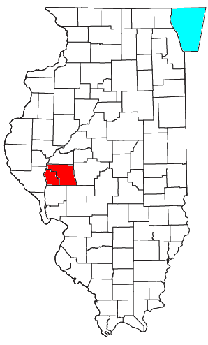
The Jacksonville, IL Micropolitan Statistical Area, as defined by the United States Census Bureau, is an area consisting of two counties in west central Illinois, anchored by the city of Jacksonville.
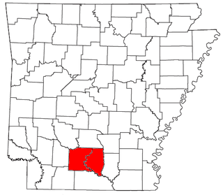
The Camden Micropolitan Statistical Area, as defined by the United States Census Bureau, is an area consisting of two counties in the U.S. state of Arkansas, anchored by the city of Camden.

The Safford Micropolitan Statistical Area, as defined by the United States Census Bureau, is a micropolitan statistical area (μSA) consisting of one county in eastern Arizona, anchored by the city of Safford.

The Alexander City Micropolitan Statistical Area is a former micropolitan statistical area that consisted of two counties in Alabama, anchored by the city of Alexander City, as defined by the United States Census Bureau. As of the 2010 census, the μSA had a population of 53,155.
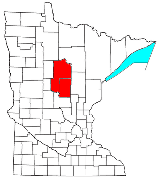
The Brainerd Micropolitan Statistical Area, as defined by the United States Census Bureau, is an area consisting of Cass County and Crow Wing County in Northern Minnesota, anchored by the city of Brainerd. As of July 1, 2022 estimate placed the population at 99,222.

The New Orleans–Metairie–Hammond combined statistical area is made up of ten parishes in southeastern Louisiana and one county in Mississippi. The statistical area consists of the New Orleans metropolitan statistical area (MSA), Hammond MSA, Picayune micropolitan statistical area (μSA), and the Bogalusa μSA. As of the 2020 census estimates, the CSA had a population of 1,510,672. In 2023, the Office of Management and Budget updated the Core Based Statistical Areas, removing St. Tammany Parish from the New Orleans–Metairie MSA to create the Slidell–Mandeville–Covington MSA.

The Hilton Head Island–Bluffton metropolitan area, officially the Hilton Head Island-Bluffton, SC Metropolitan Statistical Area as defined by the United States Census Bureau, is a metropolitan statistical area consisting of the two southernmost counties in the Lowcountry region of South Carolina, centered on the resort town of Hilton Head Island. As of the 2020 census, the MSA had a population of 215,908. Prior to March 2013, the region was considered a micropolitan statistical area.
