Columbia County is a county located in the north central portion of the U.S. state of Florida. As of the 2020 census, the population was 69,698, up from 67,531 at the 2010 census. Its county seat is Lake City.

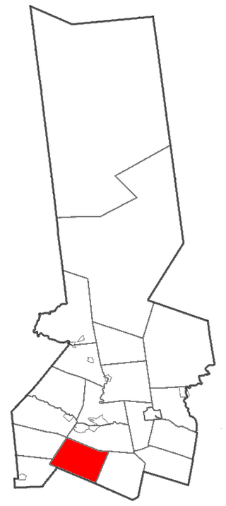
Gallatin is a town in Columbia County, New York, United States. The population at 2020 was 1,628, down from 1,668 at the 2010 census. Gallatin is on the southern border of Columbia County and located 100 miles (160 km) north of New York City.

Columbia is a town in Herkimer County, New York, United States. As of the 2010 census, the town population was 1,580. The town is at the southern border of the county and is southeast of Utica.

Kinderhook is a town in the northern part of Columbia County, New York, United States. The population was 8,330 at the 2020 census, making it the most populous municipality in Columbia County. The name of the town means "Children's Corner" in the language of the original Dutch settlers (Kinderhoek). The name "Kinderhook" has its root in the landing of Henry Hudson in the area around present-day Stuyvesant, where he was greeted by Native Americans with many children. With the Dutch kind meaning "child" and hoek meaning "corner", it could be that the name refers to a bend in the river where the children are. The eighth President of the United States, Martin Van Buren, was born in Kinderhook and retired to it.

100 Mile House is a district municipality located in the South Cariboo region of central British Columbia, Canada.
British Columbia Highway 101, also known as the Sunshine Coast Highway, is the main north–south thoroughfare on the Sunshine Coast, British Columbia, Canada.
Highway 97 is a major highway in the Canadian province of British Columbia. It is the longest continuously numbered route in the province, running 2,081 km (1,293 mi) and is the only route that runs the entire north–south length of the British Columbia, connecting the Canada–United States border near Osoyoos in the south to the British Columbia–Yukon boundary in the north at Watson Lake, Yukon.

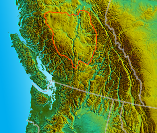
The Cariboo is an intermontane region of British Columbia, Canada, centered on a plateau stretching from Fraser Canyon to the Cariboo Mountains. The name is a reference to the caribou that were once abundant in the region.

Williams Lake is a city in the Central Interior of British Columbia, in the central part of a region known as the Cariboo. Williams Lake is one of the largest cites, by population of metropolitan area, in the Cariboo after neighbouring Quesnel. The city is famous for the Williams Lake Stampede, which was once the second largest professional rodeo in Canada, after only the Calgary Stampede.

The Cariboo Regional District spans the Cities and Districts of Quesnel, Williams Lake, 100 Mile House, and Wells in the Central Interior of British Columbia.

The Cariboo Road was a project initiated in 1860 by the Governor of the Colony of British Columbia, James Douglas. It involved a feat of engineering stretching from Fort Yale to Barkerville, B.C. through extremely hazardous canyon territory in the Interior of British Columbia.

Canim Beach Provincial Park is a provincial park in British Columbia, Canada, located at the southwest end of Canim Lake in the Interlakes District of the South Cariboo region, adjacent to the Secwepemc Indian reserve community of Canim Lake, British Columbia just northeast of 100 Mile House. The park was established by Order-in-Council in 1956 and expanded by later legislation in 2000 and 2004 to total a current approximate of 8.2 hectares, 3.6 hectares of upland and 4.6 hectares of foreshore.
Ruth Lake Provincial Park is a provincial park in British Columbia, Canada, located northeast of 100 Mile House.

Ainsworth Hot Springs, previously named Ainsworth, is a historic village on Kootenay Lake in British Columbia, Canada and has a population of 20. Founded on May 31, 1883, it is the oldest surviving community on Kootenay Lake. Ainsworth Hot Springs is located on Highway 31, 11 miles (18 km) north of Balfour and 12 miles (19 km) south of Kaslo, British Columbia. Today, Ainsworth Hot Springs and the Cody Caves are a popular destination for tourists and spelunkers.
Lac La Hache is a recreational and retirement community in the Cariboo region of British Columbia, Canada. Located on the shore of Lac La Hache alongside British Columbia Highway 97 near the regional centre of 100 Mile House, the community's origins date to the days of the Cariboo Gold Rush and the Cariboo Wagon Road, for which it provided an important roadhouse. Lac La Hache, or "The Lake of the Axe" as it translates to, was named, during the fur trade era, after the unfortunate incident of a French-Canadian voyageur who lost his axe head while chopping a hole in the ice. It is a town rich in history, as it sits along the Gold Rush Trail.
Bridge Creek is a creek in the South Cariboo region of the Interior of British Columbia, Canada. Its meandering course across the Cariboo Plateau is approximately 85 kilometres in length, beginning at Bridge Lake and running roughly westwards to the town of 100 Mile House and from there turning and running northeast to Canim Lake. Below Canim Lake the Canim River connects to Mahood Lake and the short Mahood River to the Clearwater River, which meets the North Thompson at the town of Clearwater.
103 Mile Lake is a small lake located near the town of 100 Mile House, in the Cariboo District, in British Columbia, Canada.
Kelly Lake is a community in the Peace River Country of northeastern British Columbia, Canada. It is west of the border with the province of Alberta.
100 Mile House Regional Transit System provides transit services in the Cariboo of British Columbia to 100 Mile House and communities north of 100 Mile House. The system is served by community shuttle-type buses from Monday to Friday.


