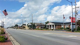
Hazel Crest is a village in Cook County, Illinois, United States. The population was 13,382 at the 2020 census.
Oak Forest is a city in Cook County, Illinois, United States. The city is out 24 miles (39 km) south-southwest of downtown Chicago in Bremen Township. Per the 2020 census, the population was 27,478.

Interstate 355 (I-355), also known as the Veterans Memorial Tollway, is an Interstate Highway and tollway in the western and southwest suburbs of Chicago in the U.S. state of Illinois. Like most other toll roads in the northeastern portion of the state, I-355 is maintained by the Illinois State Toll Highway Authority (ISTHA). I-355 runs from I-80 in New Lenox north to I-290 in Itasca, a distance of 32.5 miles (52.3 km). With the exception of a four-mile (6.4 km) expansion in 2009, from U.S. Route 34 to 75th Street, the highway is six lanes wide for its entire length.
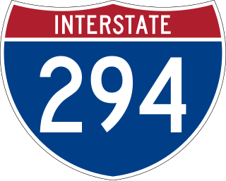
Interstate 294 (I-294) is a tolled auxiliary Interstate Highway in the northeastern part of the U.S. state of Illinois. Forming the southern portion of the Tri-State Tollway in Illinois, I-294 runs from South Holland at I-80/I-94 and Illinois Route 394 (IL 394) to Northbrook at I-94. I-294 is 53.42 miles (85.97 km) long; 5.32 miles (8.56 km) are shared with I-80. It serves as a bypass around the city of Chicago. I-294 is also the longest auxiliary route of I-94, at 10 miles (16 km) longer than I-494 in Minneapolis–Saint Paul. In addition, the tollway is the longest auxiliary Interstate Highway in Illinois, and it intersects the most primary Interstate Highways at six.
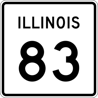
Illinois Route 83 (IL 83) is a 91.73-mile-long (147.63 km) major north–south state highway in northeast Illinois. It stretches from U.S. Route 30 by Lynwood and Dyer, Indiana, north to the Wisconsin border by Antioch at Wisconsin Highway 83 (WIS 83).

Illinois Route 50 (IL 50) is a 66.49-mile-long (107.01 km) north–south state highway in northeastern Illinois. It runs from the junction with U.S. Route 45 (US 45) and U.S. Route 52 (US 52) in West Kankakee north to US 41 in Skokie. In Chicago and the suburbs it's known as Cicero Avenue. Before this, Cicero Avenue was previously known as 48th Avenue, owing to its City of Chicago address of 4800 West.

Illinois Route 171 (IL 171) is a 38.61-mile-long (62.14 km) north–south state highway in northeastern Illinois. It runs from U.S. Route 6 (US 6) in Joliet north to Illinois Route 72 at the Chicago–Park Ridge border. The section of IL 171 on Archer Avenue from Joliet to Summit is historically significant, originating as a Native American trail, and later serving for a time as part of the first numbered highway between St. Louis and Chicago.
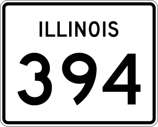
Illinois Route 394, also known as the Calumet Expressway, is a 14.6-mile-long (23.5 km) four-lane state highway that travels north from a junction with IL 1 south of Crete to an interchange in South Holland with Interstate 294/Interstate 94/Interstate 80. Although not an Interstate Highway, Illinois 394 is an Interstate-standard highway from its junction with Sauk Trail at Sauk Village to its northern terminus at the I-294/I-94/I-80 interchange in South Holland. IL 394 functions as a bypass of IL 1 to the west, of which it was formerly part, and provides access to southern suburbs of Chicago.

Illinois Route 7 is a northeast–southwest state route in northeastern Illinois. Currently, IL 7 runs from U.S. Route 6 (US 6) at Rockdale north through Joliet, and Crest Hill into Lockport, and then east to Orland Park before terminating at IL 43 in Worth. IL 7 runs for about 28.06 miles (45.16 km).

Illinois Route 1 (IL 1) is a state highway in the U.S. state of Illinois. Running parallel to the Indiana border, the highway starts at the free ferry crossing to Kentucky at Cave-in-Rock on the Ohio River and runs north to the south side of Chicago as Halsted Street at an intersection with Interstate 57. This is a distance of 325.59 miles (523.99 km).

U.S. Route 6 (US 6) in the state of Illinois is an east–west arterial surface road that runs 179.88 miles (289.49 km) from the city of Moline in the Quad Cities area to Lansing at the Indiana state line.

U.S. Route 30 (US 30) is an east–west arterial surface road in northern Illinois. It runs from across the Mississippi River from Clinton, Iowa, to Lynwood at the Indiana state line. This is a distance of 153.79 miles (247.50 km).

U.S. Route 12 (US 12) in the U.S. state of Illinois is an arterial highway that runs northwest to southeast through the Chicago metropolitan area. It enters Illinois at the Wisconsin border north of Richmond, and exits into Hammond, Indiana, from Chicago near the foot of the onramp to the Indiana Toll Road ; as it exits Illinois, the route is also concurrent with US 20 and US 41. Within Illinois, US 12 runs for a distance of 85.14 miles (137.02 km).
The Chicago Southland is a region comprising the south and southwest suburbs of the City of Chicago in the U.S. state of Illinois. Home to roughly 2.5 million residents, this region has been known as the Southland by the local populace and regional media for over 20 years. Despite this relatively recent term, some older native Southlanders and current local advertisements colloquially refer to the Southland as the Southside, meaning on the southern side/border of Chicago as extended into the suburbs since some of them previously lived on Chicago's Southside but moved to the suburbs during post WWII white flight.

Bremen Township is one of 29 townships in Cook County, Illinois, USA. As of the 2020 census, its population was 107,149 and it contained 42,611 housing units. It was organized in 1850 and is located southwest of Chicago in southern Cook County. An administrative office for Bremen Township is located at 16361 South Kedzie Parkway, Markham, Illinois. It is named after the State of the same name in Germany as this area was settled by primarily German settlers.

Interstate 94 (I-94) generally runs north–south through the northeastern portion of the US state of Illinois, in Lake and Cook counties. It is signed east–west in Illinois in accordance with its general alignment across the country, with west signage aligned with northbound travel and east signage aligned with southbound travel. I-94 in Illinois is 61.53 miles (99.02 km) long.

North Avenue is a major east–west street in Chicago, Illinois, and its western suburbs. Starting at St. Charles's eastern border with West Chicago, its name changes from Main Street to North Avenue, just east of the Kane/DuPage county line. From there, it travels straight east, carrying Illinois Route 64 until LaSalle Drive in Chicago. Illinois Route 64 then continues north onto LaSalle Drive for a very short distance until ending at U.S. Route 41, while North Avenue continues east for less than one-half mile, changing its name to North Boulevard at Clark Street, and then continuing until its termination in a cul-de-sac at 200 East, just west of Lake Shore Drive. From Illinois Route 43 to its east end, North Avenue is within the city limits of Chicago.

U.S. Route 45 in the state of Illinois is a major north–south U.S. Highway that runs from the Brookport Bridge over the Ohio River at Brookport north through rural sections of eastern Illinois and then through the suburbs of Chicago to the Wisconsin state line east of Antioch. This is a distance of 428.99 miles (690.39 km). US 45 is the longest numbered route in Illinois.
95th Street is a major east–west highway on Chicago's South Side, and in the southwest suburbs, is designated as 9500 South in Chicago's address system. 95th Street is 11 miles (18 km) south of Madison Street.
Torrence Avenue is a major north–south street in the South Side of Chicago, as well as its southern suburbs. It marks 2628 East in the Chicago address system, being located slightly more than 3+1⁄4 miles (5.2 km) east of State Street. The road runs north from Richton Road in Crete to Steger Road at the Will–Cook county line in Sauk Village. From there, its northern segment begins just west of here. Torrence Avenue continues north, intersecting Interstate 80 (I-80) and I-94 in Lansing. From here, the road goes north until ending just south of 95th Street. The road carries Illinois Route 83 (IL 83) from Glenwood Dyer Road in Lynwood to Sibley Boulevard in Calumet City, as well as carrying US 6 from the Kingery Expressway to 159th Street.