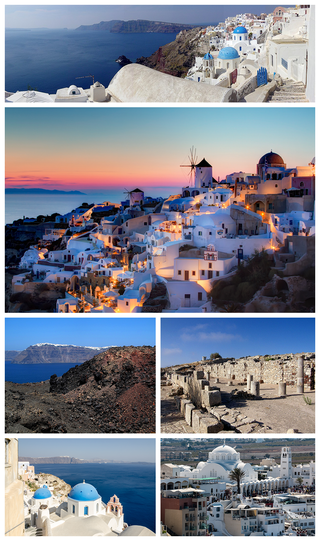
Santorini, officially Thira or Thera, is a Greek island in the southern Aegean Sea, about 200 km (120 mi) southeast from the mainland. It is the largest island of a small, circular archipelago formed by the Santorini caldera. It is the southernmost member of the Cyclades group of islands, with an area of approximately 73 km2 (28 sq mi) and a 2021 census population of 15,480. The municipality of Santorini includes the inhabited islands of Santorini and Therasia, and the uninhabited islands of Nea Kameni, Palaia Kameni, Aspronisi, Anydros, and Christiana. The total land area is 91 km2 (35 sq mi). Santorini is part of the Thira regional unit.
The 1481 Rhodes earthquake occurred at 3:00 in the morning on 3 May. It triggered a small tsunami, which caused local flooding. There were an estimated 30,000 fatalities. It was the largest of a series of earthquakes that affected Rhodes, starting on 15 March 1481, continuing until January 1482.
The 1303 Crete earthquake occurred at about dawn on 8 August. It had an estimated magnitude of about 8, a maximum intensity of IX (Violent) on the Mercalli intensity scale, and triggered a major tsunami that caused severe damage and loss of life on Crete and at Alexandria. It badly damaged the Lighthouse of Alexandria.

The 1993 southwest-off Hokkaido earthquake or Okushiri earthquake occurred at 13:17:12 UTC on 12 July 1993 in the Sea of Japan near the island of Hokkaido. It had a magnitude of 7.7 on the moment magnitude scale and a maximum felt intensity of VIII (Severe) on the Mercalli intensity scale. It triggered a major tsunami that caused deaths on Hokkaidō and in southeastern Russia, with a total of 230 fatalities recorded. The island of Okushiri was hardest hit, with 165 casualties from the earthquake, the tsunami and a large landslide.

The 1983 Sea of Japan earthquake occurred on May 26, 1983, at 11:59:57 local time. It had a magnitude of 7.8 on the moment magnitude scale. It occurred in the Sea of Japan, about 100 km west of the coast of Noshiro in Akita Prefecture, Japan. Out of the 104 fatalities, all but four were killed by the resulting tsunami, which struck communities along the coast, especially Aomori and Akita Prefectures and the east coast of Noto Peninsula. Images of the tsunami hitting the fishing harbor of Wajima on Noto Peninsula were broadcast on TV. The waves exceeded 10 meters (33 ft) in some areas. Three of the fatalities were along the east coast of South Korea. The tsunami also hit Okushiri Island, the site of a more deadly tsunami 10 years later.

An earthquake occurred in the northern Aegean Sea between Greece and Turkey on May 24, 2014. It had a moment magnitude of 6.9 and a maximum Mercalli intensity of VIII (Severe). Serious damage was reported on the Turkish island of Imbros and the cities of Edirne and Çanakkale, as well as on the Greek island of Lemnos. The earthquake was felt in Bulgaria and southern Romania. Several aftershocks followed the main shock, the strongest measuring 5.3 ML. This aftershock struck the Gulf of Saros at 12:31 local time.

On 21 July 2017, a large earthquake measuring 6.6 on the moment magnitude scale struck right near Bodrum, a popular town of tourism in Turkey, killing 2 and injuring hundreds. Mostly referenced as the 2017 Bodrum–Kos earthquake, this earthquake generated a tsunami which was one of the largest tsunamis in the Mediterranean Sea region.

An earthquake with a moment magnitude of 7.0 occurred on 30 October 2020 about 14 km (8.7 mi) northeast of the Greek island of Samos. Although Samos was closest to the epicentre, it was the large Turkish city İzmir, 70 km (43 mi) northeast that was heavily affected—more than 700 residential and commercial structures were seriously damaged or destroyed. One hundred and seventeen people died in İzmir Province while an additional 1,034 were injured. In Greece, there were two fatalities and 19 injured. The earthquake is the deadliest in the year 2020, and the third major earthquake to strike Turkey that year. It generated an unusually large tsunami. The event is called the Samos earthquake by the International Seismological Centre.
The 2018 Fiji earthquakes occurred on August 19, at 00:19:40 UTC and on September 6 15:49 UTC. The epicenters were located close to the Fijian island Lakeba, and around 270 km from the small town of Levuka on Ovalau. The first earthquake registered a magnitude of Mww 8.2, and is the largest earthquake of 2018. It had a focal depth of 600 km, making it the second largest earthquake ever recorded at a depth greater than 300 km; a tie with the 1994 Bolivia earthquake, and behind the 2013 Okhotsk Sea earthquake. The initial earthquake was caused by a normal fault below the South Pacific Ocean. A Mww 7.9 event struck the islands again on September 6 at a depth of 670 km; this earthquake was a mainshock of its own. Both earthquakes may be considered a doublet event.
On July 18, 2017, an earthquake struck near the Komandorski Islands, east of the Kamchatka Peninsula in the Bering Sea at 11:34 local time. Although there were no casualties from this earthquake, it was notable for a rare characteristic known as supershear, and is one of the few times a large supershear earthquake has been observed. It was preceded by a few foreshocks months earlier, and aftershocks that continued for nearly six months.
The 1856 Heraklion earthquake, also known as the Crete earthquake or Rhodes earthquake, occurred on the morning of October 12 at 02:45 am local time. This extremely catastrophic earthquake had an estimated magnitude of 7.7 to 8.3 at a depth of approximately 61 to 100 km. The earthquake was felt over a very wide area extending from Sicily, Italy to the Levant and North Africa. On the Greek island of Crete, the effects of the earthquake were cataclysmic, over 500 bodies were recovered in the city of Heraklion. Shockwaves from the earthquake were felt intensely, covering all of the Ottoman Empire; present-day Turkey, Cyprus and the Middle East where damage and human losses were reported. In Malta, the Għajn Ħadid Tower—a coastal watchtower built around the year 1638—was severely damaged in the earthquake, when its upper floor collapsed. In Cairo, Egypt, the earthquake destroyed buildings, created seiches in canals, and killed several people. Off the Egyptian and Italian coasts, sailors reported feeling a seaquake.
The Nemuro-Oki earthquake in scientific literature, occurred on June 17 at 12:55 local time. It struck with an epicenter just off the Nemuro Peninsula in northern Hokkaidō, Japan. It measured 7.8–7.9 on the moment magnitude scale (Mw ), 8.1 on the tsunami magnitude scale (Mt ) and 7.4 on the Japan Meteorological Agency magnitude scale (MJMA ).
The 1852 Banda Sea earthquake struck on 26 November at 07:40 local time, affecting coastal communities on the Banda Islands. It caused violent shaking lasting five minutes, and was assigned XI on the Modified Mercalli intensity scale in the Maluku Islands. A tsunami measuring up to 8 m (26 ft) slammed into the islands of Banda Neira, Saparua, Haruku and Ceram. The tsunami caused major damage, washing away many villages, ships and residents. At least 60 people were killed in the earthquake and tsunami. The earthquake had an estimated moment magnitude of 7.5 or 8.4–8.8, according to various academic studies.
The 1986 Kalamata earthquake struck the southern Peloponnese Region of Greece on September 13 at 20:24 local time. The 12.5 km (7.8 mi) deep moment magnitude (Mw ) 5.9 earthquake had an epicenter near the coastal city of Kalamata and was assigned X (Extreme) on the Mercalli intensity scale. The earthquake was the result of normal faulting along a northwest-dipping fault and produced surface ruptures. Extensive damage was reported in Kalamata and Elaiochori. At least 20 people died and 330 were injured. Survivors sought refuge at campsites and reconstruction work lasted five years.

An earthquake occurred off the coast of the Alaska Peninsula on July 28, 2021, at 10:15 p.m. local time. The large megathrust earthquake had a moment magnitude of 8.2 according to the United States Geological Survey (USGS). A tsunami warning was issued by the National Oceanic and Atmospheric Administration (NOAA) but later cancelled. The mainshock was followed by a number of aftershocks, including three that were of magnitude 5.9, 6.1 and 6.9 respectively.
The 1944 Gulf of Edremit–Ayvacik earthquake occurred on October 6 at 05:34:48 local time in Balıkesir Province, Turkey. It measured 6.7 on the moment magnitude scale (Mw ) and occurred at a depth of 15 km (9 mi). The normal-faulting event had a maximum MSK-64 intensity of IX. A total of 73 people died and 275 others were injured.
The 1968 Aegean Sea earthquake was a 7.0 earthquake that occurred in the early morning hours of February 20, 1968 local time about 57.1 km (35.5 mi) away from Myrina, Greece. This earthquake occurred between mainland Greece and Turkey, meaning both countries were impacted. 20 people died, and 39 people were injured to various degrees. It was the deadliest Greek earthquake since the 1956 Amorgos earthquake.

The 1940 Shakotan earthquake occurred on August 2 at 00:08:22 JST with a moment magnitude (Mw ) of 7.5 and maximum JMA seismic intensity of Shindo 4. The shock had an epicenter off the coast of Hokkaido, Japan. Damage from the shock was comparatively light, but the accomanying tsunami was destructive. The tsunami caused 10 deaths and 24 injuries on Hokkaido, and destroyed homes and boats across the Sea of Japan. The highest tsunami waves were recorded at the coast of Russia while along the coast of Hokkaido, waves were about 2 m.
The 1933 Kos earthquake struck the Aegean Sea region on 23 April. It measured Mw 6.4 and had an epicenter offshore, near Kos, Greece. The earthquake collapsed many buildings on Kos, Nisyros and other islands. At least 181 people were killed with a possible death toll reaching several hundred.
The 2025 Santorini earthquakes refer to a series of seismic events that began in February 2025, on and around the Greek island of Santorini. The events prompted emergency measures across several Aegean islands and raised concerns about potential stronger seismic activity in the region.
