2021 Arkalochori earthquake

Last updated • 8 min readFrom Wikipedia, The Free Encyclopedia
2021 Arkalochori earthquake
2021 Crete earthquake shakemap.jpg
Greece relief location map.jpg
Bullseye1.png
UTC  time2021-09-27 06:17:22
ISC  event 621110572
USGS-ANSS ComCat
Local date27 September 2021 (2021-09-27)
Local time09:17:22
Magnitude6.0 Mw (EMSC)
6.0 Mw (USGS)
5.8 ML (IOG)
Depth6 km (3.7 mi)
Epicenter 35°15′07″N25°15′36″E / 35.252°N 25.260°E / 35.252; 25.260
Type Normal
Max. intensity MMI VIII (Severe) [1] [2]
Peak acceleration0.82 g at Arkalochori [2]
AftershocksMultiple, largest is a Mw 5.3 [3]
Casualties1 dead, 36 injured

A moment magnitude 6.0 earthquake struck the island of Crete in Greece at a depth of 6 km on 27 September 2021. [4] [5] [6] The epicenter of the earthquake was located southeast of Heraklion. The quake killed one person, injured 36 (one indirect) and damaged over 5,000 old buildings on the island. [7] [8]

Contents

Tectonic setting

This region in the Mediterranean is part of the Hellenic arc and is known for its frequent and violent seismic activity and is home to Europe's deadliest earthquakes. The island of Crete in particular lies above a convergent boundary where the Aegean Sea and African plates meet, specifically the African plate subducting beneath the Aegean Sea. The process of subduction along the Hellenic subduction zone makes the region prone to large earthquakes and tsunamis. The ~Mw 8.0–8.5 earthquake in Crete in 365 AD and 1303 are examples of subduction zone events. In 1810 and 1856, Crete was struck by large intermediate-depth intraplate earthquakes which were devastating and felt strongly in Africa and the Levant. The 1810 and 1856 earthquakes occurred within the subducting African plate rather than at the plate boundary.

During the Holocene period, the island of Crete has been affected by a combination of east–west extension on north northeast–south southwest trending normal faults and north–south extension on WNW-ESE trending normal faults. The local tectonic movement on these two fault sets are 0.3–1.3 mm/yr and 0.6–1.0 mm/yr respectively. These faults range from 3 km to 30 km in length and can produce earthquakes of magnitude of 7.0 at their maximum. [9]

The epicentre of the earthquake lies within the Heraklion sedimentary basin, which is fault-controlled. The Kastelli Fault forms the near the east edge of the Heraklion basin, and is the most active. Other faults in the region include the Geraki Fault, and the Nipiditos Fault. The Nipiditos Fault is exposed fault near the epicentral area and truncates the southward prolongation of both the Geraki and Kastelli Faults. It is the youngest structure in the area. [10]

Earthquake

Map which shows 5.8 ML Earthquake on 27 September 2021 in Arkalochori Arkalochori 5.8 ML Earthquake on 27 September 2021 (cropped).jpg
Map which shows 5.8 ML Earthquake on 27 September 2021 in Arkalochori

An initial measurement of Mw 6.5 was obtained by the European-Mediterranean Seismological Centre (EMSC), and later downgraded to 6.0. [4] [5] The United States Geological Survey (USGS) said the event was Mw 6.0 at 8.7 km depth. Normal faulting was indicated by the focal mechanism. [6] According to Greece's Institute of Geodynamics, the earthquake had a local magnitude of ML 5.8. [11]

According to Konstantinos Papazachos, [12] a professor of geophysics at the Aristotle University of Thessaloniki in Thessaloniki, the probability of the earthquake being a foreshock to a larger event is small. The professor added that the earthquake with its magnitude was large enough for the active faults in Crete, and that strong aftershocks are expected. [13] The earthquake occurred along a shallow crustal fault on the island. [14] He stated that some faults on the island have been the subject of geological studies, but they have not shown any signs of past seismic activity. [15] The fault responsible for the quake was identified as the Kastelli Fault; a north northeast–south southwest trending normal fault with a length of 13 km, dipping at an angle of 70° to the west. [16]

According to scientists at the Geodynamic Institution, Arkalochori subsided by up to 15 cm. [17] A maximum ground subsidence of ~22 cm was estimated from the displacement decomposition in the vertical (up-down) direction. There was also horizontal (east-west) displacement observed, with eastward movement up to 14 cm to the west of Arckalochori and westward movement up to 7 cm to the east of Arckalochori. [10]

Foreshocks and aftershocks

The mainshock itself is part of an earthquake swarm which began four months earlier. [18] [19] The increased activity started on 1 June 2021 and continued until the noon of 25 September 2021 (last event on 13:11:13.0 UTC). The largest foreshock of Mw4.8 occurred on 24 July 2021. Spatially the foreshock activity concentrated a relatively small area covering only partly the area that was later occupied by the southern aftershock cluster. The foreshock's focal depths ranged between 5 and 20 km with an average of 10.6 ± 2.3 km. [10]

A warning was issued on Facebook to Arkalochori and the surrounding area by a scientist at the Athens Geodynamic Institute after a magnitude 3.7 foreshock occurred the week before. [20]

Following the earthquake were more than 10 aftershocks greater or equal to magnitude 4.0. The strongest aftershock was a Mw 5.3 occurring the day later. [3] The strongest aftershock had a maximum intensity of VIII (Severe), collapsing several already damaged but unoccupied homes. [21] [22] A total of 2,000 aftershocks were recorded. [17] The aftershocks were groupped in a southern and northern cluster. The southern cluster is the most extensive one, nearly overlaps with the deformation area. The seismogenic layer of aftershocks ranges in depth from 5 to about 20 km with the average depth being 15.1 ± 4.1 km. All the earthquakes of magnitude ≥ 4.0 that occurred in the entire foreshock-main shock-aftershock sequence ruptured within the southern aftershock cluster. Additionally, the largest aftershocks of magnitude ≥ 4.6 occurred within the first three days from the mainshock occurrence. [10]

Local officials said strong aftershocks with the potential to cause further damage is expected, and that it is not abnormal. The aftershock sequence is expected to last 20 to 30 days after the mainshock, and residents were urged not to approach any damaged buildings. [23]

2021 Crete earthquake aftershock sequence (only aftershocks greater than 4.0) [24]
Time (UTC)LocationMagnitudeDepth (km)MMIRemarks
2021-09-27 06:17:227 km NNW of Thrapsanón6.08.7VIIIMainshock. One killed, 36 injured.
2021-09-27 06:27:462 km N of Profítis Ilías4.110.0-
2021-09-27 06:37:45Crete4.67.4IV
2021-09-27 07:30:461 km N of Kokkíni Cháni4.510.0IV
2021-09-27 07:46:318 km W of Arkalochóri4.210.0III
2021-09-27 08:21:584 km E of Kastélli4.410.0-
2021-09-27 10:23:136 km SSE of Goúrnes4.310.0-
2021-09-27 10:34:222 km NNW of Kastélli4.310.0-
2021-09-27 11:02:256 km NE of Pýrgos4.810.0IV
2021-09-27 14:22:487 km WNW of Arkalochóri4.410.0IV
2021-09-27 14:49:272 km SSW of Pýrgos4.210.0-
2021-09-27 16:15:317 km W of Arkalochóri4.411.2-
2021-09-27 20:10:015 km W of Thrapsanón4.710.0IV
2021-09-27 21:37:113 km NW of Kastélli4.310.0IV
2021-09-28 04:48:088 km SW of Arkalochóri5.310.0VIIILargest aftershock. Further damage.
2021-09-28 15:13:161 km N of Thrapsanón4.710.0IV
2021-09-29 11:54:482 km N of Pýrgos4.610.0II
2021-10-02 18:31:0711 km SW of Pýrgos4.110.0-
2021-10-03 14:31:272 km W of Arkalochóri4.610.0-
2021-10-20 02:44:0410 km ENE of Pýrgos4.37.3IV
2021-10-21 08:12:572 km W of Thrapsanón4.810.0IV
2021-10-21 09:38:398 km NE of Pýrgos4.610.0V
2021-10-22 17:12:503 km SE of Arkalochóri4.310.0V

Ground motion

According to the Institute of Engineering Seismology and Earthquake Engineering (ITSAK), the instrumentally recorded peak ground acceleration (pga) was 0.82 g in Arkalochori. [2] This exceeded the building codes strength as they are only enforced for pga values of 0.24 g. A University of Bristol professor in earthquake engineering said that such pga values are unsurprising as the town is located close to the earthquake rupture. The pga in this event is significantly higher than the one at Larissa during the March 2021 earthquake. [25]

Other events

About two weeks after the event a magnitude 6.4 earthquake struck the eastern part of Crete. [26] The second earthquake was said to have been unconnected to this earthquake but was instead the possible activation of the eastern portion of the seismic arc located nearby. [27] Despite being larger the September 27 quake, the shock caused no casualties. Severe damage was reported in Zakros, where a church collapsed. [28]

Impact

Damage at a warehouse caused by the earthquake. 2021 Heraklion earthquake damage.jpg
Damage at a warehouse caused by the earthquake.

According to local officials, more than 5,000 structures were destroyed, damaged or unsafe for use. [8]

At Arkalochori, 80% of the town's buildings were damaged with varying extent. [29] A preliminary inspection of the town found that 60% of the town's buildings were damaged. In Heraklion, 40 schools were confirmed damaged. [30] One person died when the church he was working in collapsed. The son of the man who perished was also injured in the collapse. Another person was trapped in the collapse of a house. [31] Thirty-five individuals were also injured, two with fractured bones and the rest minor abrasions, all treated at nearby medical facilities. [32] [7] Among the injured were a pair who suffered minor head injuries due to falling rocks. Two seniors were transported to a hospital following orthopedic injuries. [33] Landslides near Profitis Ilias resulted in the closure of roads leading to the town, and damaging at least one vehicle. [34]

Kato Poulies, located in the Minoa Pediada municipality was nearly destroyed, with only two homes left intact. The other homes were badly damaged and at the risk of collapse. Many of the village residents became homeless and sought refuge under a tree. A supermarket in nearby Arkalochori provided the displaced residents with drinking water. [35]

A new inspection of 415 homes in the Heraklion area found that 11 were damaged beyond repair, 292 requiring repair, and 40 safe for use. At least 52 schools in the Municipality of Heraklion were damaged. In the Archanes-Asterousia municipality, the quake damaged 10. In total, 89 schools were affected in municipalities including Minoa Plain, Gortyna, Hersonissos, Phaistos, and Malevizi. [36] By October 1, inspectors had surveyed 2,613 homes across five municipalities, finding at least 1,784 unafe for use. [37] Inspectors found 106 buildings for business unsuitable during the survey. [38] The number of unsafe warehouses totaled to 184 after the inspection. [37]

On 30 September, a volunteer cook in Arkalochori suffered a fall when he lost his balance while resting on a windowsill. The person sustained injuries and was transported to the temporary health center for treatment. [39]

Response

The Minister of Climate Crisis and Civil Protection of Greece, Christos Stylianides is to have flown to Crete. [40] Nikos Syrigonakis, vice-governor of Heraklion said that all schools within the administrative region would be closed until further notice. [34] Greek Deputy Regional Minister of Education Efi Koutentaki added that all schools in the Heraklion regional unit are to be closed for two days in order to allow damage evaluation works. [41] Some 20 engineers from the Ministry of Infrastructure and Transport were assigned to evaluate and inspect the buildings on the island. [34] Thirty firefighters from the Hellenic Fire Service were flown into Crete via a C-130 aircraft, along with rescue dogs and equipment. [42] According to Stylianidis, local officials have set-up tents for the temporary accommodation of up to 2,500 people. [43] Authorities in Greece have urged local residents to stay away from damaged buildings due to the risk of collapse. [44] The Ministry of Health of Crete have set-up a health facility overnight to respond to the injured and sick. [45] Prime Minister Kyriakos Mitsotakis was expected to arrive on the island at 16:00 local time, alongside other officials and ministers. [46]

A basic compensation of 600 euros would be handled by the government to each affected household. An additional 600 euros would be given to families whose homes were damaged, and each disabled family member will also receive another 600 euros. Households will get another 6,000 euros to do repair works for their damaged homes. Injured individuals are also given 4,500 euros in financial assistance. [47] A quick compensation of 5,000 and 8,000 euros were given to individuals to replace damaged household and business items. Telecommunication costs for the victims were also covered. [48]

The Crete Half Marathon originally scheduled to take place in Arkalochori on October 3 was cancelled. [49]

See also

Related Research Articles

In seismology, an aftershock is a smaller earthquake that follows a larger earthquake, in the same area of the main shock, caused as the displaced crust adjusts to the effects of the main shock. Large earthquakes can have hundreds to thousands of instrumentally detectable aftershocks, which steadily decrease in magnitude and frequency according to a consistent pattern. In some earthquakes the main rupture happens in two or more steps, resulting in multiple main shocks. These are known as doublet earthquakes, and in general can be distinguished from aftershocks in having similar magnitudes and nearly identical seismic waveforms.

<span class="mw-page-title-main">Arkalochori</span> Municipal unit in Greece

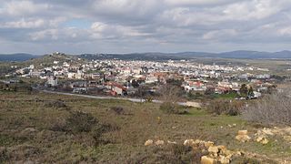
Arkalochori is a town and a former municipality in the Heraklion regional unit, Crete, Greece. Since the 2011 local government reform it is part of the municipality Minoa Pediada, of which it is a municipal unit. The municipal unit has an area of 237.589 km2 (91.734 sq mi).

The 1999 Hector Mine earthquake occurred in Southern California, United States, on October 16 at 02:46:50 PDT. Its moment magnitude was 7.1 and the earthquake was preceded by 12 foreshocks, the largest of which had a magnitude of 3.8. The event is thought to have been triggered by the 1992 Landers earthquake which occurred seven years earlier. It also deformed nearby faults vertically and horizontally. The earthquake's hypocenter was at a depth of 20 kilometers and its epicenter at 34.603° N 116.265° W.

<span class="mw-page-title-main">1931 Valentine earthquake</span> Most powerful earthquake in Texas history

In the early morning hours of August 16, 1931, a powerful earthquake occurred in West Texas with a maximum Mercalli intensity of VIII (Severe). Estimates of its magnitude range between 5.8 and 6.4 mb, making it the most powerful earthquake ever recorded in Texas history. Its epicenter was near the town of Valentine, Texas; there, the earthquake caused damage to many homes and buildings. The earthquake may have been caused by movement along oblique-slip faulting in West Texas, the most seismically active region in the state. Shaking from the earthquake was perceptible within a 400 mi (640 km) radius of the epicenter, affecting four U.S. states and northern Mexico. Several foreshocks and aftershocks accompanied the primary temblor, with the aftershocks continuing until at least November 3, 1931. The main earthquake caused no fatalities, though several people sustained minor injuries; the damage in Valentine amounted to $50,000–$75,000.

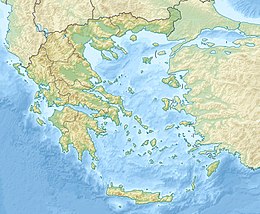
The 1303 Crete earthquake occurred at about dawn on 8 August. It had an estimated magnitude of about 8, a maximum intensity of IX (Violent) on the Mercalli intensity scale, and triggered a major tsunami that caused severe damage and loss of life on Crete and at Alexandria. It badly damaged the Lighthouse of Alexandria.

<span class="mw-page-title-main">2016 Kumamoto earthquakes</span> Earthquake in Japan

The 2016 Kumamoto earthquakes were a series of earthquakes, including a magnitude 7.0 mainshock which struck at 01:25 JST on April 16, 2016 beneath Kumamoto City of Kumamoto Prefecture in Kyushu Region, Japan, at a depth of about 10 kilometres, and a foreshock earthquake with a magnitude 6.2 at 21:26 JST (12:26 UTC) on April 14, 2016, at a depth of about 11 kilometres.

<span class="mw-page-title-main">2018 Hawaii earthquake</span> 6.9-magnitude earthquake in Hawaii

On May 4, 2018, an earthquake with a magnitude of Mw 6.9 struck Hawaii island in the Hawaii archipelago at around 12:33 p.m. local time. The earthquake's epicenter was near the south flank of Kīlauea, which has been the site of seismic and volcanic activity since late April of that year. According to the United States Geological Survey the quake was related to the new lava outbreaks at the volcano, and it resulted in the Hilina Slump moving about two feet. It was the largest earthquake to affect Hawaii since the 1975 earthquake, which affected the same region, killing two people and injuring another 28.

<span class="mw-page-title-main">2020 Masbate earthquake</span> 2020 earthquake in the Philippines

On 18 August 2020, at 8:03 PST, a 6.6 magnitude earthquake struck the island province of Masbate in the Philippines, leaving at least 2 dead and 170 injured.

The 1968 Borrego Mountain earthquake occurred on April 8, at 18:28 PST in the geologically active Salton Trough of Southern California. The Salton Trough represents a pull-apart basin formed by movements along major faults. This region is dominated by major strike-slip faults one of them being the San Jacinto Fault which produced the 1968 earthquake. The mainshock's epicenter was near the unincorporated community of Ocotillo Wells in San Diego County. The moment magnitude (Mw ) 6.6 strike-slip earthquake struck with a focal depth of 11.1 km (6.9 mi). The zone of surface rupture was assigned a maximum Modified Mercalli intensity (MMI) of VII.

The 1856 Heraklion earthquake, also known as the Crete earthquake or Rhodes earthquake, occurred on the morning of October 12 at 02:45 am local time. This extremely catastrophic earthquake had an estimated magnitude of 7.7 to 8.3 at a depth of approximately 61 to 100 km. The earthquake was felt over a very wide area extending from Sicily, Italy to the Levant and North Africa. On the Greek island of Crete, the effects of the earthquake were cataclysmic, over 500 bodies were recovered in the city of Heraklion. Shockwaves from the earthquake were felt intensely, covering all of the Ottoman Empire; present-day Turkey, Cyprus and the Middle East where damage and human losses were reported. In Malta, the Għajn Ħadid Tower—a coastal watchtower built around the year 1638—was severely damaged in the earthquake, when its upper floor collapsed. In Cairo, Egypt, the earthquake destroyed buildings, created seiches in canals, and killed several people. Off the Egyptian and Italian coasts, sailors reported feeling a seaquake.

The 1986 Kalamata earthquake struck the southern Peloponnese Region of Greece on September 13 at 20:24 local time. The 12.5 km (7.8 mi) deep moment magnitude (Mw ) 5.9 earthquake had an epicenter near the coastal city of Kalamata and was assigned X (Extreme) on the Mercalli intensity scale. The earthquake was the result of normal faulting along a northwest-dipping fault and produced surface ruptures. Extensive damage was reported in Kalamata and Elaiochori. At least 20 people died and 330 were injured. Survivors sought refuge at campsites and reconstruction work lasted five years.

The 1995 Menglian earthquake or 1995 Myanmar–China earthquake occurred on 12 July at 05:46:43 local time in the Myanmar–China border region. The earthquake had an epicenter on the Myanmar side of the border, located in the mountainous region of Shan State. It registered 7.3 on the Chinese surface-wave magnitude scale (Ms ) and 6.8 on the moment magnitude scale (Mw ). With a maximum Mercalli intensity assigned at VIII, it killed 11 people and left another 136 injured. Over 100,000 homes in both countries were destroyed and 42,000 seriously damaged. Some damage to structures were also reported in Chiang Mai and Chiang Rai, Thailand. The low death toll from this earthquake was attributed to an early warning issued prior to it happening. Precursor events including foreshocks and some seismic anomalies led to an evacuation of the area before the mainshock struck. It is thought to be one of the few successfully predicted earthquakes in history.

The 1941 Sa'dah earthquake or the Jabal Razih earthquake occurred on January 11 in Razih District of the Mutawakkilite Kingdom of Yemen. The earthquake had a surface-wave magnitude of 5.8–6.5 and a shallow focal depth. Despite the moderate size of this earthquake, an estimated 1,200 people perished and at least 200 injured. With a maximum MSK-64 intensity assigned at VIII, it destroyed many villages and collapsed homes in the region of North Yemen.

The 2021 South Sandwich Islands earthquakes were a pair of powerful earthquakes, followed by many strong aftershocks which struck along the South Sandwich Trench in August 2021. The quakes measured 7.5 and 8.1 on the moment magnitude scale, according to the United States Geological Survey. The mainshock is tied with another event in 1929 as the largest earthquake ever recorded in the South Atlantic region, and is tied with the 2021 Kermadec Islands earthquake as the second largest earthquake of 2021.

On February 7, 2021, at 12:22 PM PST, an earthquake measuring Mww  6.0 struck Davao del Sur and Cotabato. The event registered a Modified Mercalli Intensity Scale (MMI) of VIII (Severe) with VII on the PHIVOLCS Earthquake Intensity Scale (PEIS).

<span class="mw-page-title-main">2021 Larissa earthquake</span> Earthquake in Greece

On March 3, 2021, 12:16:09 the 2021 Larissa earthquake had a magnitude of 6.3 Mw with an intensity of VIII (Severe) on the Mercalli Scale 9 kilometers west of Týrnavos, Greece. One person was confirmed dead with eleven other people injured. Light shaking was also felt as far as Albania, North Macedonia, Kosovo and Montenegro.

The 2021 Lasithi earthquake was a magnitude 6.4 Mw earthquake with a maximum intensity of VIII (Severe) on the Modified Mercalli Intensity Scale which occurred on 12 October 2021, 12:24 (UTC+3:30) off the island of Crete. The quake was also felt at low intensity as far as Cairo and Istanbul.

The 1954 Sofades earthquake struck central Greece on 30 April 1954, at 16:02 (UTC+3). It was estimated to be 6.7–7.0 Mw  and had a maximum Modified Mercalli intensity of X (Extreme). More than 25 people died, 717 were injured and about 28,000 structures were damaged or destroyed.

An earthquake struck Western Greece near the coastal city of Aigio at 03:15:48 local time on 15 June 1995. The second destructive earthquake to strike Greece in a month, it measured 6.4–6.5 on the moment magnitude scale (Mw ). It was assigned a maximum Modified Mercalli intensity of VIII (Severe) and EMS-98 intensity of IX (Destructive). The horizontal peak ground acceleration reached 0.54 g and ground velocity peaked at 52 cm/s (20 in/s)—the strongest ground motion ever recorded in Greece. Fifteen minutes after the mainshock, a large aftershock struck, causing further damage to Aigio. Faulting occurred on either the Aigion fault or an unnamed offshore fault. Other faults in the region have the potential to produce earthquakes up to Mw  6.9, which poses a risk to Aigio and the surrounding Gulf of Corinth.

References

  1. "ITSAK ShakeMap: East Crete Isl. – S. Greece". Institute of Engineering Seismology and Earthquake Engineering. 27 September 2021. Retrieved 27 September 2021.
  2. 1 2 3 "Seismic Stations". Institute of Engineering Seismology and Earthquake Engineering. 27 September 2021. Retrieved 27 September 2021.
  3. 1 2 "M 5.3 – 4 km WNW of Arkalochóri, Greece". United States Geological Survey. 28 September 2021. Retrieved 28 September 2021.
  4. 1 2 "Earthquake of magnitude 6.5 strikes Crete, Greece – EMSC". Reuters. 27 September 2021. Retrieved 27 September 2021.
  5. 1 2 "M 6.2 – CRETE, GREECE – 2021-09-27 06:17:21 UTC". European-Mediterranean Seismological Centre . Retrieved 27 September 2021.
  6. 1 2 "M 6.0 – 7 km NNW of Thrapsanón, Greece". United States Geological Survey. 27 September 2021. Retrieved 27 September 2021.
  7. 1 2 "Earthquake in Heraklion / One dead in Arkalochori – 35 injured – 1,000 uninhabited houses from 5.8 Richter". Αυγή. 27 September 2021. Retrieved 27 September 2021.
  8. 1 2 "Nearly 5,000 non suitable buildings from the earthquake in Heraklion (Σχεδόν 5.000 τα ακατάλληλα κτίρια από τον σεισμό στο Ηράκλειο)". Η Εφημερίδα των Συντακτών (in Greek). 6 October 2021. Retrieved 8 October 2021.
  9. Riccardo Caputo; Stefano Catalano; Carmelo Monaco; Gino Romagnoli; Giuseppe Tortorici; Luigi Tortorici (2010). "Active faulting on the island of Crete (Greece)". Geophysical Journal International. 183 (1): 111–126. Bibcode:2010GeoJI.183..111C. doi: 10.1111/j.1365-246X.2010.04749.x .
  10. 1 2 3 4 Triantafyllou, Ioanna; Karavias, Andreas; Koukouvelas, Ioannis; Papadopoulos, Gerassimos A.; Parcharidis, Issaak (March 2022). "The Crete Isl. (Greece) Mw6.0 Earthquake of 27 September 2021: Expecting the Unexpected". GeoHazards. 3 (1): 106–124. doi: 10.3390/geohazards3010006 . ISSN   2624-795X. CC-BY icon.svg This article contains quotations from this source, which is available under the Creative Commons Attribution 4.0 Unported (CC BY 4.0) license.
  11. "EVENT 2021sybnk Crete, Greece". Institute of Geodynamics. Retrieved 27 September 2021.
  12. "Κωνσταντίνος Παπαζάχος: Άγνωστο το ρήγμα που προκάλεσε το σημερινό σεισμό στο Αρκαλοχώρι" [Konstantinos Papazachos: The fault caused by today's earthquake in Arkalochori is unknown] (in Greek). BusinessNews.gr. businessnews.gr/ellada. 27 September 2021. Retrieved 13 November 2021.
  13. "Earthquake in Crete: "It is unlikely tha we will have a much stronger earthquake", says Papazahos". ethnos.gr. 27 September 2021. Retrieved 27 September 2021.
  14. ΑΠΕ-ΜΠΕ (27 September 2021). "K. Papazachos: The fault that caused the earthquake in Heraklion, Crete is unknown". Capital. Athens News Agency . Retrieved 27 September 2021.
  15. "Παπαζάχος σε ΣΚΑΪ για σεισμό Κρήτης: Σπάνια δίνουν δραστηριοποίηση τα ρήγματα της περιοχής [Papazachos in SKAI for the earthquake in Crete: The faults of the area are rarely activated]". sport-fm.gr. 27 September 2021. Retrieved 27 September 2021.
  16. R. Caputo; S. Catalano; C. Monaco; G. Romagnoli (2010). "Middle-Late Quaternary Geodynamics of Crete, Southern Aegean, and Seismotectonic Implications". Bulletin of the Geological Society of Greece. 43 (1): 400–408. Bibcode:2010EGUGA..12..379C. doi: 10.12681/bgsg.11191 .
  17. 1 2 "Earthquake in Crete: Arkalochori sank by 15 cm – Egelados "raised houses"". permissos.gr. 29 September 2021. Retrieved 29 September 2021.
  18. "Search Earthquake Catalog". United States Geological Survey. Retrieved 27 September 2021.
  19. "At 6 Richter the earthquake in Crete: What scientists say – Vibrations for four months in Arkalochori". Proto Thema. 27 September 2021. Retrieved 27 September 2021.
  20. "Earthquake in Crete: The "warning" post of Celenti on Facebook last Thursday". The TOC. 27 September 2021. Retrieved 27 September 2021.
  21. "Crete Buildings in Arkalochori collapsed after the 5.4 magnitude earthquake". cna.gr. 28 September 2021. Retrieved 28 September 2021.
  22. "Seismic Stations". ITSAK. Retrieved 28 September 2021.
  23. "Arkalochori: "Earthquakes will continue for 1 month, they aggravate the problem"" (in Greek). iEidiseis. 4 October 2021. Retrieved 4 October 2021.
  24. "Search Earthquake Catalog". United States Geological Survey. Retrieved 20 October 2021.
  25. Rapanis, Stefanos (27 September 2021). "Earthquake in Crete – Sextus: Double seismic accelerations compared to construction design". ethnos.gr. Retrieved 27 September 2021.
  26. "M 6.4 – 0 km SSE of Palekastro, Greece". United States Geological Survey. 12 October 2021. Retrieved 12 October 2021.
  27. "Σεισμός στην Κρήτη – Λέκκας: Πιθανή ενεργοποίηση στο ανατολικό τμήμα του σεισμικού τόξου – Δόνηση 3,3R και στην Κάσο". ProtoThema (in Greek). 2021-10-12. Retrieved 2021-10-12.
  28. ΤοΒΗΜΑ Team (12 October 2021). "Τσελέντης για σεισμό στην Κρήτη – Δεν έχει σχέση με το Αρκαλοχώρι – Ο κόσμος να είναι ιδιαίτερα προσεκτικός" [Celentis for earthquake in Crete – It has nothing to do with Arkalochori – People should be especially careful] (in Greek). Το Βήμα Online. Retrieved 12 October 2021.
  29. "Κρήτη – "Το 80% των κτισμάτων του Αρκαλοχωρίου έχει ζημιές" [Crete – "80% of the buildings in Arkalochori are damaged"]". In.gr. 28 September 2021. Retrieved 28 September 2021.
  30. "Heraklion – earthquake: Ladder of the Ministry of Infrastructure in the affected areas – Damage to 60% of the houses" (in Greek). ERT News. Athens News Agency. 27 September 2021. Retrieved 27 September 2021.
  31. "5.8 magnitude earthquake shakes Crete – Two trapped in a house wreck" (in Greek). News 24/7. 27 September 2021. Retrieved 27 September 2021.
  32. "Earthquake – Crete: Athens Observatory directly installs a portable network of seismographs". ERT News. Athens News Agency. 27 September 2021. Retrieved 27 September 2021.
  33. "Earthquake in Crete: Seven people were transported by ambulance to health facilities". Proto Thema. 27 September 2021. Retrieved 27 September 2021.
  34. 1 2 3 "Deadly earthquake in Crete" (in Greek). Efimerida ton Syntakton. 27 September 2021. Retrieved 27 September 2021.
  35. "Except for two, all the houses in the village of Kato Poulies are uninhabitable, with the residents in despair". News 24/7. 27 September 2021. Retrieved 27 September 2021.
  36. Kyriakos Koronaios (29 September 2021). "Earthquake in Crete: At least 89 schools have problems – Big damage in Arkalochori, Kastelli". newsbomb.gr. Retrieved 29 September 2021.
  37. 1 2 "Earthquake in Crete: The number of unsuitable buildings is increasing" (in Greek). ethnos.gr. 4 October 2021. Retrieved 4 October 2021.
  38. "Earthquake in Crete: 772 houses are uninhabitable". Proto Thema . 29 September 2021. Retrieved 30 September 2021.
  39. "Earthquake in Crete: Konstantinos Polychronopoulos, who was helping voluntarily, was injured in Arkalochori" (in Greek). Proto Thema. 30 September 2021. Retrieved 30 September 2021.
  40. "Σεισμός 5,8 Ρίχτερ στην Κρήτη: Αναφορές για 3 εγκλωβισμένους σε Αρκαλοχώρι και Πατσίδερο -Επεσαν 2 εκκλησίες, ζημιές σε σπίτια" [5.8 magnitude earthquake shakes Crete: Reports of 3 trapped in Arkalochori and Patsidero – 2 churches fell, houses damaged] (in Greek). iefimerida.gr. 27 September 2021. Retrieved 27 September 2021.
  41. "The schools in the regional unit of Heraklion are closed on Tuesday and Wednesday". Athens 98.4 FM. 27 September 2021. Retrieved 27 September 2021.
  42. Alexandros Kalafatis. "Earthquake in Crete: Alarm at the Fire Brigade – Rescue dogs and EMAK go with C-130". News Bomb. Retrieved 27 September 2021.
  43. "Earthquake in Crete: 2,500 scenes for earthquake victims – What the experts say". Kathimerini. 27 September 2021. Retrieved 27 September 2021.
  44. "Ελλάδα Σεισμός στην Κρήτη- Μήνυμα από το 112 στους κατοίκους". lifo.gr. 27 September 2021. Retrieved 27 September 2021.
  45. "Σεισμός στο Ηράκλειο: Έστησαν Κέντρο Υγείας σε σκηνή του στρατού στο Αρκαλοχώρι". grtimes.gr. 28 September 2021. Retrieved 28 September 2021.
  46. NewsRoom (28 September 2021). "Earthquake in Crete: New collapses in Arkalochori due to the 5.4R vibration". mononews.gr. Retrieved 28 September 2021.{{cite news}}: |author1= has generic name (help)
  47. "How will the earthquake victims of Crete be compensated?". CNN Greece. 28 September 2021. Retrieved 28 September 2021.
  48. "Earthquake in Crete: "What happened in Damasi should not happen in Arkalochori" say Pappas – Zachariadis". LarissaPress. 28 September 2021. Retrieved 28 September 2021.
  49. "Cancellation of the Crete Half Marathon after the deadly earthquake in Arkalochori". DocumentoNews. 29 September 2021. Retrieved 29 September 2021.