Adams Township | |
|---|---|
 | |
| Coordinates: 39°16′25″N85°8′40″W / 39.27361°N 85.14444°W | |
| Country | United States |
| State | Indiana |
| County | Ripley |
| Government | |
| • Type | Indiana township |
| Area | |
• Total | 43.79 sq mi (113.4 km2) |
| • Land | 43.26 sq mi (112.0 km2) |
| • Water | 0.54 sq mi (1.4 km2) |
| Elevation | 980 ft (300 m) |
| Population (2020) | |
• Total | 5,165 |
| • Density | 119.4/sq mi (46.10/km2) |
| Time zone | UTC-5 (Eastern (EST)) |
| • Summer (DST) | UTC-4 (EDT) |
| Area code | 812 |
| FIPS code | 18-00478 [2] |
| GNIS feature ID | 453081 |
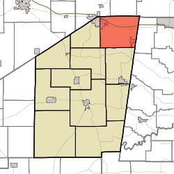
Adams Township is one of eleven townships in Ripley County, Indiana. As of the 2020 census, its population was 5,165 (up from 5,119 at 2010 [3] ) and it contained 2,135 housing units. [4]
Contents
| Census | Pop. | Note | %± |
|---|---|---|---|
| 1890 | 2,328 | — | |
| 1900 | 2,208 | −5.2% | |
| 1910 | 2,066 | −6.4% | |
| 1920 | 1,988 | −3.8% | |
| 1930 | 1,984 | −0.2% | |
| 1940 | 1,971 | −0.7% | |
| 1950 | 1,865 | −5.4% | |
| 1960 | 2,331 | 25.0% | |
| 1970 | 2,733 | 17.2% | |
| 1980 | 3,385 | 23.9% | |
| 1990 | 3,553 | 5.0% | |
| 2000 | 4,325 | 21.7% | |
| 2010 | 5,119 | 18.4% | |
| 2020 | 5,165 | 0.9% | |
| Source: US Decennial Census [5] | |||
