Addison | |
---|---|
Location within New York | |
Coordinates: 42°06′14″N77°14′02″W / 42.10389°N 77.23389°W | |
Country | United States |
State | New York |
County | Steuben County |
Incorporated | 1796 |
Area | |
• Total | 25.69 sq mi (66.53 km2) |
• Land | 25.55 sq mi (66.16 km2) |
• Water | 0.14 sq mi (0.37 km2) |
Elevation | 998 ft (304 m) |
Population | |
• Total | 2,397 |
• Estimate (2021) [2] | 2,369 |
• Density | 99.04/sq mi (38.24/km2) |
Time zone | UTC-5 (EST) |
• Summer (DST) | UTC-4 (EDT) |
ZIP code | 14801 |
Area code | 607 |
FIPS code | 36-101-00287 |
Website | Town of Addison |
Addison is a town in Steuben County, New York. The population was 2,397 at the 2020 census. [2] The name was selected to honor the author Joseph Addison. An interior town in the southeastern part of the county, the town includes a village, also called Addison.
The town was first settled in 1791 by Samuel Rice. Originally a part of the old town of Painted Post, Addison was organized as Middletown at the time of Steuben County's creation in March 1796. The name was changed to Addison to honor of Joseph Addison, the English author, on April 6, 1808. The early settlers called it also Tuscarora. Addison Academy opened in 1840. In 1890, the town's population was 2,884. [3]
According to the U.S. Census Bureau, the town has a total area of 25.7 square miles (66.5 km2), of which 25.6 square miles (66.4 km2) is land and 0.04 square mile (0.1 km2) (0.16%) is water.
Former NY Route 432, now County Road 119, is an east-west highway through the town. NY Route 417, formerly NY Route 17, passes through the town's southeast corner.
Addison is on the Southern Tier Main Line of the Norfolk Southern Railway, the ultimate successor to the Erie/Erie Lackawanna Railroads, which ran it from its opening in 1850 to 1976. From c. 1885 to 1961, Addison was also the northern terminus of the Wellsville, Addison & Galeton Railroad, Baltimore & Ohio, and Buffalo & Susquehanna lines from Galeton, Pennsylvania.
The Canisteo River flows through the southern part of the town. Goodhue Creek flows into the river near the eastern town boundary.
Census | Pop. | Note | %± |
---|---|---|---|
1820 | 652 | — | |
1830 | 944 | 44.8% | |
1840 | 1,920 | 103.4% | |
1850 | 3,721 | 93.8% | |
1860 | 1,715 | −53.9% | |
1870 | 2,218 | 29.3% | |
1880 | 2,534 | 14.2% | |
1890 | 2,908 | 14.8% | |
1900 | 2,637 | −9.3% | |
1910 | 2,509 | −4.9% | |
1920 | 2,122 | −15.4% | |
1930 | 1,975 | −6.9% | |
1940 | 2,032 | 2.9% | |
1950 | 2,368 | 16.5% | |
1960 | 2,645 | 11.7% | |
1970 | 2,698 | 2.0% | |
1980 | 2,734 | 1.3% | |
1990 | 2,645 | −3.3% | |
2000 | 2,640 | −0.2% | |
2010 | 2,595 | −1.7% | |
2020 | 2,397 | −7.6% | |
2021 (est.) | 2,369 | [2] | −1.2% |
U.S. Decennial Census [4] |
As of the 2000 census, [5] of 2000, there were 2,640 people, 1,026 households, and 687 families residing in the town. The population density was 103.0 inhabitants per square mile (39.8/km2). There were 1,177 housing units at an average density of 45.9 per square mile (17.7/km2). The racial makeup of the town was 98.45% White, 0.30% Black or African American, 0.34% Native American, 0.04% Asian, 0.08% from other races, and 0.80% from two or more races. Hispanic or Latino of any race were 0.61% of the population.
There were 1,026 households, out of which 34.1% had children under the age of 18 living with them, 48.4% were married couples living together, 12.5% had a female householder with no husband present, and 33.0% were non-families. 25.7% of all households were made up of individuals, and 12.1% had someone living alone who was 65 years of age or older. The average household size was 2.57 and the average family size was 3.06.
In the town, the population was spread out, with 27.1% under the age of 18, 8.9% from 18 to 24, 26.7% from 25 to 44, 23.9% from 45 to 64, and 13.3% who were 65 years of age or older. The median age was 36 years. For every 100 females, there were 92.3 males. For every 100 females age 18 and over, there were 90.9 males.
The median income for a household in the town was $31,942, and the median income for a family was $37,813. Males had a median income of $32,159 versus $22,708 for females. The per capita income for the town was $15,473. About 13.2% of families and 17.7% of the population were below the poverty line, including 23.1% of those under age 18 and 9.7% of those age 65 or over.
Climate data for the village of Addison, New York, 1991–2020 normals, extremes 1893–2020 | |||||||||||||
---|---|---|---|---|---|---|---|---|---|---|---|---|---|
Month | Jan | Feb | Mar | Apr | May | Jun | Jul | Aug | Sep | Oct | Nov | Dec | Year |
Record high °F (°C) | 74 (23) | 73 (23) | 85 (29) | 92 (33) | 98 (37) | 100 (38) | 106 (41) | 103 (39) | 103 (39) | 99 (37) | 84 (29) | 71 (22) | 106 (41) |
Mean daily maximum °F (°C) | 33.1 (0.6) | 35.8 (2.1) | 44.0 (6.7) | 57.5 (14.2) | 69.6 (20.9) | 77.9 (25.5) | 82.0 (27.8) | 80.8 (27.1) | 73.7 (23.2) | 61.5 (16.4) | 48.7 (9.3) | 38.0 (3.3) | 58.6 (14.8) |
Daily mean °F (°C) | 23.5 (−4.7) | 25.0 (−3.9) | 32.5 (0.3) | 44.3 (6.8) | 55.5 (13.1) | 64.6 (18.1) | 69.1 (20.6) | 67.8 (19.9) | 60.5 (15.8) | 49.2 (9.6) | 38.2 (3.4) | 29.5 (−1.4) | 46.6 (8.1) |
Mean daily minimum °F (°C) | 13.8 (−10.1) | 14.1 (−9.9) | 21.1 (−6.1) | 31.1 (−0.5) | 41.3 (5.2) | 51.3 (10.7) | 56.2 (13.4) | 54.8 (12.7) | 47.4 (8.6) | 37.0 (2.8) | 27.6 (−2.4) | 21.0 (−6.1) | 34.7 (1.5) |
Record low °F (°C) | −35 (−37) | −28 (−33) | −22 (−30) | 1 (−17) | 18 (−8) | 16 (−9) | 34 (1) | 34 (1) | 24 (−4) | 10 (−12) | −4 (−20) | −26 (−32) | −35 (−37) |
Average precipitation inches (mm) | 1.80 (46) | 1.61 (41) | 2.52 (64) | 3.34 (85) | 3.55 (90) | 3.19 (81) | 4.22 (107) | 3.55 (90) | 3.66 (93) | 3.81 (97) | 2.54 (65) | 2.26 (57) | 36.05 (916) |
Average snowfall inches (cm) | 13.3 (34) | 11.8 (30) | 9.6 (24) | 1.0 (2.5) | 0.1 (0.25) | 0.0 (0.0) | 0.0 (0.0) | 0.0 (0.0) | 0.0 (0.0) | 0.3 (0.76) | 2.1 (5.3) | 10.0 (25) | 48.2 (121.81) |
Average precipitation days (≥ 0.01 in) | 13.7 | 10.9 | 13.8 | 14.4 | 15.3 | 13.9 | 11.7 | 11.9 | 11.4 | 15.1 | 13.6 | 14.9 | 160.6 |
Average snowy days (≥ 0.1 in) | 10.0 | 8.0 | 5.8 | 1.0 | 0.1 | 0.0 | 0.0 | 0.0 | 0.0 | 0.1 | 2.4 | 8.0 | 35.4 |
Source 1: NOAA [8] | |||||||||||||
Source 2: National Weather Service [9] |
Steuben County (stu-BEN) is a county located in the U.S. state of New York. As of the 2020 census, the population was 93,584. Its county seat is Bath. Its name is in honor of Baron von Steuben, a Prussian general who fought on the American side in the American Revolutionary War, though it is not pronounced the same. The county is part of the Southern Tier region of the state.
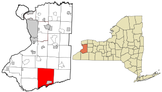
Concord is a town in Erie County, New York, United States. The population was 8,494 at the 2010 census. The town is believed to be named after Concord, Massachusetts, by early settlers from New England.
Springwater is a town in Livingston County, New York, United States. The population was 2,439 at the 2010 census. Springwater is in the southeast part of the county.
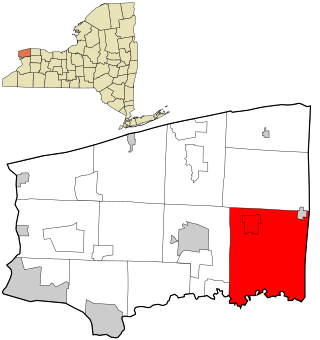
Royalton is a town in Niagara County, New York, United States. The population was 7,660 at the 2010 census.
Seneca is a town in Ontario County, New York, United States. The population was 2,658 at the 2020 census. The town is named after a group of local natives.
Tyrone is a town in Schuyler County, New York, United States. The population was 1,650 at the 2020 census.
Cameron is a town in Steuben County, New York, United States. The population is 898 as of 2020. The town is named after Dugald Cameron, an early settler and land agent of the Pulteney Estate.
Campbell is a town in Steuben County, New York, United States. The population was 3,163 at the 2020 census. The name is from Robert Campbell, an early landowner. The town is centrally located in the county and is northwest of Corning.
Caton is a town in Steuben County, New York, United States. The population was 2,046 at the 2020 census. The town is named after Richard Caton.
Erwin is a town in Steuben County, New York, United States. The population was 8,090 at the 2020 census. The name is that of an early settler, who became the first Town Supervisor. Erwin is in the southeast part of the county and is west of the city of Corning.
Prattsburgh is a town in Steuben County, New York, United States. The population was 1,985 at the 2020 census. It is situated in the northeast part of the county, north of Bath.
Troupsburg is a town in Steuben County, New York, United States. The population was 1,016 at the 2020 census. The town is named after Robert Troup, an agent of the Pulteney Estate.
Tuscarora township is a township in Steuben County, New York, United States. The population was 1,388 at the 2020 census. The township is named after the Tuscarora tribe.
Wheeler is a town in Steuben County, New York, United States. The population was 1,136 at the 2020 census. The town is named after Captain Silas Wheeler, an early settler.
Woodhull is a town in Steuben County, New York, United States. The population was 1,719 at the time of the 2010 United States Census.
Starksboro is a town in Addison County, Vermont, United States. The population was 1,756 at the 2020 census.
Addison is a village in Steuben County, New York, United States, in the southeast part of the town of the same name, and southwest of the city of Corning. The population was 1,763 at the 2010 census. The village and the surrounding town are named after the author Joseph Addison.
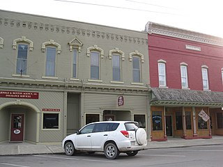
Avoca is a town in Steuben County, New York, United States. The population was 1,996 at the 2020 census.
Wayland is a village in Steuben County, New York, United States. The population was 1,865 at the 2010 census.
Wayland is a town in Steuben County, New York, United States. The population was 3,733 at the 2020 census.
Media related to Addison, New York at Wikimedia Commons