Ailey, Georgia | |
---|---|
![]() Ailey City Hall | |
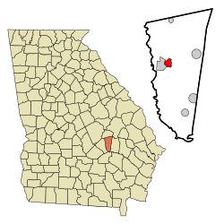
![]() Location in Montgomery County and the state of Georgia | |
Coordinates: 32°11′14″N82°34′8″W / 32.18722°N 82.56889°W | |
Country | United States |
State | Georgia |
County | Montgomery |
Area | |
• Total | 2.18 sq mi (5.64 km2) |
• Land | 2.16 sq mi (5.59 km2) |
• Water | 0.02 sq mi (0.05 km2) |
Elevation | 249 ft (76 m) |
Population | |
• Total | 519 |
• Density | 240.39/sq mi (92.82/km2) |
Time zone | UTC-5 (Eastern (EST)) |
• Summer (DST) | UTC-4 (EDT) |
ZIP code | 30410 |
Area code | 912 |
FIPS code | 13-00828 [3] |
GNIS feature ID | 0310413 [4] |
Ailey is a city in Montgomery County, Georgia, United States. As of the 2020 census, the city had a population of 519, [2] up from 432 in 2010.
A post office called Ailey was established in 1891. [5] The town incorporated in 1893. [6]
Ailey is located in western Montgomery County at 32°11′14″N82°34′8″W / 32.18722°N 82.56889°W (32.187181, -82.568932). [7] It is bordered to the west by Mount Vernon, the county seat. U.S. Route 280 passes through Ailey, leading west through Mount Vernon 23 miles (37 km) to McRae–Helena and east 10 miles (16 km) to Vidalia.
According to the United States Census Bureau, the city of Ailey has a total area of 2.2 square miles (5.7 km2), of which 0.02 square miles (0.05 km2), or 0.92%, are water. [1] The city is drained by tributaries of the Oconee River.
Climate data for Ailey, Georgia | |||||||||||||
---|---|---|---|---|---|---|---|---|---|---|---|---|---|
Month | Jan | Feb | Mar | Apr | May | Jun | Jul | Aug | Sep | Oct | Nov | Dec | Year |
Mean daily maximum °F (°C) | 60.4 (15.8) | 64.3 (17.9) | 70.7 (21.5) | 78.6 (25.9) | 85.6 (29.8) | 90.7 (32.6) | 92.7 (33.7) | 91.6 (33.1) | 87.0 (30.6) | 79.5 (26.4) | 70.3 (21.3) | 62.9 (17.2) | 77.9 (25.5) |
Mean daily minimum °F (°C) | 37.1 (2.8) | 38.9 (3.8) | 44.3 (6.8) | 52.4 (11.3) | 60.3 (15.7) | 66.5 (19.2) | 69.8 (21.0) | 69.3 (20.7) | 64.5 (18.1) | 54.2 (12.3) | 44.4 (6.9) | 38.6 (3.7) | 53.4 (11.9) |
Average precipitation inches (mm) | 4.4 (110) | 4.2 (110) | 4.7 (120) | 3.2 (81) | 3.8 (97) | 4.2 (110) | 4.8 (120) | 5.4 (140) | 3.6 (91) | 2.4 (61) | 2.5 (64) | 3.5 (89) | 46.5 (1,180) |
Source: Weatherbase [8] |
Census | Pop. | Note | %± |
---|---|---|---|
1900 | 271 | — | |
1910 | 306 | 12.9% | |
1920 | 385 | 25.8% | |
1930 | 428 | 11.2% | |
1940 | 506 | 18.2% | |
1950 | 508 | 0.4% | |
1960 | 469 | −7.7% | |
1970 | 487 | 3.8% | |
1980 | 579 | 18.9% | |
1990 | 579 | 0.0% | |
2000 | 394 | −32.0% | |
2010 | 432 | 9.6% | |
2020 | 519 | 20.1% | |
U.S. Decennial Census [9] 1850-1870 [10] 1880 [11] 1890-1910 [12] 1920-1930 [13] 1930-1940 [14] 1940-1950 [15] 1960-1980 [16] 1980-2000 [17] |
In 2020, the city had a resident population of 519.