
Waltham is an inner suburb of Christchurch, New Zealand, located approximately two kilometres south-east of the city centre. State Highway 76, part of Christchurch's ring road system, and known there as Brougham Street, runs through the suburb, as does the Lyttelton Line rail corridor.

Hornby is a major residential and retail suburb at the western edge of Christchurch, New Zealand. The suburb is directly connected to other parts of Christchurch and the South Island by a number of main arterial routes, including State Highway 1 and the Christchurch Southern Motorway.

Belmont, a suburb of Lower Hutt, to the north of Wellington in the North Island of New Zealand, lies on the west bank of the Hutt River, on State Highway 2, the Wellington-Hutt main road, and across the river from the centre of Lower Hutt.
Westmorland is an outer suburb of Christchurch, New Zealand. It is situated mostly on a hillside and is a recent development of the city, dating back to the late 1970s. It is still under development, with the end of Pentonville Close being recently settled with modern family homes typical of middle to upper-middle class New Zealanders, predominantly in the usual bungalow style, called Worsley Estate. There is a road nearby called 'Worsleys Road'. However this is not connected to Worsley Estate at this time. Currently there is a lot of development happening at the top of the hill, going under the name of 'Westmorland Heights'. This is the final stage of the Westmorland development, and is expected to be completed in approx 2020, adding 250 homes to the suburb of Westmorland.

Boulcott is a central suburb of Lower Hutt City situated in the south of the North Island of New Zealand. The suburb lies about a kilometre north-east of the Lower Hutt CBD.
The Wood is a suburb of the South Island, New Zealand city of Nelson. It lies just to the north-east of the city centre and adjoins it.
The Waimea Plains is a small but fertile area of low-lying land southwest of the port city of Nelson, situated on Tasman Bay / Te Tai-o-Aorere in the South Island of New Zealand. It is irrigated by the Waimea River from the Waimea Inlet in the north and bounded by the town of Brightwater in the south. The fertile soil promotes the growth of kiwifruit, apples and vineyards.

Appleby is a locality in the Tasman district in the South Island of New Zealand. It is located around the Waimea River near the Tasman Bay / Te Tai-o-Aorere. It was first settled in the early 1840s. State Highway 60 passes through the settlement.

Sockburn is an industrial suburb of Christchurch, New Zealand, located between Hornby and Riccarton, some 7 kilometres (4.3 mi) west of the Christchurch city centre. The suburb is roughly bounded by the triangle formed by State Highway 1 in the west, Main South Road (SH73a) in the south and SH73 in the north. The suburb of Wigram, containing the city's former RNZAF base, is located nearby. One of the city's main horseracing circuits, Riccarton Racecourse, is located close to Sockburn's northern edge, and Racecourse was the initial name for the area. The name Sockburn is likely to have come from the village of Sockburn in County Durham, England.
Washington Valley is a major inner suburb of Nelson, New Zealand. It lies to the west of Nelson city centre and south of Stepneyville and Beachville.
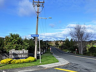
Algies Bay is a northern coastal suburb of Auckland, in New Zealand. It is on the Mahurangi Peninsula about 68 kilometres north of the city centre.
Pipitea is a central suburb of Wellington, in the Wellington region of New Zealand's North Island.

Kew is a suburb in the New Zealand city of Invercargill.
Woodend is a rural suburb of the New Zealand city of Invercargill.

Southgate is a suburb of Wellington, New Zealand, in the Paekawakawa/Southern Ward. The main road is Buckley Road, which runs south from the point at which Mount Albert Road changes name to Houghton Bay Road.
Russley is a suburb on the western side of Christchurch city.
Islington is a suburb on the western side of Christchurch city.
Northcote is a suburb on the northern side of Christchurch, New Zealand.
Glenwood is a suburb of Timaru, in the South Canterbury area and Canterbury region of New Zealand's South Island. It is located west of the town centre.
Kensington is a suburb of Timaru, in the South Canterbury area and Canterbury region of New Zealand's South Island. It is located south of the town centre.
