April 1923 Kamchatka earthquake and tsunami

Last updated • 6 min readFrom Wikipedia, The Free Encyclopedia

April 1923 Kamchatka earthquake
Map of the Kamchatka Krai. Epicenter marked as a bullseye.
UTC  time1923-04-13 15:31:07
ISC  event 911331
USGS-ANSS ComCat
Local dateApril 14, 1923 (1923-04-14)
Local time02:31
Magnitude6.8–7.3 Ms , [1] 7.0–8.2 Mw [2] [3] [4]
Depth15 km
Epicenter 56°34′N163°02′E / 56.56°N 163.03°E / 56.56; 163.03
Areas affected Kamchatka, USSR (present-day Russia)
Max. intensity MMI X (Extreme)
TsunamiUp to 30 meters
Casualties36 dead

On April 14, 1923, at 02:31 local time, an earthquake occurred off the northern coast of the Kamchatka Peninsula in the USSR, present-day Russia. The earthquake had a surface-wave magnitude (Ms) of 6.8–7.3 and an estimated moment magnitude (Mw) of 7.0–8.2. [5] [1] This event came just two months after a slightly larger earthquake with an epicenter struck south of the April event. Both earthquakes were tsunamigenic although the latter generated wave heights far exceeding that of the one in February. [6] After two foreshocks of "moderate force", the main event caused considerable damage. [5] Most of the 36 casualties were the result of the tsunami inundation rather than the earthquake. [7]

Contents

Tectonic setting

The earthquake occurred off the Kamchatka Peninsula's east coast, which runs parallel to the Kuril-Kamchatka Trench, the area where the Pacific and Okhotsk Sea plates converge. Being older and therefore denser, the Pacific subducts beneath the Kamchatka Peninsula, which sits on the Okhotsk Sea Plate. These two plates meet along a convergent boundary, marked by the trench. The subduction zone is seismogenic and produces Kamchatka earthquakes, which occasionally generate tsunamis; some of these megathrust earthquakes are very strong (such as the 1952 magnitude 9.0 earthquake, the 5th largest ever recorded). [8]

Earthquake

The April earthquake was part of a sequence of megathrust earthquakes on the Kamchatka Peninsula, which began in February. On February 3, a magnitude 8.4 earthquake, whose hypocenter was 15 km deep, [9] resulted in extreme shaking assigned XI (Extreme) on the Modified Mercalli intensity scale and caused a tsunami with run-ups of 6 meters. [10] [11] It was followed by a magnitude 7.4 aftershock the same month. [12]

The International Seismological Centre placed the April earthquake magnitude at 6.8 Ms or 7.0 Mw, [4] [13] while the NGDC and some older studies placed it at 7.3–7.4 Mw. Beno Gutenberg and Charles Richter assigned the event a magnitude of 7.2 Ms. [12] A 2004 reevaluation of earthquakes in the region revised the earthquake magnitude to 8.2 Mw , based on analyzing the associated tsunami. [2] [3] It was not considered an aftershock of the February earthquake because it ruptured another segment of the subduction zone. [12]

Location

The epicenter coordinates of this earthquake differ across sources and journals. The International Seismological Summary placed this at 55.7°N, 162.5°E, while the ISC-GEM Catalogue lists this event as having an epicenter at 56.36° N 162.70° E. [13] [6] Meanwhile, Beno Gutenberg and Charles Richter suggested the epicenter location to be 56.5° N, 16.5° E. [14] In a 2017 study, Salaree and Okal argued it was located 110 km to the north, at 57.35° N, 162.91° E, which is northwest of Bering Island. [6] In another study by Bourgeois and Pinegina published in 2018, the source area of the April earthquake is north of the February rupture but southwest of Bering Island and in Kamchatka Bay  [ ru ]. [3] On the other hand, E.R. Engdahl's relocation places the epicenter coordinates at 56.56°N, 163.03°E, inside the Kamchatskiy Peninsula and close to the ISC-GEM coordinates. [6] [13]

Characteristic

The earthquake was initially interpreted to be a tsunami earthquake because it generated a larger tsunami relative to the February earthquake despite having a smaller magnitude. Further supporting this early characterisation was the absence of a documented tsunami during an MPAS 7.4 aftershock of the February event. However, a study published in Pure and Applied Geophysics found that no numerical modelling of the earthquake could reproduce the unusually large tsunami. Despire confirming the tsunamigenic earthquake source characteristic using the available seismograph readings, it did not account for the local tsunami observations. Instead, numerical simulation suggest the tsunami was triggered by a submarine landslide in Kamchatka Bay. [6]

Tsunami

An earthquake-triggered submarine landslide is thought to have accounted for the unusually high local tsunami run-ups. [6] A landslide-triggered tsunami simulation satisfactorily reproduced the tsunami height distribution. [6] A survey of the affected region discovered high run-up heights of 20–30 m (66–98 ft). [15] The first tsunami wave arrived at Ust-Kamchatsk 15 minutes after the earthquake. [16] Fifteen minutes later, an 11 m (36 ft) wave began advancing onshore, washing away structures at a nearby settlement and flowing upstream by 7 km (4.3 mi) on the Kamchatka River. [16]

West of the Kamchatka River, the tsunami waves were reported with run-ups of 20–30 m (66–98 ft). [6] [17] [16] Japanese-owned fish canneries and villages were totally destroyed. [18] A small cutter belonging to the Nichiro cannery was found 1–2 km (0.62–1.24 mi) inland, 30 m (98 ft) above sea level. The extent of damage decreased abruptly eastwards along a 10 km (6.2 mi) portion of a spit that separated Lake Nerpichye from Kamchatka Bay. On the spit, a cannery was completely destroyed. A newer cannery and radio station at the same location had moderate damage only. The tsunami height at Perevoloka was approximately 1 m (3 ft 3 in). [17]

A run-up of 4 m (13 ft) was recorded at Bering Island. [7] On the Hawaiian Islands, the tsunami was recorded 0.3 m (1 ft 0 in) at Hilo, 0.2 m (7.9 in) at Honolulu and 0.08 m (3.1 in) at Tofino. On the United States west coast, a 0.15 m (5.9 in) wave was recorded at San Francisco while at the Port of Los Angeles, some swirls were observed between 06:00 and 10:00. [6] A weak tsunami was also recorded along the Japanese coast. [18]

Damage and aftermath

Before the main shock, a sequence of foreshocks was felt for four hours, keeping the residents on high alert. Two noticeable foreshocks occurred on 13 April at 21:00 and 14 April at 01:00 local time respectively. They were felt with light to moderate intensities, causing hanging items to sway slightly. [19]

The earthquake struck at 02:00 am local time on 14 April. Its reported intensity was as high as X (Extreme) on the Modified Mercalli intensity scale. [5] A local newspaper reported that many barns and dilapidated houses were destroyed. More than 230 animals perished, including dogs, cows, and pigs. [18] Residents in towns and villages were driven out of their homes when the earthquake shook. The tremors knocked hanging photographs, dishes on shelves, and stoves to the floor. It also cracked the windows of many homes. [19]

The tsunami killed 36 people along the coast of Kamchatka. [18] Twenty-three of those killed were in Ust-Kamchatsk, of which there were 13 Japanese and five Russian and Chinese victims. Along the coasts, the tsunami tore off trees by the roots. [18] A small Japanese boat was also deposited some 30 meters on top of a raised beach. At the time, the boat was occupied by a Japanese couple and when the tsunami struck, one of them was killed. [18]

After the earthquake and tsunami, many survivors relocated to other villages upstream to avoid a similar disaster. [18] Cherny Yar and Nizhnekamchatsk were among the villages that survivors moved into because they were situated far inland and safe from future tsunamis. Some of the remaining inhabitants of Ust-Kamchatsk later founded the village of Krutoberegovo  [ ru ] because the tsunami had badly affected the main city. [20] Others remained in the city to reconstruct the damaged city. [21]

The Los Angeles Times on 15 April reported that flooding in the Korean of city Busan caused over 1,000 deaths. [6] Meanwhile, the Sydney Morning Herald on 16 April claimed that 400 people went missing due to a tidal wave in the same city. The news article also stated that the total number of people that perished was unknown, but believed to be large. [22] Further analysis however, concluded that the Busan flooding occurred approximately 24 hours before the earthquake and is, therefore, an unrelated event. [6]

See also

Related Research Articles

<span class="mw-page-title-main">1946 Aleutian Islands earthquake</span> Earthquake near the Aleutian Islands, Alaska

The 1946 Aleutian Islands earthquake occurred near the Aleutian Islands, Alaska on April 1, 1946. The shock measured 8.6, Mt 9.3 or 7.4. It had a maximum Mercalli intensity of VI (Strong). It resulted in 165–173 casualties and over US$26 million in damage. The seafloor along the fault was elevated, triggering a Pacific-wide tsunami with multiple destructive waves at heights ranging from 45–138 ft (14–42 m). The tsunami obliterated the Scotch Cap Lighthouse on Unimak Island, Alaska among others, and killed all five lighthouse keepers. Despite the destruction to the Aleutian Island Unimak, the tsunami had almost an imperceptible effect on the Alaskan mainland.

<span class="mw-page-title-main">Kamchatka earthquakes</span> Earthquakes in the Kamchatka Peninsula, far eastern Russia

Many major earthquakes have occurred in the region of the Kamchatka Peninsula in far eastern Russia. Events in 1737, 1923 and 1952, were megathrust earthquakes and caused tsunamis. There are many more earthquakes and tsunamis originating from the region.

<span class="mw-page-title-main">2006 Pangandaran earthquake and tsunami</span> Destructive tsunami earthquake south of Java Island

An earthquake occurred on July 17, 2006, at 15:19:27 local time along a subduction zone off the coast of west and central Java, a large and densely populated island in the Indonesian archipelago. The shock had a moment magnitude of 7.7 and a maximum perceived intensity of IV (Light) in Jakarta, the capital and largest city of Indonesia. There were no direct effects of the earthquake's shaking due to its low intensity, and the large loss of life from the event was due to the resulting tsunami, which inundated a 300 km (190 mi) portion of the Java coast that had been unaffected by the earlier 2004 Indian Ocean earthquake and tsunami that was off the coast of Sumatra. The July 2006 earthquake was also centered in the Indian Ocean, 180 kilometers (110 mi) from the coast of Java, and had a duration of more than three minutes.

The 1938 Banda Sea earthquake occurred on February 2 at 04:04 local time with an estimated magnitude of 8.5-8.6 on the moment magnitude scale. Shaking was intense with an assigned Rossi–Forel intensity of VII and intensity of VI (Strong) on the Modified Mercalli intensity scale. This oblique-slip event generated a destructive tsunami of up to 1.5 metres in the Banda Sea region, but there were no deaths.

<span class="mw-page-title-main">2007 Bengkulu earthquakes</span> Earthquakes affecting Indonesia

The 2007 Bengkulu earthquakes were a series of megathrust earthquakes that struck the Sunda Trench off the coast of Sumatra, Indonesia, with three of magnitude 7 or greater. A series of tsunami bulletins was issued for the area. The most powerful of the series had a magnitude of 8.4, which makes it in the top 20 of the largest earthquakes ever recorded on a seismograph.

The 1922 Vallenar earthquake occurred with a moment magnitude of 8.3 and a tsunami magnitude of 8.7 in the Atacama Region of Chile, near the border with Argentina on 11 November at 04:32 UTC. It triggered a destructive tsunami that caused significant damage to the coast of Chile and was observed as far away as Australia.

<span class="mw-page-title-main">1952 Severo-Kurilsk earthquake</span> Sixth most powerful on record; in Russia

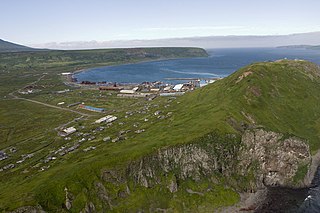
The 1952 Severo-Kurilsk earthquake struck off the coast of the Kamchatka Peninsula. The 9.0 Mw earthquake occurred on 5 November 1952 at 04:58 local time, triggering a major tsunami that hit Severo-Kurilsk, Kuril Islands, Sakhalin Oblast, Russian SFSR, USSR. This led to the destruction of many settlements in Sakhalin Oblast and Kamchatka Oblast, while the main impact struck the town of Severo-Kurilsk. It was the most powerful earthquake ever recorded in Russia, and the fifth most powerful earthquake ever recorded in the world since modern seismography began in 1900.

The 1997 Kamchatka earthquake, or 1997 Kronotsky earthquake, occurred on December 5 at 11:26 UTC near the east coast of the Kamchatka Peninsula. It was an Mw 7.7 (7.6–7.8) earthquake and was felt with intensity MM V in Petropavlovsk-Kamchatskiy. A 60 cm (23.6 in) tsunami was recorded in Kahului, 47 cm in Hilo, and 15 cm in Unalaska. The local tsunami generated by this earthquake affected a mostly unpopulated region. A post-tsunami survey found runup on the Kronotsky Peninsula was no more than a few meters. However, a later geological survey north of the peninsula, as well as an interview with a park ranger, indicate that runup was up to 8 meters (26 ft) along the coast near the Little and Big Chazhma rivers and north to the Storozh River.

The 1994 Kuril Islands earthquake – also known as the Hokkaido Toho-oki earthquake – occurred on October 5 at 00:23:00 local time. The magnitude of this earthquake was put at Mw8.3, or MJMA8.1. The epicenter was located at about 70 km east of Shikotan Island. The shaking and tsunami caused road and building damage. At least 10 people were reported dead.

<span class="mw-page-title-main">Tsunami earthquake</span> Type of earthquake which triggers a tsunami of far-larger magnitude

In seismology, a tsunami earthquake is an earthquake which triggers a tsunami of significantly greater magnitude, as measured by shorter-period seismic waves. The term was introduced by Japanese seismologist Hiroo Kanamori in 1972. Such events are a result of relatively slow rupture velocities. They are particularly dangerous as a large tsunami may arrive at a coastline with little or no warning.

The 1959 Kamchatka earthquake occurred on May 4 at 19:15 local time with a moment magnitude of 8.0–8.3, and a surface wave magnitude of 8.25. The epicenter was near the Kamchatka Peninsula, Russian SFSR, USSR. Building damage was reported in Petropavlovsk-Kamchatsky. The maximum intensity was VIII (Damaging) on the Medvedev–Sponheuer–Karnik scale. The intensity in Petropavlovsk-Kamchatsky was about VIII MSK.

The 1941 Andaman Islands earthquake struck the Andaman Islands on June 26 with a magnitude of 7.7 to 8.1. Details of this event are poorly known as much of Southeast Asia was in the turmoil of World War II. The quake caused severe damage in the Andaman Islands. The tsunami it triggered was reported along the Andaman and Nicobar Islands, India and British Ceylon. There may have been damage and deaths in Bangladesh, Myanmar, and Thailand due to the tsunami.

The February 1923 Kamchatka earthquake occurred on 4 February 1923. The epicenter was on the southeastern coast of the Kamchatka Peninsula. The earthquake triggered a tsunami with wave heights up to eight metres, causing damage as far away as Hawaii. The maximum perceived Mercalli intensity was XI (Extreme). The tsunami caused two deaths in Kamchatka and one in Hawaii.

<span class="mw-page-title-main">1918 Celebes Sea earthquake</span> Earthquake in the Philippines

The 1918 Celebes Sea earthquake occurred on August 15 at 12:18 UTC near the Moro Gulf coast of Mindanao. It had a magnitude of 8.3 on the moment magnitude scale and a maximum perceived intensity of X (Extreme) on the Mercalli intensity scale. It triggered a tsunami of up to 7 m in height and the combined effects of the earthquake and tsunami led to the deaths of 52 people.

On July 18, 2017, an earthquake struck near the Komandorski Islands, east of the Kamchatka Peninsula in the Bering Sea at 11:34 local time. Although there were no casualties from this earthquake, it was notable for a rare characteristic known as supershear, and is one of the few times a large supershear earthquake has been observed. It was preceded by a few foreshocks months earlier, and aftershocks that continued for nearly six months.

<span class="mw-page-title-main">2021 Chignik earthquake</span> 7th largest earthquake in the US

An earthquake occurred off the coast of the Alaska Peninsula on July 28, 2021, at 10:15 p.m. local time. The large megathrust earthquake had a moment magnitude of 8.2 according to the United States Geological Survey (USGS). A tsunami warning was issued by the National Oceanic and Atmospheric Administration (NOAA) but later cancelled. The mainshock was followed by a number of aftershocks, including three that were of magnitude 5.9, 6.1 and 6.9 respectively.

The 1841 Kamchatka earthquake occurred in the Pacific Ocean on May 17 at 08:00 local time. The earthquake had an epicenter off the Russian Far East's Kamchatka Peninsula. With an estimated moment magnitude of 9.0 or higher, it is one of the largest to strike the region. A large tsunami with a run-up height of up to 15 metres (49 ft) struck the coast.

The 1979 Yapen earthquake occurred on September 12 at 05:17:51 UTC. It had an epicenter near the coast of Yapen Island in Irian Jaya, Indonesia. Measuring 7.5 on the moment magnitude scale and having a depth of 20 km (12 mi), it caused severe damage on the island. At least 115 were killed due to shaking and a moderate tsunami.

<span class="mw-page-title-main">1940 Shakotan earthquake</span> Earthquake in Japan

The 1940 Shakotan earthquake occurred on August 2 at 00:08:22 JST with a moment magnitude (Mw ) of 7.5 and maximum JMA seismic intensity of Shindo 4. The shock had an epicenter off the coast of Hokkaido, Japan. Damage from the shock was comparatively light, but the accomanying tsunami was destructive. The tsunami caused 10 deaths and 24 injuries on Hokkaido, and destroyed homes and boats across the Sea of Japan. The highest tsunami waves were recorded at the coast of Russia while along the coast of Hokkaido, waves were about 2 m.

The 1958 Kuril Islands earthquake or Etorofu earthquake was a Mw 8.3–8.4 earthquake that struck near the Kuril island of Iturup on November 6, 1958, at 22:58 UTC, or 09:58 on the 7th local time. The earthquake occurred as the result of shallow reverse faulting along the Kuril-Kamchatka Trench, and caused Modified Mercalli Intensity (MMI) X (Extreme) shaking, as well as a tsunami 5 m (16 ft) high. Iturup sustained significant damage as a result of the shaking and tsunami, with other locations along the Kuril Islands also reporting strong damage.

References

  1. 1 2 N. V. Kondorskaya; N. Shebalin; Y. A. Khrometskaya (1982). A. Gvishiani (ed.). New catalog of strong earthquakes in the U.S.S.R. from ancient times through 1977. Boulder, Colorado: World Data Center A for Solid Earth Geophysics. p. 455. Retrieved 12 June 2021.
  2. 1 2 Gusev, A. A.; Shumilina, L.S. (2004). "Recurrence of Kamchatka strong earthquakes on a scale of moment magnitudes" (PDF). Physics of the Solid Earth. 40: 206–215. Archived from the original (PDF) on 5 July 2022.
  3. 1 2 3 Bourgeois, Joanne; Pinegina, Tatiana K. (2018). "The 1997 Kronotsky earthquake and tsunami and their predecessors, Kamchatka, Russia" (PDF). Natural Hazards and Earth System Sciences. 18 (1): 335–350. Bibcode:2018NHESS..18..335B. doi: 10.5194/nhess-18-335-2018 . Retrieved 5 June 2021.
  4. 1 2 ISC (2022), ISC-GEM Global Instrumental Earthquake Catalogue (1904–2018), Version 9.0, International Seismological Centre
  5. 1 2 3 "Comments for the Significant Earthquake RUSSIA: NEAR KAMCHATKA". National Geophysical Data Center. Retrieved 5 June 2021.
  6. 1 2 3 4 5 6 7 8 9 10 11 Salaree, A., Okal, E.A. (2017). "The "Tsunami Earthquake" of 13 April 1923 in Northern Kamchatka: Seismological and Hydrodynamic Investigations" (PDF). Pure and Applied Geophysics. 175 (4): 1257–1285. doi:10.1007/s00024-017-1721-9. S2CID   134560632 . Retrieved 5 June 2021.{{cite journal}}: CS1 maint: multiple names: authors list (link)
  7. 1 2 "Comments for the Tsunami Event KAMCHATKA". United States Geological Survey. Retrieved 5 June 2021.
  8. "20 Largest Earthquakes in the World". United States Geological Survey. Retrieved 2021-06-20.
  9. "M 8.4 – near the east coast of the Kamchatka Peninsula, Russia". United States Geological Survey. Retrieved 6 June 2021.
  10. "Comments for the Tsunami Event". NGDC/WDS Tsunami Event Database. National Geophysical Data Center . Retrieved 8 June 2021.
  11. "Comments for the Significant Earthquake". Significant Earthquake Database. National Geophysical Data Center . Retrieved 8 June 2021.
  12. 1 2 3 Emile A. Okal, José C. Borrero (2011). "The 'tsunami earthquake' of 1932 June 22 in Manzanillo, Mexico: seismological study and tsunami simulations". Geophysical Journal International. 187 (3): 1443–1459. Bibcode:2011GeoJI.187.1443O. doi: 10.1111/j.1365-246X.2011.05199.x .
  13. 1 2 3 "Event 911331 Near east coast of Kamchatka Peninsula". International Seismological Centre. Retrieved 6 June 2021.
  14. Gutenberg, B., & Richter, C. F. (1954). Seismicity of the Earth and associated phenomena. Princeton, NJ: Princeton University Press.{{cite book}}: CS1 maint: multiple names: authors list (link)
  15. Troshin, A. N., & Diagilev, G. A. (1926). "The Ust' Kamchatsk earthquake of April 13, 1923". Library Institute Physics Earth (in Russian). Moscow, Russia: USSR Academy of Sciences.{{cite journal}}: CS1 maint: multiple names: authors list (link)
  16. 1 2 3 Soloviev, S.L. and Ferchev, M.D. "Summary of data on tsunamis in the USSR". Bulletin of the Counsel on Seismology (in Russian). USSR Academy of Sciences, Moscow.{{cite journal}}: CS1 maint: multiple names: authors list (link)
  17. 1 2 Zayakin, Y., & Luchinina, A. (1987). "Catalogue of Tsunamis on Kamchatka". Vniigmi-MTSD (in Russian).{{cite journal}}: CS1 maint: multiple names: authors list (link)
  18. 1 2 3 4 5 6 7 Borisov V.I. (2002). "Forgotten Tragedy". kamchatsky-krai.ru (in Russian). Retrieved 5 June 2021.
  19. 1 2 Sergeeva, A. A. Godzikovskaya, L.P. Zabarinskaya. "CATALOG OF MACROSEISMIC DESCRIPTIONS AND INSTRUMENTAL MATERIALS OF EARTHQUAKES IN KAMCHATKA DURING THE EARLY INSTRUMENTAL OBSERVATION PERIOD 1900–1951". Institution of the Russian Academy of Sciences Geophysical Center RAS: World Data Center for Solid Earth Physics. Retrieved 6 June 2021.{{cite web}}: CS1 maint: multiple names: authors list (link)
  20. "95th anniversary of Krutoberyogov". Ust-Kamchatka municipal district. 24 September 2018. Archived from the original on 6 June 2021. Retrieved 6 June 2021.
  21. "Ust-Kamchatsk, Kamchatka". Kamchatkaland. Retrieved 6 June 2021.
  22. "Tidal wave. 400 Persons Missing". The Sydney Morning Herald. New South Wales, Australia. 16 April 1923.