Arkansaw, West Virginia | |
|---|---|
 Arkansaw  Arkansaw | |
| Coordinates: 39°4′28″N78°43′45″W / 39.07444°N 78.72917°W | |
| Country | United States |
| State | West Virginia |
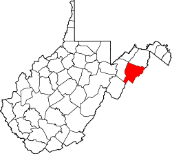
| County | Hardy |
| Time zone | UTC-5 (Eastern (EST)) |
| • Summer (DST) | UTC-4 (EDT) |
| GNIS feature ID | 1550114 [1] |
Arkansaw (sometimes misspelled Arkansas) is an unincorporated community in Hardy County, West Virginia, United States. It is located on Arkansaw Road (County Route 3/2) off West Virginia Route 29.