Hardy County is a county in the U.S. state of West Virginia. As of the 2020 census, the population was 14,299. Its county seat is Moorefield. The county was created from Hampshire County in 1786 and named for Samuel Hardy, a distinguished Virginian.

Grant County is a county in the U.S. state of West Virginia. As of the 2020 census, the population was 10,976. Its county seat is Petersburg. The county was created from Hardy County in 1866 and named for Civil War General Ulysses S. Grant.

Moorefield is a town and the county seat of Hardy County, West Virginia, United States. It is located at the confluence of the South Branch Potomac River and the South Fork South Branch Potomac River. Moorefield was originally chartered in 1777; it was named for Conrad Moore, who owned the land upon which the town was laid out. The population was 2,527 at the 2020 census.

UTC−05:00 is an identifier for a time offset from UTC of −05:00. In North America, it is observed in the Eastern Time Zone during standard time, and in the Central Time Zone during the other eight months. The western Caribbean uses it year round.

The Eastern Panhandle is the eastern of the two panhandles in the U.S. state of West Virginia; the other is the Northern Panhandle. It is a small stretch of territory in the northeast of the state, bordering Maryland and Virginia. Some sources and regional associations only identify the Eastern Panhandle as being composed of Morgan, Berkeley, and Jefferson counties. Berkeley and Jefferson counties are geographically located in the Shenandoah Valley. West Virginia is the only U.S. state with two panhandles.

The South Branch Potomac River has its headwaters in northwestern Highland County, Virginia near Hightown along the eastern edge of the Allegheny Front. After a river distance of 139 miles (224 km), the mouth of the South Branch lies east of Green Spring in Hampshire County, West Virginia where it meets the North Branch Potomac River to form the Potomac.

Shenandoah Mountain is a mountain ridge approximately 73 miles (117 km) long in Virginia and West Virginia. The steep, narrow, sandstone-capped ridge extends from northern Bath County, Virginia to southern Hardy County, West Virginia. Along the way, its crest defines the borders between Highland and Augusta counties, Virginia, and between Pendleton County, West Virginia, and Rockingham County, Virginia. The name comes from the Iroquoian word for 'deer'. Its high point is 4397’/1340 m Reddish Knob along the Virginia/West Virginia border.

West Virginia's 2nd congressional district consists of the northern half of the state. It contains Barbour, Berkeley, Brooke, Doddridge, Grant, Hampshire, Hancock, Hardy, Harrison, Jefferson, Lewis, Marion, Marshall, Mineral, Monongalia, Morgan, Ohio, Pleasants, Preston, Randolph, Ritchie, Taylor, Tucker, Tyler, Upshur, Wetzel, and Wood counties.
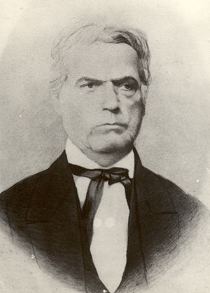
James Greene Hardy was a politician from the U.S. state of Kentucky who belonged to the American or Know-Nothing Party. Prior to being elected the 15th Lieutenant Governor of Kentucky, he was a prominent surveyor and teacher for many years.
Eckman is an unincorporated community in McDowell County, West Virginia, United States. Eckman is located along U.S. Route 52 to the west of the city of Keystone. Eckman was formerly known as Shawnee Camp. At Shawnee Camp, miner John Hardy reportedly murdered a man in a gambling dispute. His death was memorialized in the popular folk song, “John Hardy.”

The United States census of 1820 was the fourth census conducted in the United States. It was conducted on August 7, 1820. The 1820 census included six new states: Louisiana, Indiana, Mississippi, Illinois, Alabama and Maine. There has been a district wide loss of 1820 census records for Arkansas Territory, Missouri Territory and New Jersey.
Hardy County Schools is the operating school district within Hardy County, West Virginia. It is governed by the Hardy County Board of Education.
Trout Run is an 18.5-mile-long (29.8 km) tributary of the Cacapon River, belonging to the Potomac River and Chesapeake Bay watersheds. The stream is located in Hardy County in West Virginia's Eastern Panhandle. Trout Run rises between Devils Hole Mountain and Great North Mountain near the Virginia state line in the George Washington National Forest. The stream empties into the Cacapon River at Wardensville.

Great North Mountain is a 50-mile (80 km) long mountain ridge within the Ridge-and-valley Appalachians in the U.S. states of Virginia and West Virginia. The ridge is located west of the Shenandoah Valley and Massanutten Mountain in Virginia, and east of the Allegheny Mountains and Cacapon River in West Virginia.

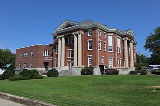
This is a list of the National Register of Historic Places listings in Hardy County, West Virginia.
Hardy is an unincorporated community in Mercer County, West Virginia, United States. Hardy is 5.5 miles (8.9 km) southeast of Princeton.

The North River is a tributary of the Cacapon River, belonging to the Potomac River and Chesapeake Bay watersheds. The river is located in Hampshire and Hardy counties in the U.S. state of West Virginia's Eastern Panhandle. The mouth of the North River into the Cacapon is located at Forks of Cacapon. From its headwaters to its mouth, the North River spans 52.4 miles (84.3 km) in length.

The 1996 United States presidential election in West Virginia took place on November 5, 1996, as part of the 1996 United States presidential election. Voters chose five representatives, or electors to the Electoral College, who voted for president and vice president.
The 1968 United States presidential election in West Virginia took place on November 5, 1968, as part of the 1968 United States presidential election. West Virginia voters chose seven representatives, or electors, to the Electoral College, who voted for president and vice president.


