Walnut Bottom, West Virginia | |
|---|---|
 | |
 Walnut Bottom  Walnut Bottom | |
| Coordinates: 39°6′21″N79°0′58″W / 39.10583°N 79.01611°W | |
| Country | United States |
| State | West Virginia |
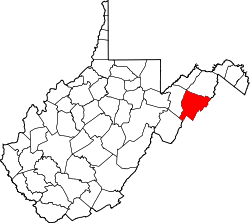
| County | Hardy |
| Time zone | UTC-5 (Eastern (EST)) |
| • Summer (DST) | UTC-4 (EDT) |
| GNIS feature ID | 1555911 [1] |
Walnut Bottom is an unincorporated community in Hardy County, West Virginia, United States.