Fisher, West Virginia

Last updated
Fisher, West Virginia
Fisher, West Virginia 2020.jpg
USA West Virginia location map.svg
Red pog.svg
Fisher
Usa edcp location map.svg
Red pog.svg
Fisher
Coordinates: 39°3′5″N79°0′12″W / 39.05139°N 79.00333°W / 39.05139; -79.00333 Coordinates: 39°3′5″N79°0′12″W / 39.05139°N 79.00333°W / 39.05139; -79.00333
Country United States
State West Virginia
County Hardy
Time zone UTC-5 (Eastern (EST))
  Summer (DST) UTC-4 (EDT)
ZIP codes
26818
GNIS feature ID1554456 [1]

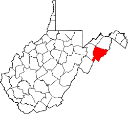
Fisher is an unincorporated community on the South Branch Potomac River in Hardy County, West Virginia, United States. It lies west of Moorefield. The precise origin of its name is unclear. [2] It may be named generally for the Fisher family that lived in its vicinity, or more specifically for George Fisher, whose family lived on the South Branch approximately one mile due south of Fisher.

Related Research Articles

Hardy County, West Virginia U.S. county in West Virginia

Hardy County is a county in the U.S. state of West Virginia. As of the 2010 census, the population was 14,025. Its county seat is Moorefield. The county was created from Hampshire County in 1786 and named for Samuel Hardy, a distinguished Virginian.

Harts, West Virginia Census-designated place in West Virginia, United States

Harts is a census-designated place (CDP) at the mouth of Big Harts Creek in Lincoln County, West Virginia, United States, situated along the Guyandotte River. As of the 2010 census, its population was 656. Harts is a part of the Huntington-Ashland, WV-KY-OH, Metropolitan Statistical Area (MSA). The Harts CDP includes the unincorporated communities of Harts, Atenville, Ferrellsburg, and Sand Creek.

Cacapon River

The Cacapon River, located in the Appalachian Mountains of West Virginia's Eastern Panhandle region, is an 81.0-mile-long (130.4 km) river known for its fishing, boating, wildlife, and scenery. As part of the Potomac River watershed, it is an American Heritage River.

Wappocomo, West Virginia Unincorporated community in West Virginia, United States

Wappocomo is an unincorporated community in Hampshire County in the U.S. state of West Virginia. The community is located south of Springfield on West Virginia Route 28 at Hanging Rocks along the South Branch Potomac River. Wappocomo has also historically been referred to as The Rocks, Wapocoma, and Wapocomo.

Antioch, West Virginia Unincorporated community in West Virginia, United States

Antioch is an unincorporated community in Mineral County, West Virginia. It is part of the 'Cumberland, MD-WV Metropolitan Statistical Area'. The village is located along a branch of Mill Creek where it exits Grayson Gap on the east side of Knobley Mountain. It lies at the intersection of Mikes Run Road and Knobley Road and is three miles south of U.S. Route 50.

Vanderlip, West Virginia Unincorporated community in West Virginia, United States

Vanderlip is an unincorporated community in Hampshire County in the U.S. state of West Virginia. Vanderlip is located west of Romney along the Northwestern Turnpike and the South Branch Valley Railroad. At times the community was referred to as West Romney Station, while its post office used the name Vanderlip, after a Baltimore and Ohio Railroad executive. The "heart" of Vanderlip is centered between Vanderlip Drive and Ozark Hill Road.

Opequon Creek

Opequon Creek is a 64.4-mile-long (103.6 km) tributary stream of the Potomac River. It flows into the Potomac northeast of Martinsburg in Berkeley County, West Virginia, and its source lies northwest of the community of Opequon at the foot of Great North Mountain in Frederick County, Virginia. The Opequon forms part of the boundary between Frederick and Clarke counties in Virginia and also partially forms the boundary between Berkeley and Jefferson counties in West Virginia's Eastern Panhandle.

Lunice Creek is a 7.3-mile-long (11.7 km) tributary of the South Branch Potomac River, belonging to the Potomac River and Chesapeake Bay watersheds. The creek is located in Grant County, West Virginia. Lunice Creek is created by its North and South Forks and empties into the South Branch at Petersburg.

Kline, West Virginia Unincorporated community in West Virginia, United States

Kline is an unincorporated community located in Pendleton County, West Virginia, United States. Originally known as Clines Cross Roads, its name was changed to Kline in about 1875. The name comes from Samuel Kline, an early postmaster.

Cabins, West Virginia Unincorporated community in West Virginia, United States

Cabins is an unincorporated community on the North Fork South Branch Potomac River in Grant County, West Virginia, United States. Cabins lies within the Spruce Knob-Seneca Rocks National Recreation Area of the Monongahela National Forest.

Milam, Hardy County, West Virginia Unincorporated community in West Virginia, United States

Milam is an unincorporated community on the South Fork South Branch Potomac River in southern Hardy County, West Virginia, United States. Milam is located along County Route 7. Originally known as Wine Spring, the community's name was changed to Milam in 1898.

McNeill, West Virginia Unincorporated community in West Virginia, United States

McNeill is an unincorporated community in Hardy County, West Virginia, United States. It lies near the South Branch Potomac River on Trough Road.

Macksville, West Virginia Unincorporated community in West Virginia, United States

Macksville is an unincorporated community in Pendleton County, West Virginia, United States. Macksville is located along U.S. Route 33/West Virginia Route 28 on the North Fork South Branch Potomac River.

Feltonville, Philadelphia Neighborhood of Philadelphia in Philadelphia County, Pennsylvania, United States

Feltonville is a working-class neighborhood in North Philadelphia It is located east of Logan and Hunting Park, west of Lawncrest and Juniata, south of Olney, and north of Fairhill and Harrowgate. Feltonville is bounded by Erie Avenue to the south, Front Street to the west, Roosevelt Boulevard to the north, Tacony Creek to the northeast, and G Street to the east.

Patterson Creek is a 51.2-mile-long (82.4 km) tributary of the North Branch Potomac River in West Virginia's Eastern Panhandle, in the United States. It enters the North Branch east of Cumberland, Maryland, with its headwaters located in Grant County, West Virginia. Patterson Creek is the watershed for two-thirds of Mineral County, West Virginia. The creek passes through Lahmansville, Forman, Medley, Williamsport, Burlington, Headsville, Reeses Mill, Champwood, and Fort Ashby.

Lost River (Cacapon River tributary) River in Hardy County, West Virginia, US

The Lost River is a 31.1-mile-long (50.1 km) river in the Appalachian Mountains of Hardy County in West Virginia's Eastern Panhandle region. The Lost River is geologically the same river as the Cacapon River: It flows into an underground channel northeast of McCauley along West Virginia Route 259 at "the Sinks" and reappears near Wardensville as the Cacapon. The source of the Lost River lies south of Mathias near the West Virginia/Virginia border. Along with the Cacapon and North rivers, the Lost River serves as one of the three main segments of the Cacapon River and its watershed.

Island Branch, West Virginia Unincorporated community in West Virginia, United States

Island Branch is an unincorporated community located in Kanawha County, West Virginia, United States.

Ingram Branch, West Virginia Unincorporated community in West Virginia, United States

Ingram Branch is an unincorporated community located in Fayette County, West Virginia, United States.

Joplin, West Virginia Unincorporated community in West Virginia, United States

Joplin is an unincorporated community in Kanawha County, West Virginia, United States. It is likely named after an early white settler in Kanawha County, James Jopling. In the early 19th century, Jopling purchased land alongside the creek later called Joplin Branch, a tributary of the Kanawha River. Many of Jopling's children and grandchildren lived along the creek near the family patriarch, and gave the community its name. James Jopling was described as "a man of powerful frame, and loved adventure. He was a noted trapper, hunter, and Indian fighter, and delighted in relating his narrow escapes and wonderful feats in woods life." Jopling also reportedly killed the last elk in the region, nearby on the Elk River.

Valley View (Romney, West Virginia) 1855 Greek Revival residence and associated farm

Valley View is a mid-19th-century Greek Revival residence and farm overlooking the South Branch Potomac River northwest of Romney, West Virginia. The house is atop a promontory where Depot Valley joins the South Branch Potomac River valley.

References

  1. U.S. Geological Survey Geographic Names Information System: Fisher, West Virginia
  2. Kenny, Hamill (1945). West Virginia Place Names: Their Origin and Meaning, Including the Nomenclature of the Streams and Mountains. Piedmont, WV: The Place Name Press. p. 242.